所有地区

探索保加利亚各地

多布里奇州

选择一个地区,探索旅行途中的景点、城市和村庄。

此地区的旅游行程

搜索覆盖整个地区,景点筛选条件和搜索半径不会限制此处的结果。

查看地区行程
景点
11
城市
6
村庄
209
居民点
215
目录中的市镇
8
有照片的地点
39

统计包含目录中已发布且注明所属地区的地点。

州府: Dobrich

清除筛选条件

找到的地点: 215 · 显示 25–48 · 页 2 / 9

当前地点地图

地图仅标出有参考坐标的地点。编号与列表对应,相邻地点会分组。请另行确认参观地址。

当前地点地图地图仅标出有参考坐标的地点。编号与列表对应,相邻地点会分组。请另行确认参观地址。Bozhurovo(Dobrich-selska 市镇), Cherna(Dobrich-selska 市镇), Dabovik(General Toshevo 市镇), Dobrevo(Dobrich-selska 市镇), Dobrich(Dobrich 市镇), Dolina(Dobrich-selska 市镇), Dryanovets(Dobrich-selska 市镇)1Branishte(Dobrich-selska 市镇), Debrene(Dobrich-selska 市镇), Donchevo(Dobrich-selska 市镇), Draganovo(Dobrich-selska 市镇)2Brestnitsa(Tervel 市镇), Efreytor Bakalovo(Krushari 市镇)3Bryastovo(Balchik 市镇), Chelopechene(Kavarna 市镇), Dabrava(Balchik 市镇), Dropla(Balchik 市镇)4Chernomortsi(Shabla 市镇), Durankulak(Shabla 市镇), Ezerets(Shabla 市镇)5Chernookovo(General Toshevo 市镇)6Chestimensko(Tervel 市镇)7Dobrin(Krushari 市镇)8Enevo(Dobrich-selska 市镇)9
  1. 1.
  2. 2.
  3. 3.
  4. 4.
  5. 5.
  6. 6.
  7. 7.
  8. 8.
  9. 9.

地图:Global Tour · 轮廓:Natural Earth

选择行程地点

可在此页选择最多 12 个地点并调整顺序。切换页面、语言或筛选条件会清除临时选择。请在规划器中确认添加。

选择行程地点 · 24
选择行程地点

已选地点: 0 / 12

尚未选择地点。

规划器会核对地点是否仍已发布。此顺序仅为建议,实际道路路线需另行规划。

Map of Bulgaria with a marker for Bozhurovo(Dobrich-selska 市镇)Representative point of the settlement. Overview map; confirm the exact visiting address.LOCATION · BULGARIABozhurovo(Dobrich-selska 市镇)NRepresentative point of the settlementMap: Global Tour · Outline: Natural Earth

Representative point of the settlement. Overview map; confirm the exact visiting address.

居民点

Bozhurovo(Dobrich-selska 市镇)

Bozhurovo, Dobrich-selska Municipality

Bozhurovo 是保加利亚多布里奇州 Dobrich-selska 市镇的一处村庄。 EKATTE 代码:05061。海拔范围:200–299 米。 本资料依据官方《全国居民点登记册》编写。您可以在地图上查看位置,并将此地加入个人旅行路线。

浏览附近地点

Map of Bulgaria with a marker for Branishte(Dobrich-selska 市镇)Representative point of the settlement. Overview map; confirm the exact visiting address.LOCATION · BULGARIABranishte(Dobrich-selska 市镇)NRepresentative point of the settlementMap: Global Tour · Outline: Natural Earth

Representative point of the settlement. Overview map; confirm the exact visiting address.

居民点

Branishte(Dobrich-selska 市镇)

Branishte, Dobrich-selska Municipality

Branishte 是保加利亚多布里奇州 Dobrich-selska 市镇的一处村庄。 EKATTE 代码:06104。海拔范围:200–299 米。 本资料依据官方《全国居民点登记册》编写。您可以在地图上查看位置,并将此地加入个人旅行路线。

浏览附近地点

Map of Bulgaria with a marker for Brestnitsa(Tervel 市镇)Representative point of the settlement. Overview map; confirm the exact visiting address.LOCATION · BULGARIABrestnitsa(Tervel 市镇)NRepresentative point of the settlementMap: Global Tour · Outline: Natural Earth

Representative point of the settlement. Overview map; confirm the exact visiting address.

居民点

Brestnitsa(Tervel 市镇)

Brestnitsa, Tervel Municipality

Brestnitsa 是保加利亚多布里奇州 Tervel 市镇的一处村庄。 EKATTE 代码:06464。海拔范围:100–199 米。 本资料依据官方《全国居民点登记册》编写。您可以在地图上查看位置,并将此地加入个人旅行路线。

浏览附近地点

Map of Bulgaria with a marker for Bryastovo(Balchik 市镇)Representative point of the settlement. Overview map; confirm the exact visiting address.LOCATION · BULGARIABryastovo(Balchik 市镇)NRepresentative point of the settlementMap: Global Tour · Outline: Natural Earth

Representative point of the settlement. Overview map; confirm the exact visiting address.

居民点

Bryastovo(Balchik 市镇)

Bryastovo, Balchik Municipality

Bryastovo 是保加利亚多布里奇州 Balchik 市镇的一处村庄。 EKATTE 代码:06793。海拔范围:100–199 米。 本资料依据官方《全国居民点登记册》编写。您可以在地图上查看位置,并将此地加入个人旅行路线。

浏览附近地点

Map of Bulgaria with a marker for Chelopechene(Kavarna 市镇)Representative point of the settlement. Overview map; confirm the exact visiting address.LOCATION · BULGARIAChelopechene(Kavarna 市镇)NRepresentative point of the settlementMap: Global Tour · Outline: Natural Earth

Representative point of the settlement. Overview map; confirm the exact visiting address.

居民点

Chelopechene(Kavarna 市镇)

Chelopechene, Kavarna Municipality

Chelopechene 是保加利亚多布里奇州 Kavarna 市镇的一处村庄。 EKATTE 代码:80340。海拔范围:100–199 米。 本资料依据官方《全国居民点登记册》编写。您可以在地图上查看位置,并将此地加入个人旅行路线。

浏览附近地点

Map of Bulgaria with a marker for Cherna(Dobrich-selska 市镇)Representative point of the settlement. Overview map; confirm the exact visiting address.LOCATION · BULGARIACherna(Dobrich-selska 市镇)NRepresentative point of the settlementMap: Global Tour · Outline: Natural Earth

Representative point of the settlement. Overview map; confirm the exact visiting address.

居民点

Cherna(Dobrich-selska 市镇)

Cherna, Dobrich-selska Municipality

Cherna 是保加利亚多布里奇州 Dobrich-selska 市镇的一处村庄。 EKATTE 代码:80769。海拔范围:100–199 米。 本资料依据官方《全国居民点登记册》编写。您可以在地图上查看位置,并将此地加入个人旅行路线。

浏览附近地点

Map of Bulgaria with a marker for Chernomortsi(Shabla 市镇)Representative point of the settlement. Overview map; confirm the exact visiting address.LOCATION · BULGARIAChernomortsi(Shabla 市镇)NRepresentative point of the settlementMap: Global Tour · Outline: Natural Earth

Representative point of the settlement. Overview map; confirm the exact visiting address.

居民点

Chernomortsi(Shabla 市镇)

Chernomortsi, Shabla Municipality

Chernomortsi 是保加利亚多布里奇州 Shabla 市镇的一处村庄。 EKATTE 代码:81181。海拔范围:50–99 米。 本资料依据官方《全国居民点登记册》编写。您可以在地图上查看位置,并将此地加入个人旅行路线。

浏览附近地点

Map of Bulgaria with a marker for Chernookovo(General Toshevo 市镇)Representative point of the settlement. Overview map; confirm the exact visiting address.LOCATION · BULGARIAChernookovo(General Toshevo 市镇)NRepresentative point of the settlementMap: Global Tour · Outline: Natural Earth

Representative point of the settlement. Overview map; confirm the exact visiting address.

居民点

Chernookovo(General Toshevo 市镇)

Chernookovo, General Toshevo Municipality

Chernookovo 是保加利亚多布里奇州 General Toshevo 市镇的一处村庄。 EKATTE 代码:81219。海拔范围:100–199 米。 本资料依据官方《全国居民点登记册》编写。您可以在地图上查看位置,并将此地加入个人旅行路线。

浏览附近地点

Map of Bulgaria with a marker for Chestimensko(Tervel 市镇)Representative point of the settlement. Overview map; confirm the exact visiting address.LOCATION · BULGARIAChestimensko(Tervel 市镇)NRepresentative point of the settlementMap: Global Tour · Outline: Natural Earth

Representative point of the settlement. Overview map; confirm the exact visiting address.

居民点

Chestimensko(Tervel 市镇)

Chestimensko, Tervel Municipality

Chestimensko 是保加利亚多布里奇州 Tervel 市镇的一处村庄。 EKATTE 代码:81270。海拔范围:200–299 米。 本资料依据官方《全国居民点登记册》编写。您可以在地图上查看位置,并将此地加入个人旅行路线。

浏览附近地点
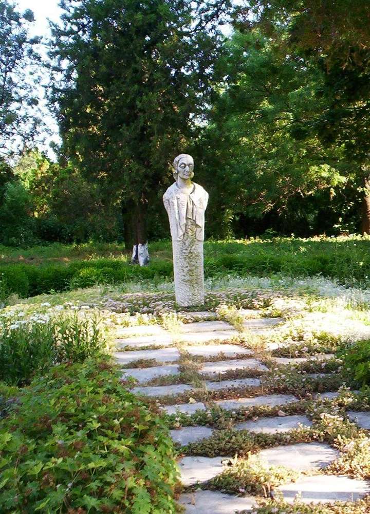
Dabovik(General Toshevo 市镇)的照片

居民点

Dabovik(General Toshevo 市镇)

Dabovik, General Toshevo Municipality

Dabovik(General Toshevo 市镇)的照片

Dabovik 是保加利亚多布里奇州 General Toshevo 市镇的一处村庄。 EKATTE 代码:24339。海拔范围:200–299 米。 本资料依据官方《全国居民点登记册》编写。您可以在地图上查看位置,并将此地加入个人旅行路线。

浏览附近地点

图片来源: Parvev · Public domain · 许可协议

Map of Bulgaria with a marker for Dabrava(Balchik 市镇)Representative point of the settlement. Overview map; confirm the exact visiting address.LOCATION · BULGARIADabrava(Balchik 市镇)NRepresentative point of the settlementMap: Global Tour · Outline: Natural Earth

Representative point of the settlement. Overview map; confirm the exact visiting address.

居民点

Dabrava(Balchik 市镇)

Dabrava, Balchik Municipality

Dabrava 是保加利亚多布里奇州 Balchik 市镇的一处村庄。 EKATTE 代码:24387。海拔范围:200–299 米。 本资料依据官方《全国居民点登记册》编写。您可以在地图上查看位置,并将此地加入个人旅行路线。

浏览附近地点
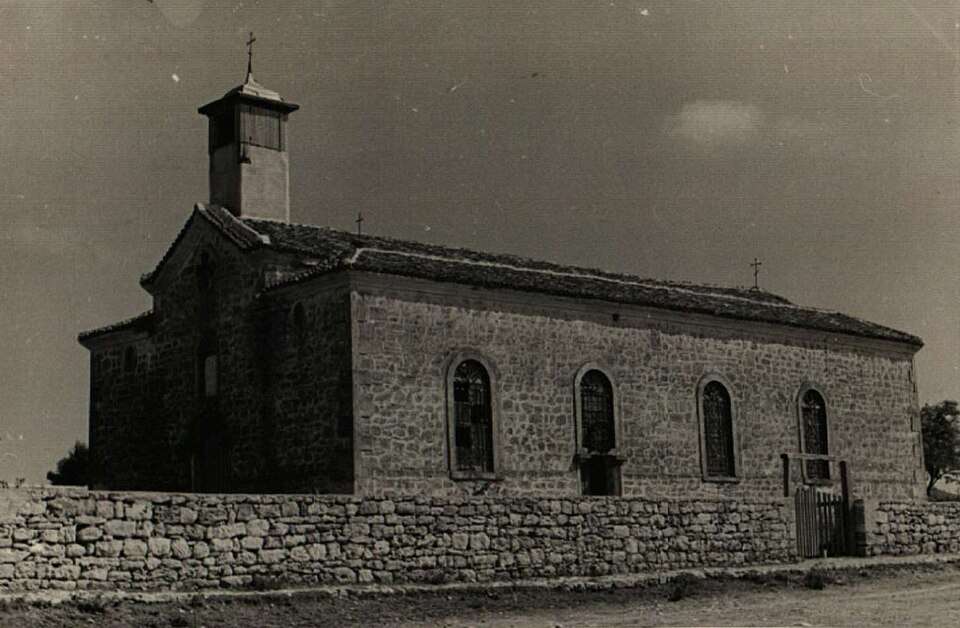
Debrene(Dobrich-selska 市镇)的历史照片

居民点

Debrene(Dobrich-selska 市镇)

Debrene, Dobrich-selska Municipality

Debrene(Dobrich-selska 市镇)的历史照片

Debrene 是保加利亚多布里奇州 Dobrich-selska 市镇的一处村庄。 EKATTE 代码:20359。海拔范围:300–499 米。 本资料依据官方《全国居民点登记册》编写。您可以在地图上查看位置,并将此地加入个人旅行路线。

浏览附近地点

图片来源: Unknown author Unknown author · Public domain · 许可协议

Map of Bulgaria with a marker for Dobrevo(Dobrich-selska 市镇)Representative point of the settlement. Overview map; confirm the exact visiting address.LOCATION · BULGARIADobrevo(Dobrich-selska 市镇)NRepresentative point of the settlementMap: Global Tour · Outline: Natural Earth

Representative point of the settlement. Overview map; confirm the exact visiting address.

居民点

Dobrevo(Dobrich-selska 市镇)

Dobrevo, Dobrich-selska Municipality

Dobrevo 是保加利亚多布里奇州 Dobrich-selska 市镇的一处村庄。 EKATTE 代码:21350。海拔范围:100–199 米。 本资料依据官方《全国居民点登记册》编写。您可以在地图上查看位置,并将此地加入个人旅行路线。

浏览附近地点
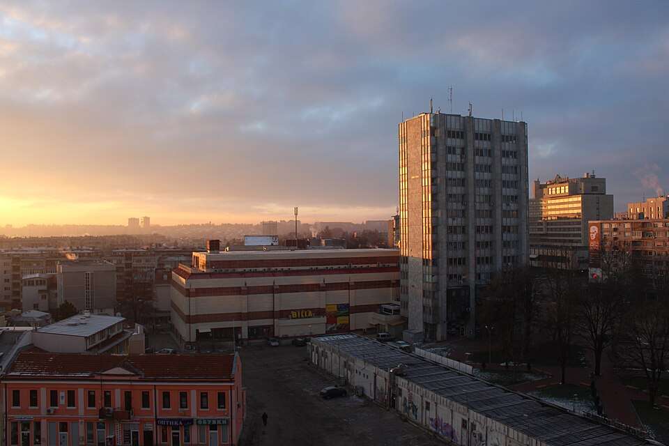
Dobrich(Dobrich 市镇)的照片

居民点

Dobrich(Dobrich 市镇)

Dobrich, Dobrich Municipality

Dobrich(Dobrich 市镇)的照片

Dobrich 是保加利亚多布里奇州 Dobrich 市镇的一处城市。 EKATTE 代码:72624。海拔范围:200–299 米。该地是市镇行政中心兼州行政中心。 本资料依据官方《全国居民点登记册》编写。您可以在地图上查看位置,并将此地加入个人旅行路线。

浏览附近地点

图片来源: Atob37 · CC BY-SA 3.0 · 许可协议

Map of Bulgaria with a marker for Dobrin(Krushari 市镇)Representative point of the settlement. Overview map; confirm the exact visiting address.LOCATION · BULGARIADobrin(Krushari 市镇)NRepresentative point of the settlementMap: Global Tour · Outline: Natural Earth

Representative point of the settlement. Overview map; confirm the exact visiting address.

居民点

Dobrin(Krushari 市镇)

Dobrin, Krushari Municipality

Dobrin 是保加利亚多布里奇州 Krushari 市镇的一处村庄。 EKATTE 代码:21470。海拔范围:100–199 米。 本资料依据官方《全国居民点登记册》编写。您可以在地图上查看位置,并将此地加入个人旅行路线。

浏览附近地点

Map of Bulgaria with a marker for Dolina(Dobrich-selska 市镇)Representative point of the settlement. Overview map; confirm the exact visiting address.LOCATION · BULGARIADolina(Dobrich-selska 市镇)NRepresentative point of the settlementMap: Global Tour · Outline: Natural Earth

Representative point of the settlement. Overview map; confirm the exact visiting address.

居民点

Dolina(Dobrich-selska 市镇)

Dolina, Dobrich-selska Municipality

Dolina 是保加利亚多布里奇州 Dobrich-selska 市镇的一处村庄。 EKATTE 代码:21957。海拔范围:100–199 米。 本资料依据官方《全国居民点登记册》编写。您可以在地图上查看位置,并将此地加入个人旅行路线。

浏览附近地点

Map of Bulgaria with a marker for Donchevo(Dobrich-selska 市镇)Representative point of the settlement. Overview map; confirm the exact visiting address.LOCATION · BULGARIADonchevo(Dobrich-selska 市镇)NRepresentative point of the settlementMap: Global Tour · Outline: Natural Earth

Representative point of the settlement. Overview map; confirm the exact visiting address.

居民点

Donchevo(Dobrich-selska 市镇)

Donchevo, Dobrich-selska Municipality

Donchevo 是保加利亚多布里奇州 Dobrich-selska 市镇的一处村庄。 EKATTE 代码:22988。海拔范围:200–299 米。 本资料依据官方《全国居民点登记册》编写。您可以在地图上查看位置,并将此地加入个人旅行路线。

浏览附近地点

Map of Bulgaria with a marker for Draganovo(Dobrich-selska 市镇)Representative point of the settlement. Overview map; confirm the exact visiting address.LOCATION · BULGARIADraganovo(Dobrich-selska 市镇)NRepresentative point of the settlementMap: Global Tour · Outline: Natural Earth

Representative point of the settlement. Overview map; confirm the exact visiting address.

居民点

Draganovo(Dobrich-selska 市镇)

Draganovo, Dobrich-selska Municipality

Draganovo 是保加利亚多布里奇州 Dobrich-selska 市镇的一处村庄。 EKATTE 代码:23128。海拔范围:200–299 米。 本资料依据官方《全国居民点登记册》编写。您可以在地图上查看位置,并将此地加入个人旅行路线。

浏览附近地点

Map of Bulgaria with a marker for Dropla(Balchik 市镇)Representative point of the settlement. Overview map; confirm the exact visiting address.LOCATION · BULGARIADropla(Balchik 市镇)NRepresentative point of the settlementMap: Global Tour · Outline: Natural Earth

Representative point of the settlement. Overview map; confirm the exact visiting address.

居民点

Dropla(Balchik 市镇)

Dropla, Balchik Municipality

Dropla 是保加利亚多布里奇州 Balchik 市镇的一处村庄。 EKATTE 代码:23769。海拔范围:200–299 米。 本资料依据官方《全国居民点登记册》编写。您可以在地图上查看位置,并将此地加入个人旅行路线。

浏览附近地点

Map of Bulgaria with a marker for Dryanovets(Dobrich-selska 市镇)Representative point of the settlement. Overview map; confirm the exact visiting address.LOCATION · BULGARIADryanovets(Dobrich-selska 市镇)NRepresentative point of the settlementMap: Global Tour · Outline: Natural Earth

Representative point of the settlement. Overview map; confirm the exact visiting address.

居民点

Dryanovets(Dobrich-selska 市镇)

Dryanovets, Dobrich-selska Municipality

Dryanovets 是保加利亚多布里奇州 Dobrich-selska 市镇的一处村庄。 EKATTE 代码:23933。海拔范围:200–299 米。 本资料依据官方《全国居民点登记册》编写。您可以在地图上查看位置,并将此地加入个人旅行路线。

浏览附近地点
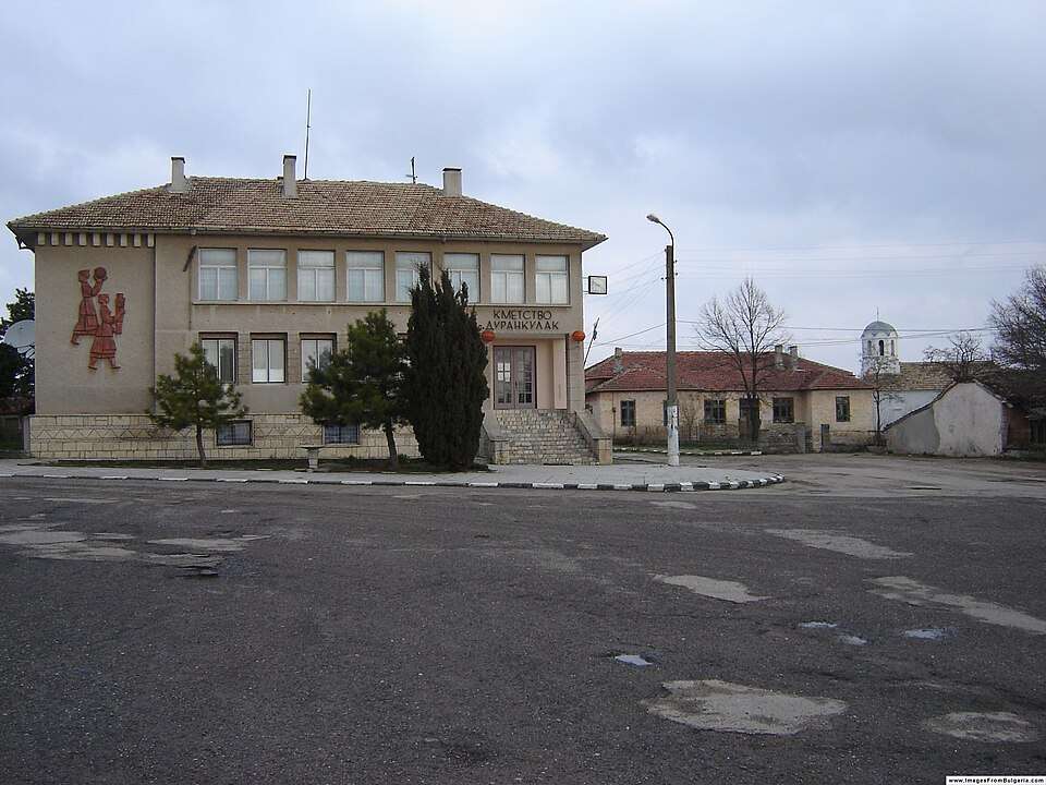
Durankulak(Shabla 市镇)的照片

居民点

Durankulak(Shabla 市镇)

Durankulak, Shabla Municipality

Durankulak(Shabla 市镇)的照片

Durankulak 是保加利亚多布里奇州 Shabla 市镇的一处村庄。 EKATTE 代码:24102。海拔范围:0–49 米。 本资料依据官方《全国居民点登记册》编写。您可以在地图上查看位置,并将此地加入个人旅行路线。

浏览附近地点

图片来源: Petar Iankov · CC BY-SA 2.5 · 许可协议

Map of Bulgaria with a marker for Efreytor Bakalovo(Krushari 市镇)Representative point of the settlement. Overview map; confirm the exact visiting address.LOCATION · BULGARIAEfreytor Bakalovo(Krushari 市镇)NRepresentative point of the settlementMap: Global Tour · Outline: Natural Earth

Representative point of the settlement. Overview map; confirm the exact visiting address.

居民点

Efreytor Bakalovo(Krushari 市镇)

Efreytor Bakalovo, Krushari Municipality

Efreytor Bakalovo 是保加利亚多布里奇州 Krushari 市镇的一处村庄。 EKATTE 代码:27656。海拔范围:100–199 米。 本资料依据官方《全国居民点登记册》编写。您可以在地图上查看位置,并将此地加入个人旅行路线。

浏览附近地点

Map of Bulgaria with a marker for Enevo(Dobrich-selska 市镇)Representative point of the settlement. Overview map; confirm the exact visiting address.LOCATION · BULGARIAEnevo(Dobrich-selska 市镇)NRepresentative point of the settlementMap: Global Tour · Outline: Natural Earth

Representative point of the settlement. Overview map; confirm the exact visiting address.

居民点

Enevo(Dobrich-selska 市镇)

Enevo, Dobrich-selska Municipality

Enevo 是保加利亚多布里奇州 Dobrich-selska 市镇的一处村庄。 EKATTE 代码:27468。海拔范围:200–299 米。 本资料依据官方《全国居民点登记册》编写。您可以在地图上查看位置,并将此地加入个人旅行路线。

浏览附近地点

Ezerets(Shabla 市镇)的历史照片

居民点

Ezerets(Shabla 市镇)

Ezerets, Shabla Municipality

Ezerets(Shabla 市镇)的历史照片

Ezerets 是保加利亚多布里奇州 Shabla 市镇的一处村庄。 EKATTE 代码:27108。海拔范围:0–49 米。 本资料依据官方《全国居民点登记册》编写。您可以在地图上查看位置,并将此地加入个人旅行路线。

浏览附近地点

图片来源: Unknown author Unknown author · Public domain · 许可协议

地区及行政区划数据来自保加利亚国家统计局 EKATTE。 НСИ · NSI

© 2026 Global Tour