所有地区探索保加利亚各地
丘斯滕迪尔州
选择一个地区,探索旅行途中的景点、城市和村庄。
此地区的旅游行程
搜索覆盖整个地区,景点筛选条件和搜索半径不会限制此处的结果。
- 景点
- 14
- 城市
- 7
- 村庄
- 174
- 居民点
- 182
- 目录中的市镇
- 9
- 有照片的地点
- 89
统计包含目录中已发布且注明所属地区的地点。
州府: Kyustendil
找到的地点: 182 · 显示 25–48 · 页 2 / 8
当前地点地图
地图仅标出有参考坐标的地点。编号与列表对应,相邻地点会分组。请另行确认参观地址。
地图:Global Tour · 轮廓:Natural Earth
Representative point of the settlement. Overview map; confirm the exact visiting address.
居民点
Chetirtsi, Nevestino Municipality
Chetirtsi 是保加利亚丘斯滕迪尔州 Nevestino 市镇的一处村庄。
EKATTE 代码:81284。海拔范围:500–699 米。
本资料依据官方《全国居民点登记册》编写。您可以在地图上查看位置,并将此地加入个人旅行路线。
浏览附近地点Representative point of the settlement. Overview map; confirm the exact visiting address.
居民点
Chudintsi, Kyustendil Municipality
Chudintsi 是保加利亚丘斯滕迪尔州 Kyustendil 市镇的一处村庄。
EKATTE 代码:81606。海拔范围:≥ 1000 米。
本资料依据官方《全国居民点登记册》编写。您可以在地图上查看位置,并将此地加入个人旅行路线。
浏览附近地点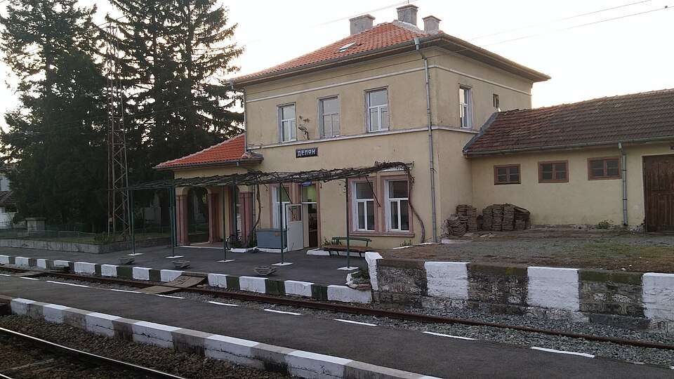
居民点
Delyan, Dupnitsa Municipality
Delyan(Dupnitsa 市镇)的照片
Delyan 是保加利亚丘斯滕迪尔州 Dupnitsa 市镇的一处村庄。
EKATTE 代码:20612。海拔范围:500–699 米。
本资料依据官方《全国居民点登记册》编写。您可以在地图上查看位置,并将此地加入个人旅行路线。
浏览附近地点图片来源: ShockD · CC BY-SA 4.0 · 许可协议
Representative point of the settlement. Overview map; confirm the exact visiting address.
居民点
Dlahchevo-Sablyar, Nevestino Municipality
Dlahchevo-Sablyar 是保加利亚丘斯滕迪尔州 Nevestino 市镇的一处村庄。
EKATTE 代码:21292。海拔范围:500–699 米。
本资料依据官方《全国居民点登记册》编写。您可以在地图上查看位置,并将此地加入个人旅行路线。
浏览附近地点Representative point of the settlement. Overview map; confirm the exact visiting address.
居民点
Dobri dol, Treklyano Municipality
Dobri dol 是保加利亚丘斯滕迪尔州 Treklyano 市镇的一处村庄。
EKATTE 代码:21422。海拔范围:700–999 米。
本资料依据官方《全国居民点登记册》编写。您可以在地图上查看位置,并将此地加入个人旅行路线。
浏览附近地点Representative point of the settlement. Overview map; confirm the exact visiting address.
居民点
Dobrovo, Boboshevo Municipality
Dobrovo 是保加利亚丘斯滕迪尔州 Boboshevo 市镇的一处村庄。
EKATTE 代码:21565。海拔范围:300–499 米。
本资料依据官方《全国居民点登记册》编写。您可以在地图上查看位置,并将此地加入个人旅行路线。
浏览附近地点Representative point of the settlement. Overview map; confirm the exact visiting address.
居民点
Dolistovo, Bobov dol Municipality
Dolistovo 是保加利亚丘斯滕迪尔州 Bobov dol 市镇的一处村庄。
EKATTE 代码:21974。海拔范围:500–699 米。
本资料依据官方《全国居民点登记册》编写。您可以在地图上查看位置,并将此地加入个人旅行路线。
浏览附近地点Representative point of the settlement. Overview map; confirm the exact visiting address.
居民点
Dolna Grashtitsa, Kyustendil Municipality
Dolna Grashtitsa 是保加利亚丘斯滕迪尔州 Kyustendil 市镇的一处村庄。
EKATTE 代码:22071。海拔范围:300–499 米。
本资料依据官方《全国居民点登记册》编写。您可以在地图上查看位置,并将此地加入个人旅行路线。
浏览附近地点Representative point of the settlement. Overview map; confirm the exact visiting address.
居民点
Dolna Koznitsa, Nevestino Municipality
Dolna Koznitsa 是保加利亚丘斯滕迪尔州 Nevestino 市镇的一处村庄。
EKATTE 代码:22112。海拔范围:700–999 米。
本资料依据官方《全国居民点登记册》编写。您可以在地图上查看位置,并将此地加入个人旅行路线。
浏览附近地点Representative point of the settlement. Overview map; confirm the exact visiting address.
居民点
Dolni Koriten, Treklyano Municipality
Dolni Koriten 是保加利亚丘斯滕迪尔州 Treklyano 市镇的一处村庄。
EKATTE 代码:22410。海拔范围:700–999 米。
本资料依据官方《全国居民点登记册》编写。您可以在地图上查看位置,并将此地加入个人旅行路线。
浏览附近地点Representative point of the settlement. Overview map; confirm the exact visiting address.
居民点
Dolno Kobile, Treklyano Municipality
Dolno Kobile 是保加利亚丘斯滕迪尔州 Treklyano 市镇的一处村庄。
EKATTE 代码:22650。海拔范围:700–999 米。
本资料依据官方《全国居民点登记册》编写。您可以在地图上查看位置,并将此地加入个人旅行路线。
浏览附近地点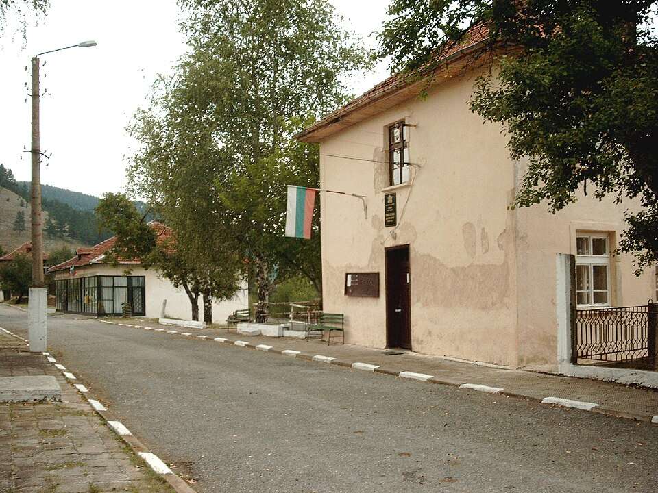
居民点
Dolno selo, Kyustendil Municipality
Dolno selo(Kyustendil 市镇)的照片
Dolno selo 是保加利亚丘斯滕迪尔州 Kyustendil 市镇的一处村庄。
EKATTE 代码:22811。海拔范围:700–999 米。
本资料依据官方《全国居民点登记册》编写。您可以在地图上查看位置,并将此地加入个人旅行路线。
浏览附近地点图片来源: Original author and uploader was Ignat Ignev at bg.wikipedia · CC BY-SA 2.5 · 许可协议
居民点
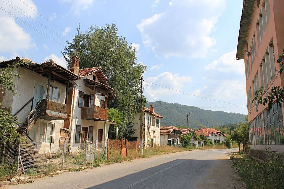
Dolno Uyno, Kyustendil Municipality
Dolno Uyno(Kyustendil 市镇)的照片
Dolno Uyno 是保加利亚丘斯滕迪尔州 Kyustendil 市镇的一处村庄。
EKATTE 代码:22862。海拔范围:500–699 米。
本资料依据官方《全国居民点登记册》编写。您可以在地图上查看位置,并将此地加入个人旅行路线。
浏览附近地点图片来源: Julian Nyča · CC BY-SA 3.0 · 许可协议
Representative point of the settlement. Overview map; confirm the exact visiting address.
居民点
Dozhdevitsa, Kyustendil Municipality
Dozhdevitsa 是保加利亚丘斯滕迪尔州 Kyustendil 市镇的一处村庄。
EKATTE 代码:21782。海拔范围:700–999 米。
本资料依据官方《全国居民点登记册》编写。您可以在地图上查看位置,并将此地加入个人旅行路线。
浏览附近地点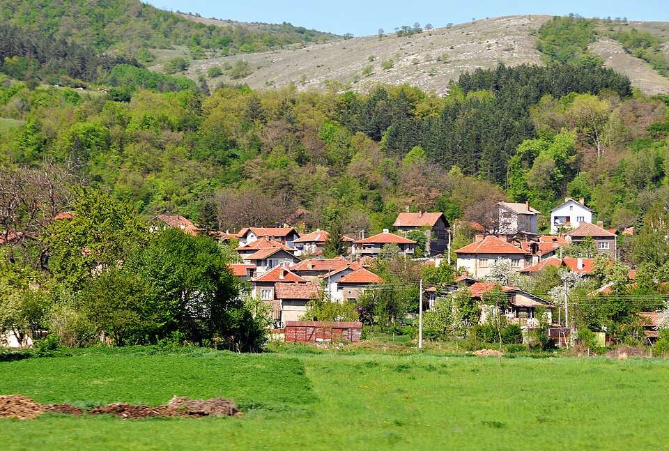
居民点
Dragodan, Kocherinovo Municipality
Dragodan(Kocherinovo 市镇)的照片
Dragodan 是保加利亚丘斯滕迪尔州 Kocherinovo 市镇的一处村庄。
EKATTE 代码:23323。海拔范围:300–499 米。
本资料依据官方《全国居民点登记册》编写。您可以在地图上查看位置,并将此地加入个人旅行路线。
浏览附近地点图片来源: Dennis G. Jarvis · CC BY-SA 2.0 · 许可协议
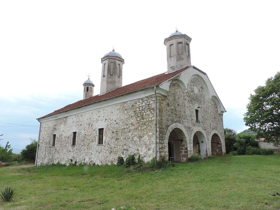
居民点
Dragovishtitsa, Kyustendil Municipality
Dragovishtitsa(Kyustendil 市镇)的照片
Dragovishtitsa 是保加利亚丘斯滕迪尔州 Kyustendil 市镇的一处村庄。
EKATTE 代码:23282。海拔范围:500–699 米。
本资料依据官方《全国居民点登记册》编写。您可以在地图上查看位置,并将此地加入个人旅行路线。
浏览附近地点图片来源: Vassia Atanassova - Spiritia · CC BY-SA 4.0 · 许可协议
Representative point of the settlement. Overview map; confirm the exact visiting address.
居民点
Dragoychintsi, Treklyano Municipality
Dragoychintsi 是保加利亚丘斯滕迪尔州 Treklyano 市镇的一处村庄。
EKATTE 代码:23399。海拔范围:≥ 1000 米。
本资料依据官方《全国居民点登记册》编写。您可以在地图上查看位置,并将此地加入个人旅行路线。
浏览附近地点Representative point of the settlement. Overview map; confirm the exact visiting address.
居民点
Drumohar, Nevestino Municipality
Drumohar 是保加利亚丘斯滕迪尔州 Nevestino 市镇的一处村庄。
EKATTE 代码:23827。海拔范围:500–699 米。
本资料依据官方《全国居民点登记册》编写。您可以在地图上查看位置,并将此地加入个人旅行路线。
浏览附近地点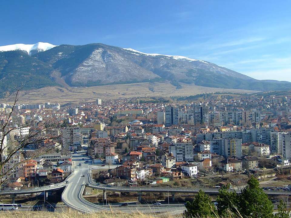
居民点
Dupnitsa, Dupnitsa Municipality
Dupnitsa(Dupnitsa 市镇)的照片
Dupnitsa 是保加利亚丘斯滕迪尔州 Dupnitsa 市镇的一处城市。
EKATTE 代码:68789。海拔范围:300–499 米。该地是市镇行政中心。
本资料依据官方《全国居民点登记册》编写。您可以在地图上查看位置,并将此地加入个人旅行路线。
浏览附近地点图片来源: http://dupnitsa.net/ · CC BY-SA 4.0 · 许可协议
Representative point of the settlement. Overview map; confirm the exact visiting address.
居民点
Dvorishte, Kyustendil Municipality
Dvorishte 是保加利亚丘斯滕迪尔州 Kyustendil 市镇的一处村庄。
EKATTE 代码:20208。海拔范围:500–699 米。
本资料依据官方《全国居民点登记册》编写。您可以在地图上查看位置,并将此地加入个人旅行路线。
浏览附近地点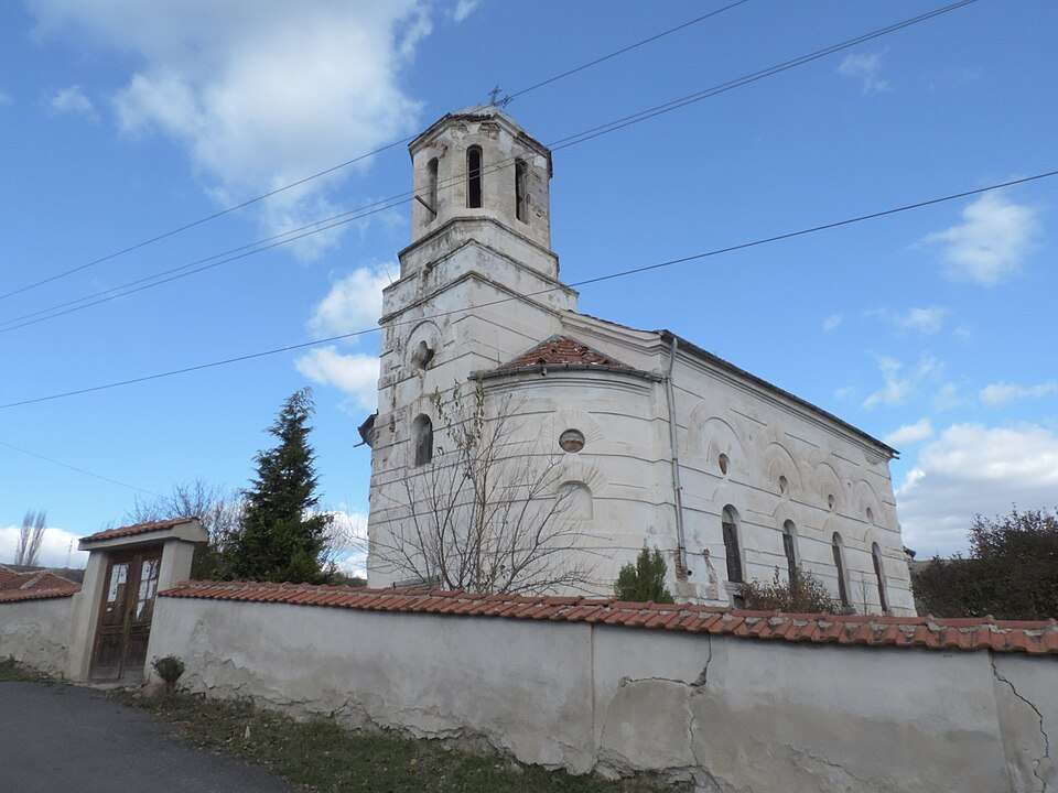
居民点
Dyakovo, Dupnitsa Municipality
Dyakovo(Dupnitsa 市镇)的照片
Dyakovo 是保加利亚丘斯滕迪尔州 Dupnitsa 市镇的一处村庄。
EKATTE 代码:24791。海拔范围:500–699 米。
本资料依据官方《全国居民点登记册》编写。您可以在地图上查看位置,并将此地加入个人旅行路线。
浏览附近地点图片来源: Vassia Atanassova - Spiritia · CC BY-SA 4.0 · 许可协议
居民点
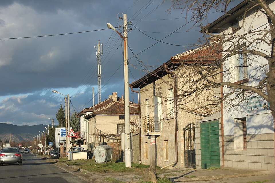
Dzherman, Dupnitsa Municipality
Dzherman(Dupnitsa 市镇)的照片
Dzherman 是保加利亚丘斯滕迪尔州 Dupnitsa 市镇的一处村庄。
EKATTE 代码:20763。海拔范围:300–499 米。
本资料依据官方《全国居民点登记册》编写。您可以在地图上查看位置,并将此地加入个人旅行路线。
浏览附近地点图片来源: Anton Lefterov · CC BY-SA 4.0 · 许可协议
Representative point of the settlement. Overview map; confirm the exact visiting address.
居民点
Eremia, Nevestino Municipality
Eremia 是保加利亚丘斯滕迪尔州 Nevestino 市镇的一处村庄。
EKATTE 代码:27574。海拔范围:500–699 米。
本资料依据官方《全国居民点登记册》编写。您可以在地图上查看位置,并将此地加入个人旅行路线。
浏览附近地点Representative point of the settlement. Overview map; confirm the exact visiting address.
居民点
Frolosh, Kocherinovo Municipality
Frolosh 是保加利亚丘斯滕迪尔州 Kocherinovo 市镇的一处村庄。
EKATTE 代码:76180。海拔范围:700–999 米。
本资料依据官方《全国居民点登记册》编写。您可以在地图上查看位置,并将此地加入个人旅行路线。
浏览附近地点地区及行政区划数据来自保加利亚国家统计局 EKATTE。 НСИ · NSI
