All provinces

Bulgaria by province

Pernik

Choose a province and discover places for your next trip — landmarks, cities and villages.

Trips in this province

This search covers the whole province independently of the place radius and filters.

Explore trips in this province
Landmarks
4
Cities
6
Villages
165
Settlements
171
Municipalities in catalogue
6
Places with a photo
85

Counts show current published records with an assigned province in our catalogue.

Provincial centre: Pernik

Clear filters

Places found: 171 · Displayed positions 1–24 · Page 1 / 8

Map of displayed places

Markers are shown only for places with reference coordinates. Numbers link markers to the list; nearby points are grouped. Confirm the exact visiting address.

Map of displayed placesMarkers are shown only for places with reference coordinates. Numbers link markers to the list; nearby points are grouped. Confirm the exact visiting address.Arzan (Breznik Municipality), Babitsa (Breznik Municipality), Banishte (Breznik Municipality), Batanovtsi (Pernik Municipality), Begunovtsi (Breznik Municipality), Berende (Zemen Municipality), Bilintsi (Breznik Municipality), Bogdanov dol (Pernik Municipality), Breznik (Breznik Municipality), Breznishki izvor (Breznik Municipality), Brusnik (Breznik Municipality), Butrointsi (Tran Municipality)1Bankya (Tran Municipality), Berayntsi (Tran Municipality), Bogoyna (Tran Municipality), Busintsi (Tran Municipality)2Baykalsko (Radomir Municipality), Belanitsa (Radomir Municipality), Blateshnitsa (Zemen Municipality), Boboratsi (Radomir Municipality), Bornarevo (Radomir Municipality)3Bohova (Tran Municipality)4Bosnek (Pernik Municipality)5Chepino (Kovachevtsi Municipality)6
  1. 1.
  2. 2.
  3. 3.
  4. 4.
  5. 5.
  6. 6.

Map: Global Tour · Outline: Natural Earth

Choose places for your route

Choose up to 12 places from this page and arrange them. Your selection is temporary and clears when the page, language or filters change. In the planner you will confirm how to add them to your trip.

Choose places for your route · 24
Choose places for your route

Selected places: 0 / 12

No places selected.

The planner will check that every place is still published. This order is a proposal, not an automatically calculated road route.

Map of Bulgaria with a marker for Arzan (Breznik Municipality)Representative point of the settlement. Overview map; confirm the exact visiting address.LOCATION · BULGARIAArzan (Breznik Municipality)NRepresentative point of the settlementMap: Global Tour · Outline: Natural Earth

Representative point of the settlement. Overview map; confirm the exact visiting address.

Settlements

Arzan (Breznik Municipality)

Arzan, Breznik Municipality

Arzan is a village in Breznik Municipality, Pernik Province, Bulgaria. EKATTE code: 00610. Elevation range: 700–999 m. This profile uses the official National Register of Settlements. View the location on the map and add the settlement to your personal itinerary.

Explore nearby places

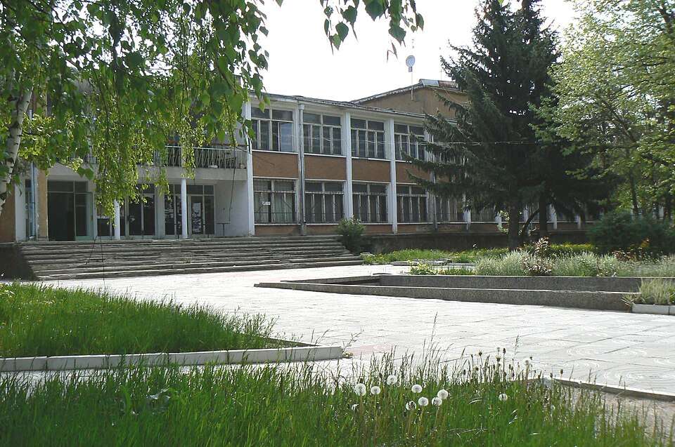
Photograph from Babitsa (Breznik Municipality)

Settlements

Babitsa (Breznik Municipality)

Babitsa, Breznik Municipality

Photograph from Babitsa (Breznik Municipality)

Babitsa is a village in Breznik Municipality, Pernik Province, Bulgaria. EKATTE code: 02066. Elevation range: 700–999 m. This profile uses the official National Register of Settlements. View the location on the map and add the settlement to your personal itinerary.
Explore nearby places

Photo: Anton Lefterov · CC BY-SA 4.0 · License

Map of Bulgaria with a marker for Banishte (Breznik Municipality)Representative point of the settlement. Overview map; confirm the exact visiting address.LOCATION · BULGARIABanishte (Breznik Municipality)NRepresentative point of the settlementMap: Global Tour · Outline: Natural Earth

Representative point of the settlement. Overview map; confirm the exact visiting address.

Settlements

Banishte (Breznik Municipality)

Banishte, Breznik Municipality

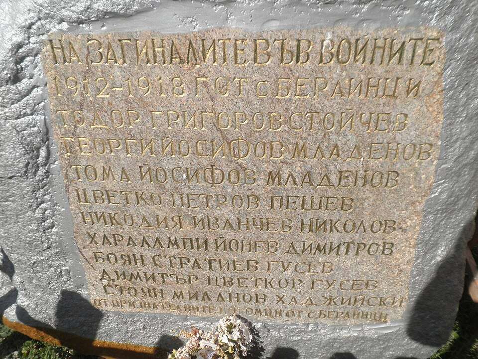
Banishte is a village in Breznik Municipality, Pernik Province, Bulgaria. EKATTE code: 02614. Elevation range: 700–999 m. This profile uses the official National Register of Settlements. View the location on the map and add the settlement to your personal itinerary.
Explore nearby places

Map of Bulgaria with a marker for Bankya (Tran Municipality)Representative point of the settlement. Overview map; confirm the exact visiting address.LOCATION · BULGARIABankya (Tran Municipality)NRepresentative point of the settlementMap: Global Tour · Outline: Natural Earth

Representative point of the settlement. Overview map; confirm the exact visiting address.

Settlements

Bankya (Tran Municipality)

Bankya, Tran Municipality

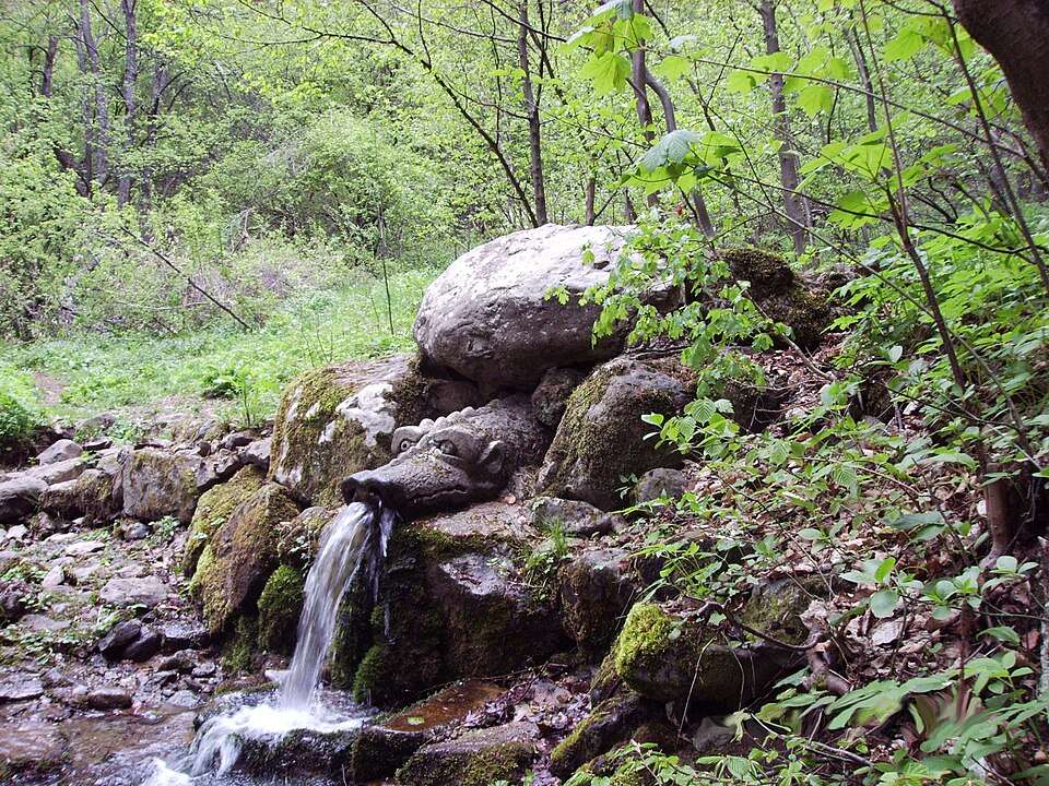
Bankya is a village in Tran Municipality, Pernik Province, Bulgaria. EKATTE code: 02645. Elevation range: 500–699 m. This profile uses the official National Register of Settlements. View the location on the map and add the settlement to your personal itinerary.
Explore nearby places

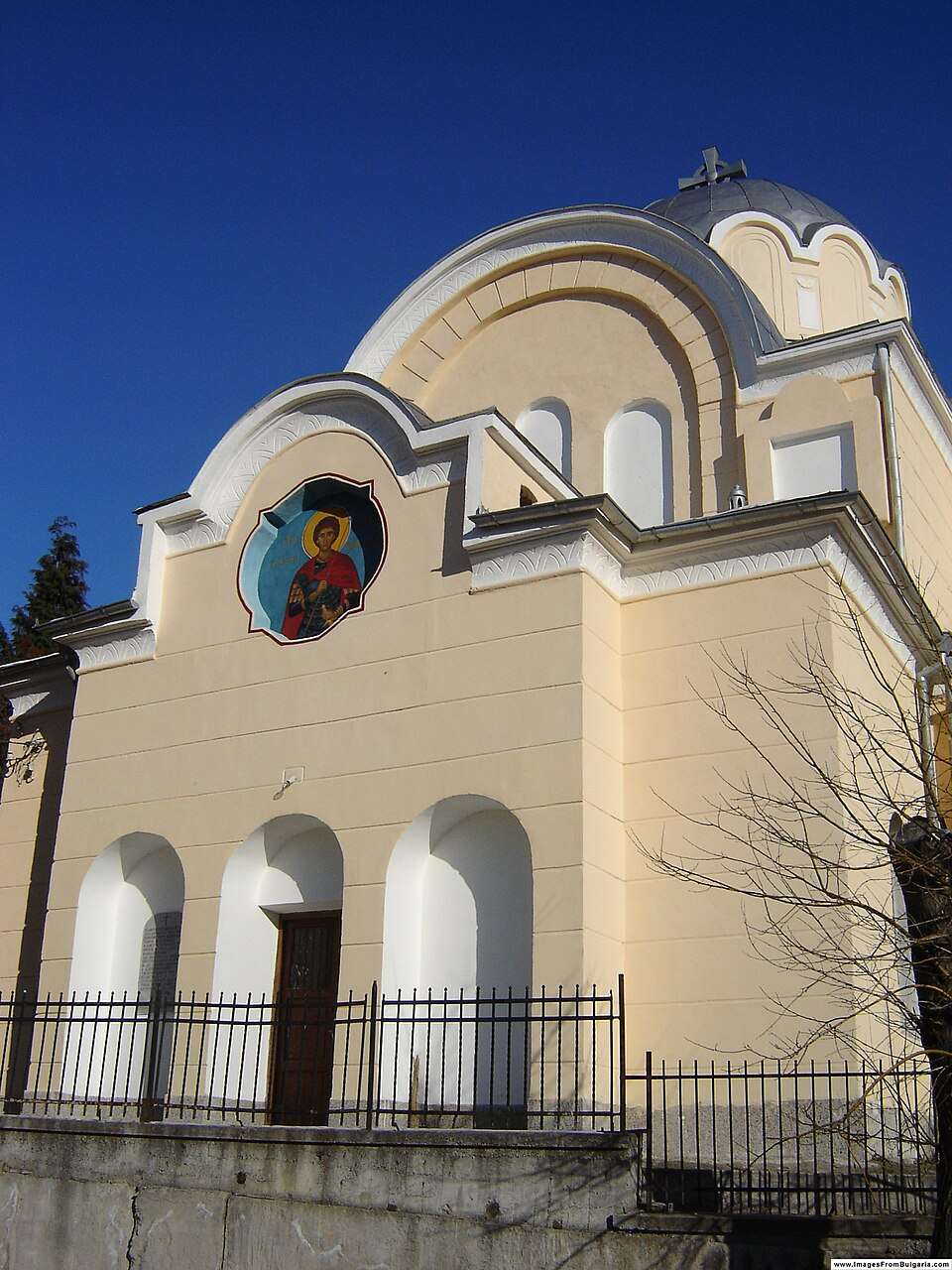
Photograph from Batanovtsi (Pernik Municipality)

Settlements

Batanovtsi (Pernik Municipality)

Batanovtsi, Pernik Municipality

Photograph from Batanovtsi (Pernik Municipality)

Batanovtsi is a city in Pernik Municipality, Pernik Province, Bulgaria. EKATTE code: 72223. Elevation range: 500–699 m. This profile uses the official National Register of Settlements. View the location on the map and add the settlement to your personal itinerary.
Explore nearby places

Photo: Spiritia · CC BY-SA 3.0 · License

Map of Bulgaria with a marker for Baykalsko (Radomir Municipality)Representative point of the settlement. Overview map; confirm the exact visiting address.LOCATION · BULGARIABaykalsko (Radomir Municipality)NRepresentative point of the settlementMap: Global Tour · Outline: Natural Earth

Representative point of the settlement. Overview map; confirm the exact visiting address.

Settlements

Baykalsko (Radomir Municipality)

Baykalsko, Radomir Municipality

Baykalsko is a village in Radomir Municipality, Pernik Province, Bulgaria. EKATTE code: 02230. Elevation range: 700–999 m. This profile uses the official National Register of Settlements. View the location on the map and add the settlement to your personal itinerary.
Explore nearby places

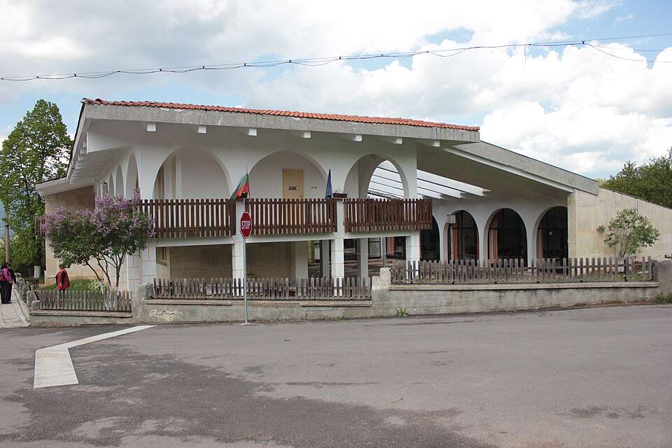
Map of Bulgaria with a marker for Begunovtsi (Breznik Municipality)Representative point of the settlement. Overview map; confirm the exact visiting address.LOCATION · BULGARIABegunovtsi (Breznik Municipality)NRepresentative point of the settlementMap: Global Tour · Outline: Natural Earth

Representative point of the settlement. Overview map; confirm the exact visiting address.

Settlements

Begunovtsi (Breznik Municipality)

Begunovtsi, Breznik Municipality

Begunovtsi is a village in Breznik Municipality, Pernik Province, Bulgaria. EKATTE code: 03099. Elevation range: 700–999 m. This profile uses the official National Register of Settlements. View the location on the map and add the settlement to your personal itinerary.
Explore nearby places

Map of Bulgaria with a marker for Belanitsa (Radomir Municipality)Representative point of the settlement. Overview map; confirm the exact visiting address.LOCATION · BULGARIABelanitsa (Radomir Municipality)NRepresentative point of the settlementMap: Global Tour · Outline: Natural Earth

Representative point of the settlement. Overview map; confirm the exact visiting address.

Settlements

Belanitsa (Radomir Municipality)

Belanitsa, Radomir Municipality

Belanitsa is a village in Radomir Municipality, Pernik Province, Bulgaria. EKATTE code: 03277. Elevation range: 500–699 m. This profile uses the official National Register of Settlements. View the location on the map and add the settlement to your personal itinerary.

Explore nearby places

Photograph from Berayntsi (Tran Municipality)

Settlements

Berayntsi (Tran Municipality)

Berayntsi, Tran Municipality

Photograph from Berayntsi (Tran Municipality)

Berayntsi is a village in Tran Municipality, Pernik Province, Bulgaria. EKATTE code: 03873. Elevation range: 700–999 m. This profile uses the official National Register of Settlements. View the location on the map and add the settlement to your personal itinerary.

Explore nearby places

Photo: Vladimir3030 · CC BY-SA 4.0 · License

Map of Bulgaria with a marker for Berende (Zemen Municipality)Representative point of the settlement. Overview map; confirm the exact visiting address.LOCATION · BULGARIABerende (Zemen Municipality)NRepresentative point of the settlementMap: Global Tour · Outline: Natural Earth

Representative point of the settlement. Overview map; confirm the exact visiting address.

Settlements

Berende (Zemen Municipality)

Berende, Zemen Municipality

Berende is a village in Zemen Municipality, Pernik Province, Bulgaria. EKATTE code: 03887. Elevation range: 700–999 m. This profile uses the official National Register of Settlements. View the location on the map and add the settlement to your personal itinerary.

Explore nearby places

Map of Bulgaria with a marker for Bilintsi (Breznik Municipality)Representative point of the settlement. Overview map; confirm the exact visiting address.LOCATION · BULGARIABilintsi (Breznik Municipality)NRepresentative point of the settlementMap: Global Tour · Outline: Natural Earth

Representative point of the settlement. Overview map; confirm the exact visiting address.

Settlements

Bilintsi (Breznik Municipality)

Bilintsi, Breznik Municipality

Bilintsi is a village in Breznik Municipality, Pernik Province, Bulgaria. EKATTE code: 04042. Elevation range: 700–999 m. This profile uses the official National Register of Settlements. View the location on the map and add the settlement to your personal itinerary.

Explore nearby places

Map of Bulgaria with a marker for Blateshnitsa (Zemen Municipality)Representative point of the settlement. Overview map; confirm the exact visiting address.LOCATION · BULGARIABlateshnitsa (Zemen Municipality)NRepresentative point of the settlementMap: Global Tour · Outline: Natural Earth

Representative point of the settlement. Overview map; confirm the exact visiting address.

Settlements

Blateshnitsa (Zemen Municipality)

Blateshnitsa, Zemen Municipality

Blateshnitsa is a village in Zemen Municipality, Pernik Province, Bulgaria. EKATTE code: 04340. Elevation range: 500–699 m. This profile uses the official National Register of Settlements. View the location on the map and add the settlement to your personal itinerary.

Explore nearby places

Map of Bulgaria with a marker for Boboratsi (Radomir Municipality)Representative point of the settlement. Overview map; confirm the exact visiting address.LOCATION · BULGARIABoboratsi (Radomir Municipality)NRepresentative point of the settlementMap: Global Tour · Outline: Natural Earth

Representative point of the settlement. Overview map; confirm the exact visiting address.

Settlements

Boboratsi (Radomir Municipality)

Boboratsi, Radomir Municipality

Boboratsi is a village in Radomir Municipality, Pernik Province, Bulgaria. EKATTE code: 04529. Elevation range: 500–699 m. This profile uses the official National Register of Settlements. View the location on the map and add the settlement to your personal itinerary.

Explore nearby places

Map of Bulgaria with a marker for Bogdanov dol (Pernik Municipality)Representative point of the settlement. Overview map; confirm the exact visiting address.LOCATION · BULGARIABogdanov dol (Pernik Municipality)NRepresentative point of the settlementMap: Global Tour · Outline: Natural Earth

Representative point of the settlement. Overview map; confirm the exact visiting address.

Settlements

Bogdanov dol (Pernik Municipality)

Bogdanov dol, Pernik Municipality

Bogdanov dol is a village in Pernik Municipality, Pernik Province, Bulgaria. EKATTE code: 04618. Elevation range: 700–999 m. This profile uses the official National Register of Settlements. View the location on the map and add the settlement to your personal itinerary.

Explore nearby places

Map of Bulgaria with a marker for Bogoyna (Tran Municipality)Representative point of the settlement. Overview map; confirm the exact visiting address.LOCATION · BULGARIABogoyna (Tran Municipality)NRepresentative point of the settlementMap: Global Tour · Outline: Natural Earth

Representative point of the settlement. Overview map; confirm the exact visiting address.

Settlements

Bogoyna (Tran Municipality)

Bogoyna, Tran Municipality

Bogoyna is a village in Tran Municipality, Pernik Province, Bulgaria. EKATTE code: 04697. Elevation range: 700–999 m. This profile uses the official National Register of Settlements. View the location on the map and add the settlement to your personal itinerary.

Explore nearby places

Map of Bulgaria with a marker for Bohova (Tran Municipality)Representative point of the settlement. Overview map; confirm the exact visiting address.LOCATION · BULGARIABohova (Tran Municipality)NRepresentative point of the settlementMap: Global Tour · Outline: Natural Earth

Representative point of the settlement. Overview map; confirm the exact visiting address.

Settlements

Bohova (Tran Municipality)

Bohova, Tran Municipality

Bohova is a village in Tran Municipality, Pernik Province, Bulgaria. EKATTE code: 05918. Elevation range: 700–999 m. This profile uses the official National Register of Settlements. View the location on the map and add the settlement to your personal itinerary.

Explore nearby places

Map of Bulgaria with a marker for Bornarevo (Radomir Municipality)Representative point of the settlement. Overview map; confirm the exact visiting address.LOCATION · BULGARIABornarevo (Radomir Municipality)NRepresentative point of the settlementMap: Global Tour · Outline: Natural Earth

Representative point of the settlement. Overview map; confirm the exact visiting address.

Settlements

Bornarevo (Radomir Municipality)

Bornarevo, Radomir Municipality

Bornarevo is a village in Radomir Municipality, Pernik Province, Bulgaria. EKATTE code: 05534. Elevation range: 500–699 m. This profile uses the official National Register of Settlements. View the location on the map and add the settlement to your personal itinerary.

Explore nearby places

Photograph from Bosnek (Pernik Municipality)

Settlements

Bosnek (Pernik Municipality)

Bosnek, Pernik Municipality

Photograph from Bosnek (Pernik Municipality)

Bosnek is a village in Pernik Municipality, Pernik Province, Bulgaria. EKATTE code: 05760. Elevation range: 700–999 m. This profile uses the official National Register of Settlements. View the location on the map and add the settlement to your personal itinerary.

Explore nearby places

Photo: Kiselica at Bulgarian Wikipedia · Public domain · License

Photograph from Breznik (Breznik Municipality)

Settlements

Breznik (Breznik Municipality)

Breznik, Breznik Municipality

Photograph from Breznik (Breznik Municipality)

Breznik is a city in Breznik Municipality, Pernik Province, Bulgaria. EKATTE code: 06286. Elevation range: 700–999 m. Municipal centre. This profile uses the official National Register of Settlements. View the location on the map and add the settlement to your personal itinerary.

Explore nearby places

Photo: Petar Iankov · CC BY 2.5 · License

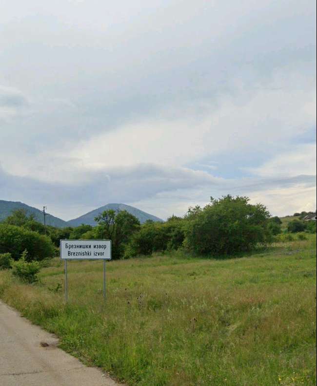
Photograph from Breznishki izvor (Breznik Municipality)

Settlements

Breznishki izvor (Breznik Municipality)

Breznishki izvor, Breznik Municipality

Photograph from Breznishki izvor (Breznik Municipality)

Breznishki izvor is a village in Breznik Municipality, Pernik Province, Bulgaria. EKATTE code: 06313. Elevation range: 700–999 m. This profile uses the official National Register of Settlements. View the location on the map and add the settlement to your personal itinerary.

Explore nearby places

Photo: 123veni456 · CC BY-SA 4.0 · License

Map of Bulgaria with a marker for Brusnik (Breznik Municipality)Representative point of the settlement. Overview map; confirm the exact visiting address.LOCATION · BULGARIABrusnik (Breznik Municipality)NRepresentative point of the settlementMap: Global Tour · Outline: Natural Earth

Representative point of the settlement. Overview map; confirm the exact visiting address.

Settlements

Brusnik (Breznik Municipality)

Brusnik, Breznik Municipality

Brusnik is a village in Breznik Municipality, Pernik Province, Bulgaria. EKATTE code: 06639. Elevation range: 700–999 m. This profile uses the official National Register of Settlements. View the location on the map and add the settlement to your personal itinerary.

Explore nearby places

Photograph from Busintsi (Tran Municipality)

Settlements

Busintsi (Tran Municipality)

Busintsi, Tran Municipality

Photograph from Busintsi (Tran Municipality)

Busintsi is a village in Tran Municipality, Pernik Province, Bulgaria. EKATTE code: 07096. Elevation range: 700–999 m. This profile uses the official National Register of Settlements. View the location on the map and add the settlement to your personal itinerary.

Explore nearby places

Photo: Anton Lefterov · CC BY-SA 4.0 · License

Map of Bulgaria with a marker for Butrointsi (Tran Municipality)Representative point of the settlement. Overview map; confirm the exact visiting address.LOCATION · BULGARIAButrointsi (Tran Municipality)NRepresentative point of the settlementMap: Global Tour · Outline: Natural Earth

Representative point of the settlement. Overview map; confirm the exact visiting address.

Settlements

Butrointsi (Tran Municipality)

Butrointsi, Tran Municipality

Butrointsi is a village in Tran Municipality, Pernik Province, Bulgaria. EKATTE code: 07137. Elevation range: 700–999 m. This profile uses the official National Register of Settlements. View the location on the map and add the settlement to your personal itinerary.

Explore nearby places

Map of Bulgaria with a marker for Chepino (Kovachevtsi Municipality)Representative point of the settlement. Overview map; confirm the exact visiting address.LOCATION · BULGARIAChepino (Kovachevtsi Municipality)NRepresentative point of the settlementMap: Global Tour · Outline: Natural Earth

Representative point of the settlement. Overview map; confirm the exact visiting address.

Settlements

Chepino (Kovachevtsi Municipality)

Chepino, Kovachevtsi Municipality

Chepino is a village in Kovachevtsi Municipality, Pernik Province, Bulgaria. EKATTE code: 80385. Elevation range: 700–999 m. This profile uses the official National Register of Settlements. View the location on the map and add the settlement to your personal itinerary.

Explore nearby places

Provinces and administrative relationships use the NSI EKATTE reference catalogue. НСИ · NSI

© 2026 Global Tour