
居民点
Balkanski(Razgrad 市镇)
Balkanski, Razgrad Municipality
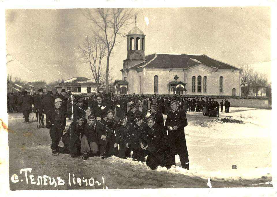
Balkanski(Razgrad 市镇)的历史照片
Balkanski 是保加利亚拉兹格勒州 Razgrad 市镇的一处村庄。 EKATTE 代码:02467。海拔范围:200–299 米。 本资料依据官方《全国居民点登记册》编写。您可以在地图上查看位置,并将此地加入个人旅行路线。
浏览附近地点图片来源: Litev · CC BY-SA 4.0 · 许可协议
探索保加利亚各地
选择一个地区,探索旅行途中的景点、城市和村庄。
搜索覆盖整个地区,景点筛选条件和搜索半径不会限制此处的结果。
统计包含目录中已发布且注明所属地区的地点。
州府: Razgrad
找到的地点: 103 · 显示 1–24 · 页 1 / 5
地图仅标出有参考坐标的地点。编号与列表对应,相邻地点会分组。请另行确认参观地址。
居民点参考坐标
坐标来源居民点参考坐标
坐标来源居民点参考坐标
坐标来源居民点参考坐标
坐标来源居民点参考坐标
坐标来源居民点参考坐标
坐标来源居民点参考坐标
坐标来源居民点参考坐标
坐标来源居民点参考坐标
坐标来源居民点参考坐标
坐标来源居民点参考坐标
坐标来源居民点参考坐标
坐标来源居民点参考坐标
坐标来源居民点参考坐标
坐标来源居民点参考坐标
坐标来源居民点参考坐标
坐标来源居民点参考坐标
坐标来源居民点参考坐标
坐标来源居民点参考坐标
坐标来源居民点参考坐标
坐标来源居民点参考坐标
坐标来源居民点参考坐标
坐标来源居民点参考坐标
坐标来源居民点参考坐标
坐标来源地图:Global Tour · 轮廓:Natural Earth
可在此页选择最多 12 个地点并调整顺序。切换页面、语言或筛选条件会清除临时选择。请在规划器中确认添加。
已选地点: 0 / 12
尚未选择地点。
规划器会核对地点是否仍已发布。此顺序仅为建议,实际道路路线需另行规划。
居民点
Balkanski, Razgrad Municipality
Balkanski(Razgrad 市镇)的历史照片
Balkanski 是保加利亚拉兹格勒州 Razgrad 市镇的一处村庄。 EKATTE 代码:02467。海拔范围:200–299 米。 本资料依据官方《全国居民点登记册》编写。您可以在地图上查看位置,并将此地加入个人旅行路线。
浏览附近地点图片来源: Litev · CC BY-SA 4.0 · 许可协议
Representative point of the settlement. Overview map; confirm the exact visiting address.
居民点
Bardokva, Isperih Municipality
Bardokva 是保加利亚拉兹格勒州 Isperih 市镇的一处村庄。 EKATTE 代码:07452。海拔范围:200–299 米。 本资料依据官方《全国居民点登记册》编写。您可以在地图上查看位置,并将此地加入个人旅行路线。
浏览附近地点Representative point of the settlement. Overview map; confirm the exact visiting address.
居民点
Beli Lom, Loznitsa Municipality
Beli Lom 是保加利亚拉兹格勒州 Loznitsa 市镇的一处村庄。 EKATTE 代码:24092。海拔范围:300–499 米。 本资料依据官方《全国居民点登记册》编写。您可以在地图上查看位置,并将此地加入个人旅行路线。
浏览附近地点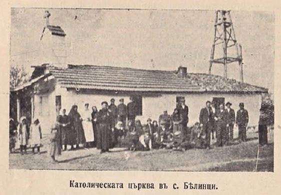
居民点
Belintsi, Isperih Municipality
Belintsi(Isperih 市镇)的历史照片
Belintsi 是保加利亚拉兹格勒州 Isperih 市镇的一处村庄。 EKATTE 代码:03472。海拔范围:200–299 米。 本资料依据官方《全国居民点登记册》编写。您可以在地图上查看位置,并将此地加入个人旅行路线。
浏览附近地点图片来源: Unknown author Unknown author · Public domain · 许可协议
Representative point of the settlement. Overview map; confirm the exact visiting address.
居民点
Belovets, Kubrat Municipality
Belovets 是保加利亚拉兹格勒州 Kubrat 市镇的一处村庄。 EKATTE 代码:03575。海拔范围:100–199 米。 本资料依据官方《全国居民点登记册》编写。您可以在地图上查看位置,并将此地加入个人旅行路线。
浏览附近地点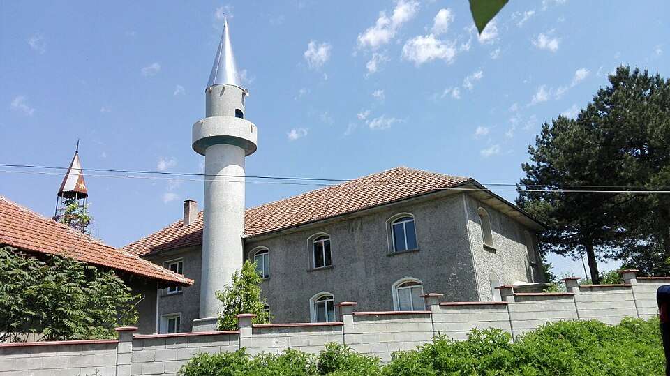
居民点
Bisertsi, Kubrat Municipality
Bisertsi(Kubrat 市镇)的照片
Bisertsi 是保加利亚拉兹格勒州 Kubrat 市镇的一处村庄。 EKATTE 代码:04131。海拔范围:100–199 米。 本资料依据官方《全国居民点登记册》编写。您可以在地图上查看位置,并将此地加入个人旅行路线。
浏览附近地点图片来源: Litev · CC BY-SA 4.0 · 许可协议

居民点
Blagoevo, Razgrad Municipality
Blagoevo(Razgrad 市镇)的照片
Blagoevo 是保加利亚拉兹格勒州 Razgrad 市镇的一处村庄。 EKATTE 代码:04296。海拔范围:200–299 米。 本资料依据官方《全国居民点登记册》编写。您可以在地图上查看位置,并将此地加入个人旅行路线。
浏览附近地点图片来源: Gelin · Public domain · 许可协议
居民点
Bogdantsi, Samuil Municipality
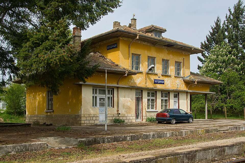
Bogdantsi(Samuil 市镇)的照片
Bogdantsi 是保加利亚拉兹格勒州 Samuil 市镇的一处村庄。 EKATTE 代码:04666。海拔范围:300–499 米。 本资料依据官方《全国居民点登记册》编写。您可以在地图上查看位置,并将此地加入个人旅行路线。
浏览附近地点图片来源: Petr Štefek · CC BY-SA 3.0 cz · 许可协议
Representative point of the settlement. Overview map; confirm the exact visiting address.
居民点
Bogomiltsi, Samuil Municipality
Bogomiltsi 是保加利亚拉兹格勒州 Samuil 市镇的一处村庄。 EKATTE 代码:04741。海拔范围:300–499 米。 本资料依据官方《全国居民点登记册》编写。您可以在地图上查看位置,并将此地加入个人旅行路线。
浏览附近地点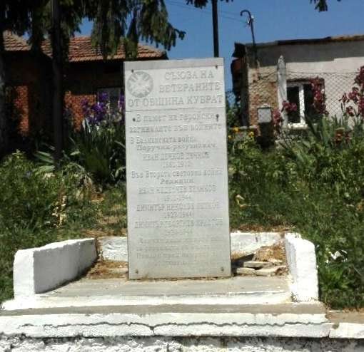
居民点
Bozhurovo, Kubrat Municipality
Bozhurovo(Kubrat 市镇)的照片
Bozhurovo 是保加利亚拉兹格勒州 Kubrat 市镇的一处村庄。 EKATTE 代码:05058。海拔范围:100–199 米。 本资料依据官方《全国居民点登记册》编写。您可以在地图上查看位置,并将此地加入个人旅行路线。
浏览附近地点图片来源: Litev · CC BY-SA 4.0 · 许可协议
Representative point of the settlement. Overview map; confirm the exact visiting address.
居民点
Brestovene, Zavet Municipality
Brestovene 是保加利亚拉兹格勒州 Zavet 市镇的一处村庄。 EKATTE 代码:06481。海拔范围:200–299 米。 本资料依据官方《全国居民点登记册》编写。您可以在地图上查看位置,并将此地加入个人旅行路线。
浏览附近地点Representative point of the settlement. Overview map; confirm the exact visiting address.
居民点
Cherkovna, Razgrad Municipality
Cherkovna 是保加利亚拉兹格勒州 Razgrad 市镇的一处村庄。 EKATTE 代码:80724。海拔范围:300–499 米。 本资料依据官方《全国居民点登记册》编写。您可以在地图上查看位置,并将此地加入个人旅行路线。
浏览附近地点Representative point of the settlement. Overview map; confirm the exact visiting address.
居民点
Chudomir, Loznitsa Municipality
Chudomir 是保加利亚拉兹格勒州 Loznitsa 市镇的一处村庄。 EKATTE 代码:81619。海拔范围:200–299 米。 本资料依据官方《全国居民点登记册》编写。您可以在地图上查看位置,并将此地加入个人旅行路线。
浏览附近地点Representative point of the settlement. Overview map; confirm the exact visiting address.
居民点
Delchevo, Isperih Municipality
Delchevo 是保加利亚拉兹格勒州 Isperih 市镇的一处村庄。 EKATTE 代码:20609。海拔范围:200–299 米。 本资料依据官方《全国居民点登记册》编写。您可以在地图上查看位置,并将此地加入个人旅行路线。
浏览附近地点Representative point of the settlement. Overview map; confirm the exact visiting address.
居民点
Dragomazh, Isperih Municipality
Dragomazh 是保加利亚拉兹格勒州 Isperih 市镇的一处村庄。 EKATTE 代码:24921。海拔范围:200–299 米。 本资料依据官方《全国居民点登记册》编写。您可以在地图上查看位置,并将此地加入个人旅行路线。
浏览附近地点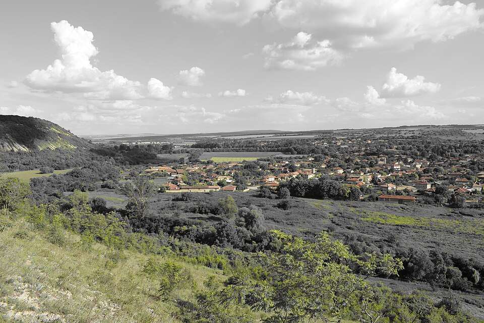
居民点
Dryanovets, Razgrad Municipality
Dryanovets(Razgrad 市镇)的照片
Dryanovets 是保加利亚拉兹格勒州 Razgrad 市镇的一处村庄。 EKATTE 代码:23902。海拔范围:100–199 米。 本资料依据官方《全国居民点登记册》编写。您可以在地图上查看位置,并将此地加入个人旅行路线。
浏览附近地点图片来源: Vmv7107 · CC BY-SA 4.0 · 许可协议
Representative point of the settlement. Overview map; confirm the exact visiting address.
居民点
Duhovets, Isperih Municipality
Duhovets 是保加利亚拉兹格勒州 Isperih 市镇的一处村庄。 EKATTE 代码:24150。海拔范围:300–499 米。 本资料依据官方《全国居民点登记册》编写。您可以在地图上查看位置,并将此地加入个人旅行路线。
浏览附近地点Representative point of the settlement. Overview map; confirm the exact visiting address.
居民点
Dyankovo, Razgrad Municipality
Dyankovo 是保加利亚拉兹格勒州 Razgrad 市镇的一处村庄。 EKATTE 代码:24829。海拔范围:300–499 米。 本资料依据官方《全国居民点登记册》编写。您可以在地图上查看位置,并将此地加入个人旅行路线。
浏览附近地点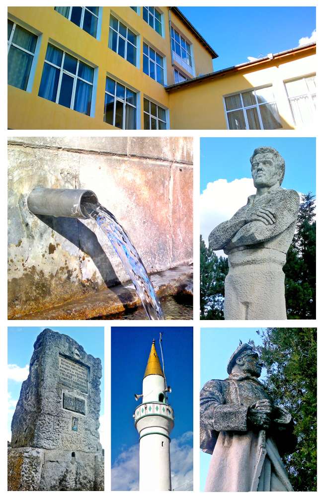
居民点
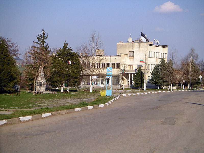
Ezerche, Tsar Kaloyan Municipality
Ezerche(Tsar Kaloyan 市镇)的照片
Ezerche 是保加利亚拉兹格勒州 Tsar Kaloyan 市镇的一处村庄。 EKATTE 代码:27156。海拔范围:300–499 米。 本资料依据官方《全国居民点登记册》编写。您可以在地图上查看位置,并将此地加入个人旅行路线。
浏览附近地点图片来源: Freshmaniak · CC BY-SA 3.0 · 许可协议
居民点
Getsovo, Razgrad Municipality
Getsovo(Razgrad 市镇)的照片
Getsovo 是保加利亚拉兹格勒州 Razgrad 市镇的一处村庄。 EKATTE 代码:18589。海拔范围:200–299 米。 本资料依据官方《全国居民点登记册》编写。您可以在地图上查看位置,并将此地加入个人旅行路线。
浏览附近地点图片来源: No machine-readable author provided. Tsonpen~commonswiki assumed (based on copyright claims). · CC BY-SA 3.0 · 许可协议
Representative point of the settlement. Overview map; confirm the exact visiting address.
居民点
Golyam izvor, Samuil Municipality
Golyam izvor 是保加利亚拉兹格勒州 Samuil 市镇的一处村庄。 EKATTE 代码:15761。海拔范围:300–499 米。 本资料依据官方《全国居民点登记册》编写。您可以在地图上查看位置,并将此地加入个人旅行路线。
浏览附近地点Representative point of the settlement. Overview map; confirm the exact visiting address.
居民点
Golyam Porovets, Isperih Municipality
Golyam Porovets 是保加利亚拉兹格勒州 Isperih 市镇的一处村庄。 EKATTE 代码:15953。海拔范围:200–299 米。 本资料依据官方《全国居民点登记册》编写。您可以在地图上查看位置,并将此地加入个人旅行路线。
浏览附近地点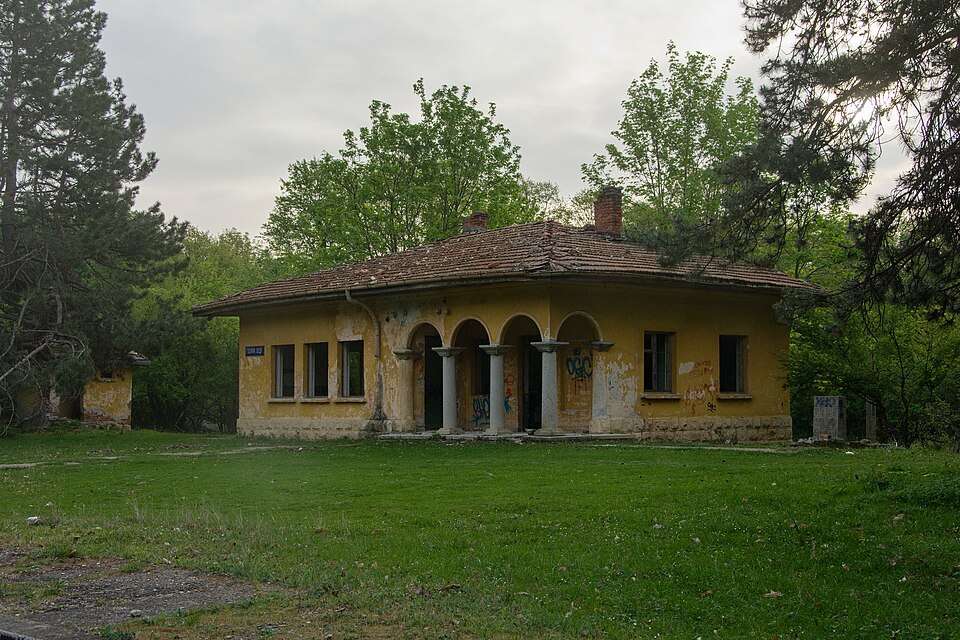
居民点
Golyama voda, Samuil Municipality
Golyama voda(Samuil 市镇)的照片
Golyama voda 是保加利亚拉兹格勒州 Samuil 市镇的一处村庄。 EKATTE 代码:15669。海拔范围:200–299 米。 本资料依据官方《全国居民点登记册》编写。您可以在地图上查看位置,并将此地加入个人旅行路线。
浏览附近地点图片来源: Petr Štefek · CC BY-SA 3.0 cz · 许可协议
Representative point of the settlement. Overview map; confirm the exact visiting address.
居民点
Gorichevo, Kubrat Municipality
Gorichevo 是保加利亚拉兹格勒州 Kubrat 市镇的一处村庄。 EKATTE 代码:16105。海拔范围:100–199 米。 本资料依据官方《全国居民点登记册》编写。您可以在地图上查看位置,并将此地加入个人旅行路线。
浏览附近地点地区及行政区划数据来自保加利亚国家统计局 EKATTE。 НСИ · NSI