
居民点
Nisovo(Ivanovo 市镇)
Nisovo, Ivanovo Municipality
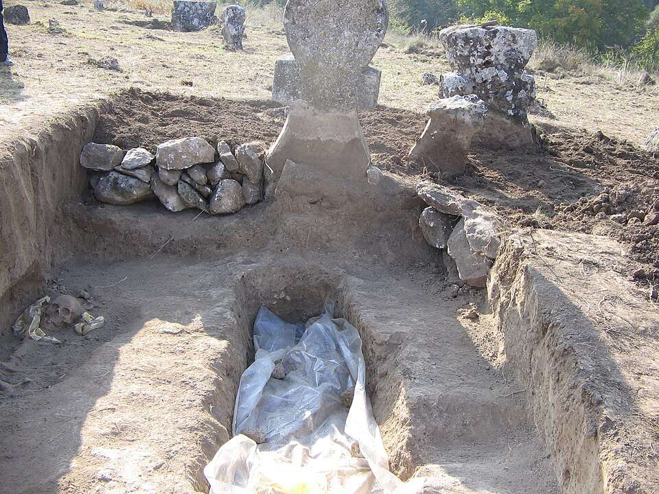
Nisovo(Ivanovo 市镇)的照片
Nisovo 是保加利亚鲁塞州 Ivanovo 市镇的一处村庄。 EKATTE 代码:51768。海拔范围:100–199 米。 本资料依据官方《全国居民点登记册》编写。您可以在地图上查看位置,并将此地加入个人旅行路线。
浏览附近地点图片来源: Ivelin Minkov · CC BY 3.0 · 许可协议
探索保加利亚各地
选择一个地区,探索旅行途中的景点、城市和村庄。
搜索覆盖整个地区,景点筛选条件和搜索半径不会限制此处的结果。
统计包含目录中已发布且注明所属地区的地点。
州府: Ruse
找到的地点: 83 · 显示 49–72 · 页 3 / 4
地图仅标出有参考坐标的地点。编号与列表对应,相邻地点会分组。请另行确认参观地址。
居民点参考坐标
坐标来源居民点参考坐标
坐标来源居民点参考坐标
坐标来源居民点参考坐标
坐标来源居民点参考坐标
坐标来源居民点参考坐标
坐标来源居民点参考坐标
坐标来源居民点参考坐标
坐标来源居民点参考坐标
坐标来源居民点参考坐标
坐标来源居民点参考坐标
坐标来源居民点参考坐标
坐标来源居民点参考坐标
坐标来源居民点参考坐标
坐标来源居民点参考坐标
坐标来源居民点参考坐标
坐标来源居民点参考坐标
坐标来源居民点参考坐标
坐标来源居民点参考坐标
坐标来源居民点参考坐标
坐标来源居民点参考坐标
坐标来源居民点参考坐标
坐标来源居民点参考坐标
坐标来源居民点参考坐标
坐标来源地图:Global Tour · 轮廓:Natural Earth
可在此页选择最多 12 个地点并调整顺序。切换页面、语言或筛选条件会清除临时选择。请在规划器中确认添加。
已选地点: 0 / 12
尚未选择地点。
规划器会核对地点是否仍已发布。此顺序仅为建议,实际道路路线需另行规划。
居民点
Nisovo, Ivanovo Municipality
Nisovo(Ivanovo 市镇)的照片
Nisovo 是保加利亚鲁塞州 Ivanovo 市镇的一处村庄。 EKATTE 代码:51768。海拔范围:100–199 米。 本资料依据官方《全国居民点登记册》编写。您可以在地图上查看位置,并将此地加入个人旅行路线。
浏览附近地点图片来源: Ivelin Minkov · CC BY 3.0 · 许可协议
居民点
Novgrad, Tsenovo Municipality
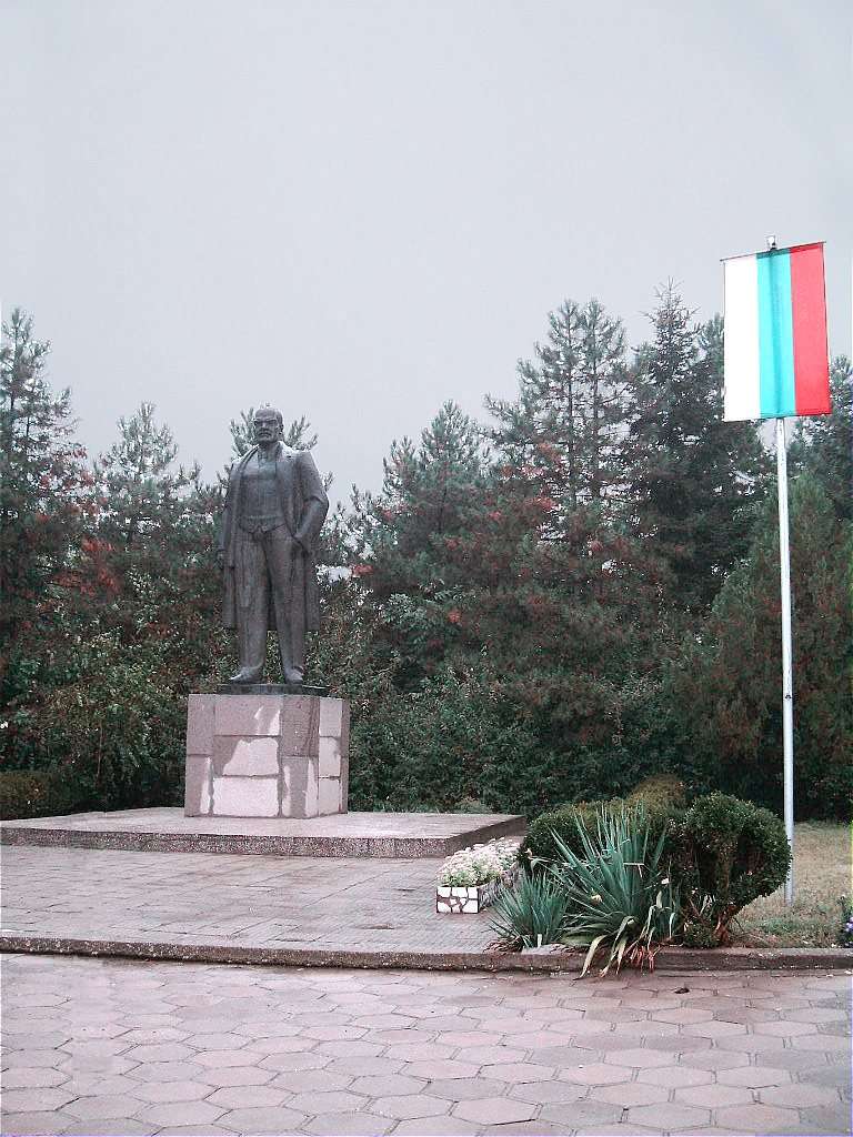
Novgrad(Tsenovo 市镇)的照片
Novgrad 是保加利亚鲁塞州 Tsenovo 市镇的一处村庄。 EKATTE 代码:51977。海拔范围:50–99 米。 本资料依据官方《全国居民点登记册》编写。您可以在地图上查看位置,并将此地加入个人旅行路线。
浏览附近地点图片来源: User:Azalia · Public domain · 许可协议
Representative point of the settlement. Overview map; confirm the exact visiting address.
居民点
Novo selo, Ruse Municipality
Novo selo 是保加利亚鲁塞州 Ruse 市镇的一处村庄。 EKATTE 代码:52235。海拔范围:100–199 米。 本资料依据官方《全国居民点登记册》编写。您可以在地图上查看位置,并将此地加入个人旅行路线。
浏览附近地点
居民点
Obretenik, Borovo Municipality
Obretenik(Borovo 市镇)的照片
Obretenik 是保加利亚鲁塞州 Borovo 市镇的一处村庄。 EKATTE 代码:53117。海拔范围:200–299 米。 本资料依据官方《全国居民点登记册》编写。您可以在地图上查看位置,并将此地加入个人旅行路线。
浏览附近地点图片来源: Svilen1970 · CC BY-SA 4.0 · 许可协议
Representative point of the settlement. Overview map; confirm the exact visiting address.
居民点
Ostritsa, Dve mogili Municipality
Ostritsa 是保加利亚鲁塞州 Dve mogili 市镇的一处村庄。 EKATTE 代码:54362。海拔范围:100–199 米。 本资料依据官方《全国居民点登记册》编写。您可以在地图上查看位置,并将此地加入个人旅行路线。
浏览附近地点Representative point of the settlement. Overview map; confirm the exact visiting address.
居民点
Pepelina, Dve mogili Municipality
Pepelina 是保加利亚鲁塞州 Dve mogili 市镇的一处村庄。 EKATTE 代码:55837。海拔范围:100–199 米。 本资料依据官方《全国居民点登记册》编写。您可以在地图上查看位置,并将此地加入个人旅行路线。
浏览附近地点Representative point of the settlement. Overview map; confirm the exact visiting address.
居民点
Pet kladentsi, Byala Municipality
Pet kladentsi 是保加利亚鲁塞州 Byala 市镇的一处村庄。 EKATTE 代码:55988。海拔范围:200–299 米。 本资料依据官方《全国居民点登记册》编写。您可以在地图上查看位置,并将此地加入个人旅行路线。
浏览附近地点Representative point of the settlement. Overview map; confirm the exact visiting address.
居民点
Peychinovo, Byala Municipality
Peychinovo 是保加利亚鲁塞州 Byala 市镇的一处村庄。 EKATTE 代码:55720。海拔范围:50–99 米。 本资料依据官方《全国居民点登记册》编写。您可以在地图上查看位置,并将此地加入个人旅行路线。
浏览附近地点Representative point of the settlement. Overview map; confirm the exact visiting address.
居民点
Piperkovo, Tsenovo Municipality
Piperkovo 是保加利亚鲁塞州 Tsenovo 市镇的一处村庄。 EKATTE 代码:56366。海拔范围:50–99 米。 本资料依据官方《全国居民点登记册》编写。您可以在地图上查看位置,并将此地加入个人旅行路线。
浏览附近地点Representative point of the settlement. Overview map; confirm the exact visiting address.
居民点
Pirgovo, Ivanovo Municipality
Pirgovo 是保加利亚鲁塞州 Ivanovo 市镇的一处村庄。 EKATTE 代码:56397。海拔范围:100–199 米。 本资料依据官方《全国居民点登记册》编写。您可以在地图上查看位置,并将此地加入个人旅行路线。
浏览附近地点Representative point of the settlement. Overview map; confirm the exact visiting address.
居民点
Pisanets, Vetovo Municipality
Pisanets 是保加利亚鲁塞州 Vetovo 市镇的一处村庄。 EKATTE 代码:56441。海拔范围:100–199 米。 本资料依据官方《全国居民点登记册》编写。您可以在地图上查看位置,并将此地加入个人旅行路线。
浏览附近地点Representative point of the settlement. Overview map; confirm the exact visiting address.
居民点
Polsko Kosovo, Byala Municipality
Polsko Kosovo 是保加利亚鲁塞州 Byala 市镇的一处村庄。 EKATTE 代码:57368。海拔范围:50–99 米。 本资料依据官方《全国居民点登记册》编写。您可以在地图上查看位置,并将此地加入个人旅行路线。
浏览附近地点Representative point of the settlement. Overview map; confirm the exact visiting address.
居民点
Pomen, Dve mogili Municipality
Pomen 是保加利亚鲁塞州 Dve mogili 市镇的一处村庄。 EKATTE 代码:57488。海拔范围:200–299 米。 本资料依据官方《全国居民点登记册》编写。您可以在地图上查看位置,并将此地加入个人旅行路线。
浏览附近地点Representative point of the settlement. Overview map; confirm the exact visiting address.
居民点
Prosena, Ruse Municipality
Prosena 是保加利亚鲁塞州 Ruse 市镇的一处村庄。 EKATTE 代码:58637。海拔范围:50–99 米。 本资料依据官方《全国居民点登记册》编写。您可以在地图上查看位置,并将此地加入个人旅行路线。
浏览附近地点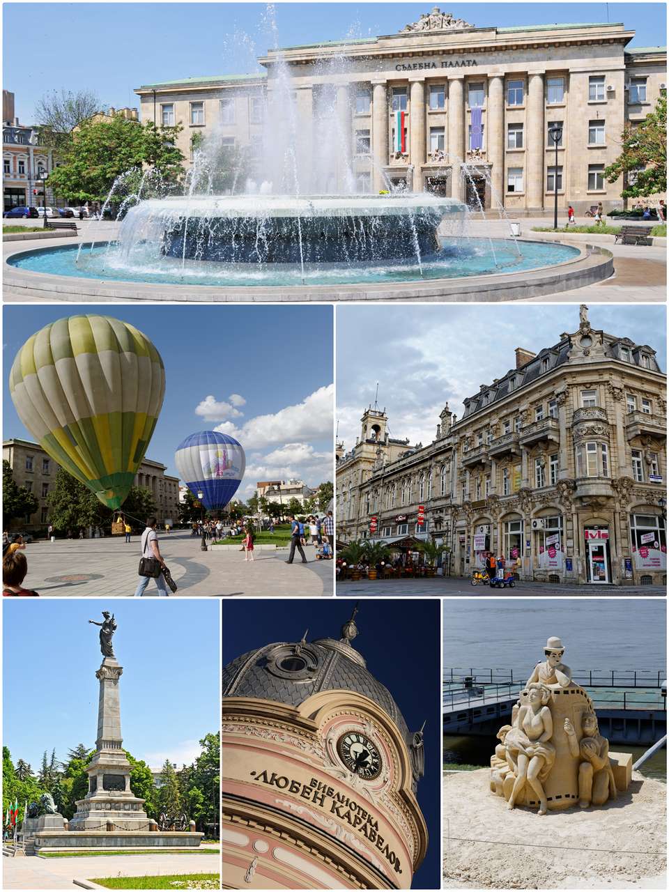
居民点
Ruse, Ruse Municipality
Ruse(Ruse 市镇)的照片
Ruse 是保加利亚鲁塞州 Ruse 市镇的一处城市。 EKATTE 代码:63427。海拔范围:0–49 米。该地是市镇行政中心兼州行政中心。 本资料依据官方《全国居民点登记册》编写。您可以在地图上查看位置,并将此地加入个人旅行路线。
浏览附近地点图片来源: Velislav Varbanov: https://www.flickr.com/photos/varbanov/ Dennis Jarvisː https://www.flickr.com/photos/archer10/ Yeowatzupː https://www.flickr.com/people/46274125@N00 · CC BY-SA 2.0 · 许可协议
居民点
Ryahovo, Slivo pole Municipality
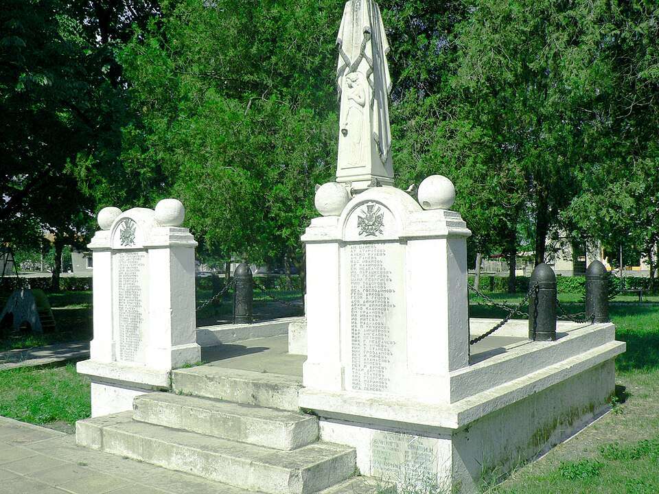
Ryahovo(Slivo pole 市镇)的照片
Ryahovo 是保加利亚鲁塞州 Slivo pole 市镇的一处村庄。 EKATTE 代码:63668。海拔范围:0–49 米。 本资料依据官方《全国居民点登记册》编写。您可以在地图上查看位置,并将此地加入个人旅行路线。
浏览附近地点图片来源: The original uploader was StanProg at Bulgarian Wikipedia . · CC BY-SA 2.5 · 许可协议
Representative point of the settlement. Overview map; confirm the exact visiting address.
居民点
Sandrovo, Ruse Municipality
Sandrovo 是保加利亚鲁塞州 Ruse 市镇的一处村庄。 EKATTE 代码:65348。海拔范围:0–49 米。 本资料依据官方《全国居民点登记册》编写。您可以在地图上查看位置,并将此地加入个人旅行路线。
浏览附近地点Representative point of the settlement. Overview map; confirm the exact visiting address.
居民点
Semerdzhievo, Ruse Municipality
Semerdzhievo 是保加利亚鲁塞州 Ruse 市镇的一处村庄。 EKATTE 代码:66158。海拔范围:100–199 米。 本资料依据官方《全国居民点登记册》编写。您可以在地图上查看位置,并将此地加入个人旅行路线。
浏览附近地点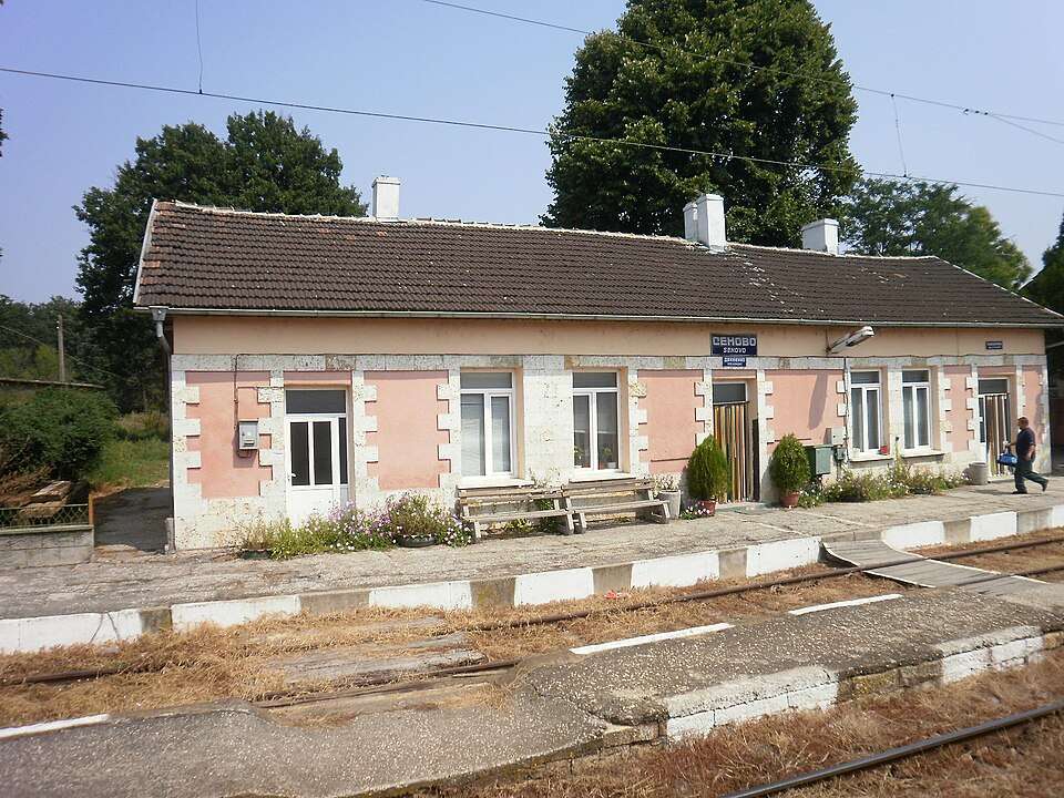
居民点
Senovo, Vetovo Municipality
Senovo(Vetovo 市镇)的照片
Senovo 是保加利亚鲁塞州 Vetovo 市镇的一处城市。 EKATTE 代码:66229。海拔范围:100–199 米。 本资料依据官方《全国居民点登记册》编写。您可以在地图上查看位置,并将此地加入个人旅行路线。
浏览附近地点图片来源: Спасимир · CC BY 3.0 · 许可协议
Representative point of the settlement. Overview map; confirm the exact visiting address.
居民点
Shirokovo, Dve mogili Municipality
Shirokovo 是保加利亚鲁塞州 Dve mogili 市镇的一处村庄。 EKATTE 代码:83301。海拔范围:100–199 米。 本资料依据官方《全国居民点登记册》编写。您可以在地图上查看位置,并将此地加入个人旅行路线。
浏览附近地点Representative point of the settlement. Overview map; confirm the exact visiting address.
居民点
Shtraklevo, Ivanovo Municipality
Shtraklevo 是保加利亚鲁塞州 Ivanovo 市镇的一处村庄。 EKATTE 代码:84049。海拔范围:100–199 米。 本资料依据官方《全国居民点登记册》编写。您可以在地图上查看位置,并将此地加入个人旅行路线。
浏览附近地点Representative point of the settlement. Overview map; confirm the exact visiting address.
居民点
Slivo pole, Slivo pole Municipality
Slivo pole 是保加利亚鲁塞州 Slivo pole 市镇的一处城市。 EKATTE 代码:67444。海拔范围:0–49 米。该地是市镇行政中心。 本资料依据官方《全国居民点登记册》编写。您可以在地图上查看位置,并将此地加入个人旅行路线。
浏览附近地点Representative point of the settlement. Overview map; confirm the exact visiting address.
居民点
Smirnenski, Vetovo Municipality
Smirnenski 是保加利亚鲁塞州 Vetovo 市镇的一处村庄。 EKATTE 代码:67578。海拔范围:200–299 米。 本资料依据官方《全国居民点登记册》编写。您可以在地图上查看位置,并将此地加入个人旅行路线。
浏览附近地点Representative point of the settlement. Overview map; confirm the exact visiting address.
居民点
Stambolovo, Slivo pole Municipality
Stambolovo 是保加利亚鲁塞州 Slivo pole 市镇的一处村庄。 EKATTE 代码:68713。海拔范围:100–199 米。 本资料依据官方《全国居民点登记册》编写。您可以在地图上查看位置,并将此地加入个人旅行路线。
浏览附近地点地区及行政区划数据来自保加利亚国家统计局 EKATTE。 НСИ · NSI