所有地区探索保加利亚各地
舒门州
选择一个地区,探索旅行途中的景点、城市和村庄。
此地区的旅游行程
搜索覆盖整个地区,景点筛选条件和搜索半径不会限制此处的结果。
- 景点
- 9
- 城市
- 8
- 村庄
- 143
- 居民点
- 151
- 目录中的市镇
- 10
- 有照片的地点
- 51
统计包含目录中已发布且注明所属地区的地点。
州府: Shumen
找到的地点: 151 · 显示 49–72 · 页 3 / 7
当前地点地图
地图仅标出有参考坐标的地点。编号与列表对应,相邻地点会分组。请另行确认参观地址。
地图:Global Tour · 轮廓:Natural Earth
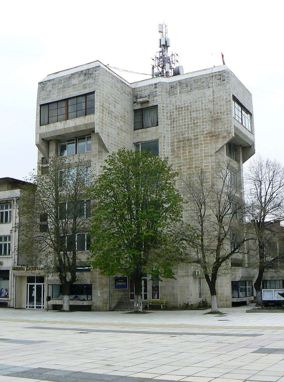
居民点
Kaspichan, Kaspichan Municipality
Kaspichan(Kaspichan 市镇) · 36587的照片
Kaspichan 是保加利亚舒门州 Kaspichan 市镇的一处城市。
EKATTE 代码:36587。海拔范围:50–99 米。该地是市镇行政中心。
本资料依据官方《全国居民点登记册》编写。您可以在地图上查看位置,并将此地加入个人旅行路线。
浏览附近地点图片来源: Spiritia · CC BY-SA 3.0 · 许可协议
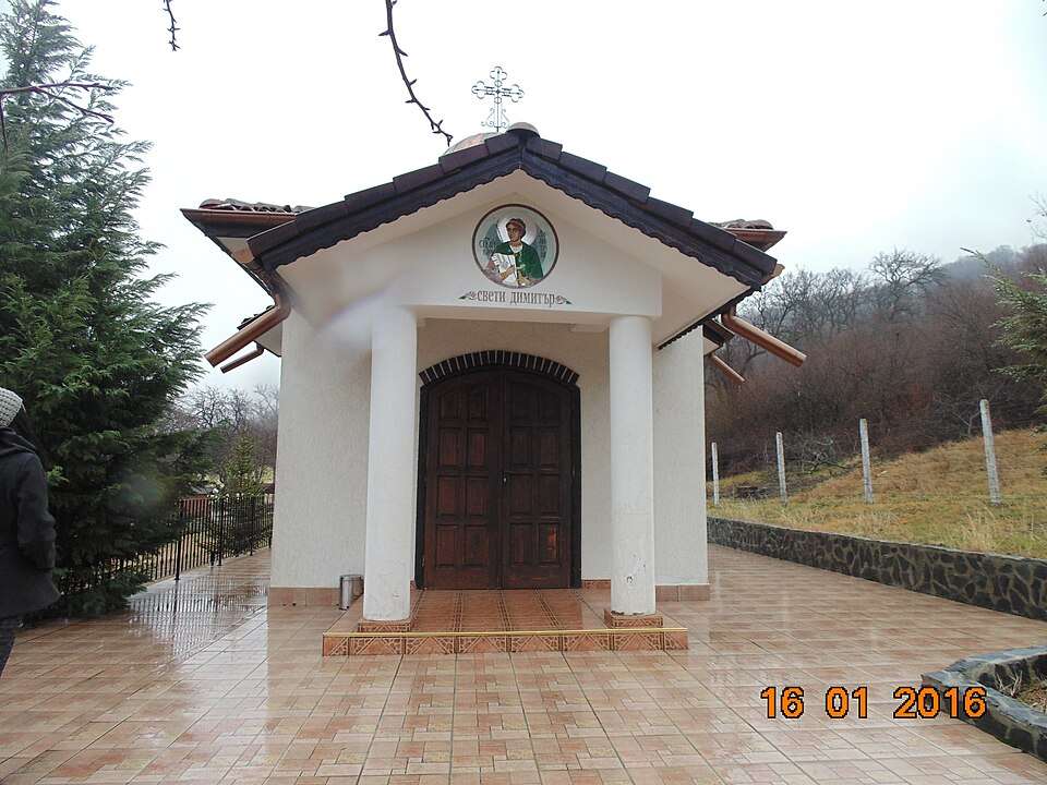
居民点
Kaspichan, Kaspichan Municipality
Kaspichan(Kaspichan 市镇) · 36590的照片
Kaspichan 是保加利亚舒门州 Kaspichan 市镇的一处村庄。
EKATTE 代码:36590。海拔范围:50–99 米。
本资料依据官方《全国居民点登记册》编写。您可以在地图上查看位置,并将此地加入个人旅行路线。
浏览附近地点图片来源: Fadli Mehmed · CC BY 3.0 · 许可协议
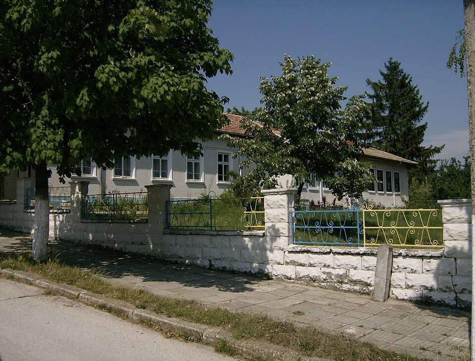
居民点
Kladenets, Shumen Municipality
Kladenets(Shumen 市镇)的照片
Kladenets 是保加利亚舒门州 Shumen 市镇的一处村庄。
EKATTE 代码:37135。海拔范围:200–299 米。
本资料依据官方《全国居民点登记册》编写。您可以在地图上查看位置,并将此地加入个人旅行路线。
浏览附近地点图片来源: Izvora · Public domain · 许可协议
Representative point of the settlement. Overview map; confirm the exact visiting address.
居民点
Kliment, Kaolinovo Municipality
Kliment 是保加利亚舒门州 Kaolinovo 市镇的一处村庄。
EKATTE 代码:37232。海拔范围:300–499 米。
本资料依据官方《全国居民点登记册》编写。您可以在地图上查看位置,并将此地加入个人旅行路线。
浏览附近地点Representative point of the settlement. Overview map; confirm the exact visiting address.
居民点
Kochovo, Veliki Preslav Municipality
Kochovo 是保加利亚舒门州 Veliki Preslav 市镇的一处村庄。
EKATTE 代码:39133。海拔范围:100–199 米。
本资料依据官方《全国居民点登记册》编写。您可以在地图上查看位置,并将此地加入个人旅行路线。
浏览附近地点Representative point of the settlement. Overview map; confirm the exact visiting address.
居民点
Konevo, Varbitsa Municipality
Konevo 是保加利亚舒门州 Varbitsa 市镇的一处村庄。
EKATTE 代码:38306。海拔范围:200–299 米。
本资料依据官方《全国居民点登记册》编写。您可以在地图上查看位置,并将此地加入个人旅行路线。
浏览附近地点Representative point of the settlement. Overview map; confirm the exact visiting address.
居民点
Konyovets, Shumen Municipality
Konyovets 是保加利亚舒门州 Shumen 市镇的一处村庄。
EKATTE 代码:41188。海拔范围:200–299 米。
本资料依据官方《全国居民点登记册》编写。您可以在地图上查看位置,并将此地加入个人旅行路线。
浏览附近地点Representative point of the settlement. Overview map; confirm the exact visiting address.
居民点
Kosovo, Kaspichan Municipality
Kosovo 是保加利亚舒门州 Kaspichan 市镇的一处村庄。
EKATTE 代码:38804。海拔范围:200–299 米。
本资料依据官方《全国居民点登记册》编写。您可以在地图上查看位置,并将此地加入个人旅行路线。
浏览附近地点Representative point of the settlement. Overview map; confirm the exact visiting address.
居民点
Kostena reka, Shumen Municipality
Kostena reka 是保加利亚舒门州 Shumen 市镇的一处村庄。
EKATTE 代码:38892。海拔范围:200–299 米。
本资料依据官方《全国居民点登记册》编写。您可以在地图上查看位置,并将此地加入个人旅行路线。
浏览附近地点Representative point of the settlement. Overview map; confirm the exact visiting address.
居民点
Krasen dol, Nikola Kozlevo Municipality
Krasen dol 是保加利亚舒门州 Nikola Kozlevo 市镇的一处村庄。
EKATTE 代码:39548。海拔范围:300–499 米。
本资料依据官方《全国居民点登记册》编写。您可以在地图上查看位置,并将此地加入个人旅行路线。
浏览附近地点Representative point of the settlement. Overview map; confirm the exact visiting address.
居民点
Kraygortsi, Varbitsa Municipality
Kraygortsi 是保加利亚舒门州 Varbitsa 市镇的一处村庄。
EKATTE 代码:39298。海拔范围:300–499 米。
本资料依据官方《全国居民点登记册》编写。您可以在地图上查看位置,并将此地加入个人旅行路线。
浏览附近地点Representative point of the settlement. Overview map; confirm the exact visiting address.
居民点
Kriva reka, Nikola Kozlevo Municipality
Kriva reka 是保加利亚舒门州 Nikola Kozlevo 市镇的一处村庄。
EKATTE 代码:39760。海拔范围:200–299 米。
本资料依据官方《全国居民点登记册》编写。您可以在地图上查看位置,并将此地加入个人旅行路线。
浏览附近地点Representative point of the settlement. Overview map; confirm the exact visiting address.
居民点
Kyolmen, Varbitsa Municipality
Kyolmen 是保加利亚舒门州 Varbitsa 市镇的一处村庄。
EKATTE 代码:41054。海拔范围:200–299 米。
本资料依据官方《全国居民点登记册》编写。您可以在地图上查看位置,并将此地加入个人旅行路线。
浏览附近地点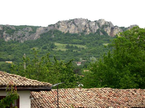
居民点
Kyulevcha, Kaspichan Municipality
Kyulevcha(Kaspichan 市镇)的照片
Kyulevcha 是保加利亚舒门州 Kaspichan 市镇的一处村庄。
EKATTE 代码:41109。海拔范围:200–299 米。
本资料依据官方《全国居民点登记册》编写。您可以在地图上查看位置,并将此地加入个人旅行路线。
浏览附近地点图片来源: Yuli · CC BY-SA 4.0 · 许可协议

居民点
Lisi vrah, Kaolinovo Municipality
Lisi vrah(Kaolinovo 市镇)的照片
Lisi vrah 是保加利亚舒门州 Kaolinovo 市镇的一处村庄。
EKATTE 代码:43846。海拔范围:200–299 米。
本资料依据官方《全国居民点登记册》编写。您可以在地图上查看位置,并将此地加入个人旅行路线。
浏览附近地点图片来源: Izvora · Public domain · 许可协议
Representative point of the settlement. Overview map; confirm the exact visiting address.
居民点
Lovets, Varbitsa Municipality
Lovets 是保加利亚舒门州 Varbitsa 市镇的一处村庄。
EKATTE 代码:43949。海拔范围:100–199 米。
本资料依据官方《全国居民点登记册》编写。您可以在地图上查看位置,并将此地加入个人旅行路线。
浏览附近地点Representative point of the settlement. Overview map; confirm the exact visiting address.
居民点
Lozevo, Shumen Municipality
Lozevo 是保加利亚舒门州 Shumen 市镇的一处村庄。
EKATTE 代码:44032。海拔范围:200–299 米。
本资料依据官方《全国居民点登记册》编写。您可以在地图上查看位置,并将此地加入个人旅行路线。
浏览附近地点Representative point of the settlement. Overview map; confirm the exact visiting address.
居民点
Lyatno, Kaolinovo Municipality
Lyatno 是保加利亚舒门州 Kaolinovo 市镇的一处村庄。
EKATTE 代码:44865。海拔范围:300–499 米。
本资料依据官方《全国居民点登记册》编写。您可以在地图上查看位置,并将此地加入个人旅行路线。
浏览附近地点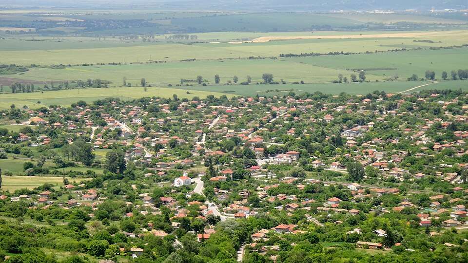
居民点
Madara, Shumen Municipality
Madara(Shumen 市镇)的照片
Madara 是保加利亚舒门州 Shumen 市镇的一处村庄。
EKATTE 代码:46053。海拔范围:100–199 米。
本资料依据官方《全国居民点登记册》编写。您可以在地图上查看位置,并将此地加入个人旅行路线。
浏览附近地点图片来源: karel291 · CC BY 3.0 · 许可协议
Representative point of the settlement. Overview map; confirm the exact visiting address.
居民点
Malomir, Varbitsa Municipality
Malomir 是保加利亚舒门州 Varbitsa 市镇的一处村庄。
EKATTE 代码:46773。海拔范围:200–299 米。
本资料依据官方《全国居民点登记册》编写。您可以在地图上查看位置,并将此地加入个人旅行路线。
浏览附近地点Representative point of the settlement. Overview map; confirm the exact visiting address.
居民点
Marash, Shumen Municipality
Marash 是保加利亚舒门州 Shumen 市镇的一处村庄。
EKATTE 代码:47161。海拔范围:100–199 米。
本资料依据官方《全国居民点登记册》编写。您可以在地图上查看位置,并将此地加入个人旅行路线。
浏览附近地点Representative point of the settlement. Overview map; confirm the exact visiting address.
居民点
Markovо, Kaspichan Municipality
Markovо 是保加利亚舒门州 Kaspichan 市镇的一处村庄。
EKATTE 代码:47319。海拔范围:200–299 米。
本资料依据官方《全国居民点登记册》编写。您可以在地图上查看位置,并将此地加入个人旅行路线。
浏览附近地点Representative point of the settlement. Overview map; confirm the exact visiting address.
居民点
Mengishevo, Varbitsa Municipality
Mengishevo 是保加利亚舒门州 Varbitsa 市镇的一处村庄。
EKATTE 代码:47785。海拔范围:200–299 米。
本资料依据官方《全国居民点登记册》编写。您可以在地图上查看位置,并将此地加入个人旅行路线。
浏览附近地点Representative point of the settlement. Overview map; confirm the exact visiting address.
居民点
Metodievo, Varbitsa Municipality
Metodievo 是保加利亚舒门州 Varbitsa 市镇的一处村庄。
EKATTE 代码:47915。海拔范围:300–499 米。
本资料依据官方《全国居民点登记册》编写。您可以在地图上查看位置,并将此地加入个人旅行路线。
浏览附近地点地区及行政区划数据来自保加利亚国家统计局 EKATTE。 НСИ · NSI
