所有地区

探索保加利亚各地

瓦尔纳州

选择一个地区,探索旅行途中的景点、城市和村庄。

此地区的旅游行程

搜索覆盖整个地区,景点筛选条件和搜索半径不会限制此处的结果。

查看地区行程
景点
12
城市
11
村庄
148
居民点
159
目录中的市镇
12
有照片的地点
56

统计包含目录中已发布且注明所属地区的地点。

州府: Varna

清除筛选条件

找到的地点: 159 · 显示 49–72 · 页 3 / 7

当前地点地图

地图仅标出有参考坐标的地点。编号与列表对应,相邻地点会分组。请另行确认参观地址。

当前地点地图地图仅标出有参考坐标的地点。编号与列表对应,相邻地点会分组。请另行确认参观地址。Gospodinovo(Byala 市镇), Kitka(Avren 市镇)1Gradinarovo(Provadia 市镇), Hrabrovo(Provadia 市镇), Kamen dyal(Dalgopol 市镇), Kiten(Provadia 市镇), Komarevo(Provadia 市镇), Komunari(Dalgopol 市镇)2Grozdyovo(Dolni chiflik 市镇), Kazashka reka(Avren 市镇)3Ignatievo(Aksakovo 市镇), Izgrev(Suvorovo 市镇), Izvorsko(Aksakovo 市镇), Kalimantsi(Suvorovo 市镇), Kamenar(Varna 市镇), Kazashko(Varna 市镇), Kichevo(Aksakovo 市镇), Kipra(Devnya 市镇), Klimentovo(Aksakovo 市镇), Konstantinovo(Varna 市镇)4Iskar(Valchi dol 市镇), Izvornik(Valchi dol 市镇), Kaloyan(Valchi dol 市镇), Karamanite(Valchi dol 市镇)5
  1. 1.
  2. 2.
  3. 3.
  4. 4.
  5. 5.

地图:Global Tour · 轮廓:Natural Earth

选择行程地点

可在此页选择最多 12 个地点并调整顺序。切换页面、语言或筛选条件会清除临时选择。请在规划器中确认添加。

选择行程地点 · 24
选择行程地点

已选地点: 0 / 12

尚未选择地点。

规划器会核对地点是否仍已发布。此顺序仅为建议,实际道路路线需另行规划。

Map of Bulgaria with a marker for Gospodinovo(Byala 市镇)Representative point of the settlement. Overview map; confirm the exact visiting address.LOCATION · BULGARIAGospodinovo(Byala 市镇)NRepresentative point of the settlementMap: Global Tour · Outline: Natural Earth

Representative point of the settlement. Overview map; confirm the exact visiting address.

居民点

Gospodinovo(Byala 市镇)

Gospodinovo, Byala Municipality

Gospodinovo 是保加利亚瓦尔纳州 Byala 市镇的一处村庄。 EKATTE 代码:17323。海拔范围:100–199 米。 本资料依据官方《全国居民点登记册》编写。您可以在地图上查看位置,并将此地加入个人旅行路线。

浏览附近地点

Map of Bulgaria with a marker for Gradinarovo(Provadia 市镇)Representative point of the settlement. Overview map; confirm the exact visiting address.LOCATION · BULGARIAGradinarovo(Provadia 市镇)NRepresentative point of the settlementMap: Global Tour · Outline: Natural Earth

Representative point of the settlement. Overview map; confirm the exact visiting address.

居民点

Gradinarovo(Provadia 市镇)

Gradinarovo, Provadia Municipality

Gradinarovo 是保加利亚瓦尔纳州 Provadia 市镇的一处村庄。 EKATTE 代码:17508。海拔范围:50–99 米。 本资料依据官方《全国居民点登记册》编写。您可以在地图上查看位置,并将此地加入个人旅行路线。

浏览附近地点
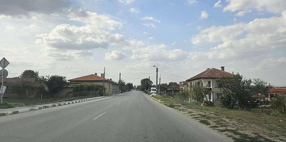
Grozdyovo(Dolni chiflik 市镇)的照片

居民点

Grozdyovo(Dolni chiflik 市镇)

Grozdyovo, Dolni chiflik Municipality

Grozdyovo(Dolni chiflik 市镇)的照片

Grozdyovo 是保加利亚瓦尔纳州 Dolni chiflik 市镇的一处村庄。 EKATTE 代码:17912。海拔范围:0–49 米。 本资料依据官方《全国居民点登记册》编写。您可以在地图上查看位置,并将此地加入个人旅行路线。

浏览附近地点

图片来源: Спрънджа · CC BY-SA 4.0 · 许可协议

Map of Bulgaria with a marker for Hrabrovo(Provadia 市镇)Representative point of the settlement. Overview map; confirm the exact visiting address.LOCATION · BULGARIAHrabrovo(Provadia 市镇)NRepresentative point of the settlementMap: Global Tour · Outline: Natural Earth

Representative point of the settlement. Overview map; confirm the exact visiting address.

居民点

Hrabrovo(Provadia 市镇)

Hrabrovo, Provadia Municipality

Hrabrovo 是保加利亚瓦尔纳州 Provadia 市镇的一处村庄。 EKATTE 代码:77387。海拔范围:50–99 米。 本资料依据官方《全国居民点登记册》编写。您可以在地图上查看位置,并将此地加入个人旅行路线。

浏览附近地点

Map of Bulgaria with a marker for Ignatievo(Aksakovo 市镇)Representative point of the settlement. Overview map; confirm the exact visiting address.LOCATION · BULGARIAIgnatievo(Aksakovo 市镇)NRepresentative point of the settlementMap: Global Tour · Outline: Natural Earth

Representative point of the settlement. Overview map; confirm the exact visiting address.

居民点

Ignatievo(Aksakovo 市镇)

Ignatievo, Aksakovo Municipality

Ignatievo 是保加利亚瓦尔纳州 Aksakovo 市镇的一处城市。 EKATTE 代码:32278。海拔范围:50–99 米。 本资料依据官方《全国居民点登记册》编写。您可以在地图上查看位置,并将此地加入个人旅行路线。

浏览附近地点

Map of Bulgaria with a marker for Iskar(Valchi dol 市镇)Representative point of the settlement. Overview map; confirm the exact visiting address.LOCATION · BULGARIAIskar(Valchi dol 市镇)NRepresentative point of the settlementMap: Global Tour · Outline: Natural Earth

Representative point of the settlement. Overview map; confirm the exact visiting address.

居民点

Iskar(Valchi dol 市镇)

Iskar, Valchi dol Municipality

Iskar 是保加利亚瓦尔纳州 Valchi dol 市镇的一处村庄。 EKATTE 代码:32860。海拔范围:200–299 米。 本资料依据官方《全国居民点登记册》编写。您可以在地图上查看位置,并将此地加入个人旅行路线。

浏览附近地点

Map of Bulgaria with a marker for Izgrev(Suvorovo 市镇)Representative point of the settlement. Overview map; confirm the exact visiting address.LOCATION · BULGARIAIzgrev(Suvorovo 市镇)NRepresentative point of the settlementMap: Global Tour · Outline: Natural Earth

Representative point of the settlement. Overview map; confirm the exact visiting address.

居民点

Izgrev(Suvorovo 市镇)

Izgrev, Suvorovo Municipality

Izgrev 是保加利亚瓦尔纳州 Suvorovo 市镇的一处村庄。 EKATTE 代码:32528。海拔范围:300–499 米。 本资料依据官方《全国居民点登记册》编写。您可以在地图上查看位置,并将此地加入个人旅行路线。

浏览附近地点

Map of Bulgaria with a marker for Izvornik(Valchi dol 市镇)Representative point of the settlement. Overview map; confirm the exact visiting address.LOCATION · BULGARIAIzvornik(Valchi dol 市镇)NRepresentative point of the settlementMap: Global Tour · Outline: Natural Earth

Representative point of the settlement. Overview map; confirm the exact visiting address.

居民点

Izvornik(Valchi dol 市镇)

Izvornik, Valchi dol Municipality

Izvornik 是保加利亚瓦尔纳州 Valchi dol 市镇的一处村庄。 EKATTE 代码:32442。海拔范围:200–299 米。 本资料依据官方《全国居民点登记册》编写。您可以在地图上查看位置,并将此地加入个人旅行路线。

浏览附近地点

Map of Bulgaria with a marker for Izvorsko(Aksakovo 市镇)Representative point of the settlement. Overview map; confirm the exact visiting address.LOCATION · BULGARIAIzvorsko(Aksakovo 市镇)NRepresentative point of the settlementMap: Global Tour · Outline: Natural Earth

Representative point of the settlement. Overview map; confirm the exact visiting address.

居民点

Izvorsko(Aksakovo 市镇)

Izvorsko, Aksakovo Municipality

Izvorsko 是保加利亚瓦尔纳州 Aksakovo 市镇的一处村庄。 EKATTE 代码:32490。海拔范围:300–499 米。 本资料依据官方《全国居民点登记册》编写。您可以在地图上查看位置,并将此地加入个人旅行路线。

浏览附近地点

Map of Bulgaria with a marker for Kalimantsi(Suvorovo 市镇)Representative point of the settlement. Overview map; confirm the exact visiting address.LOCATION · BULGARIAKalimantsi(Suvorovo 市镇)NRepresentative point of the settlementMap: Global Tour · Outline: Natural Earth

Representative point of the settlement. Overview map; confirm the exact visiting address.

居民点

Kalimantsi(Suvorovo 市镇)

Kalimantsi, Suvorovo Municipality

Kalimantsi 是保加利亚瓦尔纳州 Suvorovo 市镇的一处村庄。 EKATTE 代码:35376。海拔范围:300–499 米。 本资料依据官方《全国居民点登记册》编写。您可以在地图上查看位置,并将此地加入个人旅行路线。

浏览附近地点

Map of Bulgaria with a marker for Kaloyan(Valchi dol 市镇)Representative point of the settlement. Overview map; confirm the exact visiting address.LOCATION · BULGARIAKaloyan(Valchi dol 市镇)NRepresentative point of the settlementMap: Global Tour · Outline: Natural Earth

Representative point of the settlement. Overview map; confirm the exact visiting address.

居民点

Kaloyan(Valchi dol 市镇)

Kaloyan, Valchi dol Municipality

Kaloyan 是保加利亚瓦尔纳州 Valchi dol 市镇的一处村庄。 EKATTE 代码:35506。海拔范围:200–299 米。 本资料依据官方《全国居民点登记册》编写。您可以在地图上查看位置,并将此地加入个人旅行路线。

浏览附近地点

Map of Bulgaria with a marker for Kamen dyal(Dalgopol 市镇)Representative point of the settlement. Overview map; confirm the exact visiting address.LOCATION · BULGARIAKamen dyal(Dalgopol 市镇)NRepresentative point of the settlementMap: Global Tour · Outline: Natural Earth

Representative point of the settlement. Overview map; confirm the exact visiting address.

居民点

Kamen dyal(Dalgopol 市镇)

Kamen dyal, Dalgopol Municipality

Kamen dyal 是保加利亚瓦尔纳州 Dalgopol 市镇的一处村庄。 EKATTE 代码:35777。海拔范围:100–199 米。 本资料依据官方《全国居民点登记册》编写。您可以在地图上查看位置,并将此地加入个人旅行路线。

浏览附近地点

Map of Bulgaria with a marker for Kamenar(Varna 市镇)Representative point of the settlement. Overview map; confirm the exact visiting address.LOCATION · BULGARIAKamenar(Varna 市镇)NRepresentative point of the settlementMap: Global Tour · Outline: Natural Earth

Representative point of the settlement. Overview map; confirm the exact visiting address.

居民点

Kamenar(Varna 市镇)

Kamenar, Varna Municipality

Kamenar 是保加利亚瓦尔纳州 Varna 市镇的一处村庄。 EKATTE 代码:35701。海拔范围:200–299 米。 本资料依据官方《全国居民点登记册》编写。您可以在地图上查看位置,并将此地加入个人旅行路线。

浏览附近地点

Map of Bulgaria with a marker for Karamanite(Valchi dol 市镇)Representative point of the settlement. Overview map; confirm the exact visiting address.LOCATION · BULGARIAKaramanite(Valchi dol 市镇)NRepresentative point of the settlementMap: Global Tour · Outline: Natural Earth

Representative point of the settlement. Overview map; confirm the exact visiting address.

居民点

Karamanite(Valchi dol 市镇)

Karamanite, Valchi dol Municipality

Karamanite 是保加利亚瓦尔纳州 Valchi dol 市镇的一处村庄。 EKATTE 代码:36302。海拔范围:200–299 米。 本资料依据官方《全国居民点登记册》编写。您可以在地图上查看位置,并将此地加入个人旅行路线。

浏览附近地点

Map of Bulgaria with a marker for Kazashka reka(Avren 市镇)Representative point of the settlement. Overview map; confirm the exact visiting address.LOCATION · BULGARIAKazashka reka(Avren 市镇)NRepresentative point of the settlementMap: Global Tour · Outline: Natural Earth

Representative point of the settlement. Overview map; confirm the exact visiting address.

居民点

Kazashka reka(Avren 市镇)

Kazashka reka, Avren Municipality

Kazashka reka 是保加利亚瓦尔纳州 Avren 市镇的一处村庄。 EKATTE 代码:35208。海拔范围:0–49 米。 本资料依据官方《全国居民点登记册》编写。您可以在地图上查看位置,并将此地加入个人旅行路线。

浏览附近地点
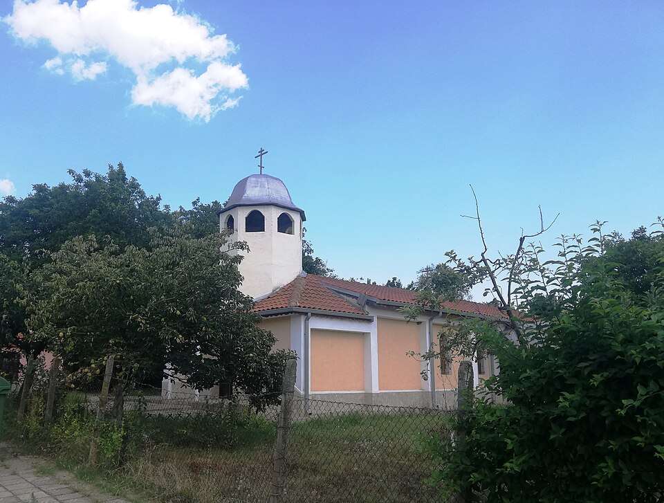
Map of Bulgaria with a marker for Kipra(Devnya 市镇)Representative point of the settlement. Overview map; confirm the exact visiting address.LOCATION · BULGARIAKipra(Devnya 市镇)NRepresentative point of the settlementMap: Global Tour · Outline: Natural Earth

Representative point of the settlement. Overview map; confirm the exact visiting address.

居民点

Kipra(Devnya 市镇)

Kipra, Devnya Municipality

Kipra 是保加利亚瓦尔纳州 Devnya 市镇的一处村庄。 EKATTE 代码:36868。海拔范围:100–199 米。 本资料依据官方《全国居民点登记册》编写。您可以在地图上查看位置,并将此地加入个人旅行路线。

浏览附近地点

Map of Bulgaria with a marker for Kiten(Provadia 市镇)Representative point of the settlement. Overview map; confirm the exact visiting address.LOCATION · BULGARIAKiten(Provadia 市镇)NRepresentative point of the settlementMap: Global Tour · Outline: Natural Earth

Representative point of the settlement. Overview map; confirm the exact visiting address.

居民点

Kiten(Provadia 市镇)

Kiten, Provadia Municipality

Kiten 是保加利亚瓦尔纳州 Provadia 市镇的一处村庄。 EKATTE 代码:37037。海拔范围:100–199 米。 本资料依据官方《全国居民点登记册》编写。您可以在地图上查看位置,并将此地加入个人旅行路线。

浏览附近地点

Map of Bulgaria with a marker for Kitka(Avren 市镇)Representative point of the settlement. Overview map; confirm the exact visiting address.LOCATION · BULGARIAKitka(Avren 市镇)NRepresentative point of the settlementMap: Global Tour · Outline: Natural Earth

Representative point of the settlement. Overview map; confirm the exact visiting address.

居民点

Kitka(Avren 市镇)

Kitka, Avren Municipality

Kitka 是保加利亚瓦尔纳州 Avren 市镇的一处村庄。 EKATTE 代码:37068。海拔范围:100–199 米。 本资料依据官方《全国居民点登记册》编写。您可以在地图上查看位置,并将此地加入个人旅行路线。

浏览附近地点

Map of Bulgaria with a marker for Klimentovo(Aksakovo 市镇)Representative point of the settlement. Overview map; confirm the exact visiting address.LOCATION · BULGARIAKlimentovo(Aksakovo 市镇)NRepresentative point of the settlementMap: Global Tour · Outline: Natural Earth

Representative point of the settlement. Overview map; confirm the exact visiting address.

居民点

Klimentovo(Aksakovo 市镇)

Klimentovo, Aksakovo Municipality

Klimentovo 是保加利亚瓦尔纳州 Aksakovo 市镇的一处村庄。 EKATTE 代码:37246。海拔范围:200–299 米。 本资料依据官方《全国居民点登记册》编写。您可以在地图上查看位置,并将此地加入个人旅行路线。

浏览附近地点

Map of Bulgaria with a marker for Komarevo(Provadia 市镇)Representative point of the settlement. Overview map; confirm the exact visiting address.LOCATION · BULGARIAKomarevo(Provadia 市镇)NRepresentative point of the settlementMap: Global Tour · Outline: Natural Earth

Representative point of the settlement. Overview map; confirm the exact visiting address.

居民点

Komarevo(Provadia 市镇)

Komarevo, Provadia Municipality

Komarevo 是保加利亚瓦尔纳州 Provadia 市镇的一处村庄。 EKATTE 代码:38114。海拔范围:50–99 米。 本资料依据官方《全国居民点登记册》编写。您可以在地图上查看位置,并将此地加入个人旅行路线。

浏览附近地点

Map of Bulgaria with a marker for Komunari(Dalgopol 市镇)Representative point of the settlement. Overview map; confirm the exact visiting address.LOCATION · BULGARIAKomunari(Dalgopol 市镇)NRepresentative point of the settlementMap: Global Tour · Outline: Natural Earth

Representative point of the settlement. Overview map; confirm the exact visiting address.

居民点

Komunari(Dalgopol 市镇)

Komunari, Dalgopol Municipality

Komunari 是保加利亚瓦尔纳州 Dalgopol 市镇的一处村庄。 EKATTE 代码:38162。海拔范围:50–99 米。 本资料依据官方《全国居民点登记册》编写。您可以在地图上查看位置,并将此地加入个人旅行路线。

浏览附近地点

Map of Bulgaria with a marker for Konstantinovo(Varna 市镇)Representative point of the settlement. Overview map; confirm the exact visiting address.LOCATION · BULGARIAKonstantinovo(Varna 市镇)NRepresentative point of the settlementMap: Global Tour · Outline: Natural Earth

Representative point of the settlement. Overview map; confirm the exact visiting address.

居民点

Konstantinovo(Varna 市镇)

Konstantinovo, Varna Municipality

Konstantinovo 是保加利亚瓦尔纳州 Varna 市镇的一处村庄。 EKATTE 代码:38354。海拔范围:50–99 米。 本资料依据官方《全国居民点登记册》编写。您可以在地图上查看位置,并将此地加入个人旅行路线。

浏览附近地点

地区及行政区划数据来自保加利亚国家统计局 EKATTE。 НСИ · NSI

© 2026 Global Tour