Places

Discover the places on our routes — history, nature and landmarks.

The catalogue continues to grow. See the linked source for visit details.

Settlements · 5,256

Places found: 5256 · Showing 3,913–3,936 of 5,256 · Page 164 / 219

Map of Bulgaria with a marker for Sazhdenik (Kyustendil Municipality)Representative point of the settlement. Overview map; confirm the exact visiting address.LOCATION · BULGARIASazhdenik (Kyustendil Municipality)NRepresentative point of the settlementMap: Global Tour · Outline: Natural Earth

Representative point of the settlement. Overview map; confirm the exact visiting address.

Bulgaria · Kyustendil

Settlements

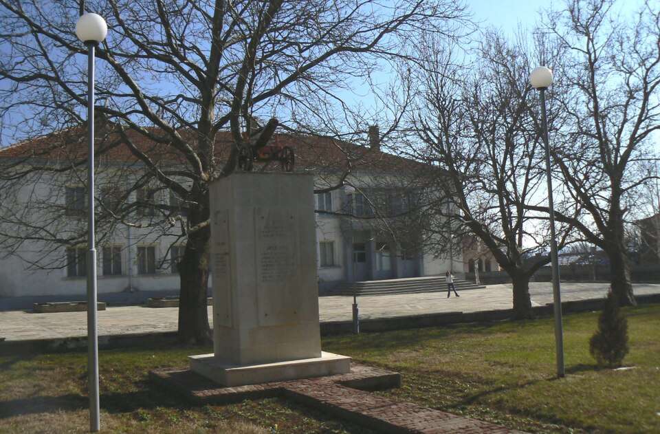
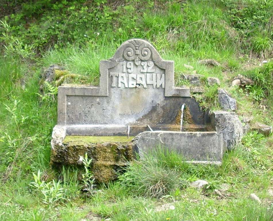
Sazhdenik (Kyustendil Municipality)

Sazhdenik is a village in Kyustendil Municipality, Kyustendil Province, Bulgaria. EKATTE code: 65142. Elevation range: ≥ 1000 m. This profile uses the official National Register of Settlements. View the location on the map and add the settlement to your personal itinerary.

About this place
View location

Map of Bulgaria with a marker for Sbor (Krumovgrad Municipality)Representative point of the settlement. Overview map; confirm the exact visiting address.LOCATION · BULGARIASbor (Krumovgrad Municipality)NRepresentative point of the settlementMap: Global Tour · Outline: Natural Earth

Representative point of the settlement. Overview map; confirm the exact visiting address.

Bulgaria · Kardzhali

Settlements

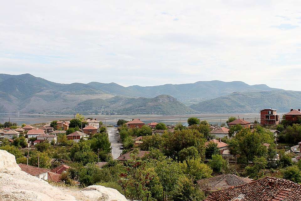
Sbor (Krumovgrad Municipality)

Sbor is a village in Krumovgrad Municipality, Kardzhali Province, Bulgaria. EKATTE code: 65454. Elevation range: 300–499 m. This profile uses the official National Register of Settlements. View the location on the map and add the settlement to your personal itinerary.

About this place
View location

Map of Bulgaria with a marker for Sbor (Pazardzhik Municipality)Representative point of the settlement. Overview map; confirm the exact visiting address.LOCATION · BULGARIASbor (Pazardzhik Municipality)NRepresentative point of the settlementMap: Global Tour · Outline: Natural Earth

Representative point of the settlement. Overview map; confirm the exact visiting address.

Bulgaria · Pazardzhik

Settlements

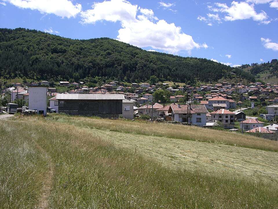
Sbor (Pazardzhik Municipality)

Sbor is a village in Pazardzhik Municipality, Pazardzhik Province, Bulgaria. EKATTE code: 65468. Elevation range: 300–499 m. This profile uses the official National Register of Settlements. View the location on the map and add the settlement to your personal itinerary.

About this place
View location

Map of Bulgaria with a marker for Sborino (Ivaylovgrad Municipality)Representative point of the settlement. Overview map; confirm the exact visiting address.LOCATION · BULGARIASborino (Ivaylovgrad Municipality)NRepresentative point of the settlementMap: Global Tour · Outline: Natural Earth

Representative point of the settlement. Overview map; confirm the exact visiting address.

Bulgaria · Haskovo

Settlements

Sborino (Ivaylovgrad Municipality)

Sborino is a village in Ivaylovgrad Municipality, Haskovo Province, Bulgaria. EKATTE code: 65485. Elevation range: 500–699 m. This profile uses the official National Register of Settlements. View the location on the map and add the settlement to your personal itinerary.

About this place
View location

Map of Bulgaria with a marker for Sechishte (Novi pazar Municipality)Representative point of the settlement. Overview map; confirm the exact visiting address.LOCATION · BULGARIASechishte (Novi pazar Municipality)NRepresentative point of the settlementMap: Global Tour · Outline: Natural Earth

Representative point of the settlement. Overview map; confirm the exact visiting address.

Bulgaria · Shumen

Settlements

Sechishte (Novi pazar Municipality)

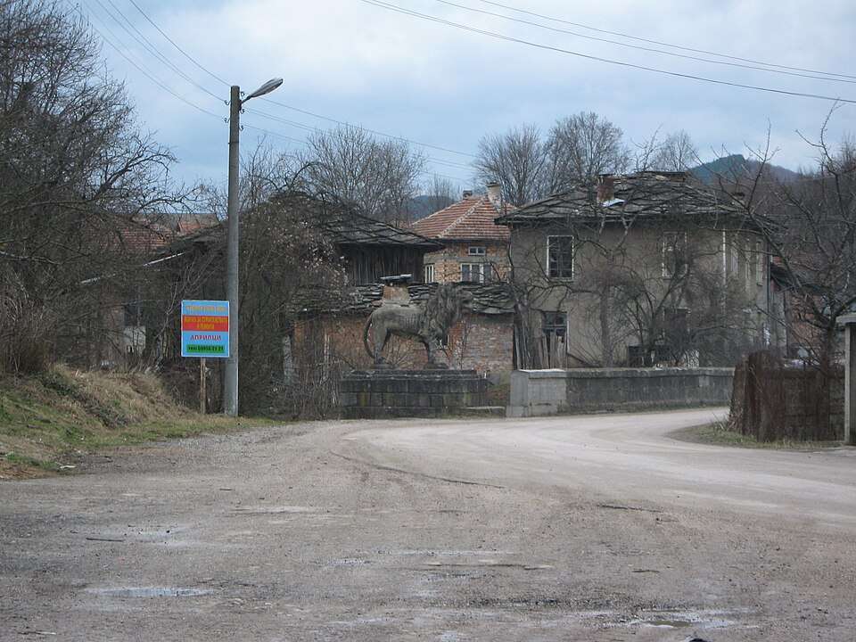
Sechishte is a village in Novi pazar Municipality, Shumen Province, Bulgaria. EKATTE code: 66353. Elevation range: 300–499 m. This profile uses the official National Register of Settlements. View the location on the map and add the settlement to your personal itinerary.

About this place
View location

Map of Bulgaria with a marker for Sedefche (Momchilgrad Municipality)Representative point of the settlement. Overview map; confirm the exact visiting address.LOCATION · BULGARIASedefche (Momchilgrad Municipality)NRepresentative point of the settlementMap: Global Tour · Outline: Natural Earth

Representative point of the settlement. Overview map; confirm the exact visiting address.

Bulgaria · Kardzhali

Settlements

Sedefche (Momchilgrad Municipality)

Sedefche is a village in Momchilgrad Municipality, Kardzhali Province, Bulgaria. EKATTE code: 65944. Elevation range: 300–499 m. This profile uses the official National Register of Settlements. View the location on the map and add the settlement to your personal itinerary.

About this place
View location

Map of Bulgaria with a marker for Sedelets (Strumyani Municipality)Representative point of the settlement. Overview map; confirm the exact visiting address.LOCATION · BULGARIASedelets (Strumyani Municipality)NRepresentative point of the settlementMap: Global Tour · Outline: Natural Earth

Representative point of the settlement. Overview map; confirm the exact visiting address.

Bulgaria · Blagoevgrad

Settlements

Sedelets (Strumyani Municipality)

Sedelets is a village in Strumyani Municipality, Blagoevgrad Province, Bulgaria. EKATTE code: 65930. Elevation range: 700–999 m. This profile uses the official National Register of Settlements. View the location on the map and add the settlement to your personal itinerary.

About this place
View location

Map of Bulgaria with a marker for Sedlarevo (Kotel Municipality)Representative point of the settlement. Overview map; confirm the exact visiting address.LOCATION · BULGARIASedlarevo (Kotel Municipality)NRepresentative point of the settlementMap: Global Tour · Outline: Natural Earth

Representative point of the settlement. Overview map; confirm the exact visiting address.

Bulgaria · Sliven

Settlements

Sedlarevo (Kotel Municipality)

Sedlarevo is a village in Kotel Municipality, Sliven Province, Bulgaria. EKATTE code: 65958. Elevation range: 300–499 m. This profile uses the official National Register of Settlements. View the location on the map and add the settlement to your personal itinerary.

About this place
View location

Map of Bulgaria with a marker for Sedlari (Momchilgrad Municipality)Representative point of the settlement. Overview map; confirm the exact visiting address.LOCATION · BULGARIASedlari (Momchilgrad Municipality)NRepresentative point of the settlementMap: Global Tour · Outline: Natural Earth

Representative point of the settlement. Overview map; confirm the exact visiting address.

Bulgaria · Kardzhali

Settlements

Sedlari (Momchilgrad Municipality)

Sedlari is a village in Momchilgrad Municipality, Kardzhali Province, Bulgaria. EKATTE code: 65961. Elevation range: 300–499 m. This profile uses the official National Register of Settlements. View the location on the map and add the settlement to your personal itinerary.

About this place
View location

Map of Bulgaria with a marker for Sedlartsi (Ardino Municipality)Representative point of the settlement. Overview map; confirm the exact visiting address.LOCATION · BULGARIASedlartsi (Ardino Municipality)NRepresentative point of the settlementMap: Global Tour · Outline: Natural Earth

Representative point of the settlement. Overview map; confirm the exact visiting address.

Bulgaria · Kardzhali

Settlements

Sedlartsi (Ardino Municipality)

Sedlartsi is a village in Ardino Municipality, Kardzhali Province, Bulgaria. EKATTE code: 70771. Elevation range: 500–699 m. This profile uses the official National Register of Settlements. View the location on the map and add the settlement to your personal itinerary.

About this place
View location

Map of Bulgaria with a marker for Sedyankovtsi (Gabrovo Municipality)Representative point of the settlement. Overview map; confirm the exact visiting address.LOCATION · BULGARIASedyankovtsi (Gabrovo Municipality)NRepresentative point of the settlementMap: Global Tour · Outline: Natural Earth

Representative point of the settlement. Overview map; confirm the exact visiting address.

Bulgaria · Gabrovo

Settlements

Sedyankovtsi (Gabrovo Municipality)

Sedyankovtsi is a village in Gabrovo Municipality, Gabrovo Province, Bulgaria. EKATTE code: 65989. Elevation range: 500–699 m. This profile uses the official National Register of Settlements. View the location on the map and add the settlement to your personal itinerary.

About this place
View location

Map of Bulgaria with a marker for Sekirka (Kirkovo Municipality)Representative point of the settlement. Overview map; confirm the exact visiting address.LOCATION · BULGARIASekirka (Kirkovo Municipality)NRepresentative point of the settlementMap: Global Tour · Outline: Natural Earth

Representative point of the settlement. Overview map; confirm the exact visiting address.

Bulgaria · Kardzhali

Settlements

Sekirka (Kirkovo Municipality)

Sekirka is a village in Kirkovo Municipality, Kardzhali Province, Bulgaria. EKATTE code: 66024. Elevation range: 500–699 m. This profile uses the official National Register of Settlements. View the location on the map and add the settlement to your personal itinerary.

About this place
View location

Map of Bulgaria with a marker for Sekulovo (Dulovo Municipality)Representative point of the settlement. Overview map; confirm the exact visiting address.LOCATION · BULGARIASekulovo (Dulovo Municipality)NRepresentative point of the settlementMap: Global Tour · Outline: Natural Earth

Representative point of the settlement. Overview map; confirm the exact visiting address.

Bulgaria · Silistra

Settlements

Sekulovo (Dulovo Municipality)

Sekulovo is a village in Dulovo Municipality, Silistra Province, Bulgaria. EKATTE code: 66038. Elevation range: 200–299 m. This profile uses the official National Register of Settlements. View the location on the map and add the settlement to your personal itinerary.

About this place
View location

Map of Bulgaria with a marker for Selanovtsi (Oryahovo Municipality)Representative point of the settlement. Overview map; confirm the exact visiting address.LOCATION · BULGARIASelanovtsi (Oryahovo Municipality)NRepresentative point of the settlementMap: Global Tour · Outline: Natural Earth

Representative point of the settlement. Overview map; confirm the exact visiting address.

Bulgaria · Vratsa

Settlements

Selanovtsi (Oryahovo Municipality)

Selanovtsi is a village in Oryahovo Municipality, Vratsa Province, Bulgaria. EKATTE code: 70723. Elevation range: 50–99 m. This profile uses the official National Register of Settlements. View the location on the map and add the settlement to your personal itinerary.

About this place
View location

Map of Bulgaria with a marker for Selishte (Blagoevgrad Municipality)Representative point of the settlement. Overview map; confirm the exact visiting address.LOCATION · BULGARIASelishte (Blagoevgrad Municipality)NRepresentative point of the settlementMap: Global Tour · Outline: Natural Earth

Representative point of the settlement. Overview map; confirm the exact visiting address.

Bulgaria · Blagoevgrad

Settlements

Selishte (Blagoevgrad Municipality)

Selishte is a village in Blagoevgrad Municipality, Blagoevgrad Province, Bulgaria. EKATTE code: 66055. Elevation range: 500–699 m. This profile uses the official National Register of Settlements. View the location on the map and add the settlement to your personal itinerary.

About this place
View location

Map of Bulgaria with a marker for Selishte (Smolyan Municipality)Representative point of the settlement. Overview map; confirm the exact visiting address.LOCATION · BULGARIASelishte (Smolyan Municipality)NRepresentative point of the settlementMap: Global Tour · Outline: Natural Earth

Representative point of the settlement. Overview map; confirm the exact visiting address.

Bulgaria · Smolyan

Settlements

Selishte (Smolyan Municipality)

Selishte is a village in Smolyan Municipality, Smolyan Province, Bulgaria. EKATTE code: 66069. Elevation range: ≥ 1000 m. This profile uses the official National Register of Settlements. View the location on the map and add the settlement to your personal itinerary.

About this place
View location

Map of Bulgaria with a marker for Selishten dol (Pernik Municipality)Representative point of the settlement. Overview map; confirm the exact visiting address.LOCATION · BULGARIASelishten dol (Pernik Municipality)NRepresentative point of the settlementMap: Global Tour · Outline: Natural Earth

Representative point of the settlement. Overview map; confirm the exact visiting address.

Bulgaria · Pernik

Settlements

Selishten dol (Pernik Municipality)

Selishten dol is a village in Pernik Municipality, Pernik Province, Bulgaria. EKATTE code: 66072. Elevation range: 700–999 m. This profile uses the official National Register of Settlements. View the location on the map and add the settlement to your personal itinerary.

About this place
View location

Map of Bulgaria with a marker for Selska polyana (Madzharovo Municipality)Representative point of the settlement. Overview map; confirm the exact visiting address.LOCATION · BULGARIASelska polyana (Madzharovo Municipality)NRepresentative point of the settlementMap: Global Tour · Outline: Natural Earth

Representative point of the settlement. Overview map; confirm the exact visiting address.

Bulgaria · Haskovo

Settlements

Selska polyana (Madzharovo Municipality)

Selska polyana is a village in Madzharovo Municipality, Haskovo Province, Bulgaria. EKATTE code: 66086. Elevation range: 300–499 m. This profile uses the official National Register of Settlements. View the location on the map and add the settlement to your personal itinerary.

About this place
View location

© 2026 Global Tour