Places

Discover the places on our routes — history, nature and landmarks.

The catalogue continues to grow. See the linked source for visit details.

Settlements · 5,256

Places found: 5256 · Showing 4,249–4,272 of 5,256 · Page 178 / 219

Map of Bulgaria with a marker for Stara reka (Sliven Municipality)Representative point of the settlement. Overview map; confirm the exact visiting address.LOCATION · BULGARIAStara reka (Sliven Municipality)NRepresentative point of the settlementMap: Global Tour · Outline: Natural Earth

Representative point of the settlement. Overview map; confirm the exact visiting address.

Bulgaria · Sliven

Settlements

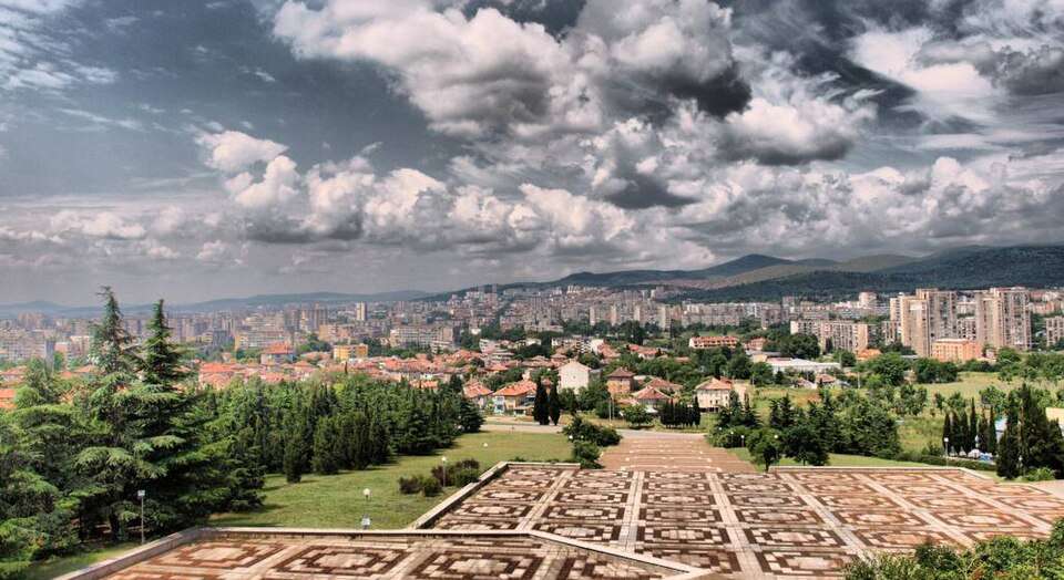
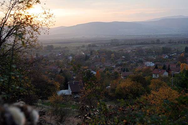
Stara reka (Sliven Municipality)

Stara reka is a village in Sliven Municipality, Sliven Province, Bulgaria. EKATTE code: 68864. Elevation range: 300–499 m. This profile uses the official National Register of Settlements. View the location on the map and add the settlement to your personal itinerary.

About this place
View location

Map of Bulgaria with a marker for Stara reka (Tundzha Municipality)Representative point of the settlement. Overview map; confirm the exact visiting address.LOCATION · BULGARIAStara reka (Tundzha Municipality)NRepresentative point of the settlementMap: Global Tour · Outline: Natural Earth

Representative point of the settlement. Overview map; confirm the exact visiting address.

Bulgaria · Yambol

Settlements

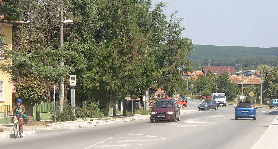
Stara reka (Tundzha Municipality)

Stara reka is a village in Tundzha Municipality, Yambol Province, Bulgaria. EKATTE code: 68878. Elevation range: 100–199 m. This profile uses the official National Register of Settlements. View the location on the map and add the settlement to your personal itinerary.

About this place
View location

Photograph from Stara Zagora (Stara Zagora Municipality)

Photograph from Stara Zagora (Stara Zagora Municipality)

Bulgaria · Stara Zagora

Settlements

Stara Zagora (Stara Zagora Municipality)

Stara Zagora is a city in Stara Zagora Municipality, Stara Zagora Province, Bulgaria. EKATTE code: 68850. Elevation range: 200–299 m. Municipal centre · Provincial centre. This profile uses the official National Register of Settlements. View the location on the map and add the settlement to your personal itinerary.

About this place
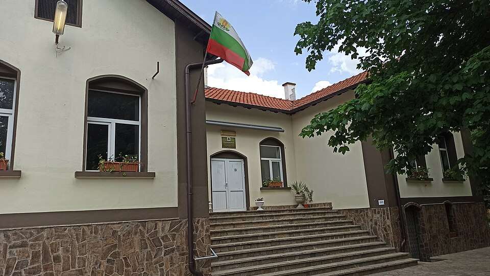
Photo: Khan Omurtag · CC0 · License

View location

Map of Bulgaria with a marker for Starchevo (Petrich Municipality)Representative point of the settlement. Overview map; confirm the exact visiting address.LOCATION · BULGARIAStarchevo (Petrich Municipality)NRepresentative point of the settlementMap: Global Tour · Outline: Natural Earth

Representative point of the settlement. Overview map; confirm the exact visiting address.

Bulgaria · Blagoevgrad

Settlements

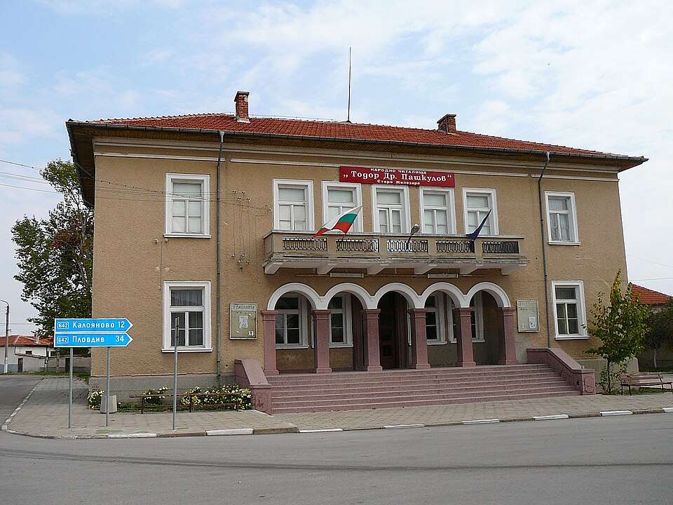
Starchevo (Petrich Municipality)

Starchevo is a village in Petrich Municipality, Blagoevgrad Province, Bulgaria. EKATTE code: 69119. Elevation range: 100–199 m. This profile uses the official National Register of Settlements. View the location on the map and add the settlement to your personal itinerary.

About this place
View location

Map of Bulgaria with a marker for Starchishte (Antonovo Municipality)Representative point of the settlement. Overview map; confirm the exact visiting address.LOCATION · BULGARIAStarchishte (Antonovo Municipality)NRepresentative point of the settlementMap: Global Tour · Outline: Natural Earth

Representative point of the settlement. Overview map; confirm the exact visiting address.

Bulgaria · Targovishte

Settlements

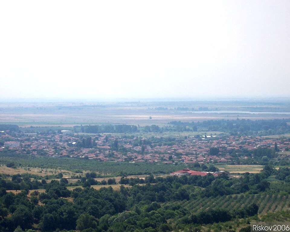
Starchishte (Antonovo Municipality)

Starchishte is a village in Antonovo Municipality, Targovishte Province, Bulgaria. EKATTE code: 69136. Elevation range: 300–499 m. This profile uses the official National Register of Settlements. View the location on the map and add the settlement to your personal itinerary.

About this place
View location

Map of Bulgaria with a marker for Stareyshino (Kirkovo Municipality)Representative point of the settlement. Overview map; confirm the exact visiting address.LOCATION · BULGARIAStareyshino (Kirkovo Municipality)NRepresentative point of the settlementMap: Global Tour · Outline: Natural Earth

Representative point of the settlement. Overview map; confirm the exact visiting address.

Bulgaria · Kardzhali

Settlements

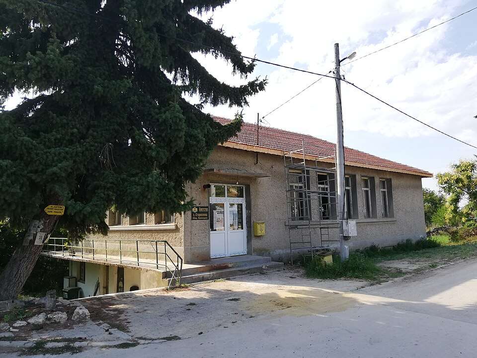
Stareyshino (Kirkovo Municipality)

Stareyshino is a village in Kirkovo Municipality, Kardzhali Province, Bulgaria. EKATTE code: 68895. Elevation range: 200–299 m. This profile uses the official National Register of Settlements. View the location on the map and add the settlement to your personal itinerary.

About this place
View location

Map of Bulgaria with a marker for Stari chal (Krumovgrad Municipality)Representative point of the settlement. Overview map; confirm the exact visiting address.LOCATION · BULGARIAStari chal (Krumovgrad Municipality)NRepresentative point of the settlementMap: Global Tour · Outline: Natural Earth

Representative point of the settlement. Overview map; confirm the exact visiting address.

Bulgaria · Kardzhali

Settlements

Stari chal (Krumovgrad Municipality)

Stari chal is a village in Krumovgrad Municipality, Kardzhali Province, Bulgaria. EKATTE code: 68936. Elevation range: 300–499 m. This profile uses the official National Register of Settlements. View the location on the map and add the settlement to your personal itinerary.

About this place
View location

Map of Bulgaria with a marker for Starilkovtsi (Gabrovo Municipality)Representative point of the settlement. Overview map; confirm the exact visiting address.LOCATION · BULGARIAStarilkovtsi (Gabrovo Municipality)NRepresentative point of the settlementMap: Global Tour · Outline: Natural Earth

Representative point of the settlement. Overview map; confirm the exact visiting address.

Bulgaria · Gabrovo

Settlements

Starilkovtsi (Gabrovo Municipality)

Starilkovtsi is a village in Gabrovo Municipality, Gabrovo Province, Bulgaria. EKATTE code: 68919. Elevation range: 300–499 m. This profile uses the official National Register of Settlements. View the location on the map and add the settlement to your personal itinerary.

About this place
View location

Map of Bulgaria with a marker for Starmen (Byala Municipality)Representative point of the settlement. Overview map; confirm the exact visiting address.LOCATION · BULGARIAStarmen (Byala Municipality)NRepresentative point of the settlementMap: Global Tour · Outline: Natural Earth

Representative point of the settlement. Overview map; confirm the exact visiting address.

Bulgaria · Ruse

Settlements

Starmen (Byala Municipality)

Starmen is a village in Byala Municipality, Ruse Province, Bulgaria. EKATTE code: 70130. Elevation range: 0–49 m. This profile uses the official National Register of Settlements. View the location on the map and add the settlement to your personal itinerary.

About this place
View location

Map of Bulgaria with a marker for Starnitsa (Banite Municipality)Representative point of the settlement. Overview map; confirm the exact visiting address.LOCATION · BULGARIAStarnitsa (Banite Municipality)NRepresentative point of the settlementMap: Global Tour · Outline: Natural Earth

Representative point of the settlement. Overview map; confirm the exact visiting address.

Bulgaria · Smolyan

Settlements

Starnitsa (Banite Municipality)

Starnitsa is a village in Banite Municipality, Smolyan Province, Bulgaria. EKATTE code: 70158. Elevation range: ≥ 1000 m. This profile uses the official National Register of Settlements. View the location on the map and add the settlement to your personal itinerary.

About this place
View location

Map of Bulgaria with a marker for Staro myasto (Kardzhali Municipality)Representative point of the settlement. Overview map; confirm the exact visiting address.LOCATION · BULGARIAStaro myasto (Kardzhali Municipality)NRepresentative point of the settlementMap: Global Tour · Outline: Natural Earth

Representative point of the settlement. Overview map; confirm the exact visiting address.

Bulgaria · Kardzhali

Settlements

Staro myasto (Kardzhali Municipality)

Staro myasto is a village in Kardzhali Municipality, Kardzhali Province, Bulgaria. EKATTE code: 68984. Elevation range: 300–499 m. This profile uses the official National Register of Settlements. View the location on the map and add the settlement to your personal itinerary.

About this place
View location

Map of Bulgaria with a marker for Staro selishte (Isperih Municipality)Representative point of the settlement. Overview map; confirm the exact visiting address.LOCATION · BULGARIAStaro selishte (Isperih Municipality)NRepresentative point of the settlementMap: Global Tour · Outline: Natural Earth

Representative point of the settlement. Overview map; confirm the exact visiting address.

Bulgaria · Razgrad

Settlements

Staro selishte (Isperih Municipality)

Staro selishte is a village in Isperih Municipality, Razgrad Province, Bulgaria. EKATTE code: 69047. Elevation range: 200–299 m. This profile uses the official National Register of Settlements. View the location on the map and add the settlement to your personal itinerary.

About this place
View location

Map of Bulgaria with a marker for Staro selo (Mezdra Municipality)Representative point of the settlement. Overview map; confirm the exact visiting address.LOCATION · BULGARIAStaro selo (Mezdra Municipality)NRepresentative point of the settlementMap: Global Tour · Outline: Natural Earth

Representative point of the settlement. Overview map; confirm the exact visiting address.

Bulgaria · Vratsa

Settlements

Staro selo (Mezdra Municipality)

Staro selo is a village in Mezdra Municipality, Vratsa Province, Bulgaria. EKATTE code: 69050. Elevation range: 300–499 m. This profile uses the official National Register of Settlements. View the location on the map and add the settlement to your personal itinerary.

About this place
View location

Map of Bulgaria with a marker for Staro selo (Sliven Municipality)Representative point of the settlement. Overview map; confirm the exact visiting address.LOCATION · BULGARIAStaro selo (Sliven Municipality)NRepresentative point of the settlementMap: Global Tour · Outline: Natural Earth

Representative point of the settlement. Overview map; confirm the exact visiting address.

Bulgaria · Sliven

Settlements

Staro selo (Sliven Municipality)

Staro selo is a village in Sliven Municipality, Sliven Province, Bulgaria. EKATTE code: 69081. Elevation range: 300–499 m. This profile uses the official National Register of Settlements. View the location on the map and add the settlement to your personal itinerary.

About this place
View location

Map of Bulgaria with a marker for Staro selo (Troyan Municipality)Representative point of the settlement. Overview map; confirm the exact visiting address.LOCATION · BULGARIAStaro selo (Troyan Municipality)NRepresentative point of the settlementMap: Global Tour · Outline: Natural Earth

Representative point of the settlement. Overview map; confirm the exact visiting address.

Bulgaria · Lovech

Settlements

Staro selo (Troyan Municipality)

Staro selo is a village in Troyan Municipality, Lovech Province, Bulgaria. EKATTE code: 70500. Elevation range: 300–499 m. This profile uses the official National Register of Settlements. View the location on the map and add the settlement to your personal itinerary.

About this place
View location

Map of Bulgaria with a marker for Staro selo (Tutrakan Municipality)Representative point of the settlement. Overview map; confirm the exact visiting address.LOCATION · BULGARIAStaro selo (Tutrakan Municipality)NRepresentative point of the settlementMap: Global Tour · Outline: Natural Earth

Representative point of the settlement. Overview map; confirm the exact visiting address.

Bulgaria · Silistra

Settlements

Staro selo (Tutrakan Municipality)

Staro selo is a village in Tutrakan Municipality, Silistra Province, Bulgaria. EKATTE code: 69078. Elevation range: 0–49 m. This profile uses the official National Register of Settlements. View the location on the map and add the settlement to your personal itinerary.

About this place
View location

Map of Bulgaria with a marker for Staropatitsa (Kula Municipality)Representative point of the settlement. Overview map; confirm the exact visiting address.LOCATION · BULGARIAStaropatitsa (Kula Municipality)NRepresentative point of the settlementMap: Global Tour · Outline: Natural Earth

Representative point of the settlement. Overview map; confirm the exact visiting address.

Bulgaria · Vidin

Settlements

Staropatitsa (Kula Municipality)

Staropatitsa is a village in Kula Municipality, Vidin Province, Bulgaria. EKATTE code: 69002. Elevation range: 200–299 m. This profile uses the official National Register of Settlements. View the location on the map and add the settlement to your personal itinerary.

About this place
View location

Map of Bulgaria with a marker for Staroseltsi (Iskar Municipality)Representative point of the settlement. Overview map; confirm the exact visiting address.LOCATION · BULGARIAStaroseltsi (Iskar Municipality)NRepresentative point of the settlementMap: Global Tour · Outline: Natural Earth

Representative point of the settlement. Overview map; confirm the exact visiting address.

Bulgaria · Pleven

Settlements

Staroseltsi (Iskar Municipality)

Staroseltsi is a village in Iskar Municipality, Pleven Province, Bulgaria. EKATTE code: 69095. Elevation range: 50–99 m. This profile uses the official National Register of Settlements. View the location on the map and add the settlement to your personal itinerary.

About this place
View location

© 2026 Global Tour