Places

Discover the places on our routes — history, nature and landmarks.

The catalogue continues to grow. See the linked source for visit details.

Settlements · 5,256

Places found: 5256 · Showing 5,065–5,088 of 5,256 · Page 212 / 219

Map of Bulgaria with a marker for Yundola (Velingrad Municipality)Representative point of the settlement. Overview map; confirm the exact visiting address.LOCATION · BULGARIAYundola (Velingrad Municipality)NRepresentative point of the settlementMap: Global Tour · Outline: Natural Earth

Representative point of the settlement. Overview map; confirm the exact visiting address.

Bulgaria · Pazardzhik

Settlements

Yundola (Velingrad Municipality)

Yundola is a village in Velingrad Municipality, Pazardzhik Province, Bulgaria. EKATTE code: 86115. Elevation range: 700–999 m. This profile uses the official National Register of Settlements. View the location on the map and add the settlement to your personal itinerary.

About this place
View location

Map of Bulgaria with a marker for Yunets (Dolni chiflik Municipality)Representative point of the settlement. Overview map; confirm the exact visiting address.LOCATION · BULGARIAYunets (Dolni chiflik Municipality)NRepresentative point of the settlementMap: Global Tour · Outline: Natural Earth

Representative point of the settlement. Overview map; confirm the exact visiting address.

Bulgaria · Varna

Settlements

Yunets (Dolni chiflik Municipality)

Yunets is a village in Dolni chiflik Municipality, Varna Province, Bulgaria. EKATTE code: 86088. Elevation range: 50–99 m. This profile uses the official National Register of Settlements. View the location on the map and add the settlement to your personal itinerary.

About this place
View location

Map of Bulgaria with a marker for Yurukovo (Yakoruda Municipality)Representative point of the settlement. Overview map; confirm the exact visiting address.LOCATION · BULGARIAYurukovo (Yakoruda Municipality)NRepresentative point of the settlementMap: Global Tour · Outline: Natural Earth

Representative point of the settlement. Overview map; confirm the exact visiting address.

Bulgaria · Blagoevgrad

Settlements

Yurukovo (Yakoruda Municipality)

Yurukovo is a village in Yakoruda Municipality, Blagoevgrad Province, Bulgaria. EKATTE code: 86101. Elevation range: ≥ 1000 m. This profile uses the official National Register of Settlements. View the location on the map and add the settlement to your personal itinerary.

About this place
View location

Map of Bulgaria with a marker for Zabel (Tran Municipality)Representative point of the settlement. Overview map; confirm the exact visiting address.LOCATION · BULGARIAZabel (Tran Municipality)NRepresentative point of the settlementMap: Global Tour · Outline: Natural Earth

Representative point of the settlement. Overview map; confirm the exact visiting address.

Bulgaria · Pernik

Settlements

Zabel (Tran Municipality)

Zabel is a village in Tran Municipality, Pernik Province, Bulgaria. EKATTE code: 30017. Elevation range: 700–999 m. This profile uses the official National Register of Settlements. View the location on the map and add the settlement to your personal itinerary.

About this place
View location

Map of Bulgaria with a marker for Zadruga (Kubrat Municipality)Representative point of the settlement. Overview map; confirm the exact visiting address.LOCATION · BULGARIAZadruga (Kubrat Municipality)NRepresentative point of the settlementMap: Global Tour · Outline: Natural Earth

Representative point of the settlement. Overview map; confirm the exact visiting address.

Bulgaria · Razgrad

Settlements

Zadruga (Kubrat Municipality)

Zadruga is a village in Kubrat Municipality, Razgrad Province, Bulgaria. EKATTE code: 30212. Elevation range: 100–199 m. This profile uses the official National Register of Settlements. View the location on the map and add the settlement to your personal itinerary.

About this place
View location

Map of Bulgaria with a marker for Zaevite (Smolyan Municipality)Representative point of the settlement. Overview map; confirm the exact visiting address.LOCATION · BULGARIAZaevite (Smolyan Municipality)NRepresentative point of the settlementMap: Global Tour · Outline: Natural Earth

Representative point of the settlement. Overview map; confirm the exact visiting address.

Bulgaria · Smolyan

Settlements

Zaevite (Smolyan Municipality)

Zaevite is a village in Smolyan Municipality, Smolyan Province, Bulgaria. EKATTE code: 30226. Elevation range: ≥ 1000 m. This profile uses the official National Register of Settlements. View the location on the map and add the settlement to your personal itinerary.

About this place
View location

Map of Bulgaria with a marker for Zafirovo (Glavinitsa Municipality)Representative point of the settlement. Overview map; confirm the exact visiting address.LOCATION · BULGARIAZafirovo (Glavinitsa Municipality)NRepresentative point of the settlementMap: Global Tour · Outline: Natural Earth

Representative point of the settlement. Overview map; confirm the exact visiting address.

Bulgaria · Silistra

Settlements

Zafirovo (Glavinitsa Municipality)

Zafirovo is a village in Glavinitsa Municipality, Silistra Province, Bulgaria. EKATTE code: 30377. Elevation range: 100–199 m. This profile uses the official National Register of Settlements. View the location on the map and add the settlement to your personal itinerary.

About this place
View location

Map of Bulgaria with a marker for Zagore (Stara Zagora Municipality)Representative point of the settlement. Overview map; confirm the exact visiting address.LOCATION · BULGARIAZagore (Stara Zagora Municipality)NRepresentative point of the settlementMap: Global Tour · Outline: Natural Earth

Representative point of the settlement. Overview map; confirm the exact visiting address.

Bulgaria · Stara Zagora

Settlements

Zagore (Stara Zagora Municipality)

Zagore is a village in Stara Zagora Municipality, Stara Zagora Province, Bulgaria. EKATTE code: 30119. Elevation range: 100–199 m. This profile uses the official National Register of Settlements. View the location on the map and add the settlement to your personal itinerary.

About this place
View location

Map of Bulgaria with a marker for Zagoriche (Kaolinovo Municipality)Representative point of the settlement. Overview map; confirm the exact visiting address.LOCATION · BULGARIAZagoriche (Kaolinovo Municipality)NRepresentative point of the settlementMap: Global Tour · Outline: Natural Earth

Representative point of the settlement. Overview map; confirm the exact visiting address.

Bulgaria · Shumen

Settlements

Zagoriche (Kaolinovo Municipality)

Zagoriche is a village in Kaolinovo Municipality, Shumen Province, Bulgaria. EKATTE code: 30137. Elevation range: 200–299 m. This profile uses the official National Register of Settlements. View the location on the map and add the settlement to your personal itinerary.

About this place
View location

Map of Bulgaria with a marker for Zagorski (Kirkovo Municipality)Representative point of the settlement. Overview map; confirm the exact visiting address.LOCATION · BULGARIAZagorski (Kirkovo Municipality)NRepresentative point of the settlementMap: Global Tour · Outline: Natural Earth

Representative point of the settlement. Overview map; confirm the exact visiting address.

Bulgaria · Kardzhali

Settlements

Zagorski (Kirkovo Municipality)

Zagorski is a village in Kirkovo Municipality, Kardzhali Province, Bulgaria. EKATTE code: 30140. Elevation range: 300–499 m. This profile uses the official National Register of Settlements. View the location on the map and add the settlement to your personal itinerary.

About this place
View location

Map of Bulgaria with a marker for Zagorsko (Momchilgrad Municipality)Representative point of the settlement. Overview map; confirm the exact visiting address.LOCATION · BULGARIAZagorsko (Momchilgrad Municipality)NRepresentative point of the settlementMap: Global Tour · Outline: Natural Earth

Representative point of the settlement. Overview map; confirm the exact visiting address.

Bulgaria · Kardzhali

Settlements

Zagorsko (Momchilgrad Municipality)

Zagorsko is a village in Momchilgrad Municipality, Kardzhali Province, Bulgaria. EKATTE code: 30154. Elevation range: 300–499 m. This profile uses the official National Register of Settlements. View the location on the map and add the settlement to your personal itinerary.

About this place
View location

Map of Bulgaria with a marker for Zagortsi (Krushari Municipality)Representative point of the settlement. Overview map; confirm the exact visiting address.LOCATION · BULGARIAZagortsi (Krushari Municipality)NRepresentative point of the settlementMap: Global Tour · Outline: Natural Earth

Representative point of the settlement. Overview map; confirm the exact visiting address.

Bulgaria · Dobrich

Settlements

Zagortsi (Krushari Municipality)

Zagortsi is a village in Krushari Municipality, Dobrich Province, Bulgaria. EKATTE code: 30185. Elevation range: 100–199 m. This profile uses the official National Register of Settlements. View the location on the map and add the settlement to your personal itinerary.

About this place
View location

Map of Bulgaria with a marker for Zagortsi (Nova Zagora Municipality)Representative point of the settlement. Overview map; confirm the exact visiting address.LOCATION · BULGARIAZagortsi (Nova Zagora Municipality)NRepresentative point of the settlementMap: Global Tour · Outline: Natural Earth

Representative point of the settlement. Overview map; confirm the exact visiting address.

Bulgaria · Sliven

Settlements

Zagortsi (Nova Zagora Municipality)

Zagortsi is a village in Nova Zagora Municipality, Sliven Province, Bulgaria. EKATTE code: 30171. Elevation range: 100–199 m. This profile uses the official National Register of Settlements. View the location on the map and add the settlement to your personal itinerary.

About this place
View location

Map of Bulgaria with a marker for Zagortsi (Sredets Municipality)Representative point of the settlement. Overview map; confirm the exact visiting address.LOCATION · BULGARIAZagortsi (Sredets Municipality)NRepresentative point of the settlementMap: Global Tour · Outline: Natural Earth

Representative point of the settlement. Overview map; confirm the exact visiting address.

Bulgaria · Burgas

Settlements

Zagortsi (Sredets Municipality)

Zagortsi is a village in Sredets Municipality, Burgas Province, Bulgaria. EKATTE code: 30168. Elevation range: 50–99 m. This profile uses the official National Register of Settlements. View the location on the map and add the settlement to your personal itinerary.

About this place
View location

Map of Bulgaria with a marker for Zagrazhden (Gulyantsi Municipality)Representative point of the settlement. Overview map; confirm the exact visiting address.LOCATION · BULGARIAZagrazhden (Gulyantsi Municipality)NRepresentative point of the settlementMap: Global Tour · Outline: Natural Earth

Representative point of the settlement. Overview map; confirm the exact visiting address.

Bulgaria · Pleven

Settlements

Zagrazhden (Gulyantsi Municipality)

Zagrazhden is a village in Gulyantsi Municipality, Pleven Province, Bulgaria. EKATTE code: 30199. Elevation range: 0–49 m. This profile uses the official National Register of Settlements. View the location on the map and add the settlement to your personal itinerary.

About this place
View location

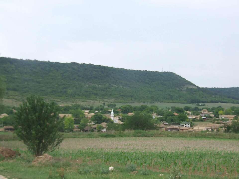
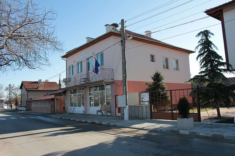
Photograph from Zahari Stoyanovo (Popovo Municipality)

Photograph from Zahari Stoyanovo (Popovo Municipality)

Bulgaria · Targovishte

Settlements

Zahari Stoyanovo (Popovo Municipality)

Zahari Stoyanovo is a village in Popovo Municipality, Targovishte Province, Bulgaria. EKATTE code: 30404. Elevation range: 100–199 m. This profile uses the official National Register of Settlements. View the location on the map and add the settlement to your personal itinerary.

About this place

Photo: Wlado bg at the Bulgarian language Wikipedia · CC BY-SA 3.0 · License

View location

Map of Bulgaria with a marker for Zahari Stoyanovo (Shabla Municipality)Representative point of the settlement. Overview map; confirm the exact visiting address.LOCATION · BULGARIAZahari Stoyanovo (Shabla Municipality)NRepresentative point of the settlementMap: Global Tour · Outline: Natural Earth

Representative point of the settlement. Overview map; confirm the exact visiting address.

Bulgaria · Dobrich

Settlements

Zahari Stoyanovo (Shabla Municipality)

Zahari Stoyanovo is a village in Shabla Municipality, Dobrich Province, Bulgaria. EKATTE code: 30394. Elevation range: 50–99 m. This profile uses the official National Register of Settlements. View the location on the map and add the settlement to your personal itinerary.

About this place
View location

Map of Bulgaria with a marker for Zaimchevo (Ruen Municipality)Representative point of the settlement. Overview map; confirm the exact visiting address.LOCATION · BULGARIAZaimchevo (Ruen Municipality)NRepresentative point of the settlementMap: Global Tour · Outline: Natural Earth

Representative point of the settlement. Overview map; confirm the exact visiting address.

Bulgaria · Burgas

Settlements

Zaimchevo (Ruen Municipality)

Zaimchevo is a village in Ruen Municipality, Burgas Province, Bulgaria. EKATTE code: 30234. Elevation range: 200–299 m. This profile uses the official National Register of Settlements. View the location on the map and add the settlement to your personal itinerary.

About this place
View location

Map of Bulgaria with a marker for Zamfir (Lom Municipality)Representative point of the settlement. Overview map; confirm the exact visiting address.LOCATION · BULGARIAZamfir (Lom Municipality)NRepresentative point of the settlementMap: Global Tour · Outline: Natural Earth

Representative point of the settlement. Overview map; confirm the exact visiting address.

Bulgaria · Montana

Settlements

Zamfir (Lom Municipality)

Zamfir is a village in Lom Municipality, Montana Province, Bulgaria. EKATTE code: 30291. Elevation range: 50–99 m. This profile uses the official National Register of Settlements. View the location on the map and add the settlement to your personal itinerary.

About this place
View location

© 2026 Global Tour