Representative point of the settlement. Overview map; confirm the exact visiting address.
保加利亚 · 扬博尔州
居民点
Zhrebino(Elhovo 市镇)
Zhrebino 是保加利亚扬博尔州 Elhovo 市镇的一处村庄。 EKATTE 代码:29516。海拔范围:100–199 米。 本资料依据官方《全国居民点登记册》编写。您可以在地图上查看位置,并将此地加入个人旅行路线。
查看详情
探索旅行路线上的自然景观、历史遗迹和文化景点。
景点目录持续更新。参观详情请查看景点页面中的来源链接。
保加利亚居民点 · 5,256找到景点: 5256 · 显示第 5,185–5,208 项,共 5,256 · 页 217 / 219
Representative point of the settlement. Overview map; confirm the exact visiting address.
保加利亚 · 扬博尔州
居民点
Zhrebino 是保加利亚扬博尔州 Elhovo 市镇的一处村庄。 EKATTE 代码:29516。海拔范围:100–199 米。 本资料依据官方《全国居民点登记册》编写。您可以在地图上查看位置,并将此地加入个人旅行路线。
查看详情Representative point of the settlement. Overview map; confirm the exact visiting address.
保加利亚 · 布尔加斯州
居民点
Zidarovo 是保加利亚布尔加斯州 Sozopol 市镇的一处村庄。 EKATTE 代码:30822。海拔范围:0–49 米。 本资料依据官方《全国居民点登记册》编写。您可以在地图上查看位置,并将此地加入个人旅行路线。
查看详情Representative point of the settlement. Overview map; confirm the exact visiting address.
保加利亚 · 佩尔尼克州
居民点
Zidartsi 是保加利亚佩尔尼克州 Pernik 市镇的一处村庄。 EKATTE 代码:30836。海拔范围:700–999 米。 本资料依据官方《全国居民点登记册》编写。您可以在地图上查看位置,并将此地加入个人旅行路线。
查看详情Representative point of the settlement. Overview map; confirm the exact visiting address.
保加利亚 · 布尔加斯州
居民点
Zimen 是保加利亚布尔加斯州 Karnobat 市镇的一处村庄。 EKATTE 代码:30853。海拔范围:200–299 米。 本资料依据官方《全国居民点登记册》编写。您可以在地图上查看位置,并将此地加入个人旅行路线。
查看详情Representative point of the settlement. Overview map; confirm the exact visiting address.
保加利亚 · 索菲亚州
居民点
Zimevitsa 是保加利亚索菲亚州 Svoge 市镇的一处村庄。 EKATTE 代码:30847。海拔范围:≥ 1000 米。 本资料依据官方《全国居民点登记册》编写。您可以在地图上查看位置,并将此地加入个人旅行路线。
查看详情Representative point of the settlement. Overview map; confirm the exact visiting address.
保加利亚 · 多布里奇州
居民点
Zimnitsa 是保加利亚多布里奇州 Krushari 市镇的一处村庄。 EKATTE 代码:30884。海拔范围:100–199 米。 本资料依据官方《全国居民点登记册》编写。您可以在地图上查看位置,并将此地加入个人旅行路线。
查看详情Representative point of the settlement. Overview map; confirm the exact visiting address.
保加利亚 · 旧扎戈拉州
居民点
Zimnitsa 是保加利亚旧扎戈拉州 Maglizh 市镇的一处村庄。 EKATTE 代码:30870。海拔范围:200–299 米。 本资料依据官方《全国居民点登记册》编写。您可以在地图上查看位置,并将此地加入个人旅行路线。
查看详情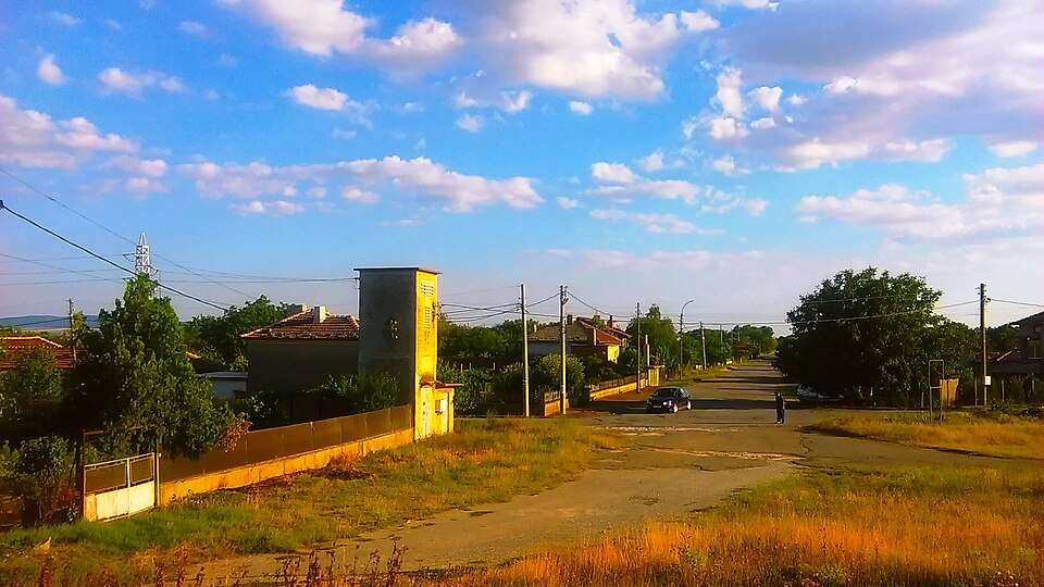
Zimnitsa(Straldzha 市镇)的照片
保加利亚 · 扬博尔州
居民点
Zimnitsa 是保加利亚扬博尔州 Straldzha 市镇的一处村庄。 EKATTE 代码:30898。海拔范围:100–199 米。 本资料依据官方《全国居民点登记册》编写。您可以在地图上查看位置,并将此地加入个人旅行路线。
查看详情图片来源: Litev · CC BY-SA 4.0 · 许可协议
查看位置Representative point of the settlement. Overview map; confirm the exact visiting address.
保加利亚 · 克尔贾利州
居民点
Zimornitsa 是保加利亚克尔贾利州 Krumovgrad 市镇的一处村庄。 EKATTE 代码:30911。海拔范围:300–499 米。 本资料依据官方《全国居民点登记册》编写。您可以在地图上查看位置,并将此地加入个人旅行路线。
查看详情Representative point of the settlement. Overview map; confirm the exact visiting address.
保加利亚 · 哈斯科沃州
居民点
Zimovina 是保加利亚哈斯科沃州 Stambolovo 市镇的一处村庄。 EKATTE 代码:30908。海拔范围:300–499 米。 本资料依据官方《全国居民点登记册》编写。您可以在地图上查看位置,并将此地加入个人旅行路线。
查看详情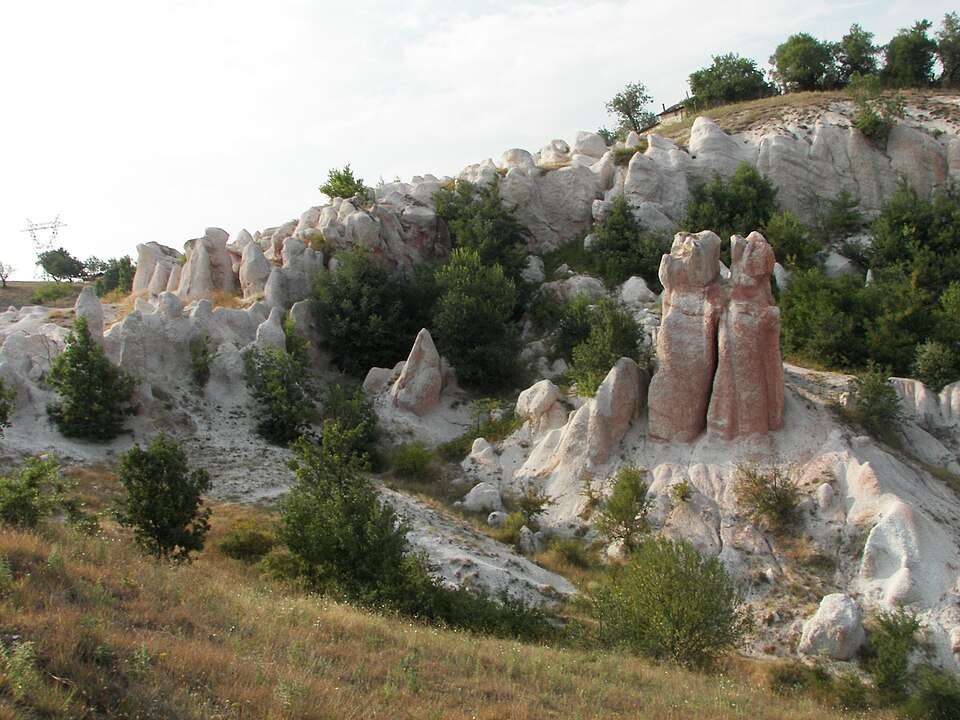
Zimzelen(Kardzhali 市镇)的照片
保加利亚 · 克尔贾利州
居民点
Zimzelen 是保加利亚克尔贾利州 Kardzhali 市镇的一处村庄。 EKATTE 代码:30867。海拔范围:300–499 米。 本资料依据官方《全国居民点登记册》编写。您可以在地图上查看位置,并将此地加入个人旅行路线。
查看详情图片来源: No machine-readable author provided. Webkid~commonswiki assumed (based on copyright claims). · CC BY-SA 2.5 · 许可协议
查看位置Representative point of the settlement. Overview map; confirm the exact visiting address.
保加利亚 · 舒门州
居民点
Zlatar 是保加利亚舒门州 Veliki Preslav 市镇的一处村庄。 EKATTE 代码:30942。海拔范围:100–199 米。 本资料依据官方《全国居民点登记册》编写。您可以在地图上查看位置,并将此地加入个人旅行路线。
查看详情Representative point of the settlement. Overview map; confirm the exact visiting address.
保加利亚 · 扬博尔州
居民点
Zlatari 是保加利亚扬博尔州 Tundzha 市镇的一处村庄。 EKATTE 代码:30956。海拔范围:100–199 米。 本资料依据官方《全国居民点登记册》编写。您可以在地图上查看位置,并将此地加入个人旅行路线。
查看详情Representative point of the settlement. Overview map; confirm the exact visiting address.
保加利亚 · 布拉戈耶夫格勒州
居民点
Zlataritsa 是保加利亚布拉戈耶夫格勒州 Belitsa 市镇的一处村庄。 EKATTE 代码:14521。海拔范围:700–999 米。 本资料依据官方《全国居民点登记册》编写。您可以在地图上查看位置,并将此地加入个人旅行路线。
查看详情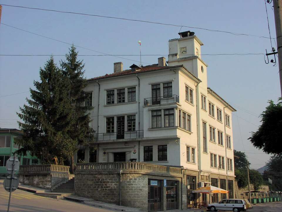
Zlataritsa(Zlataritsa 市镇)的照片
保加利亚 · 大特尔诺沃州
居民点
Zlataritsa 是保加利亚大特尔诺沃州 Zlataritsa 市镇的一处城市。 EKATTE 代码:30962。海拔范围:50–99 米。该地是市镇行政中心。 本资料依据官方《全国居民点登记册》编写。您可以在地图上查看位置,并将此地加入个人旅行路线。
查看详情图片来源: Ikonact · CC BY-SA 3.0 · 许可协议
查看位置Representative point of the settlement. Overview map; confirm the exact visiting address.
保加利亚 · 加布罗沃州
居民点
Zlatevtsi 是保加利亚加布罗沃州 Gabrovo 市镇的一处村庄。 EKATTE 代码:30973。海拔范围:300–499 米。 本资料依据官方《全国居民点登记册》编写。您可以在地图上查看位置,并将此地加入个人旅行路线。
查看详情Representative point of the settlement. Overview map; confirm the exact visiting address.
保加利亚 · 斯利文州
居民点
Zlati voyvoda 是保加利亚斯利文州 Sliven 市镇的一处村庄。 EKATTE 代码:30990。海拔范围:200–299 米。 本资料依据官方《全国居民点登记册》编写。您可以在地图上查看位置,并将此地加入个人旅行路线。
查看详情Representative point of the settlement. Overview map; confirm the exact visiting address.
保加利亚 · 多布里奇州
居民点
Zlatia 是保加利亚多布里奇州 Dobrich-selska 市镇的一处村庄。 EKATTE 代码:31067。海拔范围:200–299 米。 本资料依据官方《全国居民点登记册》编写。您可以在地图上查看位置,并将此地加入个人旅行路线。
查看详情Representative point of the settlement. Overview map; confirm the exact visiting address.
保加利亚 · 蒙塔纳州
居民点
Zlatia 是保加利亚蒙塔纳州 Valchedram 市镇的一处村庄。 EKATTE 代码:31053。海拔范围:50–99 米。 本资料依据官方《全国居民点登记册》编写。您可以在地图上查看位置,并将此地加入个人旅行路线。
查看详情Representative point of the settlement. Overview map; confirm the exact visiting address.
保加利亚 · 瓦尔纳州
居民点
Zlatina 是保加利亚瓦尔纳州 Provadia 市镇的一处村庄。 EKATTE 代码:31005。海拔范围:0–49 米。 本资料依据官方《全国居民点登记册》编写。您可以在地图上查看位置,并将此地加入个人旅行路线。
查看详情Representative point of the settlement. Overview map; confirm the exact visiting address.
保加利亚 · 扬博尔州
居民点
Zlatinitsa 是保加利亚扬博尔州 Bolyarovo 市镇的一处村庄。 EKATTE 代码:31019。海拔范围:100–199 米。 本资料依据官方《全国居民点登记册》编写。您可以在地图上查看位置,并将此地加入个人旅行路线。
查看详情Representative point of the settlement. Overview map; confirm the exact visiting address.
保加利亚 · 旧扎戈拉州
居民点
Zlatirat 是保加利亚旧扎戈拉州 Gurkovo 市镇的一处村庄。 EKATTE 代码:31022。海拔范围:500–699 米。 本资料依据官方《全国居民点登记册》编写。您可以在地图上查看位置,并将此地加入个人旅行路线。
查看详情Representative point of the settlement. Overview map; confirm the exact visiting address.
保加利亚 · 普罗夫迪夫州
居民点
Zlatitrap 是保加利亚普罗夫迪夫州 Rodopi 市镇的一处村庄。 EKATTE 代码:31036。海拔范围:100–199 米。 本资料依据官方《全国居民点登记册》编写。您可以在地图上查看位置,并将此地加入个人旅行路线。
查看详情
Zlatitsa(Zlatitsa 市镇)的照片
保加利亚 · 索菲亚州
居民点
Zlatitsa 是保加利亚索菲亚州 Zlatitsa 市镇的一处城市。 EKATTE 代码:31044。海拔范围:500–699 米。该地是市镇行政中心。 本资料依据官方《全国居民点登记册》编写。您可以在地图上查看位置,并将此地加入个人旅行路线。
查看详情图片来源: Spiritia · CC BY-SA 3.0 · 许可协议
查看位置