Places

Discover the places on our routes — history, nature and landmarks.

The catalogue continues to grow. See the linked source for visit details.

Settlements · 5,256
Clear all filters

Places found: 5604 · Showing 2,857–2,880 of 5,604 · Page 120 / 234

Map of Bulgaria with a marker for Malorad (Borovan Municipality)Representative point of the settlement. Overview map; confirm the exact visiting address.LOCATION · BULGARIAMalorad (Borovan Municipality)NRepresentative point of the settlementMap: Global Tour · Outline: Natural Earth

Representative point of the settlement. Overview map; confirm the exact visiting address.

Bulgaria · Vratsa

Settlements

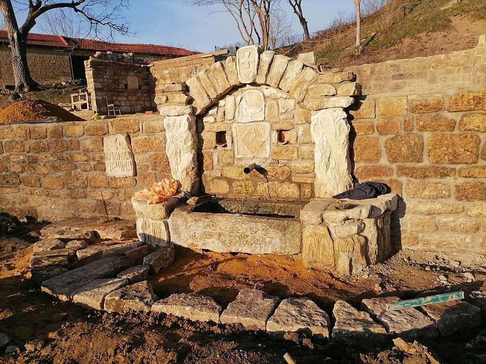
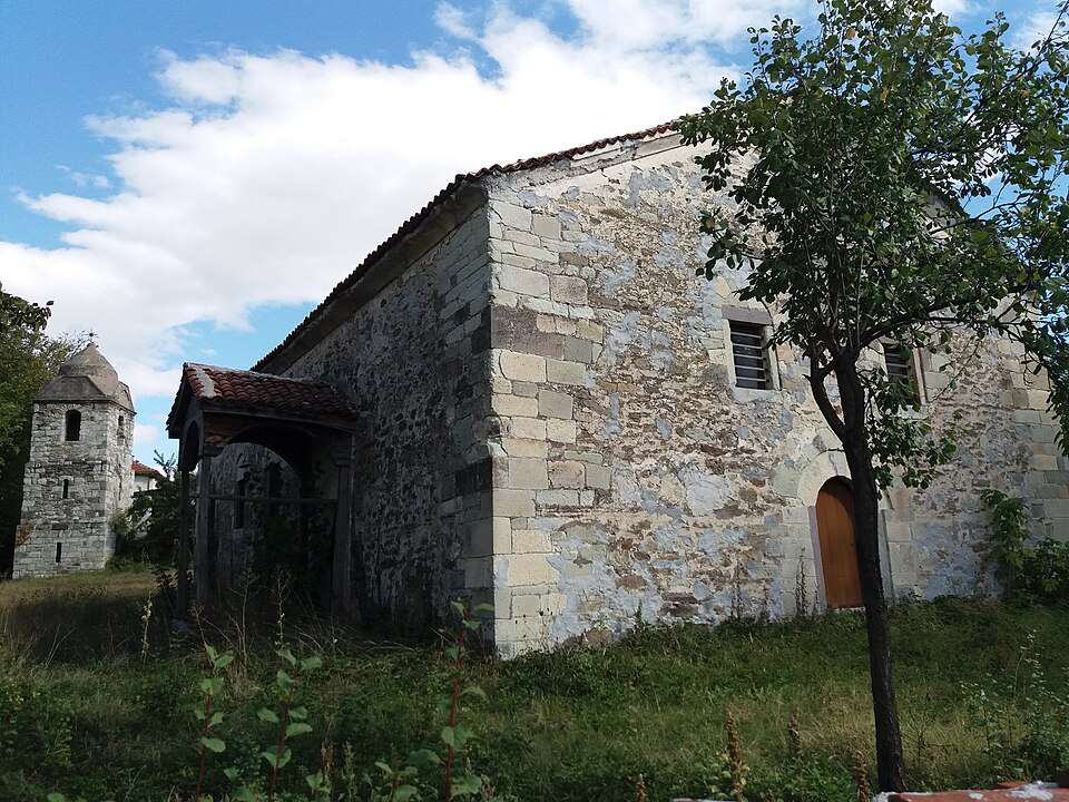
Malorad (Borovan Municipality)

Malorad is a village in Borovan Municipality, Vratsa Province, Bulgaria. EKATTE code: 46810. Elevation range: 100–199 m. This profile uses the official National Register of Settlements. View the location on the map and add the settlement to your personal itinerary.

About this place
View location

Map of Bulgaria with a marker for Malusha (Gabrovo Municipality)Representative point of the settlement. Overview map; confirm the exact visiting address.LOCATION · BULGARIAMalusha (Gabrovo Municipality)NRepresentative point of the settlementMap: Global Tour · Outline: Natural Earth

Representative point of the settlement. Overview map; confirm the exact visiting address.

Bulgaria · Gabrovo

Settlements

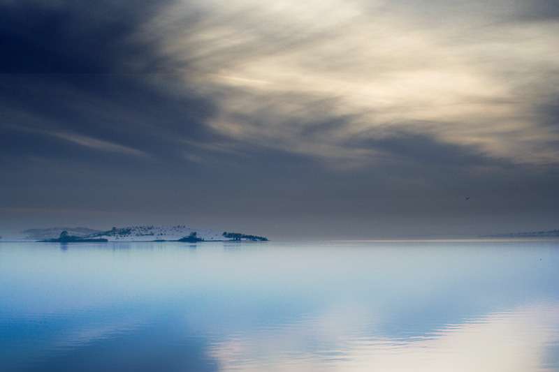
Malusha (Gabrovo Municipality)

Malusha is a village in Gabrovo Municipality, Gabrovo Province, Bulgaria. EKATTE code: 49655. Elevation range: 300–499 m. This profile uses the official National Register of Settlements. View the location on the map and add the settlement to your personal itinerary.

About this place
View location

Map of Bulgaria with a marker for Mamarchevo (Bolyarovo Municipality)Representative point of the settlement. Overview map; confirm the exact visiting address.LOCATION · BULGARIAMamarchevo (Bolyarovo Municipality)NRepresentative point of the settlementMap: Global Tour · Outline: Natural Earth

Representative point of the settlement. Overview map; confirm the exact visiting address.

Bulgaria · Yambol

Settlements

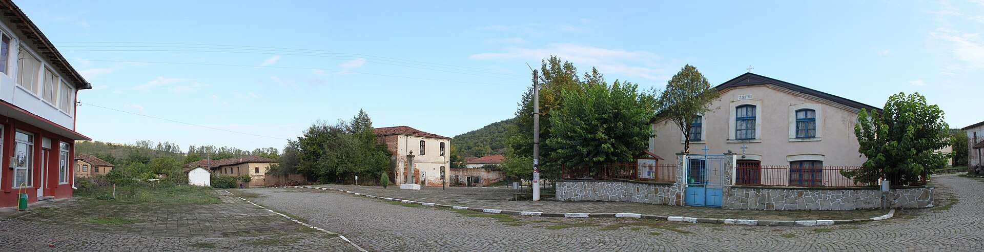
Mamarchevo (Bolyarovo Municipality)

Mamarchevo is a village in Bolyarovo Municipality, Yambol Province, Bulgaria. EKATTE code: 46958. Elevation range: 200–299 m. This profile uses the official National Register of Settlements. View the location on the map and add the settlement to your personal itinerary.

About this place
View location

Map of Bulgaria with a marker for Manaselska reka (Pravets Municipality)Representative point of the settlement. Overview map; confirm the exact visiting address.LOCATION · BULGARIAManaselska reka (Pravets Municipality)NRepresentative point of the settlementMap: Global Tour · Outline: Natural Earth

Representative point of the settlement. Overview map; confirm the exact visiting address.

Bulgaria · Sofia Province

Settlements

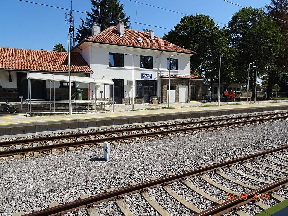
Manaselska reka (Pravets Municipality)

Manaselska reka is a village in Pravets Municipality, Sofia Province Province, Bulgaria. EKATTE code: 46961. Elevation range: 300–499 m. This profile uses the official National Register of Settlements. View the location on the map and add the settlement to your personal itinerary.

About this place
View location

Map of Bulgaria with a marker for Manastir (Haskovo Municipality)Representative point of the settlement. Overview map; confirm the exact visiting address.LOCATION · BULGARIAManastir (Haskovo Municipality)NRepresentative point of the settlementMap: Global Tour · Outline: Natural Earth

Representative point of the settlement. Overview map; confirm the exact visiting address.

Bulgaria · Haskovo

Settlements

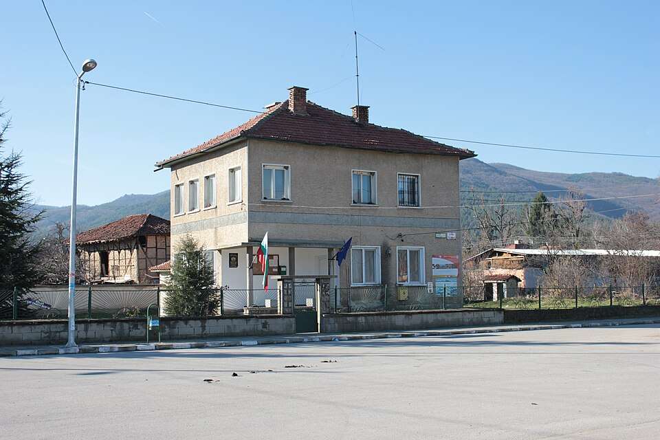
Manastir (Haskovo Municipality)

Manastir is a village in Haskovo Municipality, Haskovo Province, Bulgaria. EKATTE code: 46992. Elevation range: 100–199 m. This profile uses the official National Register of Settlements. View the location on the map and add the settlement to your personal itinerary.

About this place
View location

Map of Bulgaria with a marker for Manastir (Laki Municipality)Representative point of the settlement. Overview map; confirm the exact visiting address.LOCATION · BULGARIAManastir (Laki Municipality)NRepresentative point of the settlementMap: Global Tour · Outline: Natural Earth

Representative point of the settlement. Overview map; confirm the exact visiting address.

Bulgaria · Plovdiv

Settlements

Manastir (Laki Municipality)

Manastir is a village in Laki Municipality, Plovdiv Province, Bulgaria. EKATTE code: 46989. Elevation range: ≥ 1000 m. This profile uses the official National Register of Settlements. View the location on the map and add the settlement to your personal itinerary.

About this place
View location

Map of Bulgaria with a marker for Manastirishte (Hayredin Municipality)Representative point of the settlement. Overview map; confirm the exact visiting address.LOCATION · BULGARIAManastirishte (Hayredin Municipality)NRepresentative point of the settlementMap: Global Tour · Outline: Natural Earth

Representative point of the settlement. Overview map; confirm the exact visiting address.

Bulgaria · Vratsa

Settlements

Manastirishte (Hayredin Municipality)

Manastirishte is a village in Hayredin Municipality, Vratsa Province, Bulgaria. EKATTE code: 47010. Elevation range: 50–99 m. This profile uses the official National Register of Settlements. View the location on the map and add the settlement to your personal itinerary.

About this place
View location

Map of Bulgaria with a marker for Manastirishte (Svoge Municipality)Representative point of the settlement. Overview map; confirm the exact visiting address.LOCATION · BULGARIAManastirishte (Svoge Municipality)NRepresentative point of the settlementMap: Global Tour · Outline: Natural Earth

Representative point of the settlement. Overview map; confirm the exact visiting address.

Bulgaria · Sofia Province

Settlements

Manastirishte (Svoge Municipality)

Manastirishte is a village in Svoge Municipality, Sofia Province Province, Bulgaria. EKATTE code: 47024. Elevation range: 700–999 m. This profile uses the official National Register of Settlements. View the location on the map and add the settlement to your personal itinerary.

About this place
View location

Map of Bulgaria with a marker for Manastiritsa (Popovo Municipality)Representative point of the settlement. Overview map; confirm the exact visiting address.LOCATION · BULGARIAManastiritsa (Popovo Municipality)NRepresentative point of the settlementMap: Global Tour · Outline: Natural Earth

Representative point of the settlement. Overview map; confirm the exact visiting address.

Bulgaria · Targovishte

Settlements

Manastiritsa (Popovo Municipality)

Manastiritsa is a village in Popovo Municipality, Targovishte Province, Bulgaria. EKATTE code: 47007. Elevation range: 200–299 m. This profile uses the official National Register of Settlements. View the location on the map and add the settlement to your personal itinerary.

About this place
View location

Map of Bulgaria with a marker for Manastirsko (Loznitsa Municipality)Representative point of the settlement. Overview map; confirm the exact visiting address.LOCATION · BULGARIAManastirsko (Loznitsa Municipality)NRepresentative point of the settlementMap: Global Tour · Outline: Natural Earth

Representative point of the settlement. Overview map; confirm the exact visiting address.

Bulgaria · Razgrad

Settlements

Manastirsko (Loznitsa Municipality)

Manastirsko is a village in Loznitsa Municipality, Razgrad Province, Bulgaria. EKATTE code: 47038. Elevation range: 300–499 m. This profile uses the official National Register of Settlements. View the location on the map and add the settlement to your personal itinerary.

About this place
View location

Map of Bulgaria with a marker for Manastirtsi (Loznitsa Municipality)Representative point of the settlement. Overview map; confirm the exact visiting address.LOCATION · BULGARIAManastirtsi (Loznitsa Municipality)NRepresentative point of the settlementMap: Global Tour · Outline: Natural Earth

Representative point of the settlement. Overview map; confirm the exact visiting address.

Bulgaria · Razgrad

Settlements

Manastirtsi (Loznitsa Municipality)

Manastirtsi is a village in Loznitsa Municipality, Razgrad Province, Bulgaria. EKATTE code: 47041. Elevation range: 300–499 m. This profile uses the official National Register of Settlements. View the location on the map and add the settlement to your personal itinerary.

About this place
View location

Map of Bulgaria with a marker for Manchevo (Momchilgrad Municipality)Representative point of the settlement. Overview map; confirm the exact visiting address.LOCATION · BULGARIAManchevo (Momchilgrad Municipality)NRepresentative point of the settlementMap: Global Tour · Outline: Natural Earth

Representative point of the settlement. Overview map; confirm the exact visiting address.

Bulgaria · Kardzhali

Settlements

Manchevo (Momchilgrad Municipality)

Manchevo is a village in Momchilgrad Municipality, Kardzhali Province, Bulgaria. EKATTE code: 47144. Elevation range: 700–999 m. This profile uses the official National Register of Settlements. View the location on the map and add the settlement to your personal itinerary.

About this place
View location

Map of Bulgaria with a marker for Manevtsi (Tryavna Municipality)Representative point of the settlement. Overview map; confirm the exact visiting address.LOCATION · BULGARIAManevtsi (Tryavna Municipality)NRepresentative point of the settlementMap: Global Tour · Outline: Natural Earth

Representative point of the settlement. Overview map; confirm the exact visiting address.

Bulgaria · Gabrovo

Settlements

Manevtsi (Tryavna Municipality)

Manevtsi is a village in Tryavna Municipality, Gabrovo Province, Bulgaria. EKATTE code: 47072. Elevation range: 500–699 m. This profile uses the official National Register of Settlements. View the location on the map and add the settlement to your personal itinerary.

About this place
View location

Map of Bulgaria with a marker for Manolich (Sungurlare Municipality)Representative point of the settlement. Overview map; confirm the exact visiting address.LOCATION · BULGARIAManolich (Sungurlare Municipality)NRepresentative point of the settlementMap: Global Tour · Outline: Natural Earth

Representative point of the settlement. Overview map; confirm the exact visiting address.

Bulgaria · Burgas

Settlements

Manolich (Sungurlare Municipality)

Manolich is a village in Sungurlare Municipality, Burgas Province, Bulgaria. EKATTE code: 47096. Elevation range: 300–499 m. This profile uses the official National Register of Settlements. View the location on the map and add the settlement to your personal itinerary.

About this place
View location

Map of Bulgaria with a marker for Manolsko Konare (Maritsa Municipality)Representative point of the settlement. Overview map; confirm the exact visiting address.LOCATION · BULGARIAManolsko Konare (Maritsa Municipality)NRepresentative point of the settlementMap: Global Tour · Outline: Natural Earth

Representative point of the settlement. Overview map; confirm the exact visiting address.

Bulgaria · Plovdiv

Settlements

Manolsko Konare (Maritsa Municipality)

Manolsko Konare is a village in Maritsa Municipality, Plovdiv Province, Bulgaria. EKATTE code: 47113. Elevation range: 100–199 m. This profile uses the official National Register of Settlements. View the location on the map and add the settlement to your personal itinerary.

About this place
View location

Map of Bulgaria with a marker for Manoya (Dryanovo Municipality)Representative point of the settlement. Overview map; confirm the exact visiting address.LOCATION · BULGARIAManoya (Dryanovo Municipality)NRepresentative point of the settlementMap: Global Tour · Outline: Natural Earth

Representative point of the settlement. Overview map; confirm the exact visiting address.

Bulgaria · Gabrovo

Settlements

Manoya (Dryanovo Municipality)

Manoya is a village in Dryanovo Municipality, Gabrovo Province, Bulgaria. EKATTE code: 47127. Elevation range: 300–499 m. This profile uses the official National Register of Settlements. View the location on the map and add the settlement to your personal itinerary.

About this place
View location

Map of Bulgaria with a marker for Manushevtsi (Antonovo Municipality)Representative point of the settlement. Overview map; confirm the exact visiting address.LOCATION · BULGARIAManushevtsi (Antonovo Municipality)NRepresentative point of the settlementMap: Global Tour · Outline: Natural Earth

Representative point of the settlement. Overview map; confirm the exact visiting address.

Bulgaria · Targovishte

Settlements

Manushevtsi (Antonovo Municipality)

Manushevtsi is a village in Antonovo Municipality, Targovishte Province, Bulgaria. EKATTE code: 47130. Elevation range: 500–699 m. This profile uses the official National Register of Settlements. View the location on the map and add the settlement to your personal itinerary.

About this place
View location

© 2026 Global Tour