Places

Discover the places on our routes — history, nature and landmarks.

The catalogue continues to grow. See the linked source for visit details.

Settlements · 5,256

Places found: 5893 · Showing 3,145–3,168 of 5,893 · Page 132 / 246

Map of Bulgaria with a marker for Miladinovtsi (Tundzha Municipality)Representative point of the settlement. Overview map; confirm the exact visiting address.LOCATION · BULGARIAMiladinovtsi (Tundzha Municipality)NRepresentative point of the settlementMap: Global Tour · Outline: Natural Earth

Representative point of the settlement. Overview map; confirm the exact visiting address.

Bulgaria · Yambol

Settlements

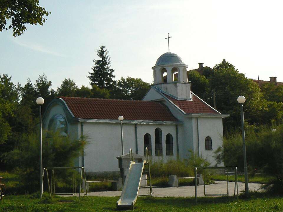
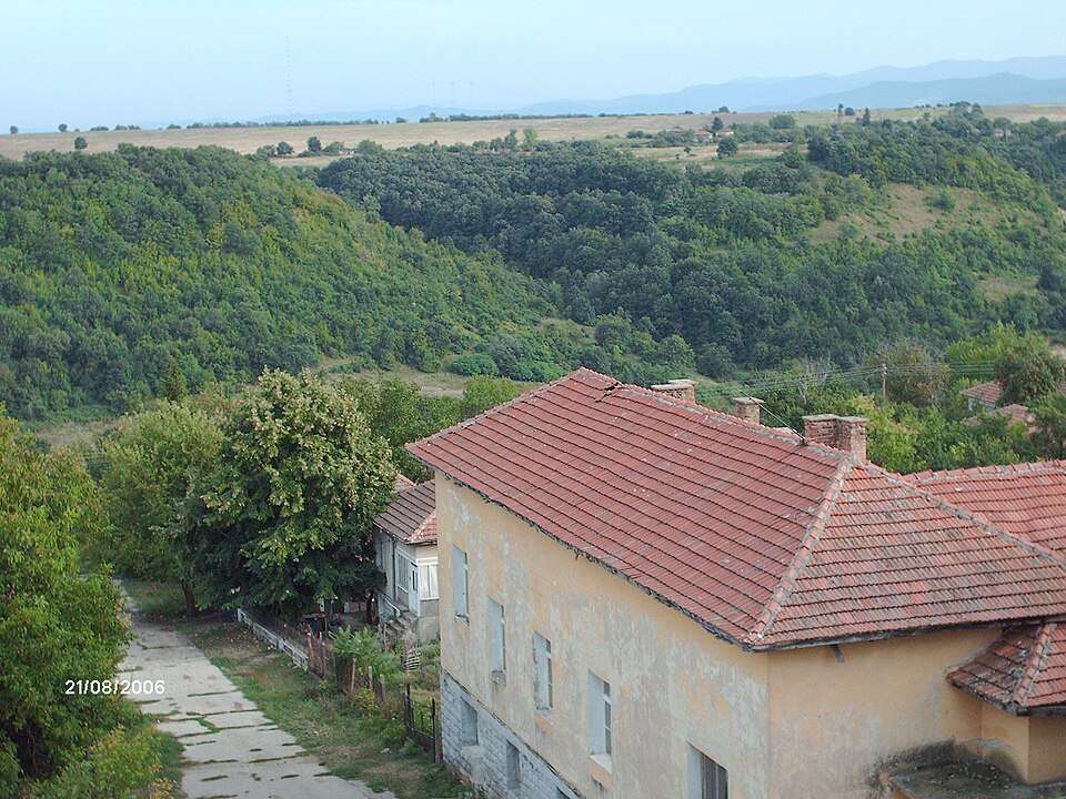
Miladinovtsi (Tundzha Municipality)

Miladinovtsi is a village in Tundzha Municipality, Yambol Province, Bulgaria. EKATTE code: 48101. Elevation range: 100–199 m. This profile uses the official National Register of Settlements. View the location on the map and add the settlement to your personal itinerary.

About this place
View location

Map of Bulgaria with a marker for Milanovo (Veliki Preslav Municipality)Representative point of the settlement. Overview map; confirm the exact visiting address.LOCATION · BULGARIAMilanovo (Veliki Preslav Municipality)NRepresentative point of the settlementMap: Global Tour · Outline: Natural Earth

Representative point of the settlement. Overview map; confirm the exact visiting address.

Bulgaria · Shumen

Settlements

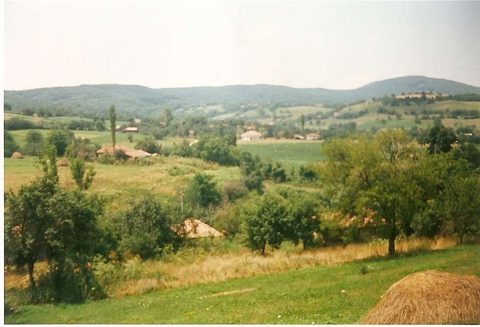
Milanovo (Veliki Preslav Municipality)

Milanovo is a village in Veliki Preslav Municipality, Shumen Province, Bulgaria. EKATTE code: 48132. Elevation range: 100–199 m. This profile uses the official National Register of Settlements. View the location on the map and add the settlement to your personal itinerary.

About this place
View location

Photograph from Milchina laka (Gramada Municipality)

Photograph from Milchina laka (Gramada Municipality)

Bulgaria · Vidin

Settlements

Milchina laka (Gramada Municipality)

Milchina laka is a village in Gramada Municipality, Vidin Province, Bulgaria. EKATTE code: 48266. Elevation range: 100–199 m. This profile uses the official National Register of Settlements. View the location on the map and add the settlement to your personal itinerary.

About this place
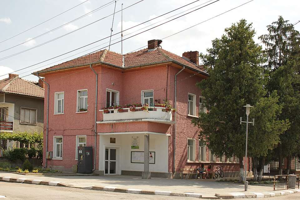
Photo: Original author and uploader was Alsnie at bg.wikipedia · Public domain · License

View location

Map of Bulgaria with a marker for Mile (Madan Municipality)Representative point of the settlement. Overview map; confirm the exact visiting address.LOCATION · BULGARIAMile (Madan Municipality)NRepresentative point of the settlementMap: Global Tour · Outline: Natural Earth

Representative point of the settlement. Overview map; confirm the exact visiting address.

Bulgaria · Smolyan

Settlements

Mile (Madan Municipality)

Mile is a village in Madan Municipality, Smolyan Province, Bulgaria. EKATTE code: 48146. Elevation range: ≥ 1000 m. This profile uses the official National Register of Settlements. View the location on the map and add the settlement to your personal itinerary.

About this place
View location

Map of Bulgaria with a marker for Milevo (Sadovo Municipality)Representative point of the settlement. Overview map; confirm the exact visiting address.LOCATION · BULGARIAMilevo (Sadovo Municipality)NRepresentative point of the settlementMap: Global Tour · Outline: Natural Earth

Representative point of the settlement. Overview map; confirm the exact visiting address.

Bulgaria · Plovdiv

Settlements

Milevo (Sadovo Municipality)

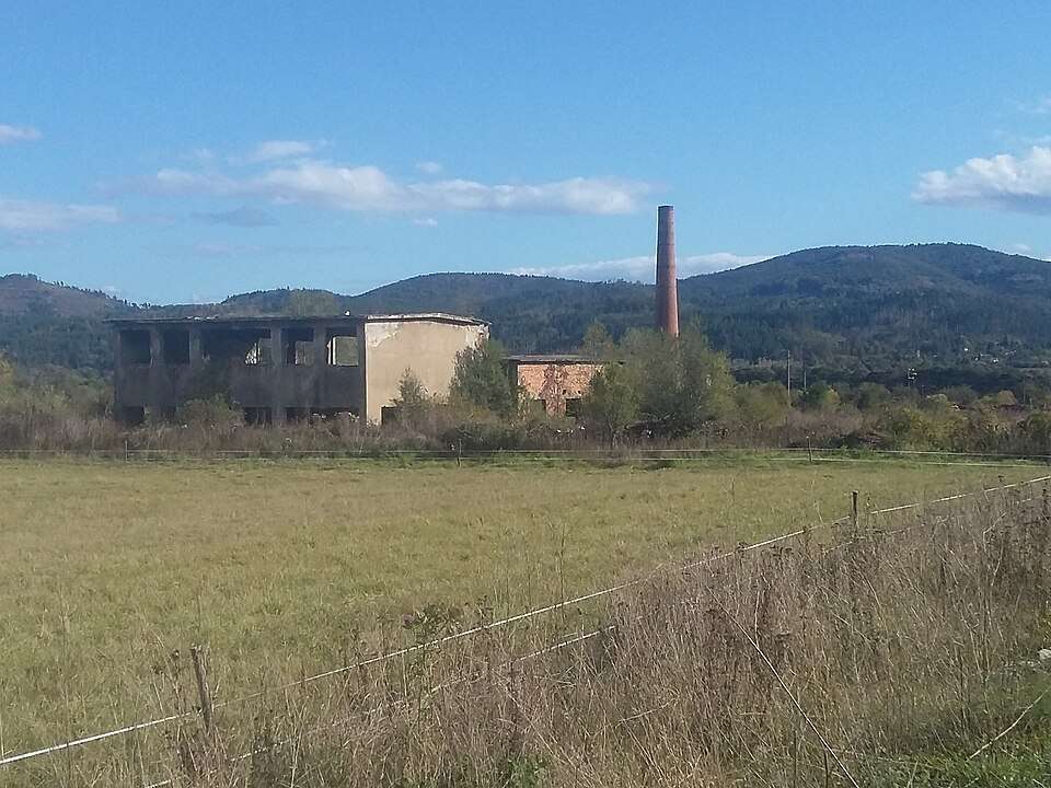
Milevo is a village in Sadovo Municipality, Plovdiv Province, Bulgaria. EKATTE code: 48152. Elevation range: 100–199 m. This profile uses the official National Register of Settlements. View the location on the map and add the settlement to your personal itinerary.

About this place
View location

Map of Bulgaria with a marker for Milevtsi (Tryavna Municipality)Representative point of the settlement. Overview map; confirm the exact visiting address.LOCATION · BULGARIAMilevtsi (Tryavna Municipality)NRepresentative point of the settlementMap: Global Tour · Outline: Natural Earth

Representative point of the settlement. Overview map; confirm the exact visiting address.

Bulgaria · Gabrovo

Settlements

Milevtsi (Tryavna Municipality)

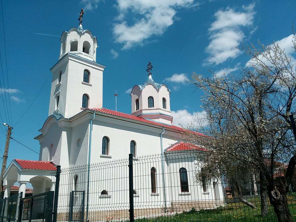
Milevtsi is a village in Tryavna Municipality, Gabrovo Province, Bulgaria. EKATTE code: 48177. Elevation range: 500–699 m. This profile uses the official National Register of Settlements. View the location on the map and add the settlement to your personal itinerary.

About this place
View location

Map of Bulgaria with a marker for Military Cemetery 1916 Memorial — TutrakanApproximate area: Tutrakan. Overview map; confirm the exact visiting address.LOCATION · BULGARIAMilitary Cemetery 1916 Memorial — TutrakanNApproximate area: TutrakanMap: Global Tour · Outline: Natural Earth

Approximate area: Tutrakan. Overview map; confirm the exact visiting address.

Bulgaria · Silistra

History and archaeology

Military Cemetery 1916 Memorial — Tutrakan

Near Shumentsi, soldiers from the different armies involved in the Tutrakan battle lie buried together. The obelisk bears inscriptions in four languages, creating a shared place of remembrance for victors and defeated.

About this place
View location

Map of Bulgaria with a marker for Milkovo (Smolyan Municipality)Representative point of the settlement. Overview map; confirm the exact visiting address.LOCATION · BULGARIAMilkovo (Smolyan Municipality)NRepresentative point of the settlementMap: Global Tour · Outline: Natural Earth

Representative point of the settlement. Overview map; confirm the exact visiting address.

Bulgaria · Smolyan

Settlements

Milkovo (Smolyan Municipality)

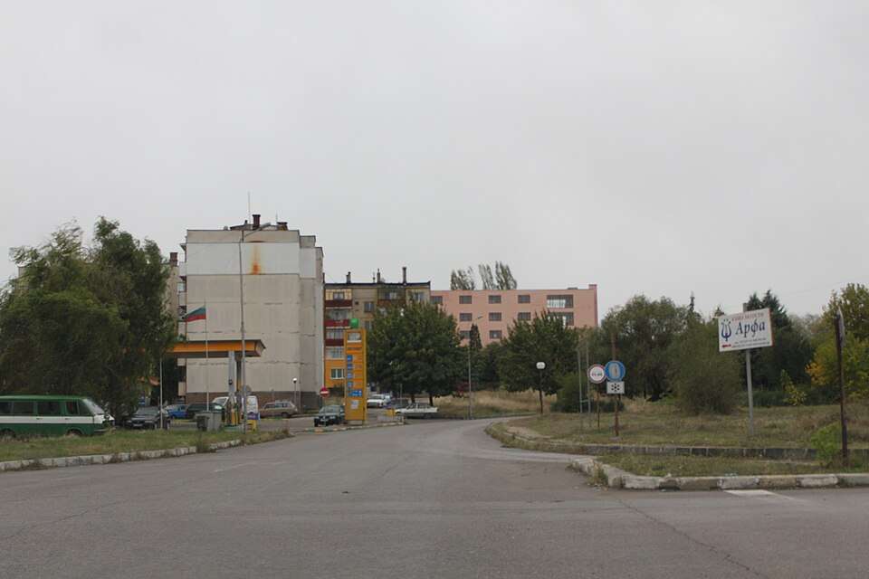
Milkovo is a village in Smolyan Municipality, Smolyan Province, Bulgaria. EKATTE code: 48218. Elevation range: ≥ 1000 m. This profile uses the official National Register of Settlements. View the location on the map and add the settlement to your personal itinerary.

About this place
View location

Map of Bulgaria with a marker for Milkovtsi (Gabrovo Municipality)Representative point of the settlement. Overview map; confirm the exact visiting address.LOCATION · BULGARIAMilkovtsi (Gabrovo Municipality)NRepresentative point of the settlementMap: Global Tour · Outline: Natural Earth

Representative point of the settlement. Overview map; confirm the exact visiting address.

Bulgaria · Gabrovo

Settlements

Milkovtsi (Gabrovo Municipality)

Milkovtsi is a village in Gabrovo Municipality, Gabrovo Province, Bulgaria. EKATTE code: 48235. Elevation range: 300–499 m. This profile uses the official National Register of Settlements. View the location on the map and add the settlement to your personal itinerary.

About this place
View location

Map of Bulgaria with a marker for Milkyovtsi (Tran Municipality)Representative point of the settlement. Overview map; confirm the exact visiting address.LOCATION · BULGARIAMilkyovtsi (Tran Municipality)NRepresentative point of the settlementMap: Global Tour · Outline: Natural Earth

Representative point of the settlement. Overview map; confirm the exact visiting address.

Bulgaria · Pernik

Settlements

Milkyovtsi (Tran Municipality)

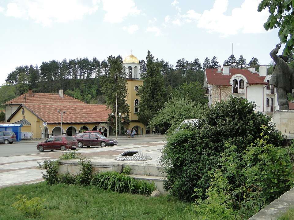
Milkyovtsi is a village in Tran Municipality, Pernik Province, Bulgaria. EKATTE code: 48249. Elevation range: 700–999 m. This profile uses the official National Register of Settlements. View the location on the map and add the settlement to your personal itinerary.

About this place
View location

Photograph from Mineralni bani (Mineralni bani Municipality)

Photograph from Mineralni bani (Mineralni bani Municipality)

Bulgaria · Haskovo

Settlements

Mineralni bani (Mineralni bani Municipality)

Mineralni bani is a village in Mineralni bani Municipality, Haskovo Province, Bulgaria. EKATTE code: 48297. Elevation range: 300–499 m. Municipal centre. This profile uses the official National Register of Settlements. View the location on the map and add the settlement to your personal itinerary.

About this place
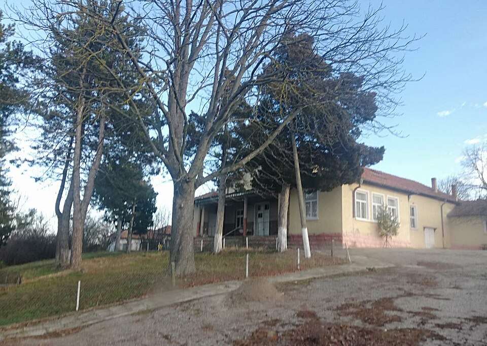
Photo: Bin im Garten · CC BY-SA 3.0 · License

View location

Map of Bulgaria with a marker for Minevtsi (Elena Municipality)Representative point of the settlement. Overview map; confirm the exact visiting address.LOCATION · BULGARIAMinevtsi (Elena Municipality)NRepresentative point of the settlementMap: Global Tour · Outline: Natural Earth

Representative point of the settlement. Overview map; confirm the exact visiting address.

Bulgaria · Veliko Tarnovo

Settlements

Minevtsi (Elena Municipality)

Minevtsi is a village in Elena Municipality, Veliko Tarnovo Province, Bulgaria. EKATTE code: 48283. Elevation range: 300–499 m. This profile uses the official National Register of Settlements. View the location on the map and add the settlement to your personal itinerary.

About this place
View location

Map of Bulgaria with a marker for Minzuhar (Chernoochene Municipality)Representative point of the settlement. Overview map; confirm the exact visiting address.LOCATION · BULGARIAMinzuhar (Chernoochene Municipality)NRepresentative point of the settlementMap: Global Tour · Outline: Natural Earth

Representative point of the settlement. Overview map; confirm the exact visiting address.

Bulgaria · Kardzhali

Settlements

Minzuhar (Chernoochene Municipality)

Minzuhar is a village in Chernoochene Municipality, Kardzhali Province, Bulgaria. EKATTE code: 48307. Elevation range: 300–499 m. This profile uses the official National Register of Settlements. View the location on the map and add the settlement to your personal itinerary.

About this place
View location

Map of Bulgaria with a marker for Mirchovtsi (Elena Municipality)Representative point of the settlement. Overview map; confirm the exact visiting address.LOCATION · BULGARIAMirchovtsi (Elena Municipality)NRepresentative point of the settlementMap: Global Tour · Outline: Natural Earth

Representative point of the settlement. Overview map; confirm the exact visiting address.

Bulgaria · Veliko Tarnovo

Settlements

Mirchovtsi (Elena Municipality)

Mirchovtsi is a village in Elena Municipality, Veliko Tarnovo Province, Bulgaria. EKATTE code: 48430. Elevation range: 300–499 m. This profile uses the official National Register of Settlements. View the location on the map and add the settlement to your personal itinerary.

About this place
View location

Map of Bulgaria with a marker for Mirolyubovo (Burgas Municipality)Representative point of the settlement. Overview map; confirm the exact visiting address.LOCATION · BULGARIAMirolyubovo (Burgas Municipality)NRepresentative point of the settlementMap: Global Tour · Outline: Natural Earth

Representative point of the settlement. Overview map; confirm the exact visiting address.

Bulgaria · Burgas

Settlements

Mirolyubovo (Burgas Municipality)

Mirolyubovo is a village in Burgas Municipality, Burgas Province, Bulgaria. EKATTE code: 48409. Elevation range: 100–199 m. This profile uses the official National Register of Settlements. View the location on the map and add the settlement to your personal itinerary.

About this place
View location

© 2026 Global Tour