Places

Discover the places on our routes — history, nature and landmarks.

The catalogue continues to grow. See the linked source for visit details.

Settlements · 5,256

Places found: 5893 · Showing 3,865–3,888 of 5,893 · Page 162 / 246

Map of Bulgaria with a marker for Podvrah (Dzhebel Municipality)Representative point of the settlement. Overview map; confirm the exact visiting address.LOCATION · BULGARIAPodvrah (Dzhebel Municipality)NRepresentative point of the settlementMap: Global Tour · Outline: Natural Earth

Representative point of the settlement. Overview map; confirm the exact visiting address.

Bulgaria · Kardzhali

Settlements

Podvrah (Dzhebel Municipality)

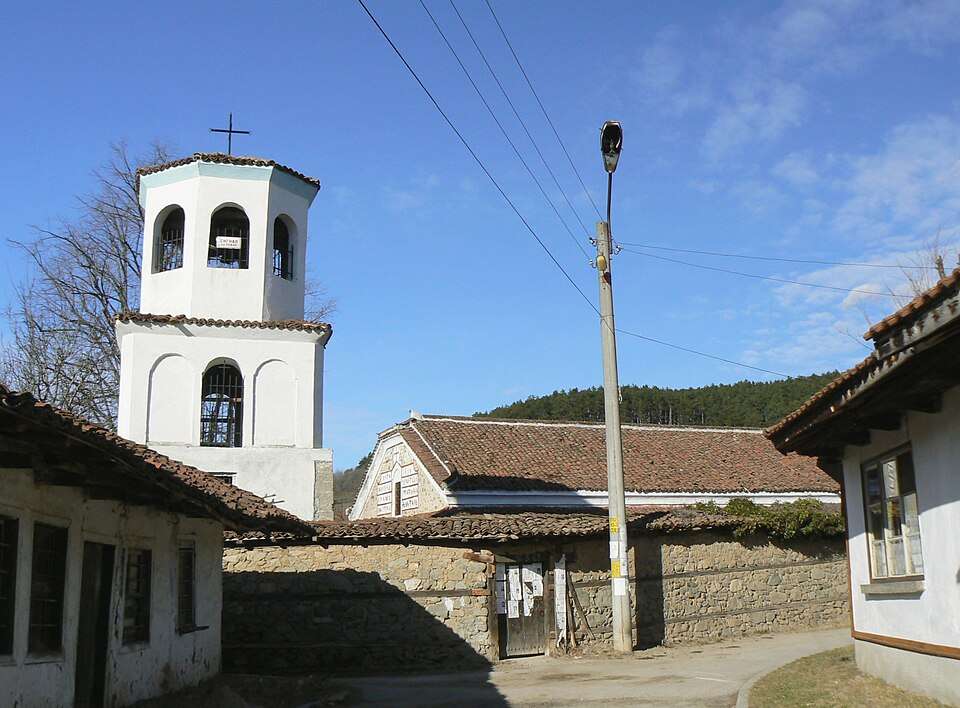
Podvrah is a village in Dzhebel Municipality, Kardzhali Province, Bulgaria. EKATTE code: 56976. Elevation range: 300–499 m. This profile uses the official National Register of Settlements. View the location on the map and add the settlement to your personal itinerary.

About this place
View location

Photograph from Poibrene (Panagyurishte Municipality)

Photograph from Poibrene (Panagyurishte Municipality)

Bulgaria · Pazardzhik

Settlements

Poibrene (Panagyurishte Municipality)

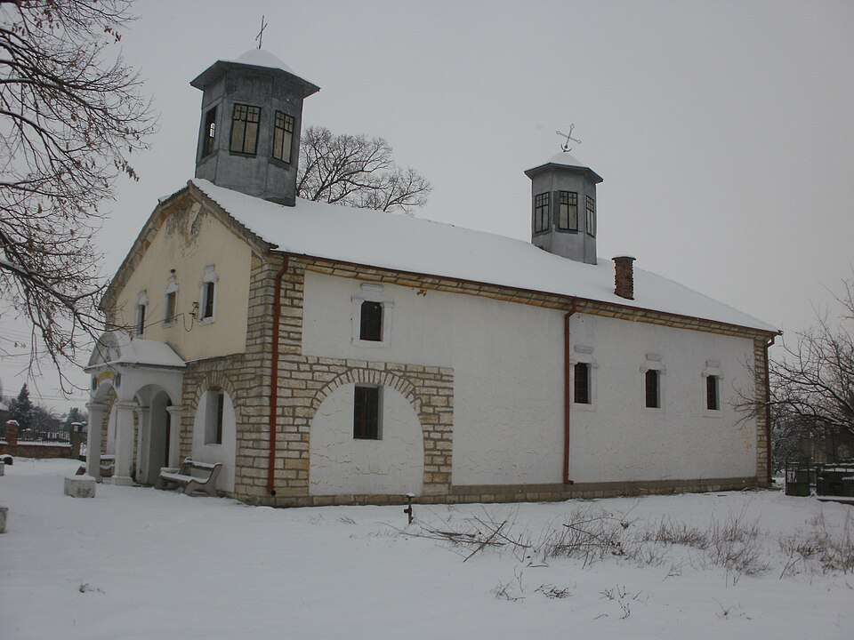
Poibrene is a village in Panagyurishte Municipality, Pazardzhik Province, Bulgaria. EKATTE code: 57128. Elevation range: 300–499 m. This profile uses the official National Register of Settlements. View the location on the map and add the settlement to your personal itinerary.

About this place
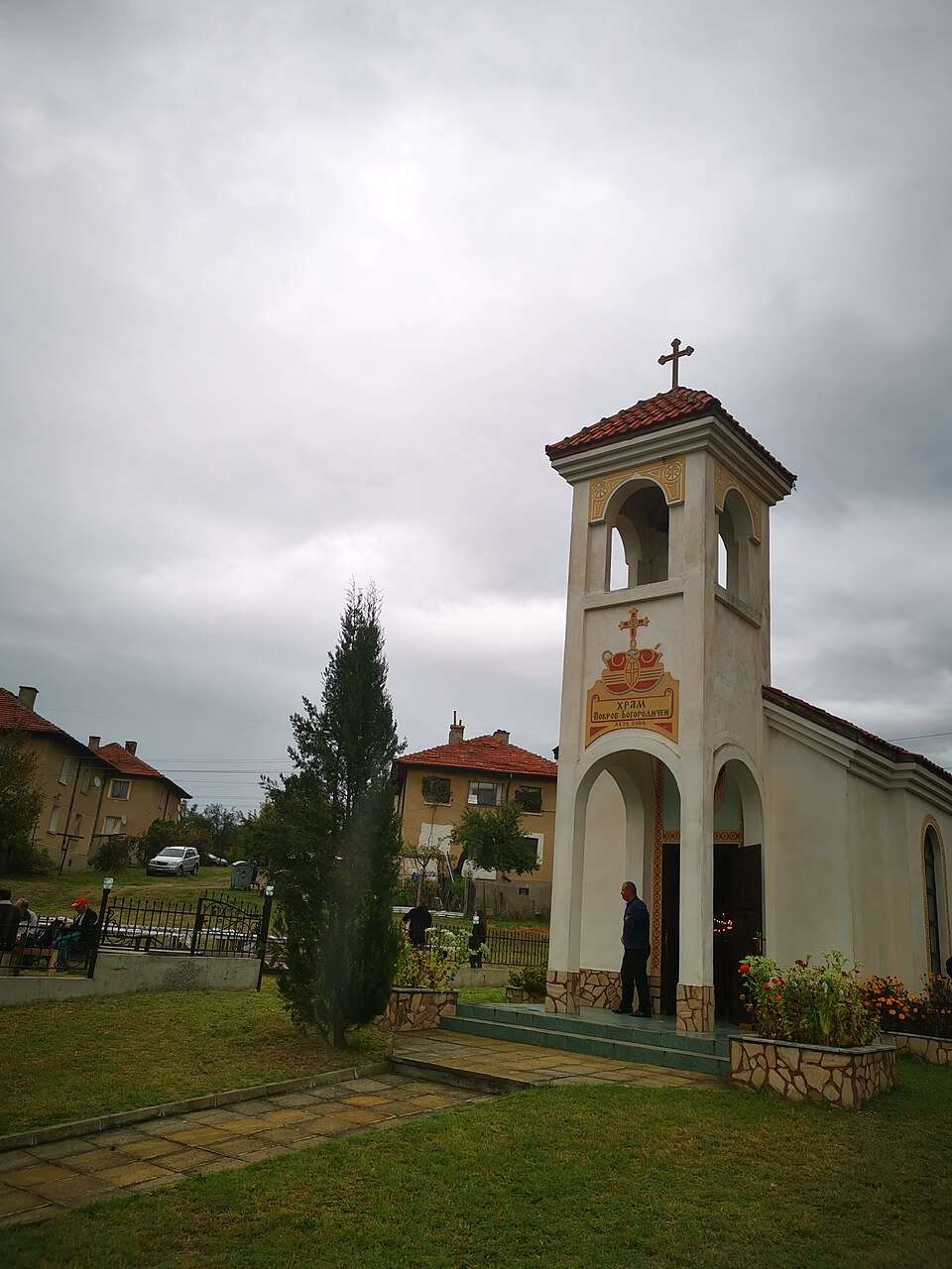
Photo: Vassia Atanassova - Spiritia · Public domain · License

View location

Map of Bulgaria with a marker for Pokrovan (Ivaylovgrad Municipality)Representative point of the settlement. Overview map; confirm the exact visiting address.LOCATION · BULGARIAPokrovan (Ivaylovgrad Municipality)NRepresentative point of the settlementMap: Global Tour · Outline: Natural Earth

Representative point of the settlement. Overview map; confirm the exact visiting address.

Bulgaria · Haskovo

Settlements

Pokrovan (Ivaylovgrad Municipality)

Pokrovan is a village in Ivaylovgrad Municipality, Haskovo Province, Bulgaria. EKATTE code: 57145. Elevation range: 300–499 m. This profile uses the official National Register of Settlements. View the location on the map and add the settlement to your personal itinerary.

About this place
View location

Map of Bulgaria with a marker for Pokrovnik (Blagoevgrad Municipality)Representative point of the settlement. Overview map; confirm the exact visiting address.LOCATION · BULGARIAPokrovnik (Blagoevgrad Municipality)NRepresentative point of the settlementMap: Global Tour · Outline: Natural Earth

Representative point of the settlement. Overview map; confirm the exact visiting address.

Bulgaria · Blagoevgrad

Settlements

Pokrovnik (Blagoevgrad Municipality)

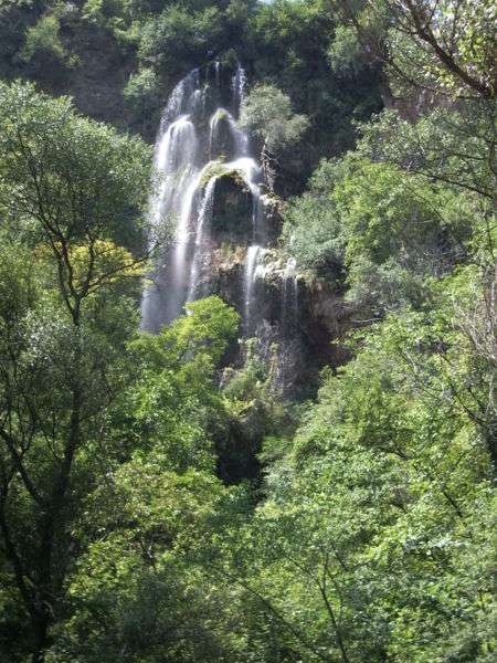
Pokrovnik is a village in Blagoevgrad Municipality, Blagoevgrad Province, Bulgaria. EKATTE code: 57159. Elevation range: 300–499 m. This profile uses the official National Register of Settlements. View the location on the map and add the settlement to your personal itinerary.

About this place
View location

Map of Bulgaria with a marker for Polena (Simitli Municipality)Representative point of the settlement. Overview map; confirm the exact visiting address.LOCATION · BULGARIAPolena (Simitli Municipality)NRepresentative point of the settlementMap: Global Tour · Outline: Natural Earth

Representative point of the settlement. Overview map; confirm the exact visiting address.

Bulgaria · Blagoevgrad

Settlements

Polena (Simitli Municipality)

Polena is a village in Simitli Municipality, Blagoevgrad Province, Bulgaria. EKATTE code: 57162. Elevation range: 300–499 m. This profile uses the official National Register of Settlements. View the location on the map and add the settlement to your personal itinerary.

About this place
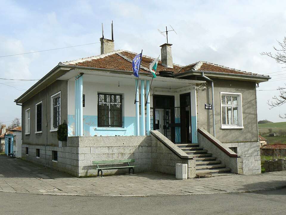
View location

Map of Bulgaria with a marker for Polenitsa (Sandanski Municipality)Representative point of the settlement. Overview map; confirm the exact visiting address.LOCATION · BULGARIAPolenitsa (Sandanski Municipality)NRepresentative point of the settlementMap: Global Tour · Outline: Natural Earth

Representative point of the settlement. Overview map; confirm the exact visiting address.

Bulgaria · Blagoevgrad

Settlements

Polenitsa (Sandanski Municipality)

Polenitsa is a village in Sandanski Municipality, Blagoevgrad Province, Bulgaria. EKATTE code: 57176. Elevation range: 300–499 m. This profile uses the official National Register of Settlements. View the location on the map and add the settlement to your personal itinerary.

About this place
View location

Map of Bulgaria with a marker for Poletintsi (Kyustendil Municipality)Representative point of the settlement. Overview map; confirm the exact visiting address.LOCATION · BULGARIAPoletintsi (Kyustendil Municipality)NRepresentative point of the settlementMap: Global Tour · Outline: Natural Earth

Representative point of the settlement. Overview map; confirm the exact visiting address.

Bulgaria · Kyustendil

Settlements

Poletintsi (Kyustendil Municipality)

Poletintsi is a village in Kyustendil Municipality, Kyustendil Province, Bulgaria. EKATTE code: 57188. Elevation range: 700–999 m. This profile uses the official National Register of Settlements. View the location on the map and add the settlement to your personal itinerary.

About this place
View location

Map of Bulgaria with a marker for Poletkovtsi (Kula Municipality)Representative point of the settlement. Overview map; confirm the exact visiting address.LOCATION · BULGARIAPoletkovtsi (Kula Municipality)NRepresentative point of the settlementMap: Global Tour · Outline: Natural Earth

Representative point of the settlement. Overview map; confirm the exact visiting address.

Bulgaria · Vidin

Settlements

Poletkovtsi (Kula Municipality)

Poletkovtsi is a village in Kula Municipality, Vidin Province, Bulgaria. EKATTE code: 57193. Elevation range: 200–299 m. This profile uses the official National Register of Settlements. View the location on the map and add the settlement to your personal itinerary.

About this place
View location

Map of Bulgaria with a marker for Polikraishte (Gorna Oryahovitsa Municipality)Representative point of the settlement. Overview map; confirm the exact visiting address.LOCATION · BULGARIAPolikraishte (Gorna OryahovitsaMunicipality)NRepresentative point of the settlementMap: Global Tour · Outline: Natural Earth

Representative point of the settlement. Overview map; confirm the exact visiting address.

Bulgaria · Veliko Tarnovo

Settlements

Polikraishte (Gorna Oryahovitsa Municipality)

Polikraishte is a village in Gorna Oryahovitsa Municipality, Veliko Tarnovo Province, Bulgaria. EKATTE code: 57217. Elevation range: 50–99 m. This profile uses the official National Register of Settlements. View the location on the map and add the settlement to your personal itinerary.

About this place
View location

Map of Bulgaria with a marker for Polkovnik Cholakovo (Kaynardzha Municipality)Representative point of the settlement. Overview map; confirm the exact visiting address.LOCATION · BULGARIAPolkovnik Cholakovo (KaynardzhaMunicipality)NRepresentative point of the settlementMap: Global Tour · Outline: Natural Earth

Representative point of the settlement. Overview map; confirm the exact visiting address.

Bulgaria · Silistra

Settlements

Polkovnik Cholakovo (Kaynardzha Municipality)

Polkovnik Cholakovo is a village in Kaynardzha Municipality, Silistra Province, Bulgaria. EKATTE code: 57306. Elevation range: 100–199 m. This profile uses the official National Register of Settlements. View the location on the map and add the settlement to your personal itinerary.

About this place
View location

Map of Bulgaria with a marker for Polkovnik Dyakovo (Krushari Municipality)Representative point of the settlement. Overview map; confirm the exact visiting address.LOCATION · BULGARIAPolkovnik Dyakovo (Krushari Municipality)NRepresentative point of the settlementMap: Global Tour · Outline: Natural Earth

Representative point of the settlement. Overview map; confirm the exact visiting address.

Bulgaria · Dobrich

Settlements

Polkovnik Dyakovo (Krushari Municipality)

Polkovnik Dyakovo is a village in Krushari Municipality, Dobrich Province, Bulgaria. EKATTE code: 57234. Elevation range: 100–199 m. This profile uses the official National Register of Settlements. View the location on the map and add the settlement to your personal itinerary.

About this place
View location

Map of Bulgaria with a marker for Polkovnik Ivanovo (Dobrich-selska Municipality)Representative point of the settlement. Overview map; confirm the exact visiting address.LOCATION · BULGARIAPolkovnik Ivanovo (Dobrich-selskaMunicipality)NRepresentative point of the settlementMap: Global Tour · Outline: Natural Earth

Representative point of the settlement. Overview map; confirm the exact visiting address.

Bulgaria · Dobrich

Settlements

Polkovnik Ivanovo (Dobrich-selska Municipality)

Polkovnik Ivanovo is a village in Dobrich-selska Municipality, Dobrich Province, Bulgaria. EKATTE code: 68103. Elevation range: 200–299 m. This profile uses the official National Register of Settlements. View the location on the map and add the settlement to your personal itinerary.

About this place
View location

Map of Bulgaria with a marker for Polkovnik Lambrinovo (Silistra Municipality)Representative point of the settlement. Overview map; confirm the exact visiting address.LOCATION · BULGARIAPolkovnik Lambrinovo (SilistraMunicipality)NRepresentative point of the settlementMap: Global Tour · Outline: Natural Earth

Representative point of the settlement. Overview map; confirm the exact visiting address.

Bulgaria · Silistra

Settlements

Polkovnik Lambrinovo (Silistra Municipality)

Polkovnik Lambrinovo is a village in Silistra Municipality, Silistra Province, Bulgaria. EKATTE code: 57251. Elevation range: 100–199 m. This profile uses the official National Register of Settlements. View the location on the map and add the settlement to your personal itinerary.

About this place
View location

Map of Bulgaria with a marker for Polkovnik Minkovo (Dobrich-selska Municipality)Representative point of the settlement. Overview map; confirm the exact visiting address.LOCATION · BULGARIAPolkovnik Minkovo (Dobrich-selskaMunicipality)NRepresentative point of the settlementMap: Global Tour · Outline: Natural Earth

Representative point of the settlement. Overview map; confirm the exact visiting address.

Bulgaria · Dobrich

Settlements

Polkovnik Minkovo (Dobrich-selska Municipality)

Polkovnik Minkovo is a village in Dobrich-selska Municipality, Dobrich Province, Bulgaria. EKATTE code: 59402. Elevation range: 200–299 m. This profile uses the official National Register of Settlements. View the location on the map and add the settlement to your personal itinerary.

About this place
View location

Map of Bulgaria with a marker for Polkovnik Savovo (Tervel Municipality)Representative point of the settlement. Overview map; confirm the exact visiting address.LOCATION · BULGARIAPolkovnik Savovo (Tervel Municipality)NRepresentative point of the settlementMap: Global Tour · Outline: Natural Earth

Representative point of the settlement. Overview map; confirm the exact visiting address.

Bulgaria · Dobrich

Settlements

Polkovnik Savovo (Tervel Municipality)

Polkovnik Savovo is a village in Tervel Municipality, Dobrich Province, Bulgaria. EKATTE code: 57265. Elevation range: 200–299 m. This profile uses the official National Register of Settlements. View the location on the map and add the settlement to your personal itinerary.

About this place
View location

Map of Bulgaria with a marker for Polkovnik Serafimovo (Smolyan Municipality)Representative point of the settlement. Overview map; confirm the exact visiting address.LOCATION · BULGARIAPolkovnik Serafimovo (SmolyanMunicipality)NRepresentative point of the settlementMap: Global Tour · Outline: Natural Earth

Representative point of the settlement. Overview map; confirm the exact visiting address.

Bulgaria · Smolyan

Settlements

Polkovnik Serafimovo (Smolyan Municipality)

Polkovnik Serafimovo is a village in Smolyan Municipality, Smolyan Province, Bulgaria. EKATTE code: 57282. Elevation range: 700–999 m. This profile uses the official National Register of Settlements. View the location on the map and add the settlement to your personal itinerary.

About this place
View location

Map of Bulgaria with a marker for Polkovnik Sveshtarovo (Dobrich-selska Municipality)Representative point of the settlement. Overview map; confirm the exact visiting address.LOCATION · BULGARIAPolkovnik Sveshtarovo (Dobrich-selskaMunicipality)NRepresentative point of the settlementMap: Global Tour · Outline: Natural Earth

Representative point of the settlement. Overview map; confirm the exact visiting address.

Bulgaria · Dobrich

Settlements

Polkovnik Sveshtarovo (Dobrich-selska Municipality)

Polkovnik Sveshtarovo is a village in Dobrich-selska Municipality, Dobrich Province, Bulgaria. EKATTE code: 57279. Elevation range: 200–299 m. This profile uses the official National Register of Settlements. View the location on the map and add the settlement to your personal itinerary.

About this place
View location

Map of Bulgaria with a marker for Polkovnik Taslakovo (Dulovo Municipality)Representative point of the settlement. Overview map; confirm the exact visiting address.LOCATION · BULGARIAPolkovnik Taslakovo (Dulovo Municipality)NRepresentative point of the settlementMap: Global Tour · Outline: Natural Earth

Representative point of the settlement. Overview map; confirm the exact visiting address.

Bulgaria · Silistra

Settlements

Polkovnik Taslakovo (Dulovo Municipality)

Polkovnik Taslakovo is a village in Dulovo Municipality, Silistra Province, Bulgaria. EKATTE code: 57296. Elevation range: 200–299 m. This profile uses the official National Register of Settlements. View the location on the map and add the settlement to your personal itinerary.

About this place
View location

Photograph from Polkovnik Zhelyazovo (Krumovgrad Municipality)

Photograph from Polkovnik Zhelyazovo (Krumovgrad Municipality)

Bulgaria · Kardzhali

Settlements

Polkovnik Zhelyazovo (Krumovgrad Municipality)

Polkovnik Zhelyazovo is a village in Krumovgrad Municipality, Kardzhali Province, Bulgaria. EKATTE code: 57248. Elevation range: 200–299 m. This profile uses the official National Register of Settlements. View the location on the map and add the settlement to your personal itinerary.

About this place

Photo: Kiril Kapustin · CC BY-SA 4.0 · License

View location

Map of Bulgaria with a marker for Polski Gradets (Radnevo Municipality)Representative point of the settlement. Overview map; confirm the exact visiting address.LOCATION · BULGARIAPolski Gradets (Radnevo Municipality)NRepresentative point of the settlementMap: Global Tour · Outline: Natural Earth

Representative point of the settlement. Overview map; confirm the exact visiting address.

Bulgaria · Stara Zagora

Settlements

Polski Gradets (Radnevo Municipality)

Polski Gradets is a village in Radnevo Municipality, Stara Zagora Province, Bulgaria. EKATTE code: 57323. Elevation range: 100–199 m. This profile uses the official National Register of Settlements. View the location on the map and add the settlement to your personal itinerary.

About this place
View location

© 2026 Global Tour