Places

Discover the places on our routes — history, nature and landmarks.

The catalogue continues to grow. See the linked source for visit details.

Settlements · 5,256

Places found: 5893 · Showing 3,889–3,912 of 5,893 · Page 163 / 246

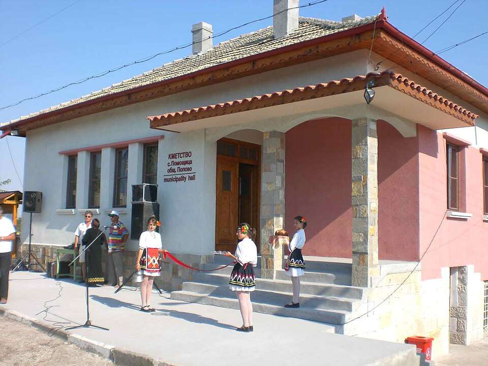
Photograph from Polski Senovets (Polski Trambesh Municipality)

Photograph from Polski Senovets (Polski Trambesh Municipality)

Bulgaria · Veliko Tarnovo

Settlements

Polski Senovets (Polski Trambesh Municipality)

Polski Senovets is a village in Polski Trambesh Municipality, Veliko Tarnovo Province, Bulgaria. EKATTE code: 57340. Elevation range: 100–199 m. This profile uses the official National Register of Settlements. View the location on the map and add the settlement to your personal itinerary.

About this place

Photo: Powerfox · CC BY-SA 4.0 · License

View location
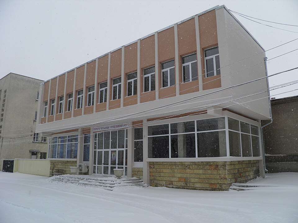
Photograph from Polski Trambesh (Polski Trambesh Municipality)

Photograph from Polski Trambesh (Polski Trambesh Municipality)

Bulgaria · Veliko Tarnovo

Settlements

Polski Trambesh (Polski Trambesh Municipality)

Polski Trambesh is a city in Polski Trambesh Municipality, Veliko Tarnovo Province, Bulgaria. EKATTE code: 57354. Elevation range: 50–99 m. Municipal centre. This profile uses the official National Register of Settlements. View the location on the map and add the settlement to your personal itinerary.

About this place

Photo: Powerfox · CC BY-SA 4.0 · License

View location

Map of Bulgaria with a marker for Polsko Kosovo (Byala Municipality)Representative point of the settlement. Overview map; confirm the exact visiting address.LOCATION · BULGARIAPolsko Kosovo (Byala Municipality)NRepresentative point of the settlementMap: Global Tour · Outline: Natural Earth

Representative point of the settlement. Overview map; confirm the exact visiting address.

Bulgaria · Ruse

Settlements

Polsko Kosovo (Byala Municipality)

Polsko Kosovo is a village in Byala Municipality, Ruse Province, Bulgaria. EKATTE code: 57368. Elevation range: 50–99 m. This profile uses the official National Register of Settlements. View the location on the map and add the settlement to your personal itinerary.

About this place
View location

Map of Bulgaria with a marker for Polsko Padarevo (Nova Zagora Municipality)Representative point of the settlement. Overview map; confirm the exact visiting address.LOCATION · BULGARIAPolsko Padarevo (Nova Zagora Municipality)NRepresentative point of the settlementMap: Global Tour · Outline: Natural Earth

Representative point of the settlement. Overview map; confirm the exact visiting address.

Bulgaria · Sliven

Settlements

Polsko Padarevo (Nova Zagora Municipality)

Polsko Padarevo is a village in Nova Zagora Municipality, Sliven Province, Bulgaria. EKATTE code: 57371. Elevation range: 100–199 m. This profile uses the official National Register of Settlements. View the location on the map and add the settlement to your personal itinerary.

About this place
View location

Map of Bulgaria with a marker for Polyana (Rudozem Municipality)Representative point of the settlement. Overview map; confirm the exact visiting address.LOCATION · BULGARIAPolyana (Rudozem Municipality)NRepresentative point of the settlementMap: Global Tour · Outline: Natural Earth

Representative point of the settlement. Overview map; confirm the exact visiting address.

Bulgaria · Smolyan

Settlements

Polyana (Rudozem Municipality)

Polyana is a village in Rudozem Municipality, Smolyan Province, Bulgaria. EKATTE code: 57399. Elevation range: ≥ 1000 m. This profile uses the official National Register of Settlements. View the location on the map and add the settlement to your personal itinerary.

About this place
View location

Map of Bulgaria with a marker for Polyana (Sitovo Municipality)Representative point of the settlement. Overview map; confirm the exact visiting address.LOCATION · BULGARIAPolyana (Sitovo Municipality)NRepresentative point of the settlementMap: Global Tour · Outline: Natural Earth

Representative point of the settlement. Overview map; confirm the exact visiting address.

Bulgaria · Silistra

Settlements

Polyana (Sitovo Municipality)

Polyana is a village in Sitovo Municipality, Silistra Province, Bulgaria. EKATTE code: 57385. Elevation range: 100–199 m. This profile uses the official National Register of Settlements. View the location on the map and add the settlement to your personal itinerary.

About this place
View location

Map of Bulgaria with a marker for Polyana (Straldzha Municipality)Representative point of the settlement. Overview map; confirm the exact visiting address.LOCATION · BULGARIAPolyana (Straldzha Municipality)NRepresentative point of the settlementMap: Global Tour · Outline: Natural Earth

Representative point of the settlement. Overview map; confirm the exact visiting address.

Bulgaria · Yambol

Settlements

Polyana (Straldzha Municipality)

Polyana is a village in Straldzha Municipality, Yambol Province, Bulgaria. EKATTE code: 57409. Elevation range: 200–299 m. This profile uses the official National Register of Settlements. View the location on the map and add the settlement to your personal itinerary.

About this place
View location

Map of Bulgaria with a marker for Polyanets (Dzhebel Municipality)Representative point of the settlement. Overview map; confirm the exact visiting address.LOCATION · BULGARIAPolyanets (Dzhebel Municipality)NRepresentative point of the settlementMap: Global Tour · Outline: Natural Earth

Representative point of the settlement. Overview map; confirm the exact visiting address.

Bulgaria · Kardzhali

Settlements

Polyanets (Dzhebel Municipality)

Polyanets is a village in Dzhebel Municipality, Kardzhali Province, Bulgaria. EKATTE code: 57412. Elevation range: 300–499 m. This profile uses the official National Register of Settlements. View the location on the map and add the settlement to your personal itinerary.

About this place
View location

Map of Bulgaria with a marker for Polyanovo (Aytos Municipality)Representative point of the settlement. Overview map; confirm the exact visiting address.LOCATION · BULGARIAPolyanovo (Aytos Municipality)NRepresentative point of the settlementMap: Global Tour · Outline: Natural Earth

Representative point of the settlement. Overview map; confirm the exact visiting address.

Bulgaria · Burgas

Settlements

Polyanovo (Aytos Municipality)

Polyanovo is a village in Aytos Municipality, Burgas Province, Bulgaria. EKATTE code: 57426. Elevation range: 100–199 m. This profile uses the official National Register of Settlements. View the location on the map and add the settlement to your personal itinerary.

About this place
View location

Map of Bulgaria with a marker for Polyanovo (Harmanli Municipality)Representative point of the settlement. Overview map; confirm the exact visiting address.LOCATION · BULGARIAPolyanovo (Harmanli Municipality)NRepresentative point of the settlementMap: Global Tour · Outline: Natural Earth

Representative point of the settlement. Overview map; confirm the exact visiting address.

Bulgaria · Haskovo

Settlements

Polyanovo (Harmanli Municipality)

Polyanovo is a village in Harmanli Municipality, Haskovo Province, Bulgaria. EKATTE code: 57434. Elevation range: 100–199 m. This profile uses the official National Register of Settlements. View the location on the map and add the settlement to your personal itinerary.

About this place
View location

Map of Bulgaria with a marker for Polyantsi (Ihtiman Municipality)Representative point of the settlement. Overview map; confirm the exact visiting address.LOCATION · BULGARIAPolyantsi (Ihtiman Municipality)NRepresentative point of the settlementMap: Global Tour · Outline: Natural Earth

Representative point of the settlement. Overview map; confirm the exact visiting address.

Bulgaria · Sofia Province

Settlements

Polyantsi (Ihtiman Municipality)

Polyantsi is a village in Ihtiman Municipality, Sofia Province Province, Bulgaria. EKATTE code: 57443. Elevation range: 700–999 m. This profile uses the official National Register of Settlements. View the location on the map and add the settlement to your personal itinerary.

About this place
View location

Map of Bulgaria with a marker for Polyatsite (Dalgopol Municipality)Representative point of the settlement. Overview map; confirm the exact visiting address.LOCATION · BULGARIAPolyatsite (Dalgopol Municipality)NRepresentative point of the settlementMap: Global Tour · Outline: Natural Earth

Representative point of the settlement. Overview map; confirm the exact visiting address.

Bulgaria · Varna

Settlements

Polyatsite (Dalgopol Municipality)

Polyatsite is a village in Dalgopol Municipality, Varna Province, Bulgaria. EKATTE code: 57457. Elevation range: 200–299 m. This profile uses the official National Register of Settlements. View the location on the map and add the settlement to your personal itinerary.

About this place
View location

Map of Bulgaria with a marker for Pomen (Dve mogili Municipality)Representative point of the settlement. Overview map; confirm the exact visiting address.LOCATION · BULGARIAPomen (Dve mogili Municipality)NRepresentative point of the settlementMap: Global Tour · Outline: Natural Earth

Representative point of the settlement. Overview map; confirm the exact visiting address.

Bulgaria · Ruse

Settlements

Pomen (Dve mogili Municipality)

Pomen is a village in Dve mogili Municipality, Ruse Province, Bulgaria. EKATTE code: 57488. Elevation range: 200–299 m. This profile uses the official National Register of Settlements. View the location on the map and add the settlement to your personal itinerary.

About this place
View location

Map of Bulgaria with a marker for Pomezhdin (Georgi Damyanovo Municipality)Representative point of the settlement. Overview map; confirm the exact visiting address.LOCATION · BULGARIAPomezhdin (Georgi Damyanovo Municipality)NRepresentative point of the settlementMap: Global Tour · Outline: Natural Earth

Representative point of the settlement. Overview map; confirm the exact visiting address.

Bulgaria · Montana

Settlements

Pomezhdin (Georgi Damyanovo Municipality)

Pomezhdin is a village in Georgi Damyanovo Municipality, Montana Province, Bulgaria. EKATTE code: 57474. Elevation range: 300–499 m. This profile uses the official National Register of Settlements. View the location on the map and add the settlement to your personal itinerary.

About this place
View location

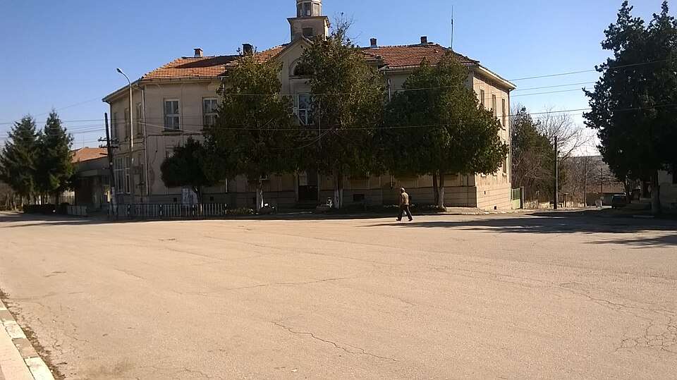
Photograph from Pomoshtitsa (Popovo Municipality)

Photograph from Pomoshtitsa (Popovo Municipality)

Bulgaria · Targovishte

Settlements

Pomoshtitsa (Popovo Municipality)

Pomoshtitsa is a village in Popovo Municipality, Targovishte Province, Bulgaria. EKATTE code: 57501. Elevation range: 200–299 m. This profile uses the official National Register of Settlements. View the location on the map and add the settlement to your personal itinerary.

About this place

Photo: Wlado bg at the Bulgarian language Wikipedia · CC BY-SA 3.0 · License

View location

Map of Bulgaria with a marker for Pomoshtnik (Galabovo Municipality)Representative point of the settlement. Overview map; confirm the exact visiting address.LOCATION · BULGARIAPomoshtnik (Galabovo Municipality)NRepresentative point of the settlementMap: Global Tour · Outline: Natural Earth

Representative point of the settlement. Overview map; confirm the exact visiting address.

Bulgaria · Stara Zagora

Settlements

Pomoshtnik (Galabovo Municipality)

Pomoshtnik is a village in Galabovo Municipality, Stara Zagora Province, Bulgaria. EKATTE code: 57515. Elevation range: 200–299 m. This profile uses the official National Register of Settlements. View the location on the map and add the settlement to your personal itinerary.

About this place
View location

Map of Bulgaria with a marker for Ponor (Kostinbrod Municipality)Representative point of the settlement. Overview map; confirm the exact visiting address.LOCATION · BULGARIAPonor (Kostinbrod Municipality)NRepresentative point of the settlementMap: Global Tour · Outline: Natural Earth

Representative point of the settlement. Overview map; confirm the exact visiting address.

Bulgaria · Sofia Province

Settlements

Ponor (Kostinbrod Municipality)

Ponor is a village in Kostinbrod Municipality, Sofia Province Province, Bulgaria. EKATTE code: 57529. Elevation range: 700–999 m. This profile uses the official National Register of Settlements. View the location on the map and add the settlement to your personal itinerary.

About this place
View location

Map of Bulgaria with a marker for Popari (Gabrovo Municipality)Representative point of the settlement. Overview map; confirm the exact visiting address.LOCATION · BULGARIAPopari (Gabrovo Municipality)NRepresentative point of the settlementMap: Global Tour · Outline: Natural Earth

Representative point of the settlement. Overview map; confirm the exact visiting address.

Bulgaria · Gabrovo

Settlements

Popari (Gabrovo Municipality)

Popari is a village in Gabrovo Municipality, Gabrovo Province, Bulgaria. EKATTE code: 57532. Elevation range: 300–499 m. This profile uses the official National Register of Settlements. View the location on the map and add the settlement to your personal itinerary.

About this place
View location

Map of Bulgaria with a marker for Popgergevtsi (Tryavna Municipality)Representative point of the settlement. Overview map; confirm the exact visiting address.LOCATION · BULGARIAPopgergevtsi (Tryavna Municipality)NRepresentative point of the settlementMap: Global Tour · Outline: Natural Earth

Representative point of the settlement. Overview map; confirm the exact visiting address.

Bulgaria · Gabrovo

Settlements

Popgergevtsi (Tryavna Municipality)

Popgergevtsi is a village in Tryavna Municipality, Gabrovo Province, Bulgaria. EKATTE code: 57546. Elevation range: 500–699 m. This profile uses the official National Register of Settlements. View the location on the map and add the settlement to your personal itinerary.

About this place
View location

Map of Bulgaria with a marker for Popgrigorovo (Dobrich-selska Municipality)Representative point of the settlement. Overview map; confirm the exact visiting address.LOCATION · BULGARIAPopgrigorovo (Dobrich-selska Municipality)NRepresentative point of the settlementMap: Global Tour · Outline: Natural Earth

Representative point of the settlement. Overview map; confirm the exact visiting address.

Bulgaria · Dobrich

Settlements

Popgrigorovo (Dobrich-selska Municipality)

Popgrigorovo is a village in Dobrich-selska Municipality, Dobrich Province, Bulgaria. EKATTE code: 57550. Elevation range: 200–299 m. This profile uses the official National Register of Settlements. View the location on the map and add the settlement to your personal itinerary.

About this place
View location

Map of Bulgaria with a marker for Popgruevo (Tervel Municipality)Representative point of the settlement. Overview map; confirm the exact visiting address.LOCATION · BULGARIAPopgruevo (Tervel Municipality)NRepresentative point of the settlementMap: Global Tour · Outline: Natural Earth

Representative point of the settlement. Overview map; confirm the exact visiting address.

Bulgaria · Dobrich

Settlements

Popgruevo (Tervel Municipality)

Popgruevo is a village in Tervel Municipality, Dobrich Province, Bulgaria. EKATTE code: 57563. Elevation range: 200–299 m. This profile uses the official National Register of Settlements. View the location on the map and add the settlement to your personal itinerary.

About this place
View location

© 2026 Global Tour