Places

Discover the places on our routes — history, nature and landmarks.

The catalogue continues to grow. See the linked source for visit details.

Settlements · 5,256

Places found: 5893 · Showing 4,129–4,152 of 5,893 · Page 173 / 246

Map of Bulgaria with a marker for Ravna (Godech Municipality)Representative point of the settlement. Overview map; confirm the exact visiting address.LOCATION · BULGARIARavna (Godech Municipality)NRepresentative point of the settlementMap: Global Tour · Outline: Natural Earth

Representative point of the settlement. Overview map; confirm the exact visiting address.

Bulgaria · Sofia Province

Settlements

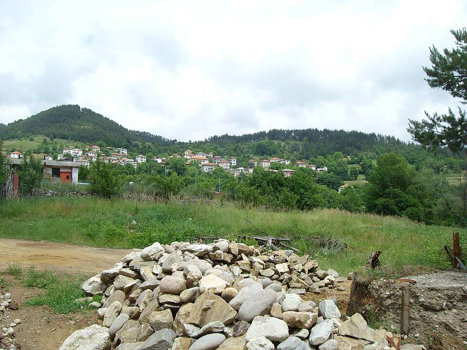
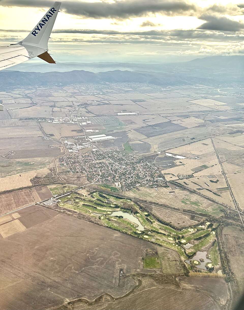
Ravna (Godech Municipality)

Ravna is a village in Godech Municipality, Sofia Province Province, Bulgaria. EKATTE code: 61100. Elevation range: ≥ 1000 m. This profile uses the official National Register of Settlements. View the location on the map and add the settlement to your personal itinerary.

About this place
View location

Map of Bulgaria with a marker for Ravna (Provadia Municipality)Representative point of the settlement. Overview map; confirm the exact visiting address.LOCATION · BULGARIARavna (Provadia Municipality)NRepresentative point of the settlementMap: Global Tour · Outline: Natural Earth

Representative point of the settlement. Overview map; confirm the exact visiting address.

Bulgaria · Varna

Settlements

Ravna (Provadia Municipality)

Ravna is a village in Provadia Municipality, Varna Province, Bulgaria. EKATTE code: 61073. Elevation range: 200–299 m. This profile uses the official National Register of Settlements. View the location on the map and add the settlement to your personal itinerary.

About this place
View location

Map of Bulgaria with a marker for Ravna gora (Avren Municipality)Representative point of the settlement. Overview map; confirm the exact visiting address.LOCATION · BULGARIARavna gora (Avren Municipality)NRepresentative point of the settlementMap: Global Tour · Outline: Natural Earth

Representative point of the settlement. Overview map; confirm the exact visiting address.

Bulgaria · Varna

Settlements

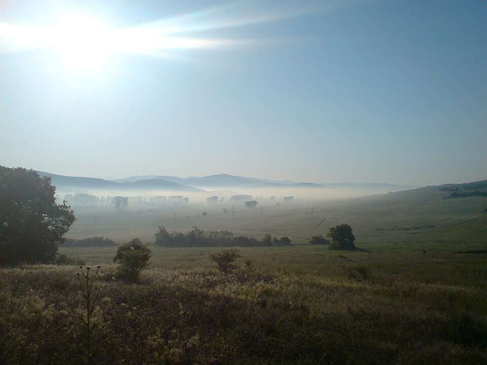
Ravna gora (Avren Municipality)

Ravna gora is a village in Avren Municipality, Varna Province, Bulgaria. EKATTE code: 61128. Elevation range: 100–199 m. This profile uses the official National Register of Settlements. View the location on the map and add the settlement to your personal itinerary.

About this place
View location

Map of Bulgaria with a marker for Ravna gora (Sozopol Municipality)Representative point of the settlement. Overview map; confirm the exact visiting address.LOCATION · BULGARIARavna gora (Sozopol Municipality)NRepresentative point of the settlementMap: Global Tour · Outline: Natural Earth

Representative point of the settlement. Overview map; confirm the exact visiting address.

Bulgaria · Burgas

Settlements

Ravna gora (Sozopol Municipality)

Ravna gora is a village in Sozopol Municipality, Burgas Province, Bulgaria. EKATTE code: 61114. Elevation range: 50–99 m. This profile uses the official National Register of Settlements. View the location on the map and add the settlement to your personal itinerary.

About this place
View location

Map of Bulgaria with a marker for Ravna gora (Svilengrad Municipality)Representative point of the settlement. Overview map; confirm the exact visiting address.LOCATION · BULGARIARavna gora (Svilengrad Municipality)NRepresentative point of the settlementMap: Global Tour · Outline: Natural Earth

Representative point of the settlement. Overview map; confirm the exact visiting address.

Bulgaria · Haskovo

Settlements

Ravna gora (Svilengrad Municipality)

Ravna gora is a village in Svilengrad Municipality, Haskovo Province, Bulgaria. EKATTE code: 61131. Elevation range: 300–499 m. This profile uses the official National Register of Settlements. View the location on the map and add the settlement to your personal itinerary.

About this place
View location

Map of Bulgaria with a marker for Ravnets (Burgas Municipality)Representative point of the settlement. Overview map; confirm the exact visiting address.LOCATION · BULGARIARavnets (Burgas Municipality)NRepresentative point of the settlementMap: Global Tour · Outline: Natural Earth

Representative point of the settlement. Overview map; confirm the exact visiting address.

Bulgaria · Burgas

Settlements

Ravnets (Burgas Municipality)

Ravnets is a village in Burgas Municipality, Burgas Province, Bulgaria. EKATTE code: 61145. Elevation range: 0–49 m. This profile uses the official National Register of Settlements. View the location on the map and add the settlement to your personal itinerary.

About this place
View location

Map of Bulgaria with a marker for Ravnets (General Toshevo Municipality)Representative point of the settlement. Overview map; confirm the exact visiting address.LOCATION · BULGARIARavnets (General Toshevo Municipality)NRepresentative point of the settlementMap: Global Tour · Outline: Natural Earth

Representative point of the settlement. Overview map; confirm the exact visiting address.

Bulgaria · Dobrich

Settlements

Ravnets (General Toshevo Municipality)

Ravnets is a village in General Toshevo Municipality, Dobrich Province, Bulgaria. EKATTE code: 61159. Elevation range: 200–299 m. This profile uses the official National Register of Settlements. View the location on the map and add the settlement to your personal itinerary.

About this place
View location

Map of Bulgaria with a marker for Ravnil (Madan Municipality)Representative point of the settlement. Overview map; confirm the exact visiting address.LOCATION · BULGARIARavnil (Madan Municipality)NRepresentative point of the settlementMap: Global Tour · Outline: Natural Earth

Representative point of the settlement. Overview map; confirm the exact visiting address.

Bulgaria · Smolyan

Settlements

Ravnil (Madan Municipality)

Ravnil is a village in Madan Municipality, Smolyan Province, Bulgaria. EKATTE code: 61162. Elevation range: 700–999 m. This profile uses the official National Register of Settlements. View the location on the map and add the settlement to your personal itinerary.

About this place
View location

Map of Bulgaria with a marker for Ravninata (Rudozem Municipality)Representative point of the settlement. Overview map; confirm the exact visiting address.LOCATION · BULGARIARavninata (Rudozem Municipality)NRepresentative point of the settlementMap: Global Tour · Outline: Natural Earth

Representative point of the settlement. Overview map; confirm the exact visiting address.

Bulgaria · Smolyan

Settlements

Ravninata (Rudozem Municipality)

Ravninata is a village in Rudozem Municipality, Smolyan Province, Bulgaria. EKATTE code: 61193. Elevation range: 700–999 m. This profile uses the official National Register of Settlements. View the location on the map and add the settlement to your personal itinerary.

About this place
View location

Map of Bulgaria with a marker for Ravnishte (Pravets Municipality)Representative point of the settlement. Overview map; confirm the exact visiting address.LOCATION · BULGARIARavnishte (Pravets Municipality)NRepresentative point of the settlementMap: Global Tour · Outline: Natural Earth

Representative point of the settlement. Overview map; confirm the exact visiting address.

Bulgaria · Sofia Province

Settlements

Ravnishte (Pravets Municipality)

Ravnishte is a village in Pravets Municipality, Sofia Province Province, Bulgaria. EKATTE code: 61189. Elevation range: 300–499 m. This profile uses the official National Register of Settlements. View the location on the map and add the settlement to your personal itinerary.

About this place
View location

Map of Bulgaria with a marker for Ravno (Kubrat Municipality)Representative point of the settlement. Overview map; confirm the exact visiting address.LOCATION · BULGARIARavno (Kubrat Municipality)NRepresentative point of the settlementMap: Global Tour · Outline: Natural Earth

Representative point of the settlement. Overview map; confirm the exact visiting address.

Bulgaria · Razgrad

Settlements

Ravno (Kubrat Municipality)

Ravno is a village in Kubrat Municipality, Razgrad Province, Bulgaria. EKATTE code: 61203. Elevation range: 200–299 m. This profile uses the official National Register of Settlements. View the location on the map and add the settlement to your personal itinerary.

About this place
View location

Map of Bulgaria with a marker for Ravno nivishte (Madan Municipality)Representative point of the settlement. Overview map; confirm the exact visiting address.LOCATION · BULGARIARavno nivishte (Madan Municipality)NRepresentative point of the settlementMap: Global Tour · Outline: Natural Earth

Representative point of the settlement. Overview map; confirm the exact visiting address.

Bulgaria · Smolyan

Settlements

Ravno nivishte (Madan Municipality)

Ravno nivishte is a village in Madan Municipality, Smolyan Province, Bulgaria. EKATTE code: 61234. Elevation range: 700–999 m. This profile uses the official National Register of Settlements. View the location on the map and add the settlement to your personal itinerary.

About this place
View location

Map of Bulgaria with a marker for Ravno selo (Antonovo Municipality)Representative point of the settlement. Overview map; confirm the exact visiting address.LOCATION · BULGARIARavno selo (Antonovo Municipality)NRepresentative point of the settlementMap: Global Tour · Outline: Natural Earth

Representative point of the settlement. Overview map; confirm the exact visiting address.

Bulgaria · Targovishte

Settlements

Ravno selo (Antonovo Municipality)

Ravno selo is a village in Antonovo Municipality, Targovishte Province, Bulgaria. EKATTE code: 61251. Elevation range: 300–499 m. This profile uses the official National Register of Settlements. View the location on the map and add the settlement to your personal itinerary.

About this place
View location

Map of Bulgaria with a marker for Ravnovo (Zlataritsa Municipality)Representative point of the settlement. Overview map; confirm the exact visiting address.LOCATION · BULGARIARavnovo (Zlataritsa Municipality)NRepresentative point of the settlementMap: Global Tour · Outline: Natural Earth

Representative point of the settlement. Overview map; confirm the exact visiting address.

Bulgaria · Veliko Tarnovo

Settlements

Ravnovo (Zlataritsa Municipality)

Ravnovo is a village in Zlataritsa Municipality, Veliko Tarnovo Province, Bulgaria. EKATTE code: 61217. Elevation range: 300–499 m. This profile uses the official National Register of Settlements. View the location on the map and add the settlement to your personal itinerary.

About this place
View location

Map of Bulgaria with a marker for Rayanovtsi (Belogradchik Municipality)Representative point of the settlement. Overview map; confirm the exact visiting address.LOCATION · BULGARIARayanovtsi (Belogradchik Municipality)NRepresentative point of the settlementMap: Global Tour · Outline: Natural Earth

Representative point of the settlement. Overview map; confirm the exact visiting address.

Bulgaria · Vidin

Settlements

Rayanovtsi (Belogradchik Municipality)

Rayanovtsi is a village in Belogradchik Municipality, Vidin Province, Bulgaria. EKATTE code: 62339. Elevation range: 300–499 m. This profile uses the official National Register of Settlements. View the location on the map and add the settlement to your personal itinerary.

About this place
View location

Map of Bulgaria with a marker for Rayantsi (Zemen Municipality)Representative point of the settlement. Overview map; confirm the exact visiting address.LOCATION · BULGARIARayantsi (Zemen Municipality)NRepresentative point of the settlementMap: Global Tour · Outline: Natural Earth

Representative point of the settlement. Overview map; confirm the exact visiting address.

Bulgaria · Pernik

Settlements

Rayantsi (Zemen Municipality)

Rayantsi is a village in Zemen Municipality, Pernik Province, Bulgaria. EKATTE code: 62356. Elevation range: 700–999 m. This profile uses the official National Register of Settlements. View the location on the map and add the settlement to your personal itinerary.

About this place
View location

Map of Bulgaria with a marker for Raykova mogila (Svilengrad Municipality)Representative point of the settlement. Overview map; confirm the exact visiting address.LOCATION · BULGARIARaykova mogila (Svilengrad Municipality)NRepresentative point of the settlementMap: Global Tour · Outline: Natural Earth

Representative point of the settlement. Overview map; confirm the exact visiting address.

Bulgaria · Haskovo

Settlements

Raykova mogila (Svilengrad Municipality)

Raykova mogila is a village in Svilengrad Municipality, Haskovo Province, Bulgaria. EKATTE code: 61844. Elevation range: 100–199 m. This profile uses the official National Register of Settlements. View the location on the map and add the settlement to your personal itinerary.

About this place
View location

Map of Bulgaria with a marker for Raykovtsi (Veliko Tarnovo Municipality)Representative point of the settlement. Overview map; confirm the exact visiting address.LOCATION · BULGARIARaykovtsi (Veliko Tarnovo Municipality)NRepresentative point of the settlementMap: Global Tour · Outline: Natural Earth

Representative point of the settlement. Overview map; confirm the exact visiting address.

Bulgaria · Veliko Tarnovo

Settlements

Raykovtsi (Veliko Tarnovo Municipality)

Raykovtsi is a village in Veliko Tarnovo Municipality, Veliko Tarnovo Province, Bulgaria. EKATTE code: 61861. Elevation range: 300–499 m. This profile uses the official National Register of Settlements. View the location on the map and add the settlement to your personal itinerary.

About this place
View location

Map of Bulgaria with a marker for Raynino (Isperih Municipality)Representative point of the settlement. Overview map; confirm the exact visiting address.LOCATION · BULGARIARaynino (Isperih Municipality)NRepresentative point of the settlementMap: Global Tour · Outline: Natural Earth

Representative point of the settlement. Overview map; confirm the exact visiting address.

Bulgaria · Razgrad

Settlements

Raynino (Isperih Municipality)

Raynino is a village in Isperih Municipality, Razgrad Province, Bulgaria. EKATTE code: 61875. Elevation range: 200–299 m. This profile uses the official National Register of Settlements. View the location on the map and add the settlement to your personal itinerary.

About this place
View location

© 2026 Global Tour