Places

Discover the places on our routes — history, nature and landmarks.

The catalogue continues to grow. See the linked source for visit details.

Settlements · 5,256

Places found: 5893 · Showing 4,561–4,584 of 5,893 · Page 191 / 246

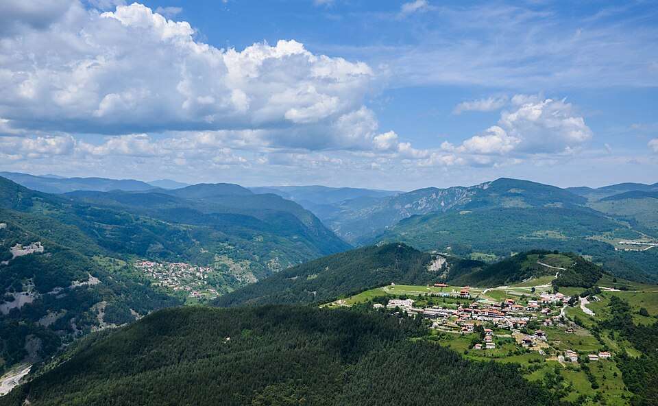
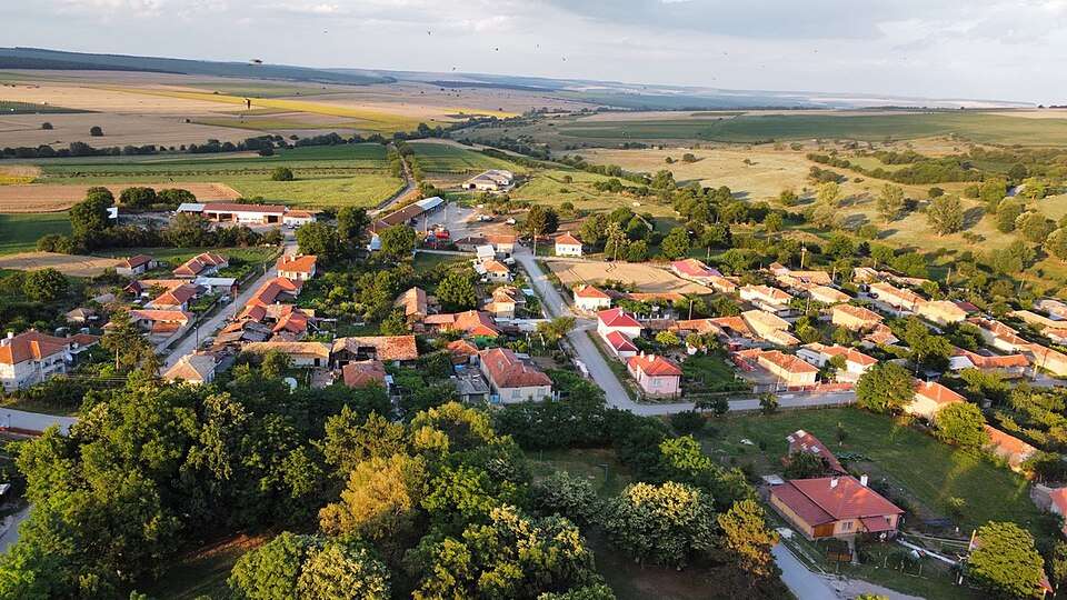
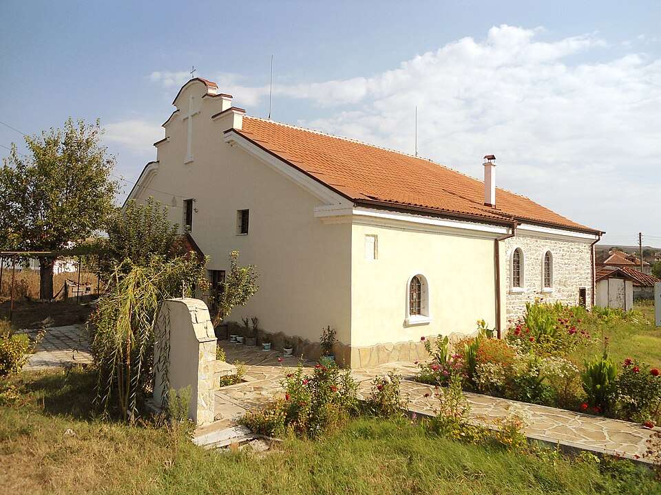
Photograph from Sinapovo (Topolovgrad Municipality)

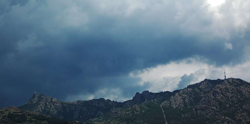
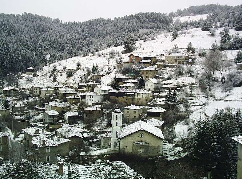
Photograph from Sinapovo (Topolovgrad Municipality)

Bulgaria · Haskovo

Settlements

Sinapovo (Topolovgrad Municipality)

Sinapovo is a village in Topolovgrad Municipality, Haskovo Province, Bulgaria. EKATTE code: 66487. Elevation range: 100–199 m. This profile uses the official National Register of Settlements. View the location on the map and add the settlement to your personal itinerary.

About this place

Photo: Димитър Найденов / Dimìtar Nàydenov · CC BY-SA 4.0 · License

View location
Map of Bulgaria with a marker for Sinchets (Ardino Municipality)Representative point of the settlement. Overview map; confirm the exact visiting address.LOCATION · BULGARIASinchets (Ardino Municipality)NRepresentative point of the settlementMap: Global Tour · Outline: Natural Earth

Representative point of the settlement. Overview map; confirm the exact visiting address.

Bulgaria · Kardzhali

Settlements

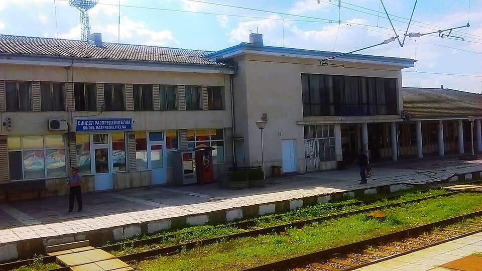
Sinchets (Ardino Municipality)

Sinchets is a village in Ardino Municipality, Kardzhali Province, Bulgaria. EKATTE code: 66562. Elevation range: 700–999 m. This profile uses the official National Register of Settlements. View the location on the map and add the settlement to your personal itinerary.

About this place
View location

Map of Bulgaria with a marker for Sindeltsi (Momchilgrad Municipality)Representative point of the settlement. Overview map; confirm the exact visiting address.LOCATION · BULGARIASindeltsi (Momchilgrad Municipality)NRepresentative point of the settlementMap: Global Tour · Outline: Natural Earth

Representative point of the settlement. Overview map; confirm the exact visiting address.

Bulgaria · Kardzhali

Settlements

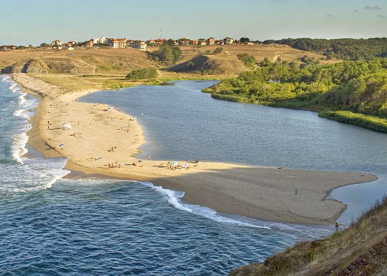
Sindeltsi (Momchilgrad Municipality)

Sindeltsi is a village in Momchilgrad Municipality, Kardzhali Province, Bulgaria. EKATTE code: 66500. Elevation range: 300–499 m. This profile uses the official National Register of Settlements. View the location on the map and add the settlement to your personal itinerary.

About this place
View location

Map of Bulgaria with a marker for Sini rid (Ruen Municipality)Representative point of the settlement. Overview map; confirm the exact visiting address.LOCATION · BULGARIASini rid (Ruen Municipality)NRepresentative point of the settlementMap: Global Tour · Outline: Natural Earth

Representative point of the settlement. Overview map; confirm the exact visiting address.

Bulgaria · Burgas

Settlements

Sini rid (Ruen Municipality)

Sini rid is a village in Ruen Municipality, Burgas Province, Bulgaria. EKATTE code: 80296. Elevation range: 300–499 m. This profile uses the official National Register of Settlements. View the location on the map and add the settlement to your personal itinerary.

About this place
View location

Map of Bulgaria with a marker for Sini vir (Kaolinovo Municipality)Representative point of the settlement. Overview map; confirm the exact visiting address.LOCATION · BULGARIASini vir (Kaolinovo Municipality)NRepresentative point of the settlementMap: Global Tour · Outline: Natural Earth

Representative point of the settlement. Overview map; confirm the exact visiting address.

Bulgaria · Shumen

Settlements

Sini vir (Kaolinovo Municipality)

Sini vir is a village in Kaolinovo Municipality, Shumen Province, Bulgaria. EKATTE code: 66531. Elevation range: 300–499 m. This profile uses the official National Register of Settlements. View the location on the map and add the settlement to your personal itinerary.

About this place
View location

Map of Bulgaria with a marker for Siniger (Krumovgrad Municipality)Representative point of the settlement. Overview map; confirm the exact visiting address.LOCATION · BULGARIASiniger (Krumovgrad Municipality)NRepresentative point of the settlementMap: Global Tour · Outline: Natural Earth

Representative point of the settlement. Overview map; confirm the exact visiting address.

Bulgaria · Kardzhali

Settlements

Siniger (Krumovgrad Municipality)

Siniger is a village in Krumovgrad Municipality, Kardzhali Province, Bulgaria. EKATTE code: 66545. Elevation range: 500–699 m. This profile uses the official National Register of Settlements. View the location on the map and add the settlement to your personal itinerary.

About this place
View location

Map of Bulgaria with a marker for Sinitovo (Pazardzhik Municipality)Representative point of the settlement. Overview map; confirm the exact visiting address.LOCATION · BULGARIASinitovo (Pazardzhik Municipality)NRepresentative point of the settlementMap: Global Tour · Outline: Natural Earth

Representative point of the settlement. Overview map; confirm the exact visiting address.

Bulgaria · Pazardzhik

Settlements

Sinitovo (Pazardzhik Municipality)

Sinitovo is a village in Pazardzhik Municipality, Pazardzhik Province, Bulgaria. EKATTE code: 66559. Elevation range: 100–199 m. This profile uses the official National Register of Settlements. View the location on the map and add the settlement to your personal itinerary.

About this place
View location

Map of Bulgaria with a marker for Sinyo bardo (Roman Municipality)Representative point of the settlement. Overview map; confirm the exact visiting address.LOCATION · BULGARIASinyo bardo (Roman Municipality)NRepresentative point of the settlementMap: Global Tour · Outline: Natural Earth

Representative point of the settlement. Overview map; confirm the exact visiting address.

Bulgaria · Vratsa

Settlements

Sinyo bardo (Roman Municipality)

Sinyo bardo is a village in Roman Municipality, Vratsa Province, Bulgaria. EKATTE code: 66576. Elevation range: 200–299 m. This profile uses the official National Register of Settlements. View the location on the map and add the settlement to your personal itinerary.

About this place
View location

Map of Bulgaria with a marker for Sinyo kamene (Sredets Municipality)Representative point of the settlement. Overview map; confirm the exact visiting address.LOCATION · BULGARIASinyo kamene (Sredets Municipality)NRepresentative point of the settlementMap: Global Tour · Outline: Natural Earth

Representative point of the settlement. Overview map; confirm the exact visiting address.

Bulgaria · Burgas

Settlements

Sinyo kamene (Sredets Municipality)

Sinyo kamene is a village in Sredets Municipality, Burgas Province, Bulgaria. EKATTE code: 66585. Elevation range: 100–199 m. This profile uses the official National Register of Settlements. View the location on the map and add the settlement to your personal itinerary.

About this place
View location

Map of Bulgaria with a marker for Sipets (Dzhebel Municipality)Representative point of the settlement. Overview map; confirm the exact visiting address.LOCATION · BULGARIASipets (Dzhebel Municipality)NRepresentative point of the settlementMap: Global Tour · Outline: Natural Earth

Representative point of the settlement. Overview map; confirm the exact visiting address.

Bulgaria · Kardzhali

Settlements

Sipets (Dzhebel Municipality)

Sipets is a village in Dzhebel Municipality, Kardzhali Province, Bulgaria. EKATTE code: 70809. Elevation range: 500–699 m. This profile uses the official National Register of Settlements. View the location on the map and add the settlement to your personal itinerary.

About this place
View location

Map of Bulgaria with a marker for Sipey (Kardzhali Municipality)Representative point of the settlement. Overview map; confirm the exact visiting address.LOCATION · BULGARIASipey (Kardzhali Municipality)NRepresentative point of the settlementMap: Global Tour · Outline: Natural Earth

Representative point of the settlement. Overview map; confirm the exact visiting address.

Bulgaria · Kardzhali

Settlements

Sipey (Kardzhali Municipality)

Sipey is a village in Kardzhali Municipality, Kardzhali Province, Bulgaria. EKATTE code: 66603. Elevation range: 300–499 m. This profile uses the official National Register of Settlements. View the location on the map and add the settlement to your personal itinerary.

About this place
View location

Map of Bulgaria with a marker for Sirakovo (Borovan Municipality)Representative point of the settlement. Overview map; confirm the exact visiting address.LOCATION · BULGARIASirakovo (Borovan Municipality)NRepresentative point of the settlementMap: Global Tour · Outline: Natural Earth

Representative point of the settlement. Overview map; confirm the exact visiting address.

Bulgaria · Vratsa

Settlements

Sirakovo (Borovan Municipality)

Sirakovo is a village in Borovan Municipality, Vratsa Province, Bulgaria. EKATTE code: 66617. Elevation range: 100–199 m. This profile uses the official National Register of Settlements. View the location on the map and add the settlement to your personal itinerary.

About this place
View location

Map of Bulgaria with a marker for Sirakovo (General Toshevo Municipality)Representative point of the settlement. Overview map; confirm the exact visiting address.LOCATION · BULGARIASirakovo (General Toshevo Municipality)NRepresentative point of the settlementMap: Global Tour · Outline: Natural Earth

Representative point of the settlement. Overview map; confirm the exact visiting address.

Bulgaria · Dobrich

Settlements

Sirakovo (General Toshevo Municipality)

Sirakovo is a village in General Toshevo Municipality, Dobrich Province, Bulgaria. EKATTE code: 66620. Elevation range: 100–199 m. This profile uses the official National Register of Settlements. View the location on the map and add the settlement to your personal itinerary.

About this place
View location

Map of Bulgaria with a marker for Sirakovo (Mineralni bani Municipality)Representative point of the settlement. Overview map; confirm the exact visiting address.LOCATION · BULGARIASirakovo (Mineralni bani Municipality)NRepresentative point of the settlementMap: Global Tour · Outline: Natural Earth

Representative point of the settlement. Overview map; confirm the exact visiting address.

Bulgaria · Haskovo

Settlements

Sirakovo (Mineralni bani Municipality)

Sirakovo is a village in Mineralni bani Municipality, Haskovo Province, Bulgaria. EKATTE code: 66634. Elevation range: 300–499 m. This profile uses the official National Register of Settlements. View the location on the map and add the settlement to your personal itinerary.

About this place
View location

Map of Bulgaria with a marker for Sitovo (Bolyarovo Municipality)Representative point of the settlement. Overview map; confirm the exact visiting address.LOCATION · BULGARIASitovo (Bolyarovo Municipality)NRepresentative point of the settlementMap: Global Tour · Outline: Natural Earth

Representative point of the settlement. Overview map; confirm the exact visiting address.

Bulgaria · Yambol

Settlements

Sitovo (Bolyarovo Municipality)

Sitovo is a village in Bolyarovo Municipality, Yambol Province, Bulgaria. EKATTE code: 66679. Elevation range: 300–499 m. This profile uses the official National Register of Settlements. View the location on the map and add the settlement to your personal itinerary.

About this place
View location

Map of Bulgaria with a marker for Sitovo (Sitovo Municipality)Representative point of the settlement. Overview map; confirm the exact visiting address.LOCATION · BULGARIASitovo (Sitovo Municipality)NRepresentative point of the settlementMap: Global Tour · Outline: Natural Earth

Representative point of the settlement. Overview map; confirm the exact visiting address.

Bulgaria · Silistra

Settlements

Sitovo (Sitovo Municipality)

Sitovo is a village in Sitovo Municipality, Silistra Province, Bulgaria. EKATTE code: 66665. Elevation range: 50–99 m. Municipal centre. This profile uses the official National Register of Settlements. View the location on the map and add the settlement to your personal itinerary.

About this place
View location

Map of Bulgaria with a marker for Siv kladenets (Ivaylovgrad Municipality)Representative point of the settlement. Overview map; confirm the exact visiting address.LOCATION · BULGARIASiv kladenets (Ivaylovgrad Municipality)NRepresentative point of the settlementMap: Global Tour · Outline: Natural Earth

Representative point of the settlement. Overview map; confirm the exact visiting address.

Bulgaria · Haskovo

Settlements

Siv kladenets (Ivaylovgrad Municipality)

Siv kladenets is a village in Ivaylovgrad Municipality, Haskovo Province, Bulgaria. EKATTE code: 66398. Elevation range: 50–99 m. This profile uses the official National Register of Settlements. View the location on the map and add the settlement to your personal itinerary.

About this place
View location

© 2026 Global Tour