Places

Discover the places on our routes — history, nature and landmarks.

The catalogue continues to grow. See the linked source for visit details.

Settlements · 5,256

Places found: 5893 · Showing 4,633–4,656 of 5,893 · Page 194 / 246

Map of Bulgaria with a marker for Slaveevo (Ivaylovgrad Municipality)Representative point of the settlement. Overview map; confirm the exact visiting address.LOCATION · BULGARIASlaveevo (Ivaylovgrad Municipality)NRepresentative point of the settlementMap: Global Tour · Outline: Natural Earth

Representative point of the settlement. Overview map; confirm the exact visiting address.

Bulgaria · Haskovo

Settlements

Slaveevo (Ivaylovgrad Municipality)

Slaveevo is a village in Ivaylovgrad Municipality, Haskovo Province, Bulgaria. EKATTE code: 66932. Elevation range: 50–99 m. This profile uses the official National Register of Settlements. View the location on the map and add the settlement to your personal itinerary.

About this place
View location

Map of Bulgaria with a marker for Slaveykovo (Dryanovo Municipality)Representative point of the settlement. Overview map; confirm the exact visiting address.LOCATION · BULGARIASlaveykovo (Dryanovo Municipality)NRepresentative point of the settlementMap: Global Tour · Outline: Natural Earth

Representative point of the settlement. Overview map; confirm the exact visiting address.

Bulgaria · Gabrovo

Settlements

Slaveykovo (Dryanovo Municipality)

Slaveykovo is a village in Dryanovo Municipality, Gabrovo Province, Bulgaria. EKATTE code: 66977. Elevation range: 300–499 m. This profile uses the official National Register of Settlements. View the location on the map and add the settlement to your personal itinerary.

About this place
View location

Map of Bulgaria with a marker for Slaveykovo (Elhovo Municipality)Representative point of the settlement. Overview map; confirm the exact visiting address.LOCATION · BULGARIASlaveykovo (Elhovo Municipality)NRepresentative point of the settlementMap: Global Tour · Outline: Natural Earth

Representative point of the settlement. Overview map; confirm the exact visiting address.

Bulgaria · Yambol

Settlements

Slaveykovo (Elhovo Municipality)

Slaveykovo is a village in Elhovo Municipality, Yambol Province, Bulgaria. EKATTE code: 66980. Elevation range: 200–299 m. This profile uses the official National Register of Settlements. View the location on the map and add the settlement to your personal itinerary.

About this place
View location

Map of Bulgaria with a marker for Slaveykovo (Provadia Municipality)Representative point of the settlement. Overview map; confirm the exact visiting address.LOCATION · BULGARIASlaveykovo (Provadia Municipality)NRepresentative point of the settlementMap: Global Tour · Outline: Natural Earth

Representative point of the settlement. Overview map; confirm the exact visiting address.

Bulgaria · Varna

Settlements

Slaveykovo (Provadia Municipality)

Slaveykovo is a village in Provadia Municipality, Varna Province, Bulgaria. EKATTE code: 66963. Elevation range: 100–199 m. This profile uses the official National Register of Settlements. View the location on the map and add the settlement to your personal itinerary.

About this place
View location

Map of Bulgaria with a marker for Slavotin (Montana Municipality)Representative point of the settlement. Overview map; confirm the exact visiting address.LOCATION · BULGARIASlavotin (Montana Municipality)NRepresentative point of the settlementMap: Global Tour · Outline: Natural Earth

Representative point of the settlement. Overview map; confirm the exact visiting address.

Bulgaria · Montana

Settlements

Slavotin (Montana Municipality)

Slavotin is a village in Montana Municipality, Montana Province, Bulgaria. EKATTE code: 67043. Elevation range: 200–299 m. This profile uses the official National Register of Settlements. View the location on the map and add the settlement to your personal itinerary.

About this place
View location

Map of Bulgaria with a marker for Slavovitsa (Dolna Mitropolia Municipality)Representative point of the settlement. Overview map; confirm the exact visiting address.LOCATION · BULGARIASlavovitsa (Dolna Mitropolia Municipality)NRepresentative point of the settlementMap: Global Tour · Outline: Natural Earth

Representative point of the settlement. Overview map; confirm the exact visiting address.

Bulgaria · Pleven

Settlements

Slavovitsa (Dolna Mitropolia Municipality)

Slavovitsa is a village in Dolna Mitropolia Municipality, Pleven Province, Bulgaria. EKATTE code: 67012. Elevation range: 50–99 m. This profile uses the official National Register of Settlements. View the location on the map and add the settlement to your personal itinerary.

About this place
View location

Map of Bulgaria with a marker for Slavshtitsa (Ugarchin Municipality)Representative point of the settlement. Overview map; confirm the exact visiting address.LOCATION · BULGARIASlavshtitsa (Ugarchin Municipality)NRepresentative point of the settlementMap: Global Tour · Outline: Natural Earth

Representative point of the settlement. Overview map; confirm the exact visiting address.

Bulgaria · Lovech

Settlements

Slavshtitsa (Ugarchin Municipality)

Slavshtitsa is a village in Ugarchin Municipality, Lovech Province, Bulgaria. EKATTE code: 67057. Elevation range: 300–499 m. This profile uses the official National Register of Settlements. View the location on the map and add the settlement to your personal itinerary.

About this place
View location

Map of Bulgaria with a marker for Slavyanin (Bratya Daskalovi Municipality)Representative point of the settlement. Overview map; confirm the exact visiting address.LOCATION · BULGARIASlavyanin (Bratya Daskalovi Municipality)NRepresentative point of the settlementMap: Global Tour · Outline: Natural Earth

Representative point of the settlement. Overview map; confirm the exact visiting address.

Bulgaria · Stara Zagora

Settlements

Slavyanin (Bratya Daskalovi Municipality)

Slavyanin is a village in Bratya Daskalovi Municipality, Stara Zagora Province, Bulgaria. EKATTE code: 67074. Elevation range: 300–499 m. This profile uses the official National Register of Settlements. View the location on the map and add the settlement to your personal itinerary.

About this place
View location

Map of Bulgaria with a marker for Slavyanovo (Harmanli Municipality)Representative point of the settlement. Overview map; confirm the exact visiting address.LOCATION · BULGARIASlavyanovo (Harmanli Municipality)NRepresentative point of the settlementMap: Global Tour · Outline: Natural Earth

Representative point of the settlement. Overview map; confirm the exact visiting address.

Bulgaria · Haskovo

Settlements

Slavyanovo (Harmanli Municipality)

Slavyanovo is a village in Harmanli Municipality, Haskovo Province, Bulgaria. EKATTE code: 67101. Elevation range: 100–199 m. This profile uses the official National Register of Settlements. View the location on the map and add the settlement to your personal itinerary.

About this place
View location

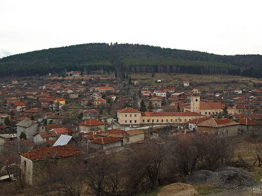
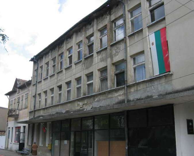
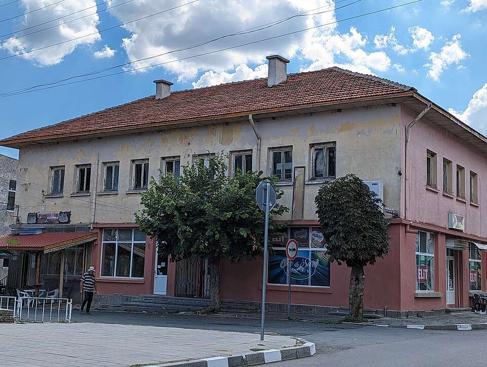
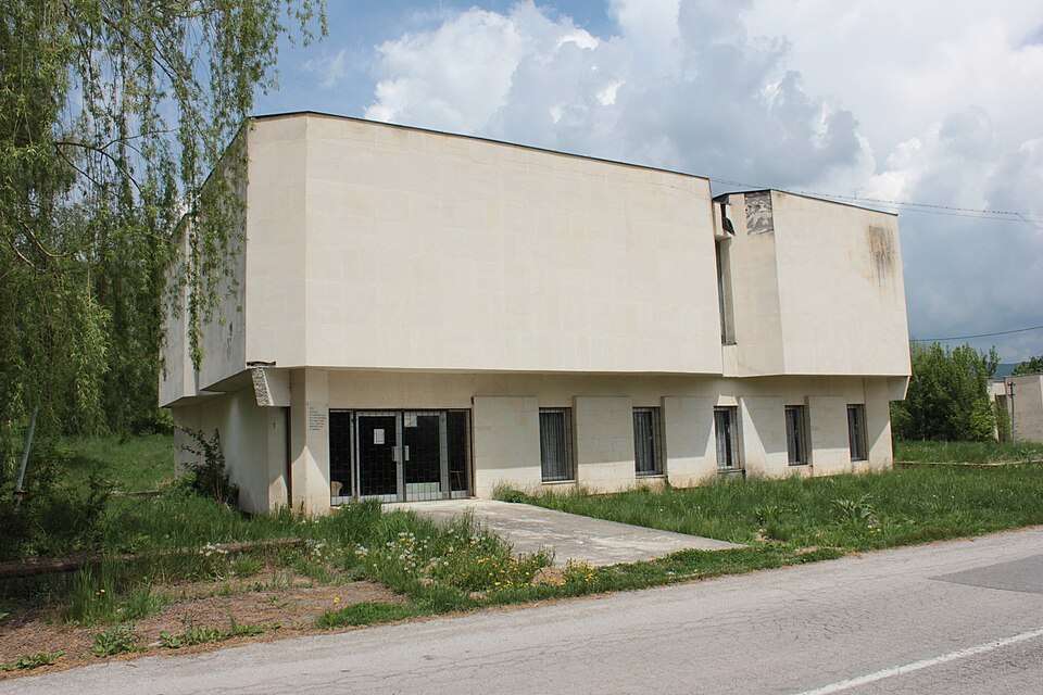
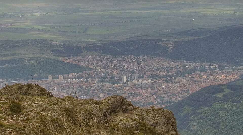
Photograph from Slavyanovo (Popovo Municipality)

Photograph from Slavyanovo (Popovo Municipality)

Bulgaria · Targovishte

Settlements

Slavyanovo (Popovo Municipality)

Slavyanovo is a village in Popovo Municipality, Targovishte Province, Bulgaria. EKATTE code: 67091. Elevation range: 200–299 m. This profile uses the official National Register of Settlements. View the location on the map and add the settlement to your personal itinerary.

About this place

Photo: Original author and uploader were Pl. Subev and Wlado bg at bg.wikipedia · CC BY-SA 3.0 · License

View location

Map of Bulgaria with a marker for Slivak (Hitrino Municipality)Representative point of the settlement. Overview map; confirm the exact visiting address.LOCATION · BULGARIASlivak (Hitrino Municipality)NRepresentative point of the settlementMap: Global Tour · Outline: Natural Earth

Representative point of the settlement. Overview map; confirm the exact visiting address.

Bulgaria · Shumen

Settlements

Slivak (Hitrino Municipality)

Slivak is a village in Hitrino Municipality, Shumen Province, Bulgaria. EKATTE code: 67283. Elevation range: 300–499 m. This profile uses the official National Register of Settlements. View the location on the map and add the settlement to your personal itinerary.

About this place
View location

Map of Bulgaria with a marker for Slivarka (Krumovgrad Municipality)Representative point of the settlement. Overview map; confirm the exact visiting address.LOCATION · BULGARIASlivarka (Krumovgrad Municipality)NRepresentative point of the settlementMap: Global Tour · Outline: Natural Earth

Representative point of the settlement. Overview map; confirm the exact visiting address.

Bulgaria · Kardzhali

Settlements

Slivarka (Krumovgrad Municipality)

Slivarka is a village in Krumovgrad Municipality, Kardzhali Province, Bulgaria. EKATTE code: 67297. Elevation range: 300–499 m. This profile uses the official National Register of Settlements. View the location on the map and add the settlement to your personal itinerary.

About this place
View location

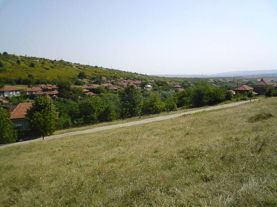
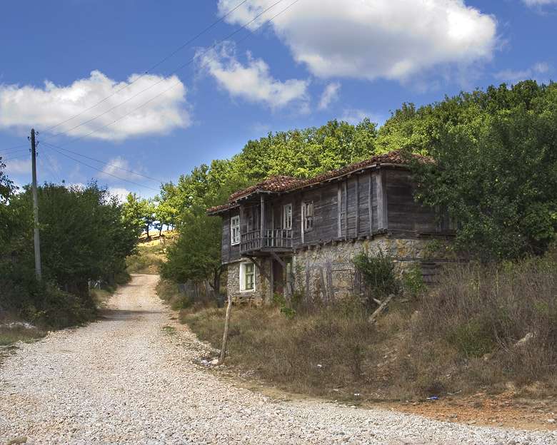
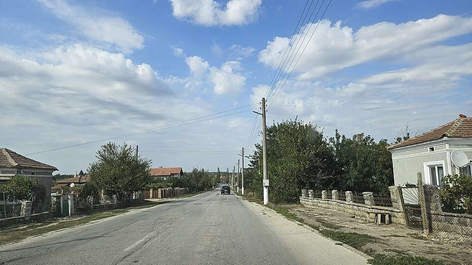
Photograph from Slivarovo (Malko Tarnovo Municipality)

Photograph from Slivarovo (Malko Tarnovo Municipality)

Bulgaria · Burgas

Settlements

Slivarovo (Malko Tarnovo Municipality)

Slivarovo is a village in Malko Tarnovo Municipality, Burgas Province, Bulgaria. EKATTE code: 67307. Elevation range: 300–499 m. This profile uses the official National Register of Settlements. View the location on the map and add the settlement to your personal itinerary.

About this place

Photo: The original uploader was Evgord at Bulgarian Wikipedia . · CC BY-SA 2.5 · License

View location

Map of Bulgaria with a marker for Slivata (Lom Municipality)Representative point of the settlement. Overview map; confirm the exact visiting address.LOCATION · BULGARIASlivata (Lom Municipality)NRepresentative point of the settlementMap: Global Tour · Outline: Natural Earth

Representative point of the settlement. Overview map; confirm the exact visiting address.

Bulgaria · Montana

Settlements

Slivata (Lom Municipality)

Slivata is a village in Lom Municipality, Montana Province, Bulgaria. EKATTE code: 67310. Elevation range: 50–99 m. This profile uses the official National Register of Settlements. View the location on the map and add the settlement to your personal itinerary.

About this place
View location

Map of Bulgaria with a marker for Slivek (Lovech Municipality)Representative point of the settlement. Overview map; confirm the exact visiting address.LOCATION · BULGARIASlivek (Lovech Municipality)NRepresentative point of the settlementMap: Global Tour · Outline: Natural Earth

Representative point of the settlement. Overview map; confirm the exact visiting address.

Bulgaria · Lovech

Settlements

Slivek (Lovech Municipality)

Slivek is a village in Lovech Municipality, Lovech Province, Bulgaria. EKATTE code: 67324. Elevation range: 200–299 m. This profile uses the official National Register of Settlements. View the location on the map and add the settlement to your personal itinerary.

About this place
View location

© 2026 Global Tour