Places

Discover the places on our routes — history, nature and landmarks.

The catalogue continues to grow. See the linked source for visit details.

Settlements · 5,256

Places found: 5893 · Showing 4,681–4,704 of 5,893 · Page 196 / 246

Map of Bulgaria with a marker for Smirov dol (Zemen Municipality)Representative point of the settlement. Overview map; confirm the exact visiting address.LOCATION · BULGARIASmirov dol (Zemen Municipality)NRepresentative point of the settlementMap: Global Tour · Outline: Natural Earth

Representative point of the settlement. Overview map; confirm the exact visiting address.

Bulgaria · Pernik

Settlements

Smirov dol (Zemen Municipality)

Smirov dol is a village in Zemen Municipality, Pernik Province, Bulgaria. EKATTE code: 67595. Elevation range: 700–999 m. This profile uses the official National Register of Settlements. View the location on the map and add the settlement to your personal itinerary.

About this place
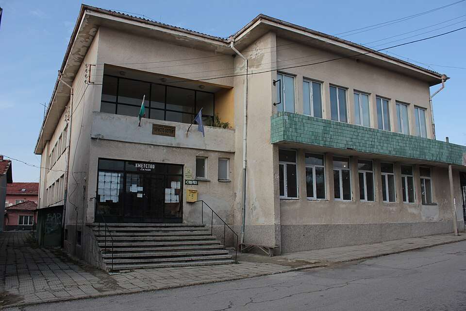
View location

Photograph from Smochan (Lovech Municipality)

Photograph from Smochan (Lovech Municipality)

Bulgaria · Lovech

Settlements

Smochan (Lovech Municipality)

Smochan is a village in Lovech Municipality, Lovech Province, Bulgaria. EKATTE code: 67670. Elevation range: 100–199 m. This profile uses the official National Register of Settlements. View the location on the map and add the settlement to your personal itinerary.

About this place
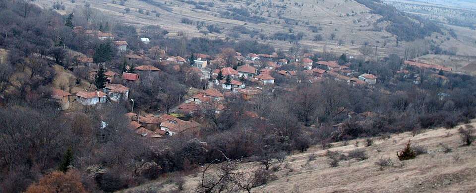
Photo: Original uploader was ЗеленоДърво at bg.wikipedia · CC BY-SA 2.5 · License

View location

Photograph from Smolcha (Godech Municipality)

Photograph from Smolcha (Godech Municipality)

Bulgaria · Sofia Province

Settlements

Smolcha (Godech Municipality)

Smolcha is a village in Godech Municipality, Sofia Province Province, Bulgaria. EKATTE code: 67641. Elevation range: 700–999 m. This profile uses the official National Register of Settlements. View the location on the map and add the settlement to your personal itinerary.

About this place
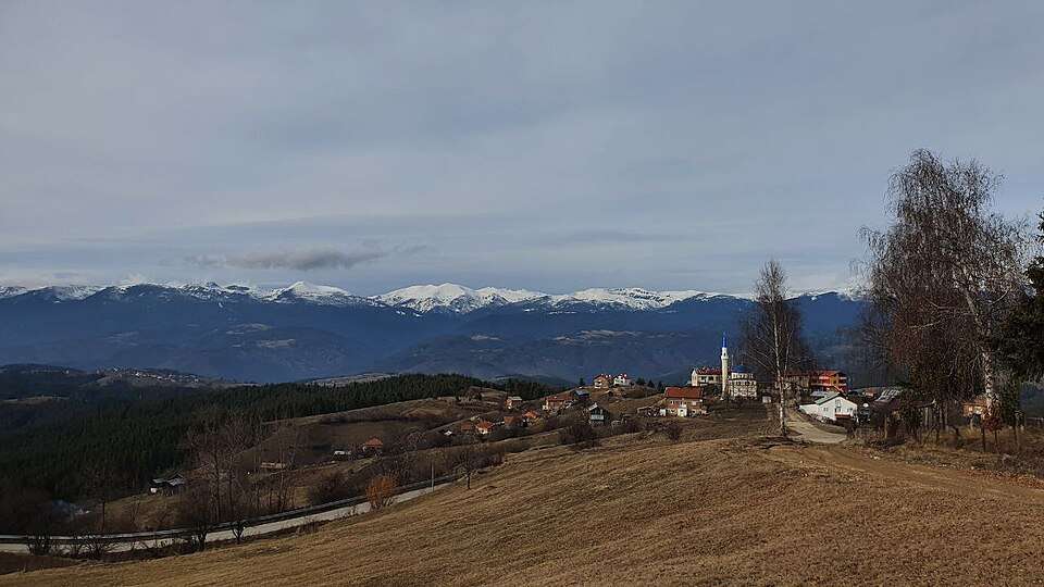
Photo: No machine-readable author provided. Evens~commonswiki assumed (based on copyright claims). · CC BY-SA 3.0 · License

View location

Map of Bulgaria with a marker for Smolichano (Nevestino Municipality)Representative point of the settlement. Overview map; confirm the exact visiting address.LOCATION · BULGARIASmolichano (Nevestino Municipality)NRepresentative point of the settlementMap: Global Tour · Outline: Natural Earth

Representative point of the settlement. Overview map; confirm the exact visiting address.

Bulgaria · Kyustendil

Settlements

Smolichano (Nevestino Municipality)

Smolichano is a village in Nevestino Municipality, Kyustendil Province, Bulgaria. EKATTE code: 67619. Elevation range: 500–699 m. This profile uses the official National Register of Settlements. View the location on the map and add the settlement to your personal itinerary.

About this place
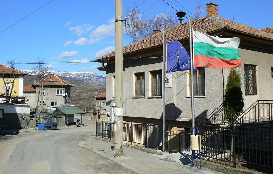
View location

Map of Bulgaria with a marker for Smolnik (Karnobat Municipality)Representative point of the settlement. Overview map; confirm the exact visiting address.LOCATION · BULGARIASmolnik (Karnobat Municipality)NRepresentative point of the settlementMap: Global Tour · Outline: Natural Earth

Representative point of the settlement. Overview map; confirm the exact visiting address.

Bulgaria · Burgas

Settlements

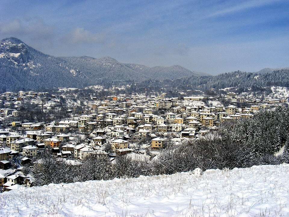
Smolnik (Karnobat Municipality)

Smolnik is a village in Karnobat Municipality, Burgas Province, Bulgaria. EKATTE code: 72080. Elevation range: 200–299 m. This profile uses the official National Register of Settlements. View the location on the map and add the settlement to your personal itinerary.

About this place
View location

Map of Bulgaria with a marker for Smolnitsa (Dobrich-selska Municipality)Representative point of the settlement. Overview map; confirm the exact visiting address.LOCATION · BULGARIASmolnitsa (Dobrich-selska Municipality)NRepresentative point of the settlementMap: Global Tour · Outline: Natural Earth

Representative point of the settlement. Overview map; confirm the exact visiting address.

Bulgaria · Dobrich

Settlements

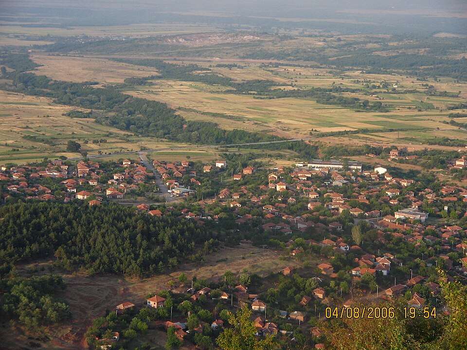
Smolnitsa (Dobrich-selska Municipality)

Smolnitsa is a village in Dobrich-selska Municipality, Dobrich Province, Bulgaria. EKATTE code: 67622. Elevation range: 200–299 m. This profile uses the official National Register of Settlements. View the location on the map and add the settlement to your personal itinerary.

About this place
View location

Map of Bulgaria with a marker for Snezha (Ruen Municipality)Representative point of the settlement. Overview map; confirm the exact visiting address.LOCATION · BULGARIASnezha (Ruen Municipality)NRepresentative point of the settlementMap: Global Tour · Outline: Natural Earth

Representative point of the settlement. Overview map; confirm the exact visiting address.

Bulgaria · Burgas

Settlements

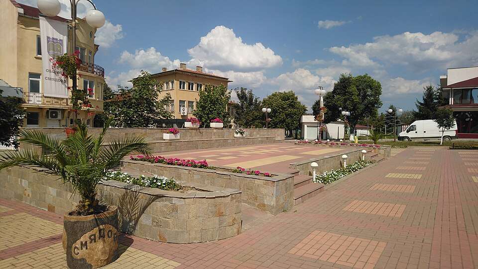
Snezha (Ruen Municipality)

Snezha is a village in Ruen Municipality, Burgas Province, Bulgaria. EKATTE code: 67725. Elevation range: 300–499 m. This profile uses the official National Register of Settlements. View the location on the map and add the settlement to your personal itinerary.

About this place
View location

Map of Bulgaria with a marker for Snezhina (Provadia Municipality)Representative point of the settlement. Overview map; confirm the exact visiting address.LOCATION · BULGARIASnezhina (Provadia Municipality)NRepresentative point of the settlementMap: Global Tour · Outline: Natural Earth

Representative point of the settlement. Overview map; confirm the exact visiting address.

Bulgaria · Varna

Settlements

Snezhina (Provadia Municipality)

Snezhina is a village in Provadia Municipality, Varna Province, Bulgaria. EKATTE code: 67739. Elevation range: 100–199 m. This profile uses the official National Register of Settlements. View the location on the map and add the settlement to your personal itinerary.

About this place
View location

Map of Bulgaria with a marker for Snezhinka (Kardzhali Municipality)Representative point of the settlement. Overview map; confirm the exact visiting address.LOCATION · BULGARIASnezhinka (Kardzhali Municipality)NRepresentative point of the settlementMap: Global Tour · Outline: Natural Earth

Representative point of the settlement. Overview map; confirm the exact visiting address.

Bulgaria · Kardzhali

Settlements

Snezhinka (Kardzhali Municipality)

Snezhinka is a village in Kardzhali Municipality, Kardzhali Province, Bulgaria. EKATTE code: 67742. Elevation range: 300–499 m. This profile uses the official National Register of Settlements. View the location on the map and add the settlement to your personal itinerary.

About this place
View location

Map of Bulgaria with a marker for Snop (General Toshevo Municipality)Representative point of the settlement. Overview map; confirm the exact visiting address.LOCATION · BULGARIASnop (General Toshevo Municipality)NRepresentative point of the settlementMap: Global Tour · Outline: Natural Earth

Representative point of the settlement. Overview map; confirm the exact visiting address.

Bulgaria · Dobrich

Settlements

Snop (General Toshevo Municipality)

Snop is a village in General Toshevo Municipality, Dobrich Province, Bulgaria. EKATTE code: 67756. Elevation range: 100–199 m. This profile uses the official National Register of Settlements. View the location on the map and add the settlement to your personal itinerary.

About this place
View location

Map of Bulgaria with a marker for Snyagovo (General Toshevo Municipality)Representative point of the settlement. Overview map; confirm the exact visiting address.LOCATION · BULGARIASnyagovo (General Toshevo Municipality)NRepresentative point of the settlementMap: Global Tour · Outline: Natural Earth

Representative point of the settlement. Overview map; confirm the exact visiting address.

Bulgaria · Dobrich

Settlements

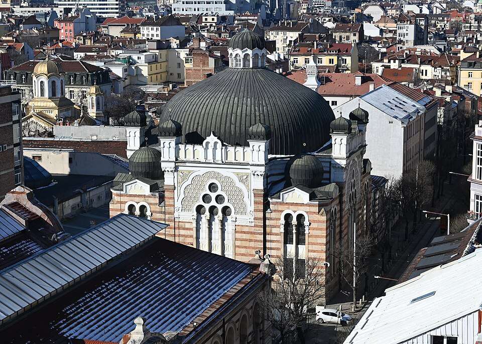
Snyagovo (General Toshevo Municipality)

Snyagovo is a village in General Toshevo Municipality, Dobrich Province, Bulgaria. EKATTE code: 67773. Elevation range: 100–199 m. This profile uses the official National Register of Settlements. View the location on the map and add the settlement to your personal itinerary.

About this place
View location

Map of Bulgaria with a marker for Snyagovo (Ruen Municipality)Representative point of the settlement. Overview map; confirm the exact visiting address.LOCATION · BULGARIASnyagovo (Ruen Municipality)NRepresentative point of the settlementMap: Global Tour · Outline: Natural Earth

Representative point of the settlement. Overview map; confirm the exact visiting address.

Bulgaria · Burgas

Settlements

Snyagovo (Ruen Municipality)

Snyagovo is a village in Ruen Municipality, Burgas Province, Bulgaria. EKATTE code: 67767. Elevation range: 300–499 m. This profile uses the official National Register of Settlements. View the location on the map and add the settlement to your personal itinerary.

About this place
View location

Map of Bulgaria with a marker for Sofiytsi (Dzhebel Municipality)Representative point of the settlement. Overview map; confirm the exact visiting address.LOCATION · BULGARIASofiytsi (Dzhebel Municipality)NRepresentative point of the settlementMap: Global Tour · Outline: Natural Earth

Representative point of the settlement. Overview map; confirm the exact visiting address.

Bulgaria · Kardzhali

Settlements

Sofiytsi (Dzhebel Municipality)

Sofiytsi is a village in Dzhebel Municipality, Kardzhali Province, Bulgaria. EKATTE code: 68120. Elevation range: 300–499 m. This profile uses the official National Register of Settlements. View the location on the map and add the settlement to your personal itinerary.

About this place
View location

© 2026 Global Tour