Places

Discover the places on our routes — history, nature and landmarks.

The catalogue continues to grow. See the linked source for visit details.

Settlements · 5,256

Places found: 5893 · Showing 4,921–4,944 of 5,893 · Page 206 / 246

Map of Bulgaria with a marker for Strupets (Sliven Municipality)Representative point of the settlement. Overview map; confirm the exact visiting address.LOCATION · BULGARIAStrupets (Sliven Municipality)NRepresentative point of the settlementMap: Global Tour · Outline: Natural Earth

Representative point of the settlement. Overview map; confirm the exact visiting address.

Bulgaria · Sliven

Settlements

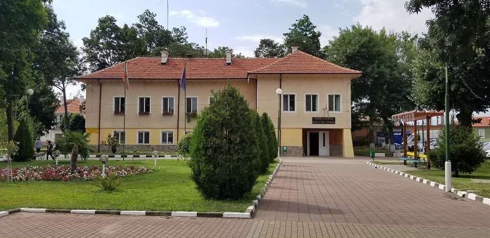
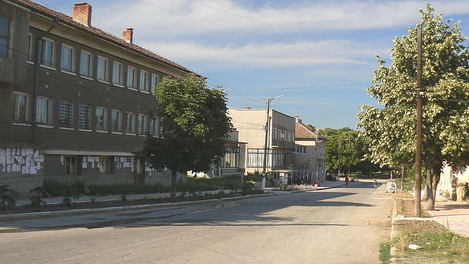
Strupets (Sliven Municipality)

Strupets is a village in Sliven Municipality, Sliven Province, Bulgaria. EKATTE code: 69986. Elevation range: 100–199 m. This profile uses the official National Register of Settlements. View the location on the map and add the settlement to your personal itinerary.

About this place
View location

Map of Bulgaria with a marker for Struya (Ruen Municipality)Representative point of the settlement. Overview map; confirm the exact visiting address.LOCATION · BULGARIAStruya (Ruen Municipality)NRepresentative point of the settlementMap: Global Tour · Outline: Natural Earth

Representative point of the settlement. Overview map; confirm the exact visiting address.

Bulgaria · Burgas

Settlements

Struya (Ruen Municipality)

Struya is a village in Ruen Municipality, Burgas Province, Bulgaria. EKATTE code: 69990. Elevation range: 50–99 m. This profile uses the official National Register of Settlements. View the location on the map and add the settlement to your personal itinerary.

About this place
View location

Photograph from Studen kladenets (Krumovgrad Municipality)

Photograph from Studen kladenets (Krumovgrad Municipality)

Bulgaria · Kardzhali

Settlements

Studen kladenets (Krumovgrad Municipality)

Studen kladenets is a village in Krumovgrad Municipality, Kardzhali Province, Bulgaria. EKATTE code: 70104. Elevation range: 100–199 m. This profile uses the official National Register of Settlements. View the location on the map and add the settlement to your personal itinerary.

About this place
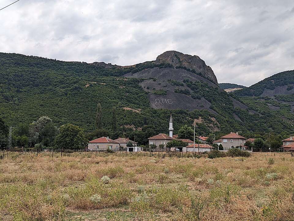
Photo: Андрей Романенко · CC BY-SA 4.0 · License

View location

Map of Bulgaria with a marker for Studena (Madan Municipality)Representative point of the settlement. Overview map; confirm the exact visiting address.LOCATION · BULGARIAStudena (Madan Municipality)NRepresentative point of the settlementMap: Global Tour · Outline: Natural Earth

Representative point of the settlement. Overview map; confirm the exact visiting address.

Bulgaria · Smolyan

Settlements

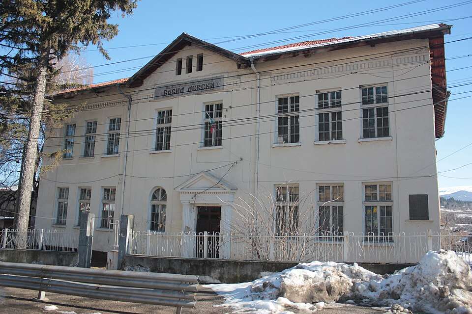
Studena (Madan Municipality)

Studena is a village in Madan Municipality, Smolyan Province, Bulgaria. EKATTE code: 70041. Elevation range: 700–999 m. This profile uses the official National Register of Settlements. View the location on the map and add the settlement to your personal itinerary.

About this place
View location

Map of Bulgaria with a marker for Studena (Svilengrad Municipality)Representative point of the settlement. Overview map; confirm the exact visiting address.LOCATION · BULGARIAStudena (Svilengrad Municipality)NRepresentative point of the settlementMap: Global Tour · Outline: Natural Earth

Representative point of the settlement. Overview map; confirm the exact visiting address.

Bulgaria · Haskovo

Settlements

Studena (Svilengrad Municipality)

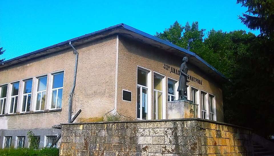
Studena is a village in Svilengrad Municipality, Haskovo Province, Bulgaria. EKATTE code: 70055. Elevation range: 200–299 m. This profile uses the official National Register of Settlements. View the location on the map and add the settlement to your personal itinerary.

About this place
View location

Map of Bulgaria with a marker for Studenets (Chepelare Municipality)Representative point of the settlement. Overview map; confirm the exact visiting address.LOCATION · BULGARIAStudenets (Chepelare Municipality)NRepresentative point of the settlementMap: Global Tour · Outline: Natural Earth

Representative point of the settlement. Overview map; confirm the exact visiting address.

Bulgaria · Smolyan

Settlements

Studenets (Chepelare Municipality)

Studenets is a village in Chepelare Municipality, Smolyan Province, Bulgaria. EKATTE code: 70072. Elevation range: ≥ 1000 m. This profile uses the official National Register of Settlements. View the location on the map and add the settlement to your personal itinerary.

About this place
View location

Map of Bulgaria with a marker for Studenitsa (Hitrino Municipality)Representative point of the settlement. Overview map; confirm the exact visiting address.LOCATION · BULGARIAStudenitsa (Hitrino Municipality)NRepresentative point of the settlementMap: Global Tour · Outline: Natural Earth

Representative point of the settlement. Overview map; confirm the exact visiting address.

Bulgaria · Shumen

Settlements

Studenitsa (Hitrino Municipality)

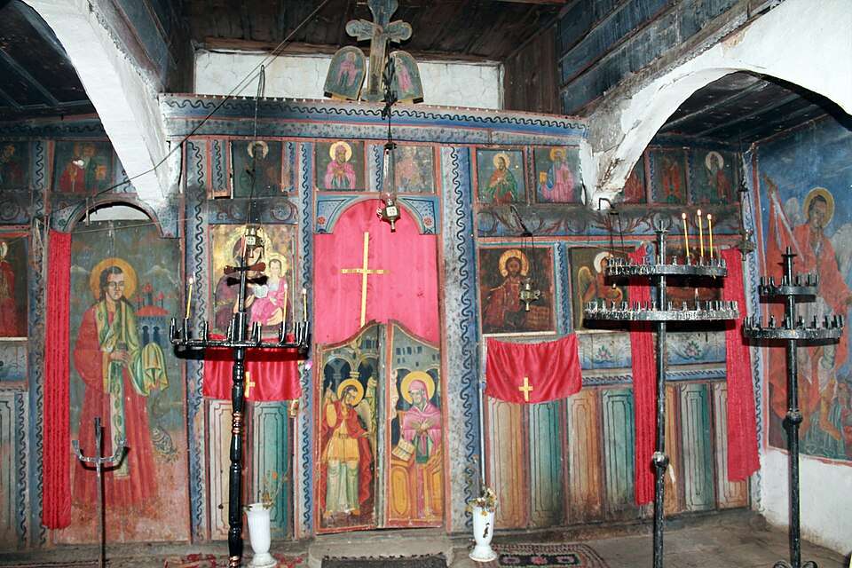
Studenitsa is a village in Hitrino Municipality, Shumen Province, Bulgaria. EKATTE code: 70099. Elevation range: 300–499 m. This profile uses the official National Register of Settlements. View the location on the map and add the settlement to your personal itinerary.

About this place
View location

Photograph from Studeno buche (Montana Municipality)

Photograph from Studeno buche (Montana Municipality)

Bulgaria · Montana

Settlements

Studeno buche (Montana Municipality)

Studeno buche is a village in Montana Municipality, Montana Province, Bulgaria. EKATTE code: 70113. Elevation range: 100–199 m. This profile uses the official National Register of Settlements. View the location on the map and add the settlement to your personal itinerary.

About this place
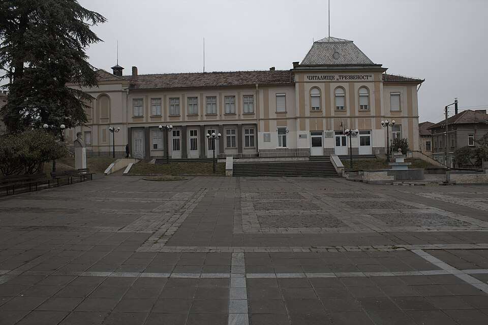
Photo: Original author and uploader was Trifon Milanov (Трифон Миланов) at bg.wikipedia · Public domain · License

View location

Map of Bulgaria with a marker for Suha reka (Veliki Preslav Municipality)Representative point of the settlement. Overview map; confirm the exact visiting address.LOCATION · BULGARIASuha reka (Veliki Preslav Municipality)NRepresentative point of the settlementMap: Global Tour · Outline: Natural Earth

Representative point of the settlement. Overview map; confirm the exact visiting address.

Bulgaria · Shumen

Settlements

Suha reka (Veliki Preslav Municipality)

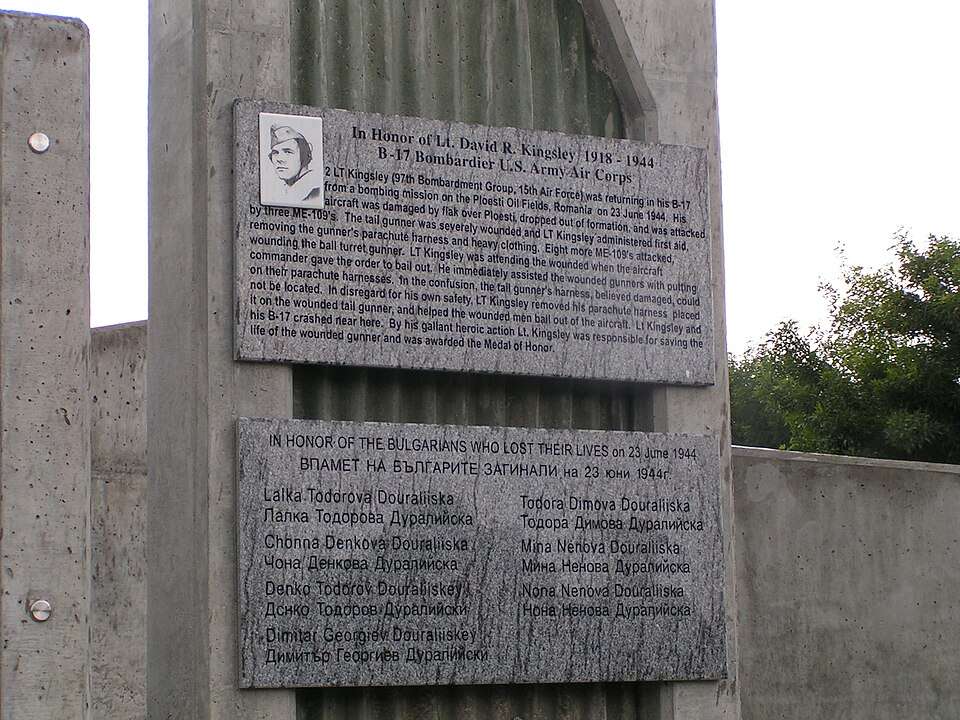
Suha reka is a village in Veliki Preslav Municipality, Shumen Province, Bulgaria. EKATTE code: 70278. Elevation range: 100–199 m. This profile uses the official National Register of Settlements. View the location on the map and add the settlement to your personal itinerary.

About this place
View location

Map of Bulgaria with a marker for Suha reka (Veliko Tarnovo Municipality)Representative point of the settlement. Overview map; confirm the exact visiting address.LOCATION · BULGARIASuha reka (Veliko Tarnovo Municipality)NRepresentative point of the settlementMap: Global Tour · Outline: Natural Earth

Representative point of the settlement. Overview map; confirm the exact visiting address.

Bulgaria · Veliko Tarnovo

Settlements

Suha reka (Veliko Tarnovo Municipality)

Suha reka is a village in Veliko Tarnovo Municipality, Veliko Tarnovo Province, Bulgaria. EKATTE code: 70264. Elevation range: 300–499 m. This profile uses the official National Register of Settlements. View the location on the map and add the settlement to your personal itinerary.

About this place
View location

Map of Bulgaria with a marker for Suhache (Cherven bryag Municipality)Representative point of the settlement. Overview map; confirm the exact visiting address.LOCATION · BULGARIASuhache (Cherven bryag Municipality)NRepresentative point of the settlementMap: Global Tour · Outline: Natural Earth

Representative point of the settlement. Overview map; confirm the exact visiting address.

Bulgaria · Pleven

Settlements

Suhache (Cherven bryag Municipality)

Suhache is a village in Cherven bryag Municipality, Pleven Province, Bulgaria. EKATTE code: 70281. Elevation range: 100–199 m. This profile uses the official National Register of Settlements. View the location on the map and add the settlement to your personal itinerary.

About this place
View location

Map of Bulgaria with a marker for Suhodol (Glavinitsa Municipality)Representative point of the settlement. Overview map; confirm the exact visiting address.LOCATION · BULGARIASuhodol (Glavinitsa Municipality)NRepresentative point of the settlementMap: Global Tour · Outline: Natural Earth

Representative point of the settlement. Overview map; confirm the exact visiting address.

Bulgaria · Silistra

Settlements

Suhodol (Glavinitsa Municipality)

Suhodol is a village in Glavinitsa Municipality, Silistra Province, Bulgaria. EKATTE code: 70336. Elevation range: 100–199 m. This profile uses the official National Register of Settlements. View the location on the map and add the settlement to your personal itinerary.

About this place
View location

Map of Bulgaria with a marker for Suhodol (Sredets Municipality)Representative point of the settlement. Overview map; confirm the exact visiting address.LOCATION · BULGARIASuhodol (Sredets Municipality)NRepresentative point of the settlementMap: Global Tour · Outline: Natural Earth

Representative point of the settlement. Overview map; confirm the exact visiting address.

Bulgaria · Burgas

Settlements

Suhodol (Sredets Municipality)

Suhodol is a village in Sredets Municipality, Burgas Province, Bulgaria. EKATTE code: 70322. Elevation range: 100–199 m. This profile uses the official National Register of Settlements. View the location on the map and add the settlement to your personal itinerary.

About this place
View location

Map of Bulgaria with a marker for Suholoevtsi (Dryanovo Municipality)Representative point of the settlement. Overview map; confirm the exact visiting address.LOCATION · BULGARIASuholoevtsi (Dryanovo Municipality)NRepresentative point of the settlementMap: Global Tour · Outline: Natural Earth

Representative point of the settlement. Overview map; confirm the exact visiting address.

Bulgaria · Gabrovo

Settlements

Suholoevtsi (Dryanovo Municipality)

Suholoevtsi is a village in Dryanovo Municipality, Gabrovo Province, Bulgaria. EKATTE code: 70367. Elevation range: 500–699 m. This profile uses the official National Register of Settlements. View the location on the map and add the settlement to your personal itinerary.

About this place
View location

Map of Bulgaria with a marker for Suhostrel (Simitli Municipality)Representative point of the settlement. Overview map; confirm the exact visiting address.LOCATION · BULGARIASuhostrel (Simitli Municipality)NRepresentative point of the settlementMap: Global Tour · Outline: Natural Earth

Representative point of the settlement. Overview map; confirm the exact visiting address.

Bulgaria · Blagoevgrad

Settlements

Suhostrel (Simitli Municipality)

Suhostrel is a village in Simitli Municipality, Blagoevgrad Province, Bulgaria. EKATTE code: 70370. Elevation range: ≥ 1000 m. This profile uses the official National Register of Settlements. View the location on the map and add the settlement to your personal itinerary.

About this place
View location

Map of Bulgaria with a marker for Suhovo (Ardino Municipality)Representative point of the settlement. Overview map; confirm the exact visiting address.LOCATION · BULGARIASuhovo (Ardino Municipality)NRepresentative point of the settlementMap: Global Tour · Outline: Natural Earth

Representative point of the settlement. Overview map; confirm the exact visiting address.

Bulgaria · Kardzhali

Settlements

Suhovo (Ardino Municipality)

Suhovo is a village in Ardino Municipality, Kardzhali Province, Bulgaria. EKATTE code: 70319. Elevation range: 300–499 m. This profile uses the official National Register of Settlements. View the location on the map and add the settlement to your personal itinerary.

About this place
View location

© 2026 Global Tour