Places

Discover the places on our routes — history, nature and landmarks.

The catalogue continues to grow. See the linked source for visit details.

Settlements · 5,256

Places found: 5893 · Showing 4,993–5,016 of 5,893 · Page 209 / 246

Map of Bulgaria with a marker for Syanovo (Tutrakan Municipality)Representative point of the settlement. Overview map; confirm the exact visiting address.LOCATION · BULGARIASyanovo (Tutrakan Municipality)NRepresentative point of the settlementMap: Global Tour · Outline: Natural Earth

Representative point of the settlement. Overview map; confirm the exact visiting address.

Bulgaria · Silistra

Settlements

Syanovo (Tutrakan Municipality)

Syanovo is a village in Tutrakan Municipality, Silistra Province, Bulgaria. EKATTE code: 70682. Elevation range: 50–99 m. This profile uses the official National Register of Settlements. View the location on the map and add the settlement to your personal itinerary.

About this place
View location

Map of Bulgaria with a marker for Syarovtsi (Dryanovo Municipality)Representative point of the settlement. Overview map; confirm the exact visiting address.LOCATION · BULGARIASyarovtsi (Dryanovo Municipality)NRepresentative point of the settlementMap: Global Tour · Outline: Natural Earth

Representative point of the settlement. Overview map; confirm the exact visiting address.

Bulgaria · Gabrovo

Settlements

Syarovtsi (Dryanovo Municipality)

Syarovtsi is a village in Dryanovo Municipality, Gabrovo Province, Bulgaria. EKATTE code: 70696. Elevation range: 300–499 m. This profile uses the official National Register of Settlements. View the location on the map and add the settlement to your personal itinerary.

About this place
View location

Map of Bulgaria with a marker for Syartsi (Momchilgrad Municipality)Representative point of the settlement. Overview map; confirm the exact visiting address.LOCATION · BULGARIASyartsi (Momchilgrad Municipality)NRepresentative point of the settlementMap: Global Tour · Outline: Natural Earth

Representative point of the settlement. Overview map; confirm the exact visiting address.

Bulgaria · Kardzhali

Settlements

Syartsi (Momchilgrad Municipality)

Syartsi is a village in Momchilgrad Municipality, Kardzhali Province, Bulgaria. EKATTE code: 70706. Elevation range: 300–499 m. This profile uses the official National Register of Settlements. View the location on the map and add the settlement to your personal itinerary.

About this place
View location

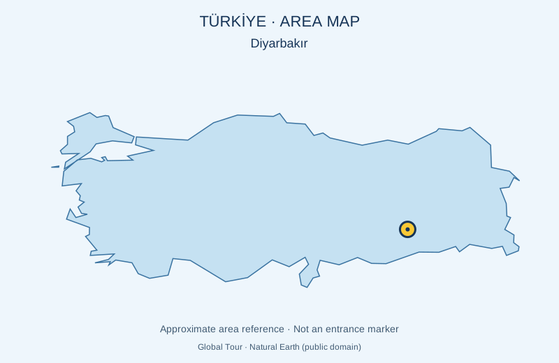
Approximate area map in Türkiye for Syriac Church of the Virgin Mary — Diyarbakır

Türkiye

Syriac Church of the Virgin Mary — Diyarbakır

Meryem Ana Church stands in the historic part of Diyarbakır. It is associated with the Syriac Orthodox community and preserves architectural traces of different periods. The map marks an approximate area reference, not an entrance. Visits and supplements depend on the selected programme; access is confirmed before booking.

About this place

Photo: Global Tour · Natural Earth (public domain) · approximate area map · License

View location

Map of Bulgaria with a marker for Taban (Dragoman Municipality)Representative point of the settlement. Overview map; confirm the exact visiting address.LOCATION · BULGARIATaban (Dragoman Municipality)NRepresentative point of the settlementMap: Global Tour · Outline: Natural Earth

Representative point of the settlement. Overview map; confirm the exact visiting address.

Bulgaria · Sofia Province

Settlements

Taban (Dragoman Municipality)

Taban is a village in Dragoman Municipality, Sofia Province Province, Bulgaria. EKATTE code: 72014. Elevation range: 500–699 m. This profile uses the official National Register of Settlements. View the location on the map and add the settlement to your personal itinerary.

About this place
View location

Map of Bulgaria with a marker for Tabashka (Sevlievo Municipality)Representative point of the settlement. Overview map; confirm the exact visiting address.LOCATION · BULGARIATabashka (Sevlievo Municipality)NRepresentative point of the settlementMap: Global Tour · Outline: Natural Earth

Representative point of the settlement. Overview map; confirm the exact visiting address.

Bulgaria · Gabrovo

Settlements

Tabashka (Sevlievo Municipality)

Tabashka is a village in Sevlievo Municipality, Gabrovo Province, Bulgaria. EKATTE code: 72031. Elevation range: 500–699 m. This profile uses the official National Register of Settlements. View the location on the map and add the settlement to your personal itinerary.

About this place
View location

Map of Bulgaria with a marker for Takach (Kaolinovo Municipality)Representative point of the settlement. Overview map; confirm the exact visiting address.LOCATION · BULGARIATakach (Kaolinovo Municipality)NRepresentative point of the settlementMap: Global Tour · Outline: Natural Earth

Representative point of the settlement. Overview map; confirm the exact visiting address.

Bulgaria · Shumen

Settlements

Takach (Kaolinovo Municipality)

Takach is a village in Kaolinovo Municipality, Shumen Province, Bulgaria. EKATTE code: 73554. Elevation range: 300–499 m. This profile uses the official National Register of Settlements. View the location on the map and add the settlement to your personal itinerary.

About this place
View location

Map of Bulgaria with a marker for Tamarino (Straldzha Municipality)Representative point of the settlement. Overview map; confirm the exact visiting address.LOCATION · BULGARIATamarino (Straldzha Municipality)NRepresentative point of the settlementMap: Global Tour · Outline: Natural Earth

Representative point of the settlement. Overview map; confirm the exact visiting address.

Bulgaria · Yambol

Settlements

Tamarino (Straldzha Municipality)

Tamarino is a village in Straldzha Municipality, Yambol Province, Bulgaria. EKATTE code: 72076. Elevation range: 200–299 m. This profile uses the official National Register of Settlements. View the location on the map and add the settlement to your personal itinerary.

About this place
View location

Map of Bulgaria with a marker for Tanka bara (Nedelino Municipality)Representative point of the settlement. Overview map; confirm the exact visiting address.LOCATION · BULGARIATanka bara (Nedelino Municipality)NRepresentative point of the settlementMap: Global Tour · Outline: Natural Earth

Representative point of the settlement. Overview map; confirm the exact visiting address.

Bulgaria · Smolyan

Settlements

Tanka bara (Nedelino Municipality)

Tanka bara is a village in Nedelino Municipality, Smolyan Province, Bulgaria. EKATTE code: 73883. Elevation range: 700–999 m. This profile uses the official National Register of Settlements. View the location on the map and add the settlement to your personal itinerary.

About this place
View location

Map of Bulgaria with a marker for Tanki rat (Elena Municipality)Representative point of the settlement. Overview map; confirm the exact visiting address.LOCATION · BULGARIATanki rat (Elena Municipality)NRepresentative point of the settlementMap: Global Tour · Outline: Natural Earth

Representative point of the settlement. Overview map; confirm the exact visiting address.

Bulgaria · Veliko Tarnovo

Settlements

Tanki rat (Elena Municipality)

Tanki rat is a village in Elena Municipality, Veliko Tarnovo Province, Bulgaria. EKATTE code: 73568. Elevation range: 500–699 m. This profile uses the official National Register of Settlements. View the location on the map and add the settlement to your personal itinerary.

About this place
View location

Map of Bulgaria with a marker for Tankoto (Madan Municipality)Representative point of the settlement. Overview map; confirm the exact visiting address.LOCATION · BULGARIATankoto (Madan Municipality)NRepresentative point of the settlementMap: Global Tour · Outline: Natural Earth

Representative point of the settlement. Overview map; confirm the exact visiting address.

Bulgaria · Smolyan

Settlements

Tankoto (Madan Municipality)

Tankoto is a village in Madan Municipality, Smolyan Province, Bulgaria. EKATTE code: 73599. Elevation range: 700–999 m. This profile uses the official National Register of Settlements. View the location on the map and add the settlement to your personal itinerary.

About this place
View location

Map of Bulgaria with a marker for Tankovo (Nesebar Municipality)Representative point of the settlement. Overview map; confirm the exact visiting address.LOCATION · BULGARIATankovo (Nesebar Municipality)NRepresentative point of the settlementMap: Global Tour · Outline: Natural Earth

Representative point of the settlement. Overview map; confirm the exact visiting address.

Bulgaria · Burgas

Settlements

Tankovo (Nesebar Municipality)

Tankovo is a village in Nesebar Municipality, Burgas Province, Bulgaria. EKATTE code: 73571. Elevation range: 0–49 m. This profile uses the official National Register of Settlements. View the location on the map and add the settlement to your personal itinerary.

About this place
View location

Map of Bulgaria with a marker for Tankovo (Stambolovo Municipality)Representative point of the settlement. Overview map; confirm the exact visiting address.LOCATION · BULGARIATankovo (Stambolovo Municipality)NRepresentative point of the settlementMap: Global Tour · Outline: Natural Earth

Representative point of the settlement. Overview map; confirm the exact visiting address.

Bulgaria · Haskovo

Settlements

Tankovo (Stambolovo Municipality)

Tankovo is a village in Stambolovo Municipality, Haskovo Province, Bulgaria. EKATTE code: 73585. Elevation range: 100–199 m. This profile uses the official National Register of Settlements. View the location on the map and add the settlement to your personal itinerary.

About this place
View location

Map of Bulgaria with a marker for Tapchileshtovo (Omurtag Municipality)Representative point of the settlement. Overview map; confirm the exact visiting address.LOCATION · BULGARIATapchileshtovo (Omurtag Municipality)NRepresentative point of the settlementMap: Global Tour · Outline: Natural Earth

Representative point of the settlement. Overview map; confirm the exact visiting address.

Bulgaria · Targovishte

Settlements

Tapchileshtovo (Omurtag Municipality)

Tapchileshtovo is a village in Omurtag Municipality, Targovishte Province, Bulgaria. EKATTE code: 73609. Elevation range: 300–499 m. This profile uses the official National Register of Settlements. View the location on the map and add the settlement to your personal itinerary.

About this place
View location

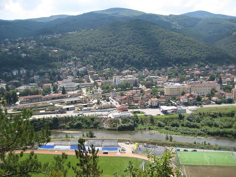
Photograph from Targovishte (Targovishte Municipality)

Photograph from Targovishte (Targovishte Municipality)

Bulgaria · Targovishte

Settlements

Targovishte (Targovishte Municipality)

Targovishte is a city in Targovishte Municipality, Targovishte Province, Bulgaria. EKATTE code: 73626. Elevation range: 100–199 m. Municipal centre · Provincial centre. This profile uses the official National Register of Settlements. View the location on the map and add the settlement to your personal itinerary.

About this place

Photo: Plamen Agov • studiolemontree.com · CC BY-SA 3.0 · License

View location
Map of Bulgaria with a marker for Tarhovo (Sevlievo Municipality)Representative point of the settlement. Overview map; confirm the exact visiting address.LOCATION · BULGARIATarhovo (Sevlievo Municipality)NRepresentative point of the settlementMap: Global Tour · Outline: Natural Earth

Representative point of the settlement. Overview map; confirm the exact visiting address.

Bulgaria · Gabrovo

Settlements

Tarhovo (Sevlievo Municipality)

Tarhovo is a village in Sevlievo Municipality, Gabrovo Province, Bulgaria. EKATTE code: 73763. Elevation range: 300–499 m. This profile uses the official National Register of Settlements. View the location on the map and add the settlement to your personal itinerary.

About this place
View location

Map of Bulgaria with a marker for Tarkasheni (Elena Municipality)Representative point of the settlement. Overview map; confirm the exact visiting address.LOCATION · BULGARIATarkasheni (Elena Municipality)NRepresentative point of the settlementMap: Global Tour · Outline: Natural Earth

Representative point of the settlement. Overview map; confirm the exact visiting address.

Bulgaria · Veliko Tarnovo

Settlements

Tarkasheni (Elena Municipality)

Tarkasheni is a village in Elena Municipality, Veliko Tarnovo Province, Bulgaria. EKATTE code: 73634. Elevation range: 300–499 m. This profile uses the official National Register of Settlements. View the location on the map and add the settlement to your personal itinerary.

About this place
View location

© 2026 Global Tour