Places

Discover the places on our routes — history, nature and landmarks.

The catalogue continues to grow. See the linked source for visit details.

Settlements · 5,256

Places found: 5893 · Showing 769–792 of 5,893 · Page 33 / 246

Map of Bulgaria with a marker for Chepino (Kovachevtsi Municipality)Representative point of the settlement. Overview map; confirm the exact visiting address.LOCATION · BULGARIAChepino (Kovachevtsi Municipality)NRepresentative point of the settlementMap: Global Tour · Outline: Natural Earth

Representative point of the settlement. Overview map; confirm the exact visiting address.

Bulgaria · Pernik

Settlements

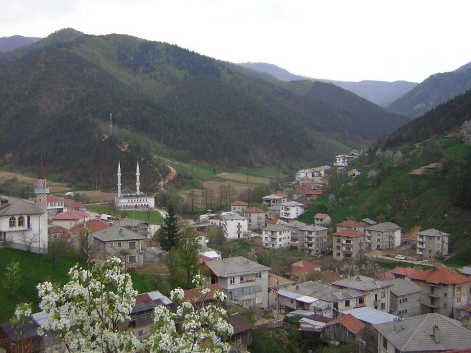
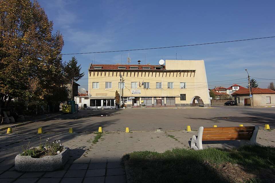
Chepino (Kovachevtsi Municipality)

Chepino is a village in Kovachevtsi Municipality, Pernik Province, Bulgaria. EKATTE code: 80385. Elevation range: 700–999 m. This profile uses the official National Register of Settlements. View the location on the map and add the settlement to your personal itinerary.

About this place
View location

Map of Bulgaria with a marker for Chepleten (Smolyan Municipality)Representative point of the settlement. Overview map; confirm the exact visiting address.LOCATION · BULGARIAChepleten (Smolyan Municipality)NRepresentative point of the settlementMap: Global Tour · Outline: Natural Earth

Representative point of the settlement. Overview map; confirm the exact visiting address.

Bulgaria · Smolyan

Settlements

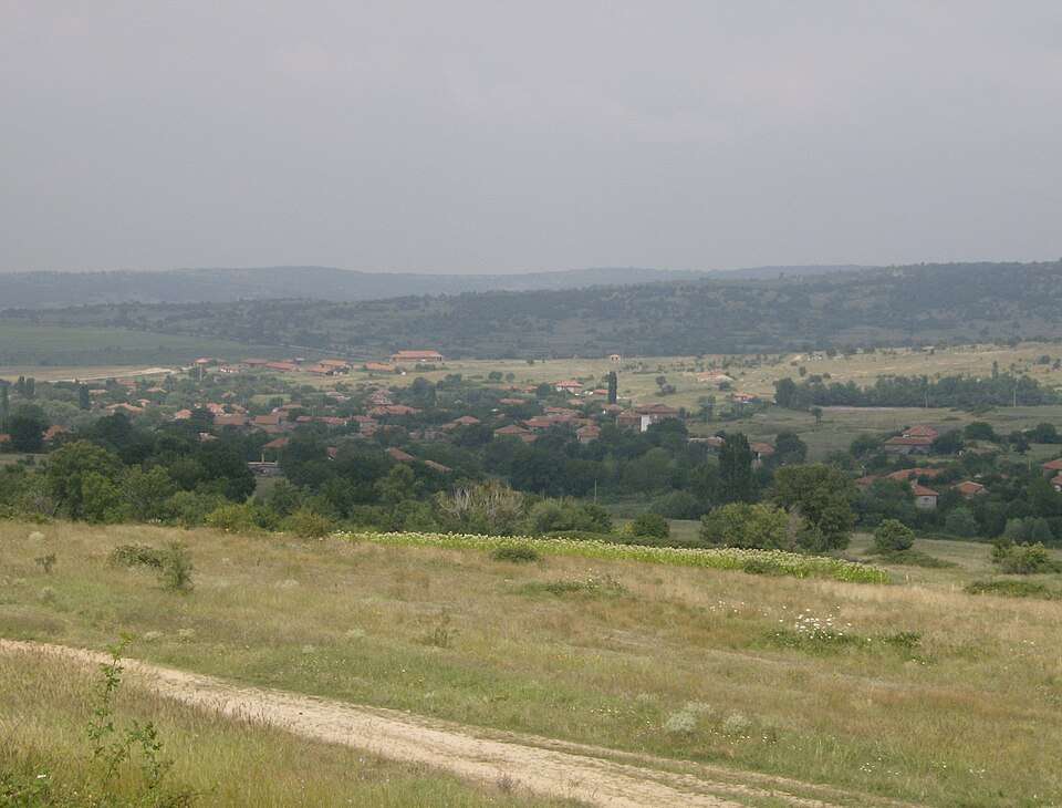
Chepleten (Smolyan Municipality)

Chepleten is a village in Smolyan Municipality, Smolyan Province, Bulgaria. EKATTE code: 80412. Elevation range: ≥ 1000 m. This profile uses the official National Register of Settlements. View the location on the map and add the settlement to your personal itinerary.

About this place
View location

Map of Bulgaria with a marker for Cherencha (Shumen Municipality)Representative point of the settlement. Overview map; confirm the exact visiting address.LOCATION · BULGARIACherencha (Shumen Municipality)NRepresentative point of the settlementMap: Global Tour · Outline: Natural Earth

Representative point of the settlement. Overview map; confirm the exact visiting address.

Bulgaria · Shumen

Settlements

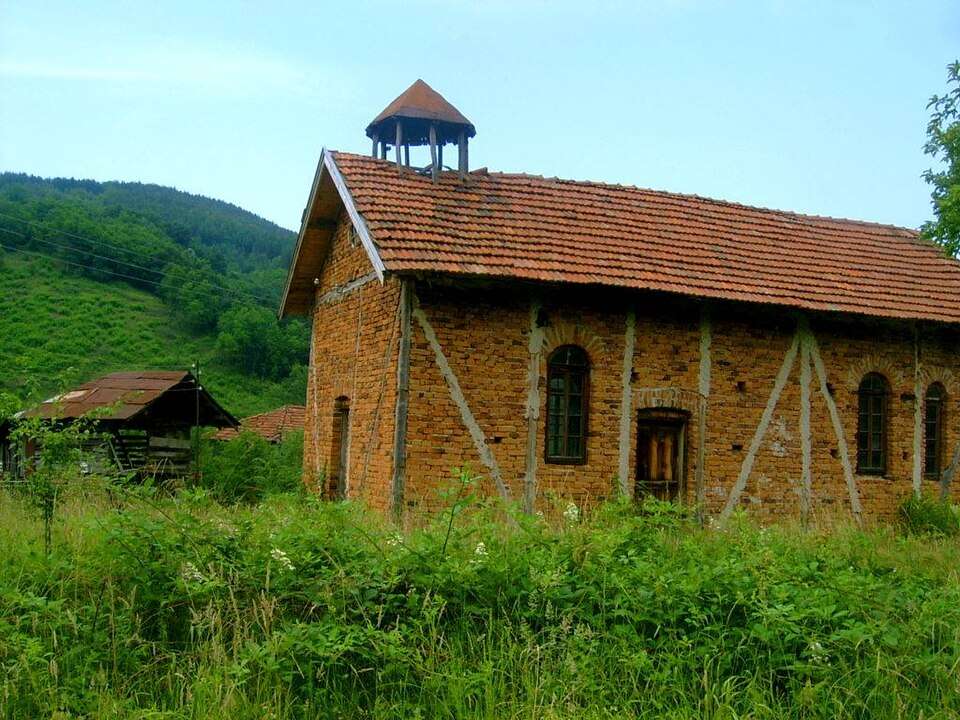
Cherencha (Shumen Municipality)

Cherencha is a village in Shumen Municipality, Shumen Province, Bulgaria. EKATTE code: 80546. Elevation range: 200–299 m. This profile uses the official National Register of Settlements. View the location on the map and add the settlement to your personal itinerary.

About this place
View location

Map of Bulgaria with a marker for Cheresha (Ruen Municipality)Representative point of the settlement. Overview map; confirm the exact visiting address.LOCATION · BULGARIACheresha (Ruen Municipality)NRepresentative point of the settlementMap: Global Tour · Outline: Natural Earth

Representative point of the settlement. Overview map; confirm the exact visiting address.

Bulgaria · Burgas

Settlements

Cheresha (Ruen Municipality)

Cheresha is a village in Ruen Municipality, Burgas Province, Bulgaria. EKATTE code: 80563. Elevation range: 100–199 m. This profile uses the official National Register of Settlements. View the location on the map and add the settlement to your personal itinerary.

About this place
View location

Map of Bulgaria with a marker for Chereshitsa (Kardzhali Municipality)Representative point of the settlement. Overview map; confirm the exact visiting address.LOCATION · BULGARIAChereshitsa (Kardzhali Municipality)NRepresentative point of the settlementMap: Global Tour · Outline: Natural Earth

Representative point of the settlement. Overview map; confirm the exact visiting address.

Bulgaria · Kardzhali

Settlements

Chereshitsa (Kardzhali Municipality)

Chereshitsa is a village in Kardzhali Municipality, Kardzhali Province, Bulgaria. EKATTE code: 80594. Elevation range: 300–499 m. This profile uses the official National Register of Settlements. View the location on the map and add the settlement to your personal itinerary.

About this place
View location

Map of Bulgaria with a marker for Chereshka (Dzhebel Municipality)Representative point of the settlement. Overview map; confirm the exact visiting address.LOCATION · BULGARIAChereshka (Dzhebel Municipality)NRepresentative point of the settlementMap: Global Tour · Outline: Natural Earth

Representative point of the settlement. Overview map; confirm the exact visiting address.

Bulgaria · Kardzhali

Settlements

Chereshka (Dzhebel Municipality)

Chereshka is a village in Dzhebel Municipality, Kardzhali Province, Bulgaria. EKATTE code: 81935. Elevation range: 700–999 m. This profile uses the official National Register of Settlements. View the location on the map and add the settlement to your personal itinerary.

About this place
View location

Map of Bulgaria with a marker for Chereshkite (Smolyan Municipality)Representative point of the settlement. Overview map; confirm the exact visiting address.LOCATION · BULGARIAChereshkite (Smolyan Municipality)NRepresentative point of the settlementMap: Global Tour · Outline: Natural Earth

Representative point of the settlement. Overview map; confirm the exact visiting address.

Bulgaria · Smolyan

Settlements

Chereshkite (Smolyan Municipality)

Chereshkite is a village in Smolyan Municipality, Smolyan Province, Bulgaria. EKATTE code: 80604. Elevation range: ≥ 1000 m. This profile uses the official National Register of Settlements. View the location on the map and add the settlement to your personal itinerary.

About this place
View location

Map of Bulgaria with a marker for Chereshnitsa (Sandanski Municipality)Representative point of the settlement. Overview map; confirm the exact visiting address.LOCATION · BULGARIAChereshnitsa (Sandanski Municipality)NRepresentative point of the settlementMap: Global Tour · Outline: Natural Earth

Representative point of the settlement. Overview map; confirm the exact visiting address.

Bulgaria · Blagoevgrad

Settlements

Chereshnitsa (Sandanski Municipality)

Chereshnitsa is a village in Sandanski Municipality, Blagoevgrad Province, Bulgaria. EKATTE code: 80618. Elevation range: 300–499 m. This profile uses the official National Register of Settlements. View the location on the map and add the settlement to your personal itinerary.

About this place
View location

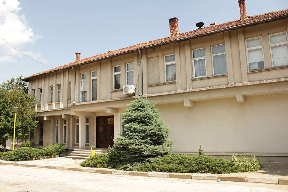
Photograph from Chereshovitsa (Berkovitsa Municipality)

Photograph from Chereshovitsa (Berkovitsa Municipality)

Bulgaria · Montana

Settlements

Chereshovitsa (Berkovitsa Municipality)

Chereshovitsa is a village in Berkovitsa Municipality, Montana Province, Bulgaria. EKATTE code: 80635. Elevation range: 300–499 m. This profile uses the official National Register of Settlements. View the location on the map and add the settlement to your personal itinerary.

About this place

Photo: Original author and uploader was Fifilota at bg.wikipedia · Public domain · License

View location

Map of Bulgaria with a marker for Chereshovo (Belitsa Municipality)Representative point of the settlement. Overview map; confirm the exact visiting address.LOCATION · BULGARIAChereshovo (Belitsa Municipality)NRepresentative point of the settlementMap: Global Tour · Outline: Natural Earth

Representative point of the settlement. Overview map; confirm the exact visiting address.

Bulgaria · Blagoevgrad

Settlements

Chereshovo (Belitsa Municipality)

Chereshovo is a village in Belitsa Municipality, Blagoevgrad Province, Bulgaria. EKATTE code: 80649. Elevation range: ≥ 1000 m. This profile uses the official National Register of Settlements. View the location on the map and add the settlement to your personal itinerary.

About this place
View location

Map of Bulgaria with a marker for Chereshovo (Slivo pole Municipality)Representative point of the settlement. Overview map; confirm the exact visiting address.LOCATION · BULGARIAChereshovo (Slivo pole Municipality)NRepresentative point of the settlementMap: Global Tour · Outline: Natural Earth

Representative point of the settlement. Overview map; confirm the exact visiting address.

Bulgaria · Ruse

Settlements

Chereshovo (Slivo pole Municipality)

Chereshovo is a village in Slivo pole Municipality, Ruse Province, Bulgaria. EKATTE code: 80652. Elevation range: 100–199 m. This profile uses the official National Register of Settlements. View the location on the map and add the settlement to your personal itinerary.

About this place
View location

Map of Bulgaria with a marker for Chereshovo (Smolyan Municipality)Representative point of the settlement. Overview map; confirm the exact visiting address.LOCATION · BULGARIAChereshovo (Smolyan Municipality)NRepresentative point of the settlementMap: Global Tour · Outline: Natural Earth

Representative point of the settlement. Overview map; confirm the exact visiting address.

Bulgaria · Smolyan

Settlements

Chereshovo (Smolyan Municipality)

Chereshovo is a village in Smolyan Municipality, Smolyan Province, Bulgaria. EKATTE code: 80666. Elevation range: ≥ 1000 m. This profile uses the official National Register of Settlements. View the location on the map and add the settlement to your personal itinerary.

About this place
View location

Map of Bulgaria with a marker for Chereshovska reka (Smolyan Municipality)Representative point of the settlement. Overview map; confirm the exact visiting address.LOCATION · BULGARIAChereshovska reka (Smolyan Municipality)NRepresentative point of the settlementMap: Global Tour · Outline: Natural Earth

Representative point of the settlement. Overview map; confirm the exact visiting address.

Bulgaria · Smolyan

Settlements

Chereshovska reka (Smolyan Municipality)

Chereshovska reka is a village in Smolyan Municipality, Smolyan Province, Bulgaria. EKATTE code: 80678. Elevation range: 700–999 m. This profile uses the official National Register of Settlements. View the location on the map and add the settlement to your personal itinerary.

About this place
View location

Map of Bulgaria with a marker for Cherganovo (Kazanlak Municipality)Representative point of the settlement. Overview map; confirm the exact visiting address.LOCATION · BULGARIACherganovo (Kazanlak Municipality)NRepresentative point of the settlementMap: Global Tour · Outline: Natural Earth

Representative point of the settlement. Overview map; confirm the exact visiting address.

Bulgaria · Stara Zagora

Settlements

Cherganovo (Kazanlak Municipality)

Cherganovo is a village in Kazanlak Municipality, Stara Zagora Province, Bulgaria. EKATTE code: 80532. Elevation range: 300–499 m. This profile uses the official National Register of Settlements. View the location on the map and add the settlement to your personal itinerary.

About this place
View location

Map of Bulgaria with a marker for Cherkaski (Varshets Municipality)Representative point of the settlement. Overview map; confirm the exact visiting address.LOCATION · BULGARIACherkaski (Varshets Municipality)NRepresentative point of the settlementMap: Global Tour · Outline: Natural Earth

Representative point of the settlement. Overview map; confirm the exact visiting address.

Bulgaria · Montana

Settlements

Cherkaski (Varshets Municipality)

Cherkaski is a village in Varshets Municipality, Montana Province, Bulgaria. EKATTE code: 80683. Elevation range: 200–299 m. This profile uses the official National Register of Settlements. View the location on the map and add the settlement to your personal itinerary.

About this place
View location

Map of Bulgaria with a marker for Cherkovishte (Mirkovo Municipality)Representative point of the settlement. Overview map; confirm the exact visiting address.LOCATION · BULGARIACherkovishte (Mirkovo Municipality)NRepresentative point of the settlementMap: Global Tour · Outline: Natural Earth

Representative point of the settlement. Overview map; confirm the exact visiting address.

Bulgaria · Sofia Province

Settlements

Cherkovishte (Mirkovo Municipality)

Cherkovishte is a village in Mirkovo Municipality, Sofia Province Province, Bulgaria. EKATTE code: 80707. Elevation range: 700–999 m. This profile uses the official National Register of Settlements. View the location on the map and add the settlement to your personal itinerary.

About this place
View location

Map of Bulgaria with a marker for Cherkovna (Dulovo Municipality)Representative point of the settlement. Overview map; confirm the exact visiting address.LOCATION · BULGARIACherkovna (Dulovo Municipality)NRepresentative point of the settlementMap: Global Tour · Outline: Natural Earth

Representative point of the settlement. Overview map; confirm the exact visiting address.

Bulgaria · Silistra

Settlements

Cherkovna (Dulovo Municipality)

Cherkovna is a village in Dulovo Municipality, Silistra Province, Bulgaria. EKATTE code: 80738. Elevation range: 200–299 m. This profile uses the official National Register of Settlements. View the location on the map and add the settlement to your personal itinerary.

About this place
View location

Map of Bulgaria with a marker for Cherkovna (Provadia Municipality)Representative point of the settlement. Overview map; confirm the exact visiting address.LOCATION · BULGARIACherkovna (Provadia Municipality)NRepresentative point of the settlementMap: Global Tour · Outline: Natural Earth

Representative point of the settlement. Overview map; confirm the exact visiting address.

Bulgaria · Varna

Settlements

Cherkovna (Provadia Municipality)

Cherkovna is a village in Provadia Municipality, Varna Province, Bulgaria. EKATTE code: 80710. Elevation range: 200–299 m. This profile uses the official National Register of Settlements. View the location on the map and add the settlement to your personal itinerary.

About this place
View location

Map of Bulgaria with a marker for Cherkovna (Razgrad Municipality)Representative point of the settlement. Overview map; confirm the exact visiting address.LOCATION · BULGARIACherkovna (Razgrad Municipality)NRepresentative point of the settlementMap: Global Tour · Outline: Natural Earth

Representative point of the settlement. Overview map; confirm the exact visiting address.

Bulgaria · Razgrad

Settlements

Cherkovna (Razgrad Municipality)

Cherkovna is a village in Razgrad Municipality, Razgrad Province, Bulgaria. EKATTE code: 80724. Elevation range: 300–499 m. This profile uses the official National Register of Settlements. View the location on the map and add the settlement to your personal itinerary.

About this place
View location

Map of Bulgaria with a marker for Cherkovna (Targovishte Municipality)Representative point of the settlement. Overview map; confirm the exact visiting address.LOCATION · BULGARIACherkovna (Targovishte Municipality)NRepresentative point of the settlementMap: Global Tour · Outline: Natural Earth

Representative point of the settlement. Overview map; confirm the exact visiting address.

Bulgaria · Targovishte

Settlements

Cherkovna (Targovishte Municipality)

Cherkovna is a village in Targovishte Municipality, Targovishte Province, Bulgaria. EKATTE code: 80741. Elevation range: 300–499 m. This profile uses the official National Register of Settlements. View the location on the map and add the settlement to your personal itinerary.

About this place
View location

© 2026 Global Tour