Places

Discover the places on our routes — history, nature and landmarks.

The catalogue continues to grow. See the linked source for visit details.

Settlements · 5,256

Places found: 5893 · Showing 1,705–1,728 of 5,893 · Page 72 / 246

Map of Bulgaria with a marker for Golyamo novo (Targovishte Municipality)Representative point of the settlement. Overview map; confirm the exact visiting address.LOCATION · BULGARIAGolyamo novo (Targovishte Municipality)NRepresentative point of the settlementMap: Global Tour · Outline: Natural Earth

Representative point of the settlement. Overview map; confirm the exact visiting address.

Bulgaria · Targovishte

Settlements

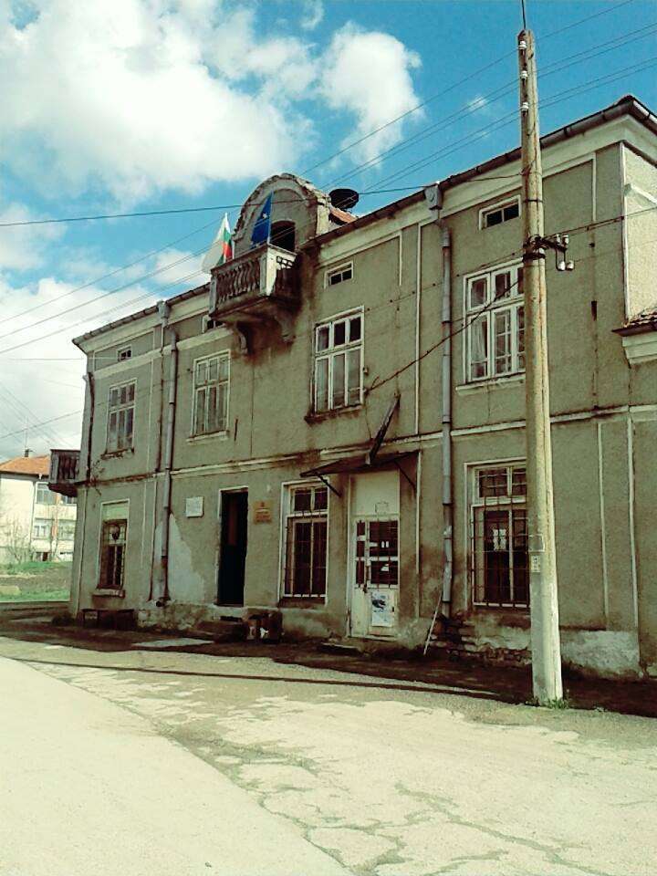
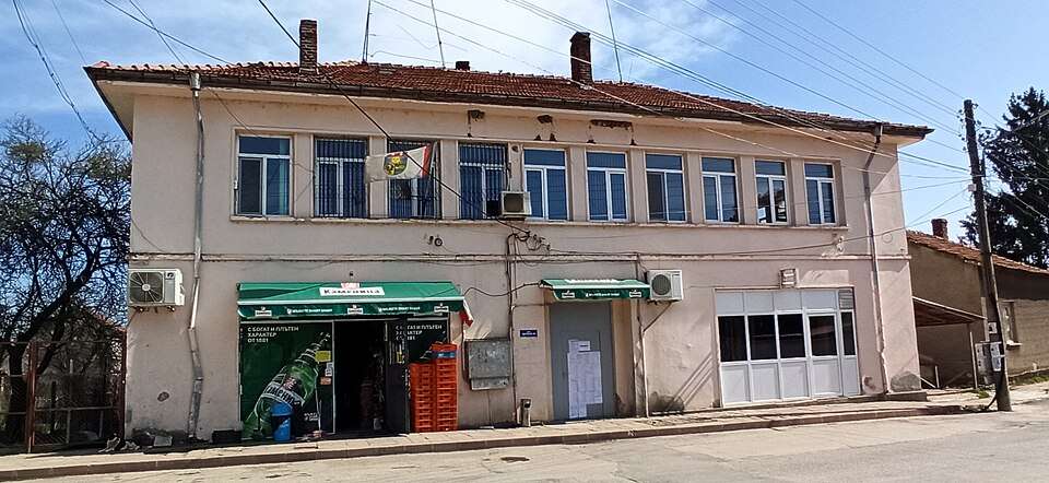
Golyamo novo (Targovishte Municipality)

Golyamo novo is a village in Targovishte Municipality, Targovishte Province, Bulgaria. EKATTE code: 15895. Elevation range: 300–499 m. This profile uses the official National Register of Settlements. View the location on the map and add the settlement to your personal itinerary.

About this place
View location

Map of Bulgaria with a marker for Golyamo Peshtene (Vratsa Municipality)Representative point of the settlement. Overview map; confirm the exact visiting address.LOCATION · BULGARIAGolyamo Peshtene (Vratsa Municipality)NRepresentative point of the settlementMap: Global Tour · Outline: Natural Earth

Representative point of the settlement. Overview map; confirm the exact visiting address.

Bulgaria · Vratsa

Settlements

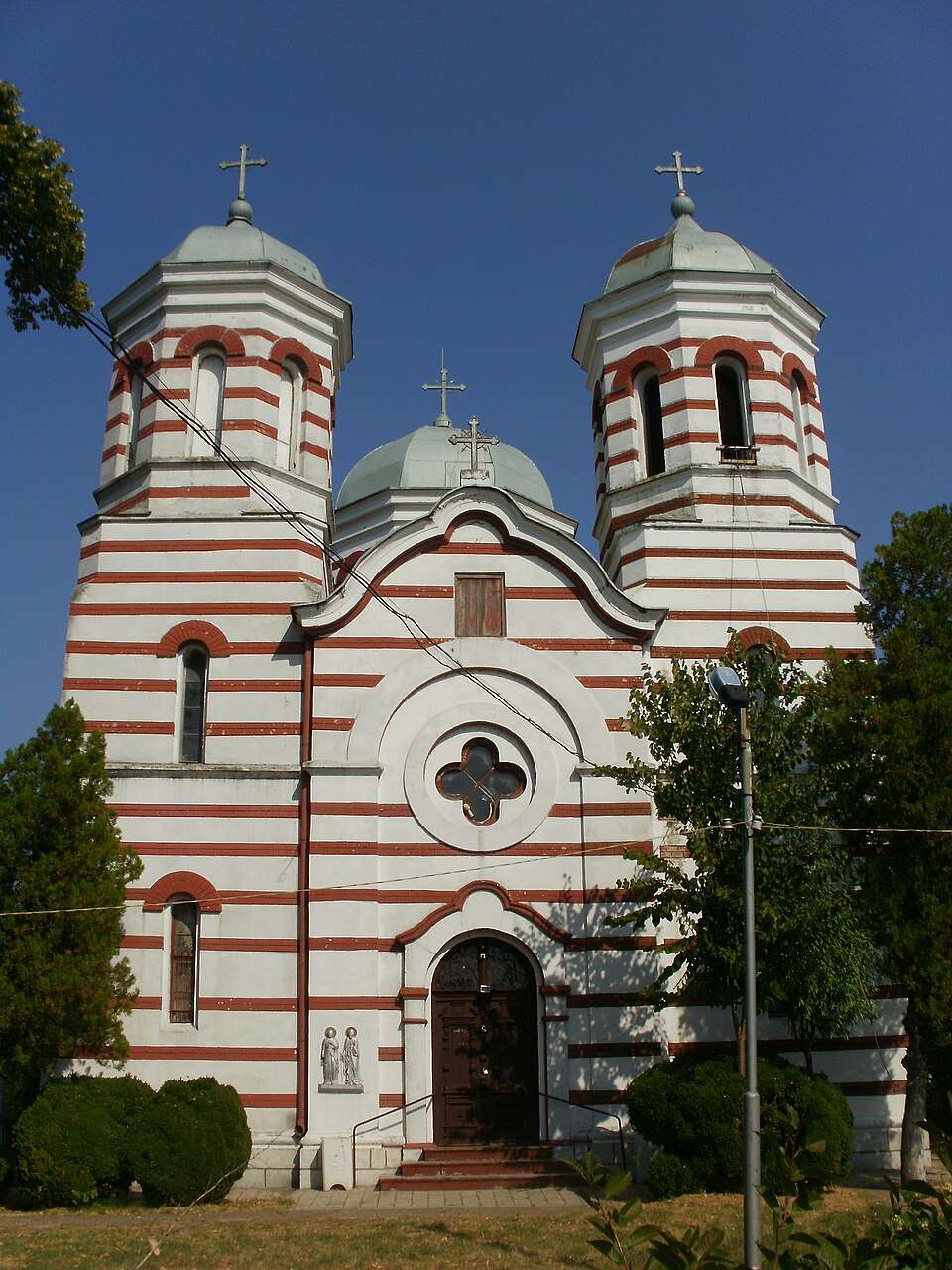
Golyamo Peshtene (Vratsa Municipality)

Golyamo Peshtene is a village in Vratsa Municipality, Vratsa Province, Bulgaria. EKATTE code: 15521. Elevation range: 100–199 m. This profile uses the official National Register of Settlements. View the location on the map and add the settlement to your personal itinerary.

About this place
View location

Photograph from Golyamo Sokolovo (Targovishte Municipality)

Photograph from Golyamo Sokolovo (Targovishte Municipality)

Bulgaria · Targovishte

Settlements

Golyamo Sokolovo (Targovishte Municipality)

Golyamo Sokolovo is a village in Targovishte Municipality, Targovishte Province, Bulgaria. EKATTE code: 15919. Elevation range: 200–299 m. This profile uses the official National Register of Settlements. View the location on the map and add the settlement to your personal itinerary.

About this place
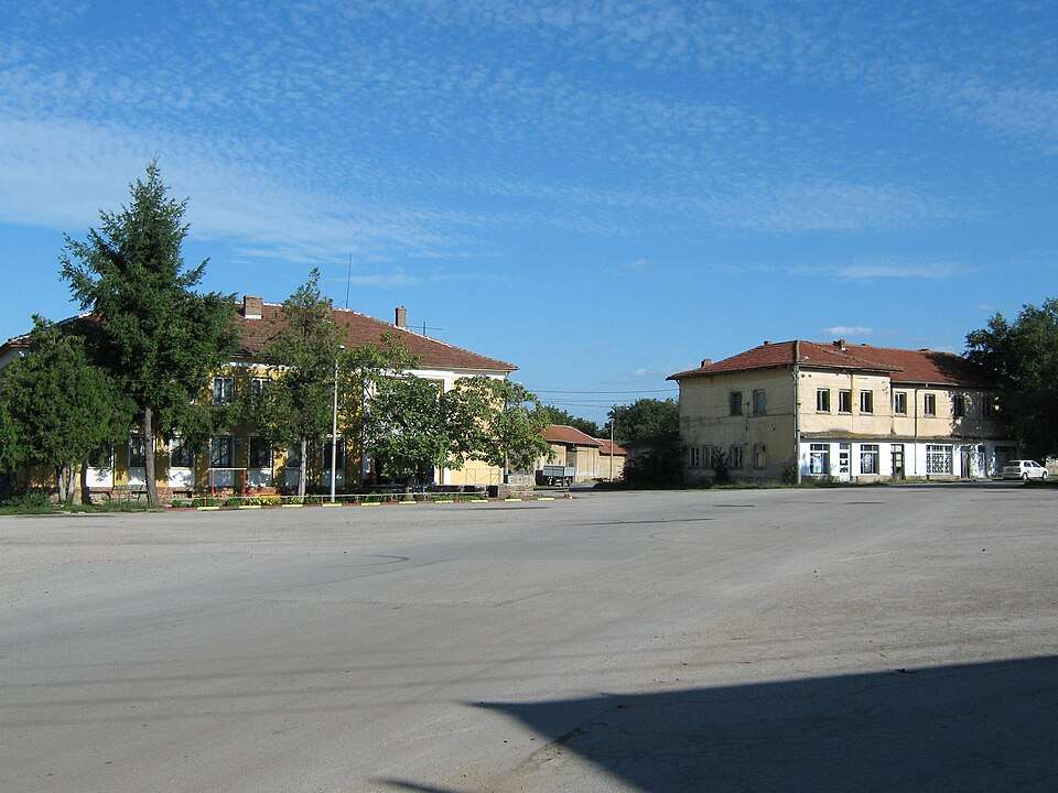
Photo: Georgi ivanov markov · CC BY-SA 4.0 · License

View location

Map of Bulgaria with a marker for Golyamo tsarkvishte (Omurtag Municipality)Representative point of the settlement. Overview map; confirm the exact visiting address.LOCATION · BULGARIAGolyamo tsarkvishte (Omurtag Municipality)NRepresentative point of the settlementMap: Global Tour · Outline: Natural Earth

Representative point of the settlement. Overview map; confirm the exact visiting address.

Bulgaria · Targovishte

Settlements

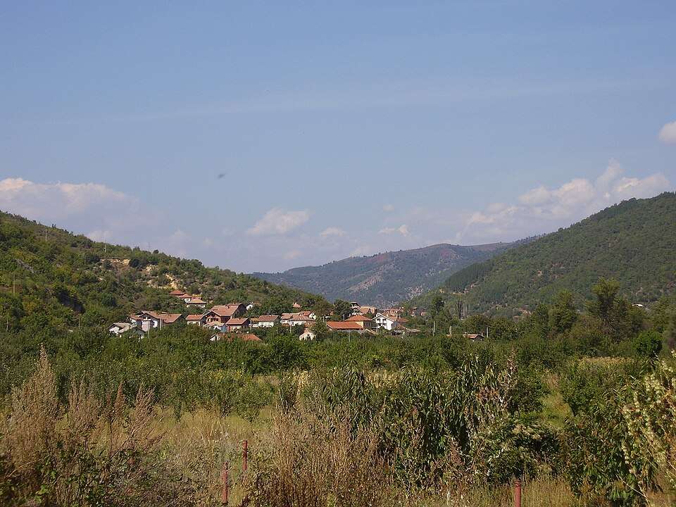
Golyamo tsarkvishte (Omurtag Municipality)

Golyamo tsarkvishte is a village in Omurtag Municipality, Targovishte Province, Bulgaria. EKATTE code: 15922. Elevation range: 300–499 m. This profile uses the official National Register of Settlements. View the location on the map and add the settlement to your personal itinerary.

About this place
View location

Map of Bulgaria with a marker for Golyamo Vranovo (Slivo pole Municipality)Representative point of the settlement. Overview map; confirm the exact visiting address.LOCATION · BULGARIAGolyamo Vranovo (Slivo pole Municipality)NRepresentative point of the settlementMap: Global Tour · Outline: Natural Earth

Representative point of the settlement. Overview map; confirm the exact visiting address.

Bulgaria · Ruse

Settlements

Golyamo Vranovo (Slivo pole Municipality)

Golyamo Vranovo is a village in Slivo pole Municipality, Ruse Province, Bulgaria. EKATTE code: 15829. Elevation range: 0–49 m. This profile uses the official National Register of Settlements. View the location on the map and add the settlement to your personal itinerary.

About this place
View location

Map of Bulgaria with a marker for Goranovtsi (Veliko Tarnovo Municipality)Representative point of the settlement. Overview map; confirm the exact visiting address.LOCATION · BULGARIAGoranovtsi (Veliko Tarnovo Municipality)NRepresentative point of the settlementMap: Global Tour · Outline: Natural Earth

Representative point of the settlement. Overview map; confirm the exact visiting address.

Bulgaria · Veliko Tarnovo

Settlements

Goranovtsi (Veliko Tarnovo Municipality)

Goranovtsi is a village in Veliko Tarnovo Municipality, Veliko Tarnovo Province, Bulgaria. EKATTE code: 16016. Elevation range: 500–699 m. This profile uses the official National Register of Settlements. View the location on the map and add the settlement to your personal itinerary.

About this place
View location

Map of Bulgaria with a marker for Gorchevo (Petrich Municipality)Representative point of the settlement. Overview map; confirm the exact visiting address.LOCATION · BULGARIAGorchevo (Petrich Municipality)NRepresentative point of the settlementMap: Global Tour · Outline: Natural Earth

Representative point of the settlement. Overview map; confirm the exact visiting address.

Bulgaria · Blagoevgrad

Settlements

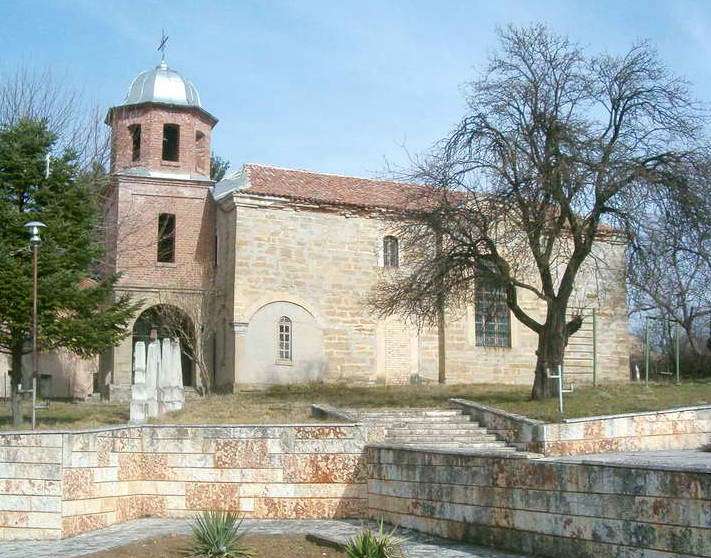
Gorchevo (Petrich Municipality)

Gorchevo is a village in Petrich Municipality, Blagoevgrad Province, Bulgaria. EKATTE code: 17302. Elevation range: 700–999 m. This profile uses the official National Register of Settlements. View the location on the map and add the settlement to your personal itinerary.

About this place
View location

Map of Bulgaria with a marker for Goreme (Strumyani Municipality)Representative point of the settlement. Overview map; confirm the exact visiting address.LOCATION · BULGARIAGoreme (Strumyani Municipality)NRepresentative point of the settlementMap: Global Tour · Outline: Natural Earth

Representative point of the settlement. Overview map; confirm the exact visiting address.

Bulgaria · Blagoevgrad

Settlements

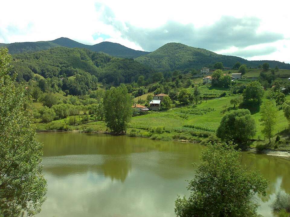
Goreme (Strumyani Municipality)

Goreme is a village in Strumyani Municipality, Blagoevgrad Province, Bulgaria. EKATTE code: 16033. Elevation range: 700–999 m. This profile uses the official National Register of Settlements. View the location on the map and add the settlement to your personal itinerary.

About this place
View location

Map of Bulgaria with a marker for Goren chiflik (Dolni chiflik Municipality)Representative point of the settlement. Overview map; confirm the exact visiting address.LOCATION · BULGARIAGoren chiflik (Dolni chiflik Municipality)NRepresentative point of the settlementMap: Global Tour · Outline: Natural Earth

Representative point of the settlement. Overview map; confirm the exact visiting address.

Bulgaria · Varna

Settlements

Goren chiflik (Dolni chiflik Municipality)

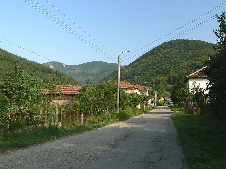
Goren chiflik is a village in Dolni chiflik Municipality, Varna Province, Bulgaria. EKATTE code: 16050. Elevation range: 0–49 m. This profile uses the official National Register of Settlements. View the location on the map and add the settlement to your personal itinerary.

About this place
View location

Map of Bulgaria with a marker for Goren Enevets (Veliko Tarnovo Municipality)Representative point of the settlement. Overview map; confirm the exact visiting address.LOCATION · BULGARIAGoren Enevets (Veliko TarnovoMunicipality)NRepresentative point of the settlementMap: Global Tour · Outline: Natural Earth

Representative point of the settlement. Overview map; confirm the exact visiting address.

Bulgaria · Veliko Tarnovo

Settlements

Goren Enevets (Veliko Tarnovo Municipality)

Goren Enevets is a village in Veliko Tarnovo Municipality, Veliko Tarnovo Province, Bulgaria. EKATTE code: 16047. Elevation range: 300–499 m. This profile uses the official National Register of Settlements. View the location on the map and add the settlement to your personal itinerary.

About this place
View location

Map of Bulgaria with a marker for Gorichane (Shabla Municipality)Representative point of the settlement. Overview map; confirm the exact visiting address.LOCATION · BULGARIAGorichane (Shabla Municipality)NRepresentative point of the settlementMap: Global Tour · Outline: Natural Earth

Representative point of the settlement. Overview map; confirm the exact visiting address.

Bulgaria · Dobrich

Settlements

Gorichane (Shabla Municipality)

Gorichane is a village in Shabla Municipality, Dobrich Province, Bulgaria. EKATTE code: 16095. Elevation range: 50–99 m. This profile uses the official National Register of Settlements. View the location on the map and add the settlement to your personal itinerary.

About this place
View location

Map of Bulgaria with a marker for Gorichevo (Kubrat Municipality)Representative point of the settlement. Overview map; confirm the exact visiting address.LOCATION · BULGARIAGorichevo (Kubrat Municipality)NRepresentative point of the settlementMap: Global Tour · Outline: Natural Earth

Representative point of the settlement. Overview map; confirm the exact visiting address.

Bulgaria · Razgrad

Settlements

Gorichevo (Kubrat Municipality)

Gorichevo is a village in Kubrat Municipality, Razgrad Province, Bulgaria. EKATTE code: 16105. Elevation range: 100–199 m. This profile uses the official National Register of Settlements. View the location on the map and add the settlement to your personal itinerary.

About this place
View location

Map of Bulgaria with a marker for Goritsa (Byala Municipality)Representative point of the settlement. Overview map; confirm the exact visiting address.LOCATION · BULGARIAGoritsa (Byala Municipality)NRepresentative point of the settlementMap: Global Tour · Outline: Natural Earth

Representative point of the settlement. Overview map; confirm the exact visiting address.

Bulgaria · Varna

Settlements

Goritsa (Byala Municipality)

Goritsa is a village in Byala Municipality, Varna Province, Bulgaria. EKATTE code: 16078. Elevation range: 100–199 m. This profile uses the official National Register of Settlements. View the location on the map and add the settlement to your personal itinerary.

About this place
View location

Map of Bulgaria with a marker for Goritsa (General Toshevo Municipality)Representative point of the settlement. Overview map; confirm the exact visiting address.LOCATION · BULGARIAGoritsa (General Toshevo Municipality)NRepresentative point of the settlementMap: Global Tour · Outline: Natural Earth

Representative point of the settlement. Overview map; confirm the exact visiting address.

Bulgaria · Dobrich

Settlements

Goritsa (General Toshevo Municipality)

Goritsa is a village in General Toshevo Municipality, Dobrich Province, Bulgaria. EKATTE code: 18575. Elevation range: 100–199 m. This profile uses the official National Register of Settlements. View the location on the map and add the settlement to your personal itinerary.

About this place
View location

Photograph from Goritsa (Popovo Municipality)

Photograph from Goritsa (Popovo Municipality)

Bulgaria · Targovishte

Settlements

Goritsa (Popovo Municipality)

Goritsa is a village in Popovo Municipality, Targovishte Province, Bulgaria. EKATTE code: 16081. Elevation range: 300–499 m. This profile uses the official National Register of Settlements. View the location on the map and add the settlement to your personal itinerary.

About this place

Photo: Original author and uploader were Pl. Sabev and Vl. Stoykov at bg.wikipedia · CC BY-SA 3.0 · License

View location

Map of Bulgaria with a marker for Gorna Beshovitsa (Mezdra Municipality)Representative point of the settlement. Overview map; confirm the exact visiting address.LOCATION · BULGARIAGorna Beshovitsa (Mezdra Municipality)NRepresentative point of the settlementMap: Global Tour · Outline: Natural Earth

Representative point of the settlement. Overview map; confirm the exact visiting address.

Bulgaria · Vratsa

Settlements

Gorna Beshovitsa (Mezdra Municipality)

Gorna Beshovitsa is a village in Mezdra Municipality, Vratsa Province, Bulgaria. EKATTE code: 16122. Elevation range: 300–499 m. This profile uses the official National Register of Settlements. View the location on the map and add the settlement to your personal itinerary.

About this place
View location

© 2026 Global Tour