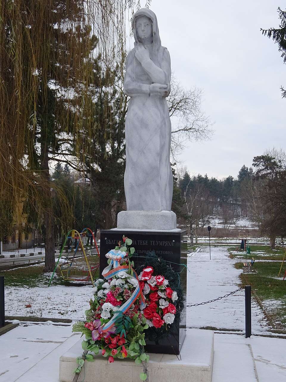
科普里韦茨(Koprivets,Byala 市镇)的照片
保加利亚 · 鲁塞州
居民点
科普里韦茨(Koprivets,Byala 市镇)
科普里韦茨是保加利亚鲁塞州 Byala 市镇的一处村庄。 EKATTE 代码:38529。海拔范围:100–199 米。 本资料依据官方《全国居民点登记册》编写。您可以在地图上查看位置,并将此地加入个人旅行路线。
查看详情图片来源: Ttaanya · CC BY-SA 4.0 · 许可协议
查看位置
探索旅行路线上的自然景观、历史遗迹和文化景点。
景点目录持续更新。参观详情请查看景点页面中的来源链接。
保加利亚居民点 · 5,256找到景点: 5893 · 显示第 2,473–2,496 项,共 5,893 · 页 104 / 246
科普里韦茨(Koprivets,Byala 市镇)的照片
保加利亚 · 鲁塞州
居民点
科普里韦茨是保加利亚鲁塞州 Byala 市镇的一处村庄。 EKATTE 代码:38529。海拔范围:100–199 米。 本资料依据官方《全国居民点登记册》编写。您可以在地图上查看位置,并将此地加入个人旅行路线。
查看详情图片来源: Ttaanya · CC BY-SA 4.0 · 许可协议
查看位置Representative point of the settlement. Overview map; confirm the exact visiting address.
保加利亚 · 布拉戈耶夫格勒州
居民点
科普里夫伦是保加利亚布拉戈耶夫格勒州 Hadzhidimovo 市镇的一处村庄。 EKATTE 代码:38532。海拔范围:500–699 米。 本资料依据官方《全国居民点登记册》编写。您可以在地图上查看位置,并将此地加入个人旅行路线。
查看详情
保加利亚 · 索菲亚州
建筑与聚落
Lyutov房屋中的墙壁奖章描绘了业主参观的遥远城市。一种感知收藏展示了当地利用未冲刷羊毛、发光的复兴时代贸易和手工艺制作地毯的技术。
查看详情图片来源: TwoWings · Public domain · 许可协议
查看位置
保加利亚 · 布拉戈耶夫格勒州
建筑与聚落
石中雕刻的隧道 形成了酒窖,巨大的桶 梅尔尼克葡萄酒。楼上,壁画,木雕和彩色玻璃 揭示了复兴商家的财富
查看详情图片来源: Vislupus · CC BY-SA 4.0 · 许可协议
查看位置Representative point of the settlement. Overview map; confirm the exact visiting address.
保加利亚 · 哈斯科沃州
居民点
Koren 是保加利亚哈斯科沃州 Haskovo 市镇的一处村庄。 EKATTE 代码:38580。海拔范围:100–199 米。 本资料依据官方《全国居民点登记册》编写。您可以在地图上查看位置,并将此地加入个人旅行路线。
查看详情Representative point of the settlement. Overview map; confirm the exact visiting address.
保加利亚 · 斯莫梁州
居民点
Koriite 是保加利亚斯莫梁州 Madan 市镇的一处村庄。 EKATTE 代码:38594。海拔范围:700–999 米。 本资料依据官方《全国居民点登记册》编写。您可以在地图上查看位置,并将此地加入个人旅行路线。
查看详情Representative point of the settlement. Overview map; confirm the exact visiting address.
保加利亚 · 斯莫梁州
居民点
Koritata 是保加利亚斯莫梁州 Rudozem 市镇的一处村庄。 EKATTE 代码:38604。海拔范围:700–999 米。 本资料依据官方《全国居民点登记册》编写。您可以在地图上查看位置,并将此地加入个人旅行路线。
查看详情Representative point of the settlement. Overview map; confirm the exact visiting address.
保加利亚 · 多布里奇州
居民点
Koriten 是保加利亚多布里奇州 Krushari 市镇的一处村庄。 EKATTE 代码:38618。海拔范围:100–199 米。 本资料依据官方《全国居民点登记册》编写。您可以在地图上查看位置,并将此地加入个人旅行路线。
查看详情Representative point of the settlement. Overview map; confirm the exact visiting address.
保加利亚 · 加布罗沃州
居民点
Koriyata 是保加利亚加布罗沃州 Sevlievo 市镇的一处村庄。 EKATTE 代码:38621。海拔范围:300–499 米。 本资料依据官方《全国居民点登记册》编写。您可以在地图上查看位置,并将此地加入个人旅行路线。
查看详情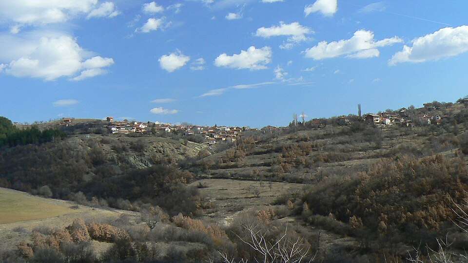
Korkina(Bobov dol 市镇)的照片
保加利亚 · 丘斯滕迪尔州
居民点
Korkina 是保加利亚丘斯滕迪尔州 Bobov dol 市镇的一处村庄。 EKATTE 代码:38635。海拔范围:700–999 米。 本资料依据官方《全国居民点登记册》编写。您可以在地图上查看位置,并将此地加入个人旅行路线。
查看详情图片来源: Vassia Atanassova - Spiritia · Public domain · 许可协议
查看位置Representative point of the settlement. Overview map; confirm the exact visiting address.
保加利亚 · 加布罗沃州
居民点
科尔米扬斯科是保加利亚加布罗沃州 Sevlievo 市镇的一处村庄。 EKATTE 代码:38652。海拔范围:200–299 米。 本资料依据官方《全国居民点登记册》编写。您可以在地图上查看位置,并将此地加入个人旅行路线。
查看详情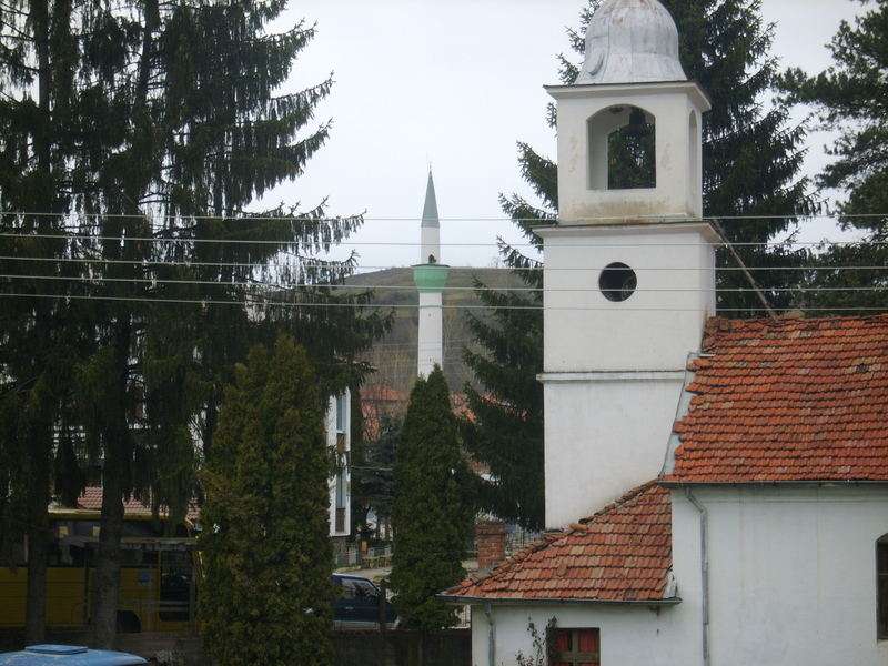
科尔尼察(Kornitsa,Gotse Delchev 市镇)的照片
保加利亚 · 布拉戈耶夫格勒州
居民点
科尔尼察是保加利亚布拉戈耶夫格勒州 Gotse Delchev 市镇的一处村庄。 EKATTE 代码:38666。海拔范围:500–699 米。 本资料依据官方《全国居民点登记册》编写。您可以在地图上查看位置,并将此地加入个人旅行路线。
查看详情图片来源: Drjmarkov · CC BY-SA 3.0 · 许可协议
查看位置Representative point of the settlement. Overview map; confirm the exact visiting address.
保加利亚 · 斯利文州
居民点
科尔滕是保加利亚斯利文州 Nova Zagora 市镇的一处村庄。 EKATTE 代码:38683。海拔范围:200–299 米。 本资料依据官方《全国居民点登记册》编写。您可以在地图上查看位置,并将此地加入个人旅行路线。
查看详情Representative point of the settlement. Overview map; confirm the exact visiting address.
保加利亚 · 克尔贾利州
居民点
Kos 是保加利亚克尔贾利州 Momchilgrad 市镇的一处村庄。 EKATTE 代码:38697。海拔范围:500–699 米。 本资料依据官方《全国居民点登记册》编写。您可以在地图上查看位置,并将此地加入个人旅行路线。
查看详情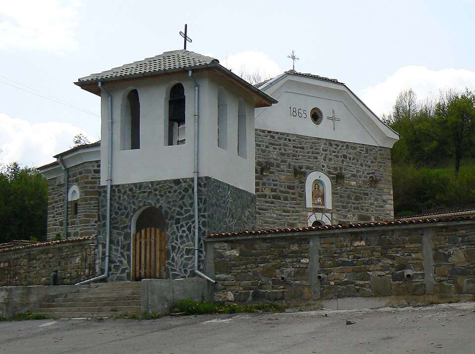
Kosacha(Kovachevtsi 市镇)的照片
保加利亚 · 佩尔尼克州
居民点
Kosacha 是保加利亚佩尔尼克州 Kovachevtsi 市镇的一处村庄。 EKATTE 代码:38724。海拔范围:500–699 米。 本资料依据官方《全国居民点登记册》编写。您可以在地图上查看位置,并将此地加入个人旅行路线。
查看详情图片来源: Spiritia · CC BY-SA 3.0 · 许可协议
查看位置Representative point of the settlement. Overview map; confirm the exact visiting address.
保加利亚 · 锡利斯特拉州
居民点
Kosara 是保加利亚锡利斯特拉州 Glavinitsa 市镇的一处村庄。 EKATTE 代码:38707。海拔范围:100–199 米。 本资料依据官方《全国居民点登记册》编写。您可以在地图上查看位置,并将此地加入个人旅行路线。
查看详情Representative point of the settlement. Overview map; confirm the exact visiting address.
保加利亚 · 加布罗沃州
居民点
Kosarka 是保加利亚加布罗沃州 Dryanovo 市镇的一处村庄。 EKATTE 代码:38710。海拔范围:200–299 米。 本资料依据官方《全国居民点登记册》编写。您可以在地图上查看位置,并将此地加入个人旅行路线。
查看详情Representative point of the settlement. Overview map; confirm the exact visiting address.
保加利亚 · 大特尔诺沃州
居民点
Kosevtsi 是保加利亚大特尔诺沃州 Elena 市镇的一处村庄。 EKATTE 代码:38738。海拔范围:500–699 米。 本资料依据官方《全国居民点登记册》编写。您可以在地图上查看位置,并将此地加入个人旅行路线。
查看详情Representative point of the settlement. Overview map; confirm the exact visiting address.
保加利亚 · 佩尔尼克州
居民点
Kosharevo 是保加利亚佩尔尼克州 Breznik 市镇的一处村庄。 EKATTE 代码:39150。海拔范围:700–999 米。 本资料依据官方《全国居民点登记册》编写。您可以在地图上查看位置,并将此地加入个人旅行路线。
查看详情Representative point of the settlement. Overview map; confirm the exact visiting address.
保加利亚 · 佩尔尼克州
居民点
Kosharite 是保加利亚佩尔尼克州 Radomir 市镇的一处村庄。 EKATTE 代码:41251。海拔范围:500–699 米。 本资料依据官方《全国居民点登记册》编写。您可以在地图上查看位置,并将此地加入个人旅行路线。
查看详情Representative point of the settlement. Overview map; confirm the exact visiting address.
保加利亚 · 布尔加斯州
居民点
科沙里察是保加利亚布尔加斯州 Nesebar 市镇的一处村庄。 EKATTE 代码:39164。海拔范围:100–199 米。 本资料依据官方《全国居民点登记册》编写。您可以在地图上查看位置,并将此地加入个人旅行路线。
查看详情Representative point of the settlement. Overview map; confirm the exact visiting address.
保加利亚 · 鲁塞州
居民点
科沙尔纳是保加利亚鲁塞州 Slivo pole 市镇的一处村庄。 EKATTE 代码:39178。海拔范围:100–199 米。 本资料依据官方《全国居民点登记册》编写。您可以在地图上查看位置,并将此地加入个人旅行路线。
查看详情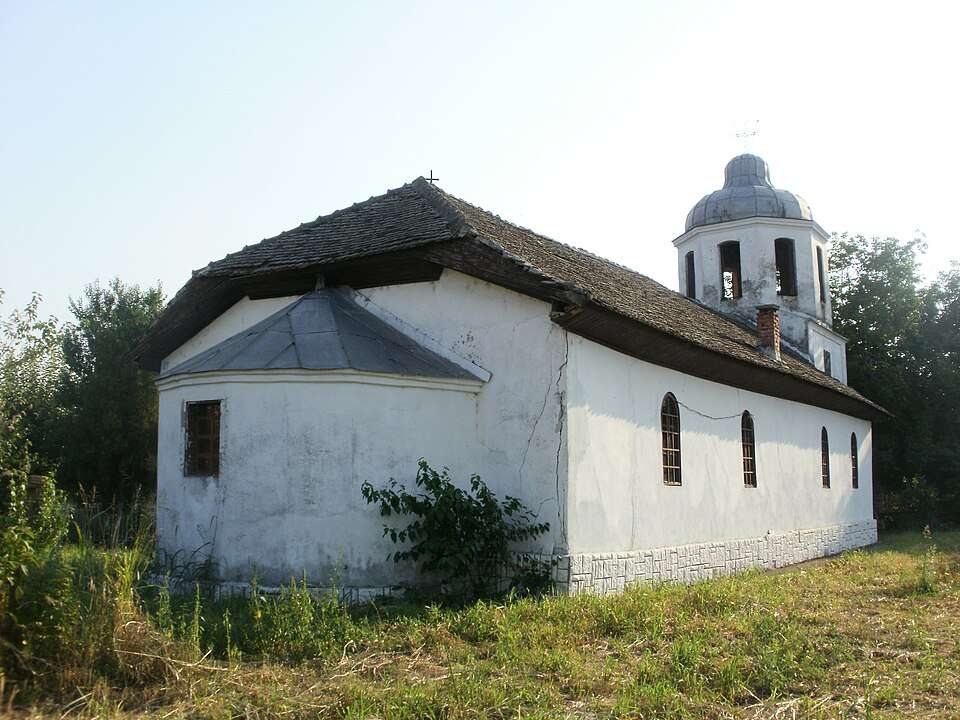
Koshava(Vidin 市镇)的照片
保加利亚 · 维丁州
居民点
Koshava 是保加利亚维丁州 Vidin 市镇的一处村庄。 EKATTE 代码:39147。海拔范围:0–49 米。 本资料依据官方《全国居民点登记册》编写。您可以在地图上查看位置,并将此地加入个人旅行路线。
查看详情图片来源: Bazov · CC BY-SA 3.0 · 许可协议
查看位置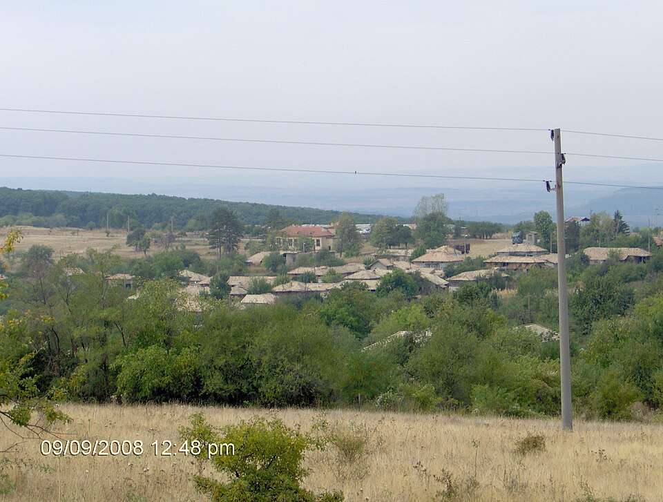
Koshnichari(Targovishte 市镇)的照片
保加利亚 · 特尔戈维什特州
居民点
Koshnichari 是保加利亚特尔戈维什特州 Targovishte 市镇的一处村庄。 EKATTE 代码:39195。海拔范围:300–499 米。 本资料依据官方《全国居民点登记册》编写。您可以在地图上查看位置,并将此地加入个人旅行路线。
查看详情图片来源: Godonikolov · Public domain · 许可协议
查看位置