Representative point of the settlement. Overview map; confirm the exact visiting address.
保加利亚 · 克尔贾利州
居民点
Podvrah(Dzhebel 市镇)
Podvrah 是保加利亚克尔贾利州 Dzhebel 市镇的一处村庄。 EKATTE 代码:56976。海拔范围:300–499 米。 本资料依据官方《全国居民点登记册》编写。您可以在地图上查看位置,并将此地加入个人旅行路线。
查看详情
探索旅行路线上的自然景观、历史遗迹和文化景点。
景点目录持续更新。参观详情请查看景点页面中的来源链接。
保加利亚居民点 · 5,256找到景点: 5893 · 显示第 3,865–3,888 项,共 5,893 · 页 162 / 246
Representative point of the settlement. Overview map; confirm the exact visiting address.
保加利亚 · 克尔贾利州
居民点
Podvrah 是保加利亚克尔贾利州 Dzhebel 市镇的一处村庄。 EKATTE 代码:56976。海拔范围:300–499 米。 本资料依据官方《全国居民点登记册》编写。您可以在地图上查看位置,并将此地加入个人旅行路线。
查看详情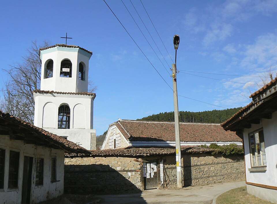
波伊布雷内(Poibrene,Panagyurishte 市镇)的照片
保加利亚 · 帕扎尔吉克州
居民点
波伊布雷内是保加利亚帕扎尔吉克州 Panagyurishte 市镇的一处村庄。 EKATTE 代码:57128。海拔范围:300–499 米。 本资料依据官方《全国居民点登记册》编写。您可以在地图上查看位置,并将此地加入个人旅行路线。
查看详情图片来源: Vassia Atanassova - Spiritia · Public domain · 许可协议
查看位置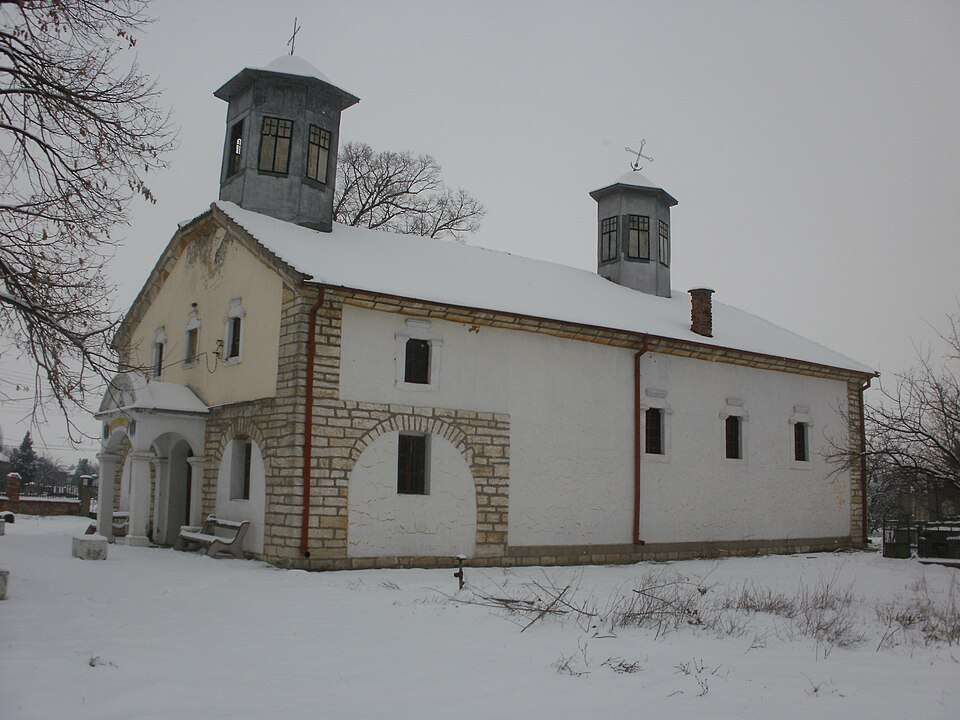
波克拉伊纳(Pokrayna,Vidin 市镇)的照片
保加利亚 · 维丁州
居民点
波克拉伊纳是保加利亚维丁州 Vidin 市镇的一处村庄。 EKATTE 代码:57131。海拔范围:0–49 米。 本资料依据官方《全国居民点登记册》编写。您可以在地图上查看位置,并将此地加入个人旅行路线。
查看详情图片来源: Bazov · CC BY-SA 3.0 · 许可协议
查看位置Representative point of the settlement. Overview map; confirm the exact visiting address.
保加利亚 · 哈斯科沃州
居民点
Pokrovan 是保加利亚哈斯科沃州 Ivaylovgrad 市镇的一处村庄。 EKATTE 代码:57145。海拔范围:300–499 米。 本资料依据官方《全国居民点登记册》编写。您可以在地图上查看位置,并将此地加入个人旅行路线。
查看详情Representative point of the settlement. Overview map; confirm the exact visiting address.
保加利亚 · 布拉戈耶夫格勒州
居民点
波克罗夫尼克是保加利亚布拉戈耶夫格勒州 Blagoevgrad 市镇的一处村庄。 EKATTE 代码:57159。海拔范围:300–499 米。 本资料依据官方《全国居民点登记册》编写。您可以在地图上查看位置,并将此地加入个人旅行路线。
查看详情Representative point of the settlement. Overview map; confirm the exact visiting address.
保加利亚 · 布拉戈耶夫格勒州
居民点
波莱纳是保加利亚布拉戈耶夫格勒州 Simitli 市镇的一处村庄。 EKATTE 代码:57162。海拔范围:300–499 米。 本资料依据官方《全国居民点登记册》编写。您可以在地图上查看位置,并将此地加入个人旅行路线。
查看详情Representative point of the settlement. Overview map; confirm the exact visiting address.
保加利亚 · 布拉戈耶夫格勒州
居民点
波莱尼察是保加利亚布拉戈耶夫格勒州 Sandanski 市镇的一处村庄。 EKATTE 代码:57176。海拔范围:300–499 米。 本资料依据官方《全国居民点登记册》编写。您可以在地图上查看位置,并将此地加入个人旅行路线。
查看详情Representative point of the settlement. Overview map; confirm the exact visiting address.
保加利亚 · 丘斯滕迪尔州
居民点
Poletintsi 是保加利亚丘斯滕迪尔州 Kyustendil 市镇的一处村庄。 EKATTE 代码:57188。海拔范围:700–999 米。 本资料依据官方《全国居民点登记册》编写。您可以在地图上查看位置,并将此地加入个人旅行路线。
查看详情Representative point of the settlement. Overview map; confirm the exact visiting address.
保加利亚 · 维丁州
居民点
Poletkovtsi 是保加利亚维丁州 Kula 市镇的一处村庄。 EKATTE 代码:57193。海拔范围:200–299 米。 本资料依据官方《全国居民点登记册》编写。您可以在地图上查看位置,并将此地加入个人旅行路线。
查看详情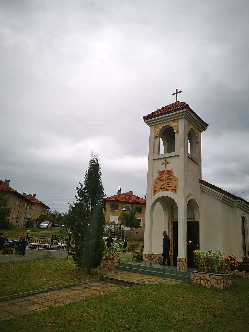
波莱托(Poleto,Simitli 市镇)的照片
保加利亚 · 布拉戈耶夫格勒州
居民点
波莱托是保加利亚布拉戈耶夫格勒州 Simitli 市镇的一处村庄。 EKATTE 代码:57203。海拔范围:500–699 米。 本资料依据官方《全国居民点登记册》编写。您可以在地图上查看位置,并将此地加入个人旅行路线。
查看详情图片来源: Barislav · CC BY-SA 4.0 · 许可协议
查看位置Representative point of the settlement. Overview map; confirm the exact visiting address.
保加利亚 · 大特尔诺沃州
居民点
波利克拉伊什泰是保加利亚大特尔诺沃州 Gorna Oryahovitsa 市镇的一处村庄。 EKATTE 代码:57217。海拔范围:50–99 米。 本资料依据官方《全国居民点登记册》编写。您可以在地图上查看位置,并将此地加入个人旅行路线。
查看详情Representative point of the settlement. Overview map; confirm the exact visiting address.
保加利亚 · 锡利斯特拉州
居民点
Polkovnik Cholakovo 是保加利亚锡利斯特拉州 Kaynardzha 市镇的一处村庄。 EKATTE 代码:57306。海拔范围:100–199 米。 本资料依据官方《全国居民点登记册》编写。您可以在地图上查看位置,并将此地加入个人旅行路线。
查看详情Representative point of the settlement. Overview map; confirm the exact visiting address.
保加利亚 · 多布里奇州
居民点
Polkovnik Dyakovo 是保加利亚多布里奇州 Krushari 市镇的一处村庄。 EKATTE 代码:57234。海拔范围:100–199 米。 本资料依据官方《全国居民点登记册》编写。您可以在地图上查看位置,并将此地加入个人旅行路线。
查看详情Representative point of the settlement. Overview map; confirm the exact visiting address.
保加利亚 · 多布里奇州
居民点
Polkovnik Ivanovo 是保加利亚多布里奇州 Dobrich-selska 市镇的一处村庄。 EKATTE 代码:68103。海拔范围:200–299 米。 本资料依据官方《全国居民点登记册》编写。您可以在地图上查看位置,并将此地加入个人旅行路线。
查看详情Representative point of the settlement. Overview map; confirm the exact visiting address.
保加利亚 · 锡利斯特拉州
居民点
Polkovnik Lambrinovo 是保加利亚锡利斯特拉州 Silistra 市镇的一处村庄。 EKATTE 代码:57251。海拔范围:100–199 米。 本资料依据官方《全国居民点登记册》编写。您可以在地图上查看位置,并将此地加入个人旅行路线。
查看详情Representative point of the settlement. Overview map; confirm the exact visiting address.
保加利亚 · 多布里奇州
居民点
Polkovnik Minkovo 是保加利亚多布里奇州 Dobrich-selska 市镇的一处村庄。 EKATTE 代码:59402。海拔范围:200–299 米。 本资料依据官方《全国居民点登记册》编写。您可以在地图上查看位置,并将此地加入个人旅行路线。
查看详情Representative point of the settlement. Overview map; confirm the exact visiting address.
保加利亚 · 多布里奇州
居民点
Polkovnik Savovo 是保加利亚多布里奇州 Tervel 市镇的一处村庄。 EKATTE 代码:57265。海拔范围:200–299 米。 本资料依据官方《全国居民点登记册》编写。您可以在地图上查看位置,并将此地加入个人旅行路线。
查看详情Representative point of the settlement. Overview map; confirm the exact visiting address.
保加利亚 · 斯莫梁州
居民点
Polkovnik Serafimovo 是保加利亚斯莫梁州 Smolyan 市镇的一处村庄。 EKATTE 代码:57282。海拔范围:700–999 米。 本资料依据官方《全国居民点登记册》编写。您可以在地图上查看位置,并将此地加入个人旅行路线。
查看详情Representative point of the settlement. Overview map; confirm the exact visiting address.
保加利亚 · 多布里奇州
居民点
Polkovnik Sveshtarovo 是保加利亚多布里奇州 Dobrich-selska 市镇的一处村庄。 EKATTE 代码:57279。海拔范围:200–299 米。 本资料依据官方《全国居民点登记册》编写。您可以在地图上查看位置,并将此地加入个人旅行路线。
查看详情Representative point of the settlement. Overview map; confirm the exact visiting address.
保加利亚 · 锡利斯特拉州
居民点
波尔科夫尼克塔斯拉科沃是保加利亚锡利斯特拉州 Dulovo 市镇的一处村庄。 EKATTE 代码:57296。海拔范围:200–299 米。 本资料依据官方《全国居民点登记册》编写。您可以在地图上查看位置,并将此地加入个人旅行路线。
查看详情
波尔科夫尼克热利亚佐沃(Polkovnik Zhelyazovo,Krumovgrad 市镇)的照片
保加利亚 · 克尔贾利州
居民点
波尔科夫尼克热利亚佐沃是保加利亚克尔贾利州 Krumovgrad 市镇的一处村庄。 EKATTE 代码:57248。海拔范围:200–299 米。 本资料依据官方《全国居民点登记册》编写。您可以在地图上查看位置,并将此地加入个人旅行路线。
查看详情图片来源: Kiril Kapustin · CC BY-SA 4.0 · 许可协议
查看位置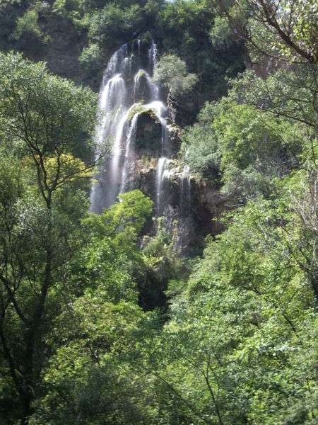
Polska Skakavitsa 瀑布景观
保加利亚 · 丘斯滕迪尔州
居民点
Polska Skakavitsa 是保加利亚丘斯滕迪尔州 Kyustendil 市镇的一处村庄。 EKATTE 代码:57319。海拔范围:700–999 米。 本资料依据官方《全国居民点登记册》编写。您可以在地图上查看位置,并将此地加入个人旅行路线。
查看详情图片来源: VallKillmar · CC BY-SA 3.0 · 许可协议
查看位置Representative point of the settlement. Overview map; confirm the exact visiting address.
保加利亚 · 旧扎戈拉州
居民点
波尔斯基格拉代茨是保加利亚旧扎戈拉州 Radnevo 市镇的一处村庄。 EKATTE 代码:57323。海拔范围:100–199 米。 本资料依据官方《全国居民点登记册》编写。您可以在地图上查看位置,并将此地加入个人旅行路线。
查看详情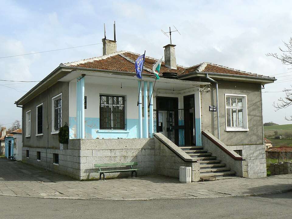
波尔斯基伊兹沃尔(Polski izvor,Kameno 市镇)的照片
保加利亚 · 布尔加斯州
居民点
波尔斯基伊兹沃尔是保加利亚布尔加斯州 Kameno 市镇的一处村庄。 EKATTE 代码:57337。海拔范围:0–49 米。 本资料依据官方《全国居民点登记册》编写。您可以在地图上查看位置,并将此地加入个人旅行路线。
查看详情图片来源: Spiritia · CC BY-SA 3.0 · 许可协议
查看位置