旅游景点

探索旅行路线上的自然景观、历史遗迹和文化景点。

景点目录持续更新。参观详情请查看景点页面中的来源链接。

保加利亚居民点 · 5,256

找到景点: 5893 · 显示第 5,065–5,088 项,共 5,893 · 页 212 / 246

Map of Bulgaria with a marker for Ticha(Kotel 市镇)Representative point of the settlement. Overview map; confirm the exact visiting address.LOCATION · BULGARIATicha(Kotel 市镇)NRepresentative point of the settlementMap: Global Tour · Outline: Natural Earth

Representative point of the settlement. Overview map; confirm the exact visiting address.

保加利亚 · 斯利文州

居民点

Ticha(Kotel 市镇)

Ticha 是保加利亚斯利文州 Kotel 市镇的一处村庄。 EKATTE 代码:72480。海拔范围:300–499 米。 本资料依据官方《全国居民点登记册》编写。您可以在地图上查看位置,并将此地加入个人旅行路线。

查看详情
查看位置

Map of Bulgaria with a marker for Tihomir(Kirkovo 市镇)Representative point of the settlement. Overview map; confirm the exact visiting address.LOCATION · BULGARIATihomir(Kirkovo 市镇)NRepresentative point of the settlementMap: Global Tour · Outline: Natural Earth

Representative point of the settlement. Overview map; confirm the exact visiting address.

保加利亚 · 克尔贾利州

居民点

Tihomir(Kirkovo 市镇)

Tihomir 是保加利亚克尔贾利州 Kirkovo 市镇的一处村庄。 EKATTE 代码:72463。海拔范围:500–699 米。 本资料依据官方《全国居民点登记册》编写。您可以在地图上查看位置,并将此地加入个人旅行路线。

查看详情
查看位置

Map of Bulgaria with a marker for Tihomirovo(Radnevo 市镇)Representative point of the settlement. Overview map; confirm the exact visiting address.LOCATION · BULGARIATihomirovo(Radnevo 市镇)NRepresentative point of the settlementMap: Global Tour · Outline: Natural Earth

Representative point of the settlement. Overview map; confirm the exact visiting address.

保加利亚 · 旧扎戈拉州

居民点

Tihomirovo(Radnevo 市镇)

Tihomirovo 是保加利亚旧扎戈拉州 Radnevo 市镇的一处村庄。 EKATTE 代码:72477。海拔范围:100–199 米。 本资料依据官方《全国居民点登记册》编写。您可以在地图上查看位置,并将此地加入个人旅行路线。

查看详情
查看位置

Map of Bulgaria with a marker for Tihovets(Antonovo 市镇)Representative point of the settlement. Overview map; confirm the exact visiting address.LOCATION · BULGARIATihovets(Antonovo 市镇)NRepresentative point of the settlementMap: Global Tour · Outline: Natural Earth

Representative point of the settlement. Overview map; confirm the exact visiting address.

保加利亚 · 特尔戈维什特州

居民点

Tihovets(Antonovo 市镇)

Tihovets 是保加利亚特尔戈维什特州 Antonovo 市镇的一处村庄。 EKATTE 代码:72452。海拔范围:300–499 米。 本资料依据官方《全国居民点登记册》编写。您可以在地图上查看位置,并将此地加入个人旅行路线。

查看详情
查看位置

Map of Bulgaria with a marker for Tikale(Smolyan 市镇)Representative point of the settlement. Overview map; confirm the exact visiting address.LOCATION · BULGARIATikale(Smolyan 市镇)NRepresentative point of the settlementMap: Global Tour · Outline: Natural Earth

Representative point of the settlement. Overview map; confirm the exact visiting address.

保加利亚 · 斯莫梁州

居民点

Tikale(Smolyan 市镇)

Tikale 是保加利亚斯莫梁州 Smolyan 市镇的一处村庄。 EKATTE 代码:72391。海拔范围:≥ 1000 米。 本资料依据官方《全国居民点登记册》编写。您可以在地图上查看位置,并将此地加入个人旅行路线。

查看详情
查看位置

Map of Bulgaria with a marker for Timarevo(Hitrino 市镇)Representative point of the settlement. Overview map; confirm the exact visiting address.LOCATION · BULGARIATimarevo(Hitrino 市镇)NRepresentative point of the settlementMap: Global Tour · Outline: Natural Earth

Representative point of the settlement. Overview map; confirm the exact visiting address.

保加利亚 · 舒门州

居民点

Timarevo(Hitrino 市镇)

Timarevo 是保加利亚舒门州 Hitrino 市镇的一处村庄。 EKATTE 代码:72401。海拔范围:300–499 米。 本资料依据官方《全国居民点登记册》编写。您可以在地图上查看位置,并将此地加入个人旅行路线。

查看详情
查看位置

Map of Bulgaria with a marker for Tintyava(Krumovgrad 市镇)Representative point of the settlement. Overview map; confirm the exact visiting address.LOCATION · BULGARIATintyava(Krumovgrad 市镇)NRepresentative point of the settlementMap: Global Tour · Outline: Natural Earth

Representative point of the settlement. Overview map; confirm the exact visiting address.

保加利亚 · 克尔贾利州

居民点

Tintyava(Krumovgrad 市镇)

Tintyava 是保加利亚克尔贾利州 Krumovgrad 市镇的一处村庄。 EKATTE 代码:72429。海拔范围:300–499 米。 本资料依据官方《全国居民点登记册》编写。您可以在地图上查看位置,并将此地加入个人旅行路线。

查看详情
查看位置

Map of Bulgaria with a marker for Tipchenitsa(Mezdra 市镇)Representative point of the settlement. Overview map; confirm the exact visiting address.LOCATION · BULGARIATipchenitsa(Mezdra 市镇)NRepresentative point of the settlementMap: Global Tour · Outline: Natural Earth

Representative point of the settlement. Overview map; confirm the exact visiting address.

保加利亚 · 弗拉察州

居民点

Tipchenitsa(Mezdra 市镇)

Tipchenitsa 是保加利亚弗拉察州 Mezdra 市镇的一处村庄。 EKATTE 代码:72432。海拔范围:500–699 米。 本资料依据官方《全国居民点登记册》编写。您可以在地图上查看位置,并将此地加入个人旅行路线。

查看详情
查看位置

Map of Bulgaria with a marker for Tishanovo(Nevestino 市镇)Representative point of the settlement. Overview map; confirm the exact visiting address.LOCATION · BULGARIATishanovo(Nevestino 市镇)NRepresentative point of the settlementMap: Global Tour · Outline: Natural Earth

Representative point of the settlement. Overview map; confirm the exact visiting address.

保加利亚 · 丘斯滕迪尔州

居民点

Tishanovo(Nevestino 市镇)

Tishanovo 是保加利亚丘斯滕迪尔州 Nevestino 市镇的一处村庄。 EKATTE 代码:72494。海拔范围:700–999 米。 本资料依据官方《全国居民点登记册》编写。您可以在地图上查看位置,并将此地加入个人旅行路线。

查看详情
查看位置

Map of Bulgaria with a marker for Tishevitsa(Vratsa 市镇)Representative point of the settlement. Overview map; confirm the exact visiting address.LOCATION · BULGARIATishevitsa(Vratsa 市镇)NRepresentative point of the settlementMap: Global Tour · Outline: Natural Earth

Representative point of the settlement. Overview map; confirm the exact visiting address.

保加利亚 · 弗拉察州

居民点

Tishevitsa(Vratsa 市镇)

Tishevitsa 是保加利亚弗拉察州 Vratsa 市镇的一处村庄。 EKATTE 代码:72504。海拔范围:200–299 米。 本资料依据官方《全国居民点登记册》编写。您可以在地图上查看位置,并将此地加入个人旅行路线。

查看详情
查看位置

Map of Bulgaria with a marker for Titevtsi(Elena 市镇)Representative point of the settlement. Overview map; confirm the exact visiting address.LOCATION · BULGARIATitevtsi(Elena 市镇)NRepresentative point of the settlementMap: Global Tour · Outline: Natural Earth

Representative point of the settlement. Overview map; confirm the exact visiting address.

保加利亚 · 大特尔诺沃州

居民点

Titevtsi(Elena 市镇)

Titevtsi 是保加利亚大特尔诺沃州 Elena 市镇的一处村庄。 EKATTE 代码:72446。海拔范围:300–499 米。 本资料依据官方《全国居民点登记册》编写。您可以在地图上查看位置,并将此地加入个人旅行路线。

查看详情
查看位置

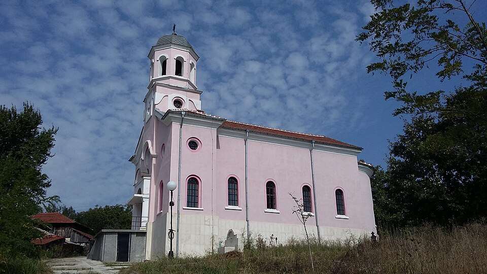
Tlachene(Byala Slatina 市镇)的照片

Tlachene(Byala Slatina 市镇)的照片

保加利亚 · 弗拉察州

居民点

Tlachene(Byala Slatina 市镇)

Tlachene 是保加利亚弗拉察州 Byala Slatina 市镇的一处村庄。 EKATTE 代码:72521。海拔范围:200–299 米。 本资料依据官方《全国居民点登记册》编写。您可以在地图上查看位置,并将此地加入个人旅行路线。

查看详情

图片来源: Original author and uploader was Martintzvetomirov at bg.wikipedia Cropped and retouched by → Spiritia · Public domain · 许可协议

查看位置

Map of Bulgaria with a marker for Tochilari(Kubrat 市镇)Representative point of the settlement. Overview map; confirm the exact visiting address.LOCATION · BULGARIATochilari(Kubrat 市镇)NRepresentative point of the settlementMap: Global Tour · Outline: Natural Earth

Representative point of the settlement. Overview map; confirm the exact visiting address.

保加利亚 · 拉兹格勒州

居民点

Tochilari(Kubrat 市镇)

Tochilari 是保加利亚拉兹格勒州 Kubrat 市镇的一处村庄。 EKATTE 代码:72895。海拔范围:100–199 米。 本资料依据官方《全国居民点登记册》编写。您可以在地图上查看位置,并将此地加入个人旅行路线。

查看详情
查看位置

Map of Bulgaria with a marker for Todor Ikonomovo(Kaolinovo 市镇)Representative point of the settlement. Overview map; confirm the exact visiting address.LOCATION · BULGARIATodor Ikonomovo(Kaolinovo 市镇)NRepresentative point of the settlementMap: Global Tour · Outline: Natural Earth

Representative point of the settlement. Overview map; confirm the exact visiting address.

保加利亚 · 舒门州

居民点

Todor Ikonomovo(Kaolinovo 市镇)

Todor Ikonomovo 是保加利亚舒门州 Kaolinovo 市镇的一处村庄。 EKATTE 代码:72549。海拔范围:200–299 米。 本资料依据官方《全国居民点登记册》编写。您可以在地图上查看位置,并将此地加入个人旅行路线。

查看详情
查看位置

Map of Bulgaria with a marker for Todorcheta(Gabrovo 市镇)Representative point of the settlement. Overview map; confirm the exact visiting address.LOCATION · BULGARIATodorcheta(Gabrovo 市镇)NRepresentative point of the settlementMap: Global Tour · Outline: Natural Earth

Representative point of the settlement. Overview map; confirm the exact visiting address.

保加利亚 · 加布罗沃州

居民点

Todorcheta(Gabrovo 市镇)

Todorcheta 是保加利亚加布罗沃州 Gabrovo 市镇的一处村庄。 EKATTE 代码:81637。海拔范围:300–499 米。 本资料依据官方《全国居民点登记册》编写。您可以在地图上查看位置,并将此地加入个人旅行路线。

查看详情
查看位置

Map of Bulgaria with a marker for Todoretsite(Tryavna 市镇)Representative point of the settlement. Overview map; confirm the exact visiting address.LOCATION · BULGARIATodoretsite(Tryavna 市镇)NRepresentative point of the settlementMap: Global Tour · Outline: Natural Earth

Representative point of the settlement. Overview map; confirm the exact visiting address.

保加利亚 · 加布罗沃州

居民点

Todoretsite(Tryavna 市镇)

Todoretsite 是保加利亚加布罗沃州 Tryavna 市镇的一处村庄。 EKATTE 代码:72535。海拔范围:500–699 米。 本资料依据官方《全国居民点登记册》编写。您可以在地图上查看位置,并将此地加入个人旅行路线。

查看详情
查看位置

Map of Bulgaria with a marker for Todorichene(Lukovit 市镇)Representative point of the settlement. Overview map; confirm the exact visiting address.LOCATION · BULGARIATodorichene(Lukovit 市镇)NRepresentative point of the settlementMap: Global Tour · Outline: Natural Earth

Representative point of the settlement. Overview map; confirm the exact visiting address.

保加利亚 · 洛维奇州

居民点

Todorichene(Lukovit 市镇)

Todorichene 是保加利亚洛维奇州 Lukovit 市镇的一处村庄。 EKATTE 代码:72552。海拔范围:100–199 米。 本资料依据官方《全国居民点登记册》编写。您可以在地图上查看位置,并将此地加入个人旅行路线。

查看详情
查看位置

Map of Bulgaria with a marker for Todorovo(Isperih 市镇)Representative point of the settlement. Overview map; confirm the exact visiting address.LOCATION · BULGARIATodorovo(Isperih 市镇)NRepresentative point of the settlementMap: Global Tour · Outline: Natural Earth

Representative point of the settlement. Overview map; confirm the exact visiting address.

保加利亚 · 拉兹格勒州

居民点

Todorovo(Isperih 市镇)

Todorovo 是保加利亚拉兹格勒州 Isperih 市镇的一处村庄。 EKATTE 代码:72578。海拔范围:200–299 米。 本资料依据官方《全国居民点登记册》编写。您可以在地图上查看位置,并将此地加入个人旅行路线。

查看详情
查看位置

Map of Bulgaria with a marker for Todorovo(Pleven 市镇)Representative point of the settlement. Overview map; confirm the exact visiting address.LOCATION · BULGARIATodorovo(Pleven 市镇)NRepresentative point of the settlementMap: Global Tour · Outline: Natural Earth

Representative point of the settlement. Overview map; confirm the exact visiting address.

保加利亚 · 普列文州

居民点

Todorovo(Pleven 市镇)

Todorovo 是保加利亚普列文州 Pleven 市镇的一处村庄。 EKATTE 代码:72566。海拔范围:200–299 米。 本资料依据官方《全国居民点登记册》编写。您可以在地图上查看位置,并将此地加入个人旅行路线。

查看详情
查看位置

© 2026 Global Tour