Representative point of the settlement. Overview map; confirm the exact visiting address.
保加利亚 · 蒙塔纳州
居民点
Dobri dol(Lom 市镇)
Dobri dol 是保加利亚蒙塔纳州 Lom 市镇的一处村庄。 EKATTE 代码:21436。海拔范围:50–99 米。 本资料依据官方《全国居民点登记册》编写。您可以在地图上查看位置,并将此地加入个人旅行路线。
查看详情
探索旅行路线上的自然景观、历史遗迹和文化景点。
景点目录持续更新。参观详情请查看景点页面中的来源链接。
保加利亚居民点 · 5,256找到景点: 5893 · 显示第 1,105–1,128 项,共 5,893 · 页 47 / 246
Representative point of the settlement. Overview map; confirm the exact visiting address.
保加利亚 · 蒙塔纳州
居民点
Dobri dol 是保加利亚蒙塔纳州 Lom 市镇的一处村庄。 EKATTE 代码:21436。海拔范围:50–99 米。 本资料依据官方《全国居民点登记册》编写。您可以在地图上查看位置,并将此地加入个人旅行路线。
查看详情Representative point of the settlement. Overview map; confirm the exact visiting address.
保加利亚 · 普罗夫迪夫州
居民点
Dobri dol 是保加利亚普罗夫迪夫州 Parvomay 市镇的一处村庄。 EKATTE 代码:21440。海拔范围:100–199 米。 本资料依据官方《全国居民点登记册》编写。您可以在地图上查看位置,并将此地加入个人旅行路线。
查看详情Representative point of the settlement. Overview map; confirm the exact visiting address.
保加利亚 · 丘斯滕迪尔州
居民点
Dobri dol 是保加利亚丘斯滕迪尔州 Treklyano 市镇的一处村庄。 EKATTE 代码:21422。海拔范围:700–999 米。 本资料依据官方《全国居民点登记册》编写。您可以在地图上查看位置,并将此地加入个人旅行路线。
查看详情Representative point of the settlement. Overview map; confirm the exact visiting address.
保加利亚 · 大特尔诺沃州
居民点
Dobri dyal 是保加利亚大特尔诺沃州 Lyaskovets 市镇的一处村庄。 EKATTE 代码:21453。海拔范围:100–199 米。 本资料依据官方《全国居民点登记册》编写。您可以在地图上查看位置,并将此地加入个人旅行路线。
查看详情Representative point of the settlement. Overview map; confirm the exact visiting address.
保加利亚 · 布拉戈耶夫格勒州
居民点
Dobri laki 是保加利亚布拉戈耶夫格勒州 Strumyani 市镇的一处村庄。 EKATTE 代码:21467。海拔范围:700–999 米。 本资料依据官方《全国居民点登记册》编写。您可以在地图上查看位置,并将此地加入个人旅行路线。
查看详情Representative point of the settlement. Overview map; confirm the exact visiting address.
保加利亚 · 舒门州
居民点
Dobri Voynikovo 是保加利亚舒门州 Hitrino 市镇的一处村庄。 EKATTE 代码:21405。海拔范围:300–499 米。 本资料依据官方《全国居民点登记册》编写。您可以在地图上查看位置,并将此地加入个人旅行路线。
查看详情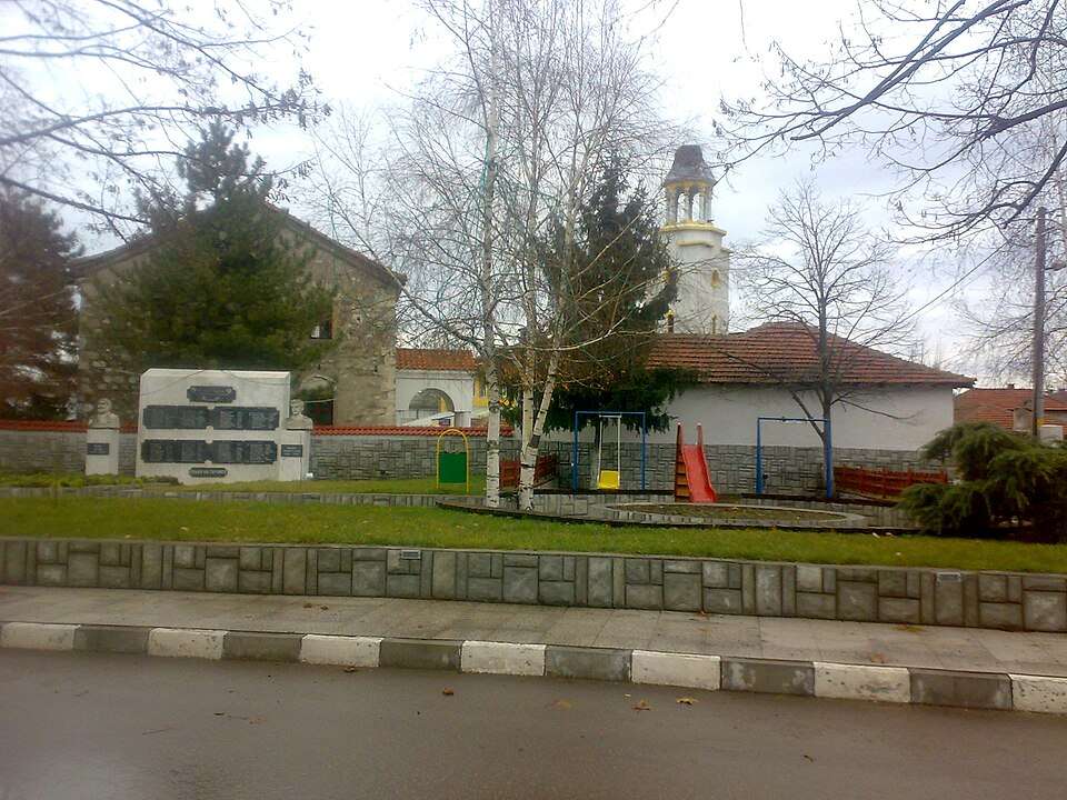
Dobrich(Dimitrovgrad 市镇)的照片
保加利亚 · 哈斯科沃州
居民点
Dobrich 是保加利亚哈斯科沃州 Dimitrovgrad 市镇的一处村庄。 EKATTE 代码:21539。海拔范围:100–199 米。 本资料依据官方《全国居民点登记册》编写。您可以在地图上查看位置,并将此地加入个人旅行路线。
查看详情图片来源: Antonjj · CC0 · 许可协议
查看位置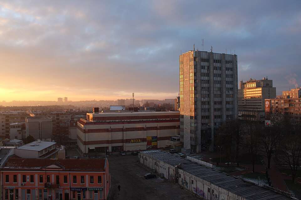
Dobrich(Dobrich 市镇)的照片
保加利亚 · 多布里奇州
居民点
Dobrich 是保加利亚多布里奇州 Dobrich 市镇的一处城市。 EKATTE 代码:72624。海拔范围:200–299 米。该地是市镇行政中心兼州行政中心。 本资料依据官方《全国居民点登记册》编写。您可以在地图上查看位置,并将此地加入个人旅行路线。
查看详情图片来源: Atob37 · CC BY-SA 3.0 · 许可协议
查看位置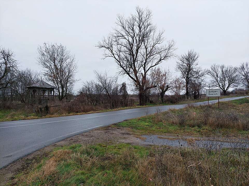
Dobrich(Elhovo 市镇)的照片
保加利亚 · 扬博尔州
居民点
Dobrich 是保加利亚扬博尔州 Elhovo 市镇的一处村庄。 EKATTE 代码:21542。海拔范围:100–199 米。 本资料依据官方《全国居民点登记册》编写。您可以在地图上查看位置,并将此地加入个人旅行路线。
查看详情图片来源: TodorBelomorski · CC BY-SA 4.0 · 许可协议
查看位置Representative point of the settlement. Overview map; confirm the exact visiting address.
保加利亚 · 多布里奇州
居民点
Dobrin 是保加利亚多布里奇州 Krushari 市镇的一处村庄。 EKATTE 代码:21470。海拔范围:100–199 米。 本资料依据官方《全国居民点登记册》编写。您可以在地图上查看位置,并将此地加入个人旅行路线。
查看详情Representative point of the settlement. Overview map; confirm the exact visiting address.
保加利亚 · 瓦尔纳州
居民点
Dobrina 是保加利亚瓦尔纳州 Provadia 市镇的一处村庄。 EKATTE 代码:21484。海拔范围:200–299 米。 本资料依据官方《全国居民点登记册》编写。您可以在地图上查看位置,并将此地加入个人旅行路线。
查看详情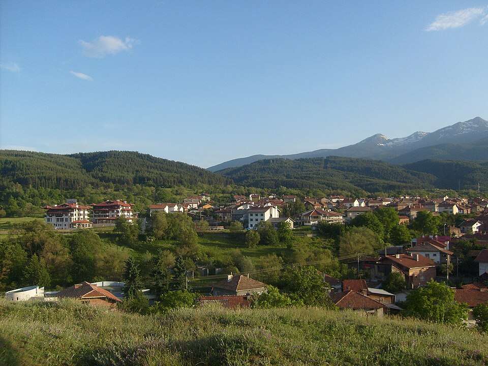
Dobrinishte(Bansko 市镇)的照片
保加利亚 · 布拉戈耶夫格勒州
居民点
Dobrinishte 是保加利亚布拉戈耶夫格勒州 Bansko 市镇的一处城市。 EKATTE 代码:21498。海拔范围:700–999 米。 本资料依据官方《全国居民点登记册》编写。您可以在地图上查看位置,并将此地加入个人旅行路线。
查看详情图片来源: Todor Bozhinov · CC BY-SA 3.0 · 许可协议
查看位置Representative point of the settlement. Overview map; confirm the exact visiting address.
保加利亚 · 克尔贾利州
居民点
Dobrinovo 是保加利亚克尔贾利州 Kardzhali 市镇的一处村庄。 EKATTE 代码:21511。海拔范围:300–499 米。 本资料依据官方《全国居民点登记册》编写。您可以在地图上查看位置,并将此地加入个人旅行路线。
查看详情Representative point of the settlement. Overview map; confirm the exact visiting address.
保加利亚 · 布尔加斯州
居民点
Dobrinovo 是保加利亚布尔加斯州 Karnobat 市镇的一处村庄。 EKATTE 代码:21508。海拔范围:200–299 米。 本资料依据官方《全国居民点登记册》编写。您可以在地图上查看位置,并将此地加入个人旅行路线。
查看详情Representative point of the settlement. Overview map; confirm the exact visiting address.
保加利亚 · 克尔贾利州
居民点
Dobrintsi 是保加利亚克尔贾利州 Dzhebel 市镇的一处村庄。 EKATTE 代码:21525。海拔范围:500–699 米。 本资料依据官方《全国居民点登记册》编写。您可以在地图上查看位置,并将此地加入个人旅行路线。
查看详情Representative point of the settlement. Overview map; confirm the exact visiting address.
保加利亚 · 洛维奇州
居民点
Dobrodan 是保加利亚洛维奇州 Troyan 市镇的一处村庄。 EKATTE 代码:21590。海拔范围:300–499 米。 本资料依据官方《全国居民点登记册》编写。您可以在地图上查看位置,并将此地加入个人旅行路线。
查看详情Representative point of the settlement. Overview map; confirm the exact visiting address.
保加利亚 · 瓦尔纳州
居民点
Dobrogled 是保加利亚瓦尔纳州 Aksakovo 市镇的一处村庄。 EKATTE 代码:21587。海拔范围:200–299 米。 本资料依据官方《全国居民点登记册》编写。您可以在地图上查看位置,并将此地加入个人旅行路线。
查看详情Representative point of the settlement. Overview map; confirm the exact visiting address.
保加利亚 · 弗拉察州
居民点
Dobrolevo 是保加利亚弗拉察州 Borovan 市镇的一处村庄。 EKATTE 代码:21600。海拔范围:100–199 米。 本资料依据官方《全国居民点登记册》编写。您可以在地图上查看位置,并将此地加入个人旅行路线。
查看详情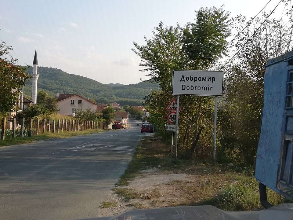
Dobromir(Ruen 市镇)的照片
保加利亚 · 布尔加斯州
居民点
Dobromir 是保加利亚布尔加斯州 Ruen 市镇的一处村庄。 EKATTE 代码:21614。海拔范围:50–99 米。 本资料依据官方《全国居民点登记册》编写。您可以在地图上查看位置,并将此地加入个人旅行路线。
查看详情图片来源: Litev · CC BY-SA 4.0 · 许可协议
查看位置Representative point of the settlement. Overview map; confirm the exact visiting address.
保加利亚 · 加布罗沃州
居民点
Dobromirka 是保加利亚加布罗沃州 Sevlievo 市镇的一处村庄。 EKATTE 代码:21628。海拔范围:300–499 米。 本资料依据官方《全国居民点登记册》编写。您可以在地图上查看位置,并将此地加入个人旅行路线。
查看详情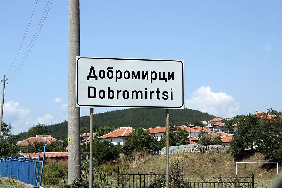
Dobromirtsi(Kirkovo 市镇)的照片
保加利亚 · 克尔贾利州
居民点
Dobromirtsi 是保加利亚克尔贾利州 Kirkovo 市镇的一处村庄。 EKATTE 代码:21631。海拔范围:300–499 米。 本资料依据官方《全国居民点登记册》编写。您可以在地图上查看位置,并将此地加入个人旅行路线。
查看详情图片来源: Edal Anton Lefterov · CC BY-SA 3.0 · 许可协议
查看位置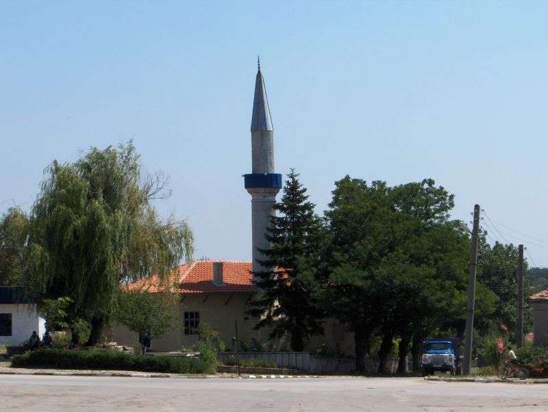
Dobroplodno(Vetrino 市镇)的照片
保加利亚 · 瓦尔纳州
居民点
Dobroplodno 是保加利亚瓦尔纳州 Vetrino 市镇的一处村庄。 EKATTE 代码:21645。海拔范围:200–299 米。 本资料依据官方《全国居民点登记册》编写。您可以在地图上查看位置,并将此地加入个人旅行路线。
查看详情图片来源: Еллес · CC BY 3.0 · 许可协议
查看位置Representative point of the settlement. Overview map; confirm the exact visiting address.
保加利亚 · 哈斯科沃州
居民点
Dobroselets 是保加利亚哈斯科沃州 Topolovgrad 市镇的一处村庄。 EKATTE 代码:21659。海拔范围:100–199 米。 本资料依据官方《全国居民点登记册》编写。您可以在地图上查看位置,并将此地加入个人旅行路线。
查看详情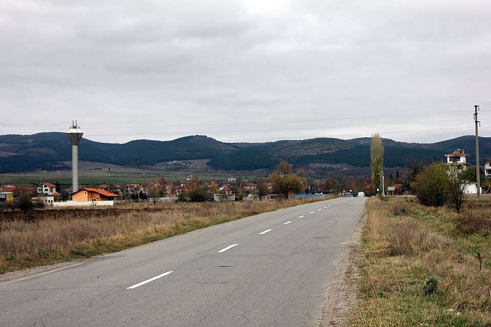
Dobroslavtsi(Stolichna 市镇)的照片
保加利亚 · 索菲亚市
居民点
Dobroslavtsi 是保加利亚索菲亚市 Stolichna 市镇的一处村庄。 EKATTE 代码:21662。海拔范围:500–699 米。 本资料依据官方《全国居民点登记册》编写。您可以在地图上查看位置,并将此地加入个人旅行路线。
查看详情图片来源: Edal Anton Lefterov · CC BY-SA 3.0 · 许可协议
查看位置