Representative point of the settlement. Overview map; confirm the exact visiting address.
保加利亚 · 普列文州
居民点
Asparuhovo(Levski 市镇)
Asparuhovo 是保加利亚普列文州 Levski 市镇的一处村庄。 EKATTE 代码:00802。海拔范围:50–99 米。 本资料依据官方《全国居民点登记册》编写。您可以在地图上查看位置,并将此地加入个人旅行路线。
查看详情
探索旅行路线上的自然景观、历史遗迹和文化景点。
景点目录持续更新。参观详情请查看景点页面中的来源链接。
保加利亚居民点 · 5,256找到景点: 5893 · 显示第 121–144 项,共 5,893 · 页 6 / 246
Representative point of the settlement. Overview map; confirm the exact visiting address.
保加利亚 · 普列文州
居民点
Asparuhovo 是保加利亚普列文州 Levski 市镇的一处村庄。 EKATTE 代码:00802。海拔范围:50–99 米。 本资料依据官方《全国居民点登记册》编写。您可以在地图上查看位置,并将此地加入个人旅行路线。
查看详情Representative point of the settlement. Overview map; confirm the exact visiting address.
保加利亚 · 蒙塔纳州
居民点
Asparuhovo 是保加利亚蒙塔纳州 Medkovets 市镇的一处村庄。 EKATTE 代码:00792。海拔范围:100–199 米。 本资料依据官方《全国居民点登记册》编写。您可以在地图上查看位置,并将此地加入个人旅行路线。
查看详情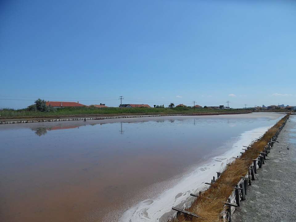
保加利亚 · 布尔加斯州
自然与山地
这座湖位于 Via Pontica 候鸟迁徙路线上,为鹈鹕和鹳类提供休憩之地。盐生产为湿地增加了文化层面,其浅咸水维持着多种鸟类生境。
查看详情图片来源: Professor Caretaker · CC BY-SA 4.0 · 许可协议
查看位置
希腊
希腊首都合并了古迹、新古典建筑和活泼的历史居民区。 是否安排游览及是否另行收费,以所选行程为准。请通过官方渠道确认当前的开放情况和时间。地图标记的是景点的大致位置,并非入口。
查看详情图片来源: Global Tour · Natural Earth (public domain) · approximate area map · 许可协议
查看位置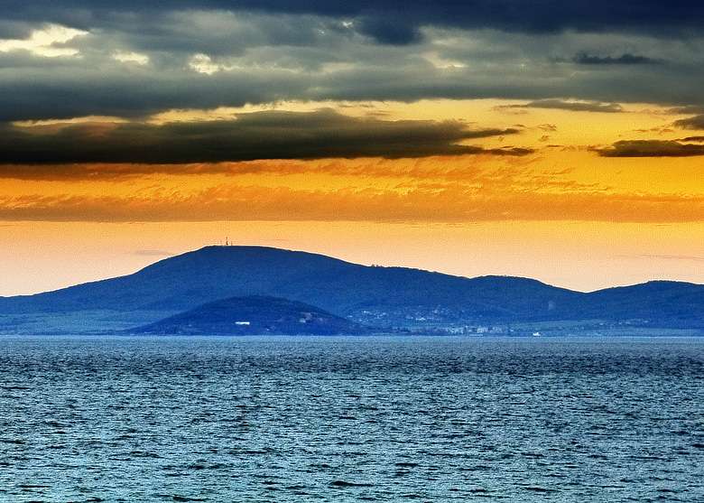
Atia(Sozopol 市镇)的照片
保加利亚 · 布尔加斯州
居民点
Atia 是保加利亚布尔加斯州 Sozopol 市镇的一处村庄。 EKATTE 代码:63015。海拔范围:50–99 米。 本资料依据官方《全国居民点登记册》编写。您可以在地图上查看位置,并将此地加入个人旅行路线。
查看详情图片来源: The original uploader was Мико at Bulgarian Wikipedia . · CC BY 2.5 · 许可协议
查看位置Representative point of the settlement. Overview map; confirm the exact visiting address.
保加利亚 · 扬博尔州
居民点
Atolovo 是保加利亚扬博尔州 Straldzha 市镇的一处村庄。 EKATTE 代码:00816。海拔范围:100–199 米。 本资料依据官方《全国居民点登记册》编写。您可以在地图上查看位置,并将此地加入个人旅行路线。
查看详情Representative point of the settlement. Overview map; confirm the exact visiting address.
保加利亚 · 克尔贾利州
居民点
Austa 是保加利亚克尔贾利州 Momchilgrad 市镇的一处村庄。 EKATTE 代码:00828。海拔范围:300–499 米。 本资料依据官方《全国居民点登记册》编写。您可以在地图上查看位置,并将此地加入个人旅行路线。
查看详情
土耳其
阿瓦诺斯是卡帕多克河上的卡普帕多克镇。它与传统陶器有关。 地图标记的是景点的大致位置,并非入口。是否安排游览及是否另行收费,以所选行程为准。预订前会确认能否参观。
查看详情图片来源: Global Tour · Natural Earth (public domain) · approximate area map · 许可协议
查看位置Representative point of the settlement. Overview map; confirm the exact visiting address.
保加利亚 · 克尔贾利州
居民点
Avramovo 是保加利亚克尔贾利州 Ardino 市镇的一处村庄。 EKATTE 代码:00062。海拔范围:500–699 米。 本资料依据官方《全国居民点登记册》编写。您可以在地图上查看位置,并将此地加入个人旅行路线。
查看详情
Avramovo(Yakoruda 市镇)的照片
保加利亚 · 布拉戈耶夫格勒州
居民点
Avramovo 是保加利亚布拉戈耶夫格勒州 Yakoruda 市镇的一处村庄。 EKATTE 代码:00059。海拔范围:700–999 米。 本资料依据官方《全国居民点登记册》编写。您可以在地图上查看位置,并将此地加入个人旅行路线。
查看详情图片来源: Spasimir Pilev · CC BY-SA 4.0 · 许可协议
查看位置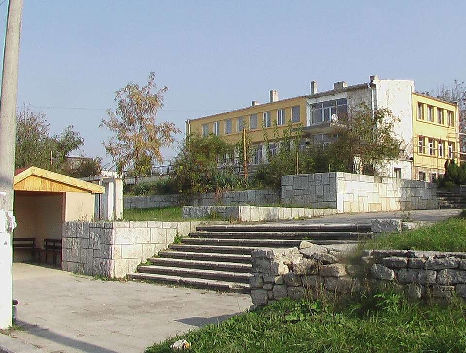
Avren(Avren 市镇)的照片
保加利亚 · 瓦尔纳州
居民点
Avren 是保加利亚瓦尔纳州 Avren 市镇的一处村庄。 EKATTE 代码:00084。海拔范围:200–299 米。该地是市镇行政中心。 本资料依据官方《全国居民点登记册》编写。您可以在地图上查看位置,并将此地加入个人旅行路线。
查看详情图片来源: Original author and uploader was SUL Rave at bg.wikipedia · Public domain · 许可协议
查看位置
Avren(Krumovgrad 市镇)的照片
保加利亚 · 克尔贾利州
居民点
Avren 是保加利亚克尔贾利州 Krumovgrad 市镇的一处村庄。 EKATTE 代码:00093。海拔范围:500–699 米。 本资料依据官方《全国居民点登记册》编写。您可以在地图上查看位置,并将此地加入个人旅行路线。
查看详情图片来源: User:Ggia · CC BY-SA 3.0 · 许可协议
查看位置
Aydemir(Silistra 市镇)的照片
保加利亚 · 锡利斯特拉州
居民点
Aydemir 是保加利亚锡利斯特拉州 Silistra 市镇的一处村庄。 EKATTE 代码:00895。海拔范围:0–49 米。 本资料依据官方《全国居民点登记册》编写。您可以在地图上查看位置,并将此地加入个人旅行路线。
查看详情图片来源: Todor Bozhinov · CC BY-SA 4.0 · 许可协议
查看位置Representative point of the settlement. Overview map; confirm the exact visiting address.
保加利亚 · 克尔贾利州
居民点
Ayrovo 是保加利亚克尔贾利州 Kardzhali 市镇的一处村庄。 EKATTE 代码:00148。海拔范围:200–299 米。 本资料依据官方《全国居民点登记册》编写。您可以在地图上查看位置,并将此地加入个人旅行路线。
查看详情
Aytos(Aytos 市镇)的照片
保加利亚 · 布尔加斯州
居民点
Aytos 是保加利亚布尔加斯州 Aytos 市镇的一处城市。 EKATTE 代码:00151。海拔范围:50–99 米。该地是市镇行政中心。 本资料依据官方《全国居民点登记册》编写。您可以在地图上查看位置,并将此地加入个人旅行路线。
查看详情图片来源: Manol Z. Manolov · CC BY-SA 3.0 · 许可协议
查看位置Representative point of the settlement. Overview map; confirm the exact visiting address.
保加利亚 · 加布罗沃州
居民点
Azmanite 是保加利亚加布罗沃州 Tryavna 市镇的一处村庄。 EKATTE 代码:00117。海拔范围:500–699 米。 本资料依据官方《全国居民点登记册》编写。您可以在地图上查看位置,并将此地加入个人旅行路线。
查看详情
Baba Tonka(Popovo 市镇)的照片
保加利亚 · 特尔戈维什特州
居民点
Baba Tonka 是保加利亚特尔戈维什特州 Popovo 市镇的一处村庄。 EKATTE 代码:02021。海拔范围:300–499 米。 本资料依据官方《全国居民点登记册》编写。您可以在地图上查看位置,并将此地加入个人旅行路线。
查看详情图片来源: Wlado bg at Bulgarian Wikipedia · Public domain · 许可协议
查看位置
保加利亚 · 维丁州
历史与考古
建在罗曼·博诺尼亚的遗骨上 堡垒将统治者的城堡与军事防御结合起来其双面墙、塔和护城河展示了多瑙河镇在中世纪如何得到保护。
查看详情图片来源: Камен Ханджиев · CC BY-SA 4.0 · 许可协议
查看位置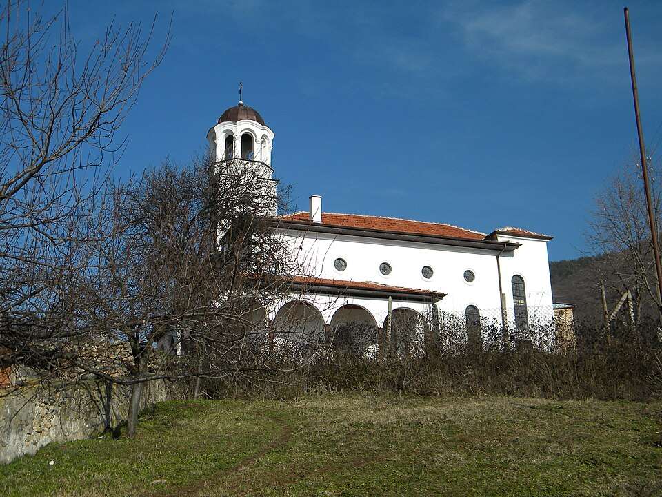
Babek(Brezovo 市镇)的照片
保加利亚 · 普罗夫迪夫州
居民点
Babek 是保加利亚普罗夫迪夫州 Brezovo 市镇的一处村庄。 EKATTE 代码:02035。海拔范围:300–499 米。 本资料依据官方《全国居民点登记册》编写。您可以在地图上查看位置,并将此地加入个人旅行路线。
查看详情图片来源: Berchaf · CC BY-SA 3.0 · 许可协议
查看位置
Babino(Bobov dol 市镇)的照片
保加利亚 · 丘斯滕迪尔州
居民点
Babino 是保加利亚丘斯滕迪尔州 Bobov dol 市镇的一处村庄。 EKATTE 代码:02049。海拔范围:500–699 米。 本资料依据官方《全国居民点登记册》编写。您可以在地图上查看位置,并将此地加入个人旅行路线。
查看详情图片来源: Vassia Atanassova - Spiritia · Public domain · 许可协议
查看位置Representative point of the settlement. Overview map; confirm the exact visiting address.
保加利亚 · 丘斯滕迪尔州
居民点
Babinska reka 是保加利亚丘斯滕迪尔州 Bobov dol 市镇的一处村庄。 EKATTE 代码:02052。海拔范围:500–699 米。 本资料依据官方《全国居民点登记册》编写。您可以在地图上查看位置,并将此地加入个人旅行路线。
查看详情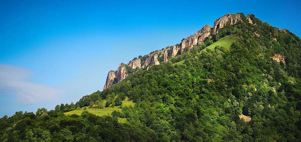
Babintsi(Teteven 市镇)的照片
保加利亚 · 洛维奇州
居民点
Babintsi 是保加利亚洛维奇州 Teteven 市镇的一处村庄。 EKATTE 代码:07884。海拔范围:700–999 米。 本资料依据官方《全国居民点登记册》编写。您可以在地图上查看位置,并将此地加入个人旅行路线。
查看详情图片来源: Doctor8888 · CC BY-SA 4.0 · 许可协议
查看位置
Babitsa(Breznik 市镇)的照片
保加利亚 · 佩尔尼克州
居民点
Babitsa 是保加利亚佩尔尼克州 Breznik 市镇的一处村庄。 EKATTE 代码:02066。海拔范围:700–999 米。 本资料依据官方《全国居民点登记册》编写。您可以在地图上查看位置,并将此地加入个人旅行路线。
查看详情图片来源: Anton Lefterov · CC BY-SA 4.0 · 许可协议
查看位置Representative point of the settlement. Overview map; confirm the exact visiting address.
保加利亚 · 斯莫梁州
居民点
Bablon 是保加利亚斯莫梁州 Smolyan 市镇的一处村庄。 EKATTE 代码:02076。海拔范围:≥ 1000 米。 本资料依据官方《全国居民点登记册》编写。您可以在地图上查看位置,并将此地加入个人旅行路线。
查看详情